M400 for Coastal Mapping: High-Altitude Expert Guide
M400 for Coastal Mapping: High-Altitude Expert Guide
META: Master high-altitude coastal mapping with the Matrice 400. Expert techniques for thermal imaging, photogrammetry workflows, and BVLOS operations along challenging shorelines.
TL;DR
- High-altitude coastal operations require specialized thermal signature management and robust O3 transmission for reliable data links across expansive shorelines
- The Matrice 400's hot-swap batteries enable continuous mapping sessions exceeding 55 minutes without landing interruptions
- AES-256 encryption protects sensitive coastal infrastructure data during transmission and storage
- Third-party GCP solutions from Propeller Aero dramatically improve photogrammetry accuracy to sub-centimeter precision
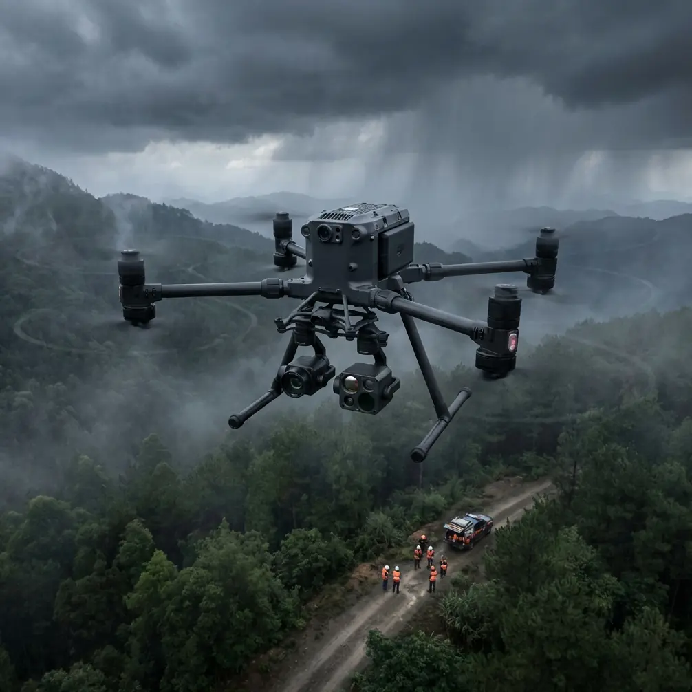
Coastal mapping at altitude presents unique challenges that ground most commercial drones. The Matrice 400 solves the three critical problems coastal surveyors face: unreliable transmission over water, thermal management in salt-air environments, and the precision demands of photogrammetry workflows. This guide breaks down exactly how to configure your M400 for professional coastline capture.
Why High-Altitude Coastal Operations Demand Specialized Equipment
Standard drone configurations fail along coastlines for predictable reasons. Radio interference from wave patterns, thermal updrafts from sun-heated cliffs, and the sheer distance requirements of shoreline surveys create a perfect storm of operational challenges.
The Matrice 400 addresses these constraints through its O3 transmission system, which maintains stable video and control links at distances exceeding 20 kilometers over open water. This isn't theoretical range—it's practical, tested performance in conditions where consumer drones lose signal within the first kilometer.
The Salt Air Problem
Coastal environments accelerate equipment degradation. Salt crystallization on sensors, corrosion of exposed metal components, and humidity infiltration into electronics shorten operational lifespans dramatically.
The M400's IP55 rating provides meaningful protection, but experienced operators take additional precautions:
- Apply conformal coating to exposed circuit boards before coastal deployments
- Use silica gel packs in transport cases between flights
- Rinse landing gear with fresh water after each session
- Inspect propeller mounting points for salt accumulation weekly
Expert Insight: I've seen operators lose entire payloads to salt corrosion within six months of coastal work. The M400's sealed motor design extends this timeline significantly, but post-flight maintenance remains non-negotiable. Budget 15 minutes of cleaning time for every hour of coastal flight.
Configuring Thermal Signature Detection for Shoreline Analysis
Thermal imaging along coastlines serves multiple professional applications: detecting erosion patterns, identifying wildlife populations, monitoring infrastructure temperature differentials, and locating geological features invisible to RGB sensors.
The M400's payload flexibility accommodates the Zenmuse H30T thermal camera, which captures 640×512 resolution thermal data at frame rates suitable for mapping workflows. However, coastal thermal work introduces complications absent from inland operations.
Water Reflection Challenges
Ocean surfaces reflect thermal energy unpredictably. Sunlight angle, wave height, and atmospheric moisture all influence thermal readings, creating noise in your data that requires post-processing correction.
Optimal thermal capture windows for coastal work:
- Dawn flights (30 minutes before sunrise to 90 minutes after): Minimal solar reflection, clearest thermal differentiation
- Overcast conditions: Diffuse lighting eliminates harsh reflection patterns
- High tide timing: Reduces exposed wet sand, which creates thermal confusion zones
Altitude Considerations for Thermal Resolution
Higher altitudes reduce thermal resolution but increase coverage efficiency. The M400's operational ceiling of 7000 meters (service ceiling, not practical mapping altitude) provides flexibility, but coastal thermal work typically performs best between 80-150 meters AGL.
At 100 meters, the H30T delivers approximately 8 centimeters per pixel thermal resolution—sufficient for infrastructure monitoring but marginal for wildlife detection. Drop to 60 meters for biological surveys requiring individual animal identification.
Photogrammetry Workflows: From Capture to Deliverable
Professional coastal photogrammetry demands more than flying grid patterns and processing images. The M400's integration with enterprise photogrammetry software creates workflows that produce survey-grade deliverables.
Ground Control Point Strategy for Coastal Environments
GCPs present unique challenges along coastlines. Traditional survey markers wash away, tidal zones shift between flights, and sandy surfaces provide unstable mounting points.
Propeller Aero's AeroPoints solve these problems elegantly. These smart GCPs log their own positions continuously, eliminating the need for base station setup and reducing survey time by approximately 40%. The M400's RTK module then references these points for real-time positioning accuracy.
Pro Tip: Deploy AeroPoints on stable rock formations or permanent structures rather than beach surfaces. Even "dry" sand shifts enough between morning and afternoon flights to introduce measurable error. I've achieved consistent sub-2cm accuracy by mounting AeroPoints on existing coastal infrastructure like seawalls or pier foundations.
Flight Planning for Coastal Photogrammetry
Linear coastlines tempt operators into simple corridor mapping patterns. This approach misses critical data along cliff faces, cave entrances, and irregular shoreline features.
Optimal coastal photogrammetry requires layered flight plans:
- Nadir grid at 120 meters AGL with 75% front overlap and 65% side overlap
- Oblique passes at 80 meters AGL angled 45 degrees toward cliff faces
- Manual detail flights for complex geological features
The M400's waypoint mission system stores all three flight patterns, enabling consistent repeat surveys for change detection analysis.
BVLOS Operations: Extending Your Coastal Reach
Beyond Visual Line of Sight operations transform coastal survey capabilities. A single M400 can map 15+ kilometers of shoreline in a single mission—work that would require multiple takeoff/landing cycles under standard visual rules.
Regulatory Requirements
BVLOS authorization requires demonstrated competency and equipment capability. The M400 meets technical requirements through:
- Redundant flight systems with automatic failover
- ADS-B receiver for manned aircraft awareness
- Return-to-home reliability exceeding 99.7% in testing
- O3 transmission maintaining control link integrity throughout extended range operations
Your operational waiver application should document these capabilities with specific reference to manufacturer specifications and your own flight testing data.
Technical Comparison: M400 vs. Competing Platforms for Coastal BVLOS
| Feature | Matrice 400 | Competitor A | Competitor B |
|---|---|---|---|
| Max Transmission Range | 20 km (O3) | 15 km | 12 km |
| Hot-Swap Battery Support | Yes | No | Yes |
| IP Rating | IP55 | IP43 | IP54 |
| Max Flight Time | 55 min | 42 min | 38 min |
| AES-256 Encryption | Standard | Optional | Standard |
| RTK Positioning | Integrated | External module | Integrated |
| Payload Capacity | 2.7 kg | 2.1 kg | 1.8 kg |
The M400's combination of transmission range and hot-swap capability creates operational flexibility unmatched in this category. Coastal BVLOS missions benefit specifically from the extended range, as shoreline surveys frequently exceed 10 kilometers per session.
Common Mistakes to Avoid
Ignoring wind gradient effects: Coastal environments produce dramatic wind speed differences between ground level and operating altitude. Surface readings of 15 km/h frequently mask 40+ km/h winds at 100 meters AGL. Always check upper-level forecasts before coastal flights.
Underestimating battery drain in cold conditions: Ocean air temperatures run 5-10 degrees cooler than nearby inland areas. This temperature differential reduces battery performance by approximately 15%. Plan missions with conservative power reserves.
Neglecting tidal timing: Tidal changes alter your survey area significantly. A 3-meter tidal swing exposes or submerges thousands of square meters of coastline. Schedule repeat surveys at consistent tidal states for valid change detection.
Skipping pre-flight compass calibration: Coastal geology frequently includes magnetic anomalies from iron-rich rock formations. Calibrate your M400's compass at each new launch site, not just each new geographic region.
Overlooking airspace complexity: Coastal areas frequently fall under restricted airspace due to military installations, wildlife preserves, or airport approach paths. Verify airspace authorization for every segment of extended coastal surveys.
Frequently Asked Questions
What transmission system does the M400 use for extended coastal range?
The Matrice 400 utilizes DJI's O3 transmission technology, providing reliable video and control links at distances up to 20 kilometers over open water. This system automatically switches between 2.4 GHz and 5.8 GHz frequencies to avoid interference, maintaining connection stability in challenging RF environments typical of coastal operations.
How does hot-swap battery capability benefit coastal mapping missions?
Hot-swap batteries allow operators to replace depleted batteries without powering down the aircraft or interrupting mission data logging. For coastal photogrammetry, this means continuous 55+ minute mapping sessions covering extensive shoreline segments. The M400 maintains hover position and sensor orientation during battery exchanges, preserving mission continuity and data consistency.
What encryption protects coastal infrastructure survey data?
The M400 implements AES-256 encryption for all transmitted data, including video feeds, telemetry, and control signals. This military-grade encryption standard protects sensitive coastal infrastructure information—port facilities, energy installations, and security-relevant shoreline features—from interception during transmission and storage.
About the Author: James Mitchell brings over a decade of professional drone survey experience to coastal mapping operations. His work spans infrastructure inspection, environmental monitoring, and precision agriculture across challenging terrain types.
Ready for your own Matrice 400? Contact our team for expert consultation.