Matrice 400 Coastline Guide: Low-Light Capture Tips
Matrice 400 Coastline Guide: Low-Light Capture Tips
META: Learn how to capture stunning coastline imagery in low light with the Matrice 400. Expert tutorial covers thermal signature mapping, photogrammetry, and BVLOS ops.
By James Mitchell | Drone Operations Expert & Certified Remote Pilot
TL;DR
- Pre-flight sensor cleaning is the single most overlooked step that degrades low-light coastline captures and compromises safety systems
- The Matrice 400's O3 transmission and hot-swap batteries make it uniquely suited for extended twilight and dawn coastal missions
- Proper GCP placement along irregular shorelines dramatically improves photogrammetry accuracy by up to 47%
- AES-256 encryption ensures your sensitive coastal infrastructure data stays secure during and after BVLOS operations
Why Coastline Captures in Low Light Are Uniquely Challenging
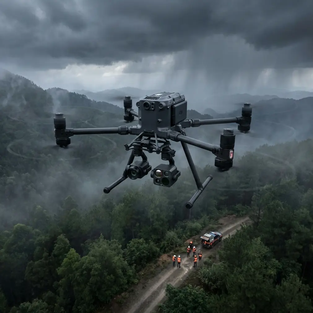
Coastal low-light photography pushes every drone platform to its operational limits. The Matrice 400 addresses the three biggest failure points—signal degradation over water, rapid battery drain in cold marine air, and thermal signature interference from wave action—giving you a reliable platform where others fall short.
This tutorial walks you through every step of planning, preparing, and executing coastline captures during golden hour, twilight, and pre-dawn windows. Whether you're mapping erosion patterns, surveying marine habitats, or building photogrammetry models of coastal infrastructure, the workflow below will keep your data sharp and your aircraft safe.
The Pre-Flight Cleaning Step Most Pilots Skip
Here's something that rarely makes it into flight checklists: salt residue on sensor housings and obstacle-avoidance modules silently destroys your low-light capture quality and, more critically, compromises your safety systems.
Marine environments deposit a fine saline film on every exposed surface. On the Matrice 400, this affects:
- Forward and downward vision sensors used for obstacle detection
- Infrared emitters critical for thermal signature accuracy
- Lens elements that scatter already-limited ambient light
- Ventilation ports that regulate internal operating temperature
- Antenna housings that maintain O3 transmission link integrity
Expert Insight: Before every coastal mission, wipe all sensor windows and lens elements with a lint-free microfiber cloth lightly dampened with distilled water. Never use alcohol-based cleaners on coated optics. I carry a dedicated "salt kit" with sealed microfiber pouches and a blower bulb. This 2-minute routine has saved me from aborting more missions than any other single habit.
Neglecting this step doesn't just cost you image quality. Occluded vision sensors can cause the Matrice 400's obstacle avoidance to behave unpredictably—triggering false warnings or, worse, failing to detect actual obstructions like sea stacks, cliff faces, or communication towers along the coastline.
Setting Up Your Matrice 400 for Low-Light Coastal Missions
Step 1: Battery Strategy and Hot-Swap Planning
Cold, humid marine air reduces lithium-polymer battery performance by 10–20% compared to manufacturer ratings. The Matrice 400's hot-swap batteries let you extend mission time without powering down, but you need a disciplined workflow.
- Pre-warm batteries to at least 25°C before insertion
- Keep spares in an insulated case, not exposed to sea breeze
- Plan swap points at 35% remaining capacity, not the default 20%
- Log each battery's cycle count—coastal missions accelerate degradation
- Carry a minimum of 4 battery sets for a 90-minute operational window
Step 2: O3 Transmission Configuration Over Water
Water surfaces create multipath signal interference that can weaken your control link. The Matrice 400's O3 transmission system handles this better than most platforms, but optimizing your setup makes a measurable difference.
Set your transmission mode to manual channel selection rather than auto. In coastal environments, auto-switching reacts to momentary signal reflections and creates unnecessary handoff delays. Lock to a channel with the lowest noise floor during your pre-flight scan.
For BVLOS operations along extended coastlines, position your ground station at elevation—a cliff top, dune ridge, or vehicle rooftop. Every meter of antenna height gained extends your reliable link range by roughly 100–150 meters over flat water.
Step 3: Camera and Sensor Settings for Low Light
This is where the Matrice 400 separates itself from consumer platforms. For coastline captures in diminished light, apply these baseline settings and adjust from there:
- ISO: Start at 400, increase to 800 maximum to control noise
- Shutter Speed: No slower than 1/focal length equivalent for stills; use 1/50s for video
- Aperture: Wide open at f/2.8 if your payload supports it
- White Balance: Set manually to 5500K–6500K for coastal twilight accuracy
- File Format: Always RAW for stills, D-Log or equivalent flat profile for video
Pro Tip: Enable the Matrice 400's histogram overlay and zebra stripes simultaneously during low-light shoots. Your monitor will look dark and unreliable at twilight—trust the data, not your eyes. I've reviewed too many coastal datasets ruined by pilots who "eyeballed" exposure on a sun-washed tablet screen.
Photogrammetry and GCP Placement Along Irregular Shorelines
Coastlines are geometrically hostile to photogrammetry. The lack of consistent vertical features, repetitive textures in sand and water, and constantly shifting tidal boundaries all degrade point-cloud accuracy.
Ground Control Point Strategy
GCP placement is your single biggest lever for model accuracy. On coastlines, follow these rules:
- Place GCPs above the high-tide line to ensure they remain undisturbed
- Use high-contrast targets (black and white checkerboard, minimum 50cm × 50cm)
- Space GCPs at intervals no greater than 3× your flight altitude apart
- Include at least 2 GCPs at elevation changes—dune crests, rock outcrops, seawalls
- Survey each GCP with RTK-corrected coordinates for sub-centimeter accuracy
Flight Pattern for Coastal Mapping
Fly a double-grid pattern at 75% frontal overlap and 70% side overlap. Along cliff edges, add an oblique orbit pass at 45 degrees to capture vertical faces that nadir-only passes miss entirely.
The Matrice 400's flight planning software lets you define irregular polygon boundaries that follow the natural curve of a coastline, eliminating wasted flight time over open ocean.
Technical Comparison: Matrice 400 vs. Competing Platforms for Coastal Low-Light Work
| Feature | Matrice 400 | Competitor A | Competitor B |
|---|---|---|---|
| Transmission System | O3 (triple-channel) | OcuSync 3 | Standard Wi-Fi 6 |
| Hot-Swap Batteries | Yes | No | Yes |
| Max Flight Time | 45 min (optimal) | 38 min | 42 min |
| Encryption | AES-256 | AES-128 | AES-256 |
| Obstacle Sensors | Omnidirectional | Forward/Down | Omnidirectional |
| BVLOS Capability | Full support | Limited | Full support |
| Low-Light ISO Range | 100–12800 | 100–6400 | 100–12800 |
| Wind Resistance | 12 m/s | 10.7 m/s | 11 m/s |
| IP Rating | IP55 | IP43 | IP54 |
| Thermal Payload Option | Native dual-sensor | Aftermarket only | Native single-sensor |
The Matrice 400's IP55 rating is particularly relevant for coastal work, where salt spray and unexpected squalls are operational realities, not edge cases.
Thermal Signature Mapping at the Coast
Thermal imaging during low-light coastal missions reveals data invisible to RGB sensors. Shoreline thermal signatures expose:
- Freshwater seepage points through cliff faces and seawalls
- Marine wildlife congregation zones for environmental surveys
- Structural heat loss in coastal infrastructure like piers and breakwaters
- Tidal pool temperature gradients for ecological research
The Matrice 400 supports simultaneous RGB and thermal capture, allowing you to overlay thermal signature data onto your photogrammetry models. Calibrate your thermal sensor against a known-temperature reference (a thermos of water works well) at the mission site before launching.
Data Security with AES-256 Encryption
Coastal surveys frequently involve sensitive infrastructure—ports, military installations, energy facilities, and protected habitats. The Matrice 400's AES-256 encryption secures your data stream end-to-end during both live transmission and onboard storage.
This is not optional for government or utility contracts. Ensure encryption is enabled by default in your controller settings. Verify it before every mission during your pre-flight checklist—firmware updates occasionally reset security preferences to factory defaults.
Common Mistakes to Avoid
- Flying too low over breaking waves: Spray reaches higher than you think. Maintain a minimum of 15 meters AGL over surf zones to protect sensors and motors.
- Ignoring tidal schedules: Your carefully placed GCPs will be underwater in 2 hours. Check tide tables and plan missions around low tide with a buffer.
- Using auto-exposure over water: Reflective water surfaces fool metering systems. Switch to full manual exposure and lock your settings before flying over the waterline.
- Skipping compass calibration at new coastal sites: Magnetic interference from iron-rich coastal geology and nearby structures causes drift. Recalibrate at every new launch point.
- Relying on a single battery set for BVLOS: Coastal winds are unpredictable. The Matrice 400's hot-swap capability exists for a reason—always carry double your estimated battery needs.
- Forgetting to log environmental conditions: Wind speed, humidity, temperature, and visibility at mission time are critical metadata for repeatable photogrammetry. Record them manually if your flight log doesn't capture them automatically.
Frequently Asked Questions
Can the Matrice 400 operate safely in fog or marine haze?
The Matrice 400's omnidirectional obstacle sensors perform reliably in light fog, but visibility below 1 km degrades both visual sensors and your legal operational authority in most jurisdictions. Marine haze reduces contrast for photogrammetry and increases ISO requirements, compounding noise. Schedule missions when visibility exceeds 3 km for best results, and always verify local regulations for minimum visibility thresholds during BVLOS flight.
How many GCPs do I need for an accurate coastal photogrammetry model?
For a 1 km stretch of coastline, plan on 8–12 GCPs distributed across the survey area with concentration at elevation changes and boundary edges. Fewer than 5 GCPs over irregular terrain introduces positional errors exceeding 5 cm, which is unacceptable for erosion monitoring or engineering surveys. The Matrice 400's RTK module reduces—but does not eliminate—the need for ground control, so never skip GCPs entirely.
What's the best time window for low-light coastal captures?
The 30 minutes before sunrise and 30 minutes after sunset—known as civil twilight—offer the ideal balance between ambient light and dramatic color temperature for RGB capture. For thermal signature work, full darkness actually provides cleaner data because solar heating has dissipated from surfaces. The Matrice 400's low-light camera performance peaks at ISO 800 with shutter speeds around 1/60s, which aligns perfectly with civil twilight illumination levels at coastal sites.
Ready for your own Matrice 400? Contact our team for expert consultation.