How Matrice 400 Changes Urban Construction Mapping
How Matrice 400 Changes Urban Construction Mapping: A Reclamation Lesson Applied to City Sites
META: A specialist case-study view of Matrice 400 for urban construction capture, connecting drone photogrammetry, terrain modeling, and operational efficiency to real reclamation outcomes.
By Dr. Lisa Wang, Specialist
Most articles about enterprise drones stay at the feature level. Sensors. Flight time. Transmission range. Payload flexibility. Useful, but incomplete.
What matters on a real job is whether the aircraft helps a team make better site decisions under pressure: uneven terrain, partial access, tight schedules, and a constant need to convert raw imagery into something engineers, contractors, and owners can actually use.
That is why a mining land-reclamation study offers a surprisingly sharp lens for understanding the Matrice 400 in urban construction capture.
The source case was not about city towers or road corridors. It focused on a bauxite mining area where low-altitude UAV remote sensing was used to produce digital orthophotos, digital elevation models, and digital linework to guide reclamation. The operational result was not cosmetic. It altered the land itself. Cultivated area increased from 38 km² before mining to 41.8 km² after reclamation, a 10% gain. Slope land was converted into flatter, more usable ground. Soil productivity improved enough to change what could be grown and how profitably it could be farmed.
Those are land outcomes, not drone specs. And that is exactly the point.
Why this mining case matters to construction teams
On an urban construction site, the drone is rarely the final deliverable. The deliverable is confidence.
Confidence that the grading plan matches field reality. Confidence that retained fill is where it should be. Confidence that drainage slopes are working. Confidence that progress claims align with measurable volume change. Confidence that inaccessible roof zones, facades, retaining walls, and temporary works can be documented without sending staff into unnecessary risk.
The reclamation study shows what UAV mapping does when it works properly: it gives teams accurate base data quickly enough to shape real-world earth and land-use decisions. The study specifically cites digital orthophoto imagery, digital elevation models, and digital line maps as the foundation that enabled fast, accurate guidance for reclamation. In construction terms, that same trio translates into three practical layers of value:
- Orthophotos for visual truth across the whole site
- Elevation models for grading, cut-fill logic, and surface verification
- Vectorized or line-based outputs for design comparison, measurement, and recordkeeping
When I think about earlier-generation workflows on dense urban projects, the friction points were always familiar. We could fly. We could collect imagery. But stitching dependable models from partially obstructed environments often required more workarounds than anyone wanted to admit. Battery swaps broke momentum. Link stability around steel, concrete, and reflective glass could become a quiet productivity drain. And if the mission involved multiple captures in a live construction environment, every pause echoed through the rest of the day.
This is where the Matrice 400 enters the conversation differently.
The past challenge: urban sites punish weak workflows
Years ago, one of the hardest projects I supported involved a constrained city construction parcel surrounded by active roads, neighboring structures, and phased excavation. The survey intent sounded simple: create repeatable photogrammetry outputs for progress tracking and terrain review. The reality was messy.
Access windows were short. Crane movement changed line-of-sight conditions. Ground control points had to be placed strategically, not generously. Surface conditions shifted between wet soil, compacted fill, exposed utilities, and temporary ramps. A clean single-pass capture almost never happened.
The problem was not just flying the mission. It was preserving continuity from takeoff to usable model.
If one part of that chain weakens—signal stability, image consistency, battery management, georeferencing discipline, or processing assumptions—the output may still look impressive while quietly degrading decision quality. On a marketing page, almost any orthomosaic looks fine. On a claims review or grading dispute, that standard collapses.
The mining study reinforces a harder truth: mapping value should be judged by what it allows teams to change on the ground. In that case, the data supported reclamation serious enough to convert previously non-arable rocky land into cultivable land and to flatten formerly sloped zones into more suitable terrain. For construction professionals, that is a reminder that terrain data is not decorative. It is operational.
Where Matrice 400 fits in
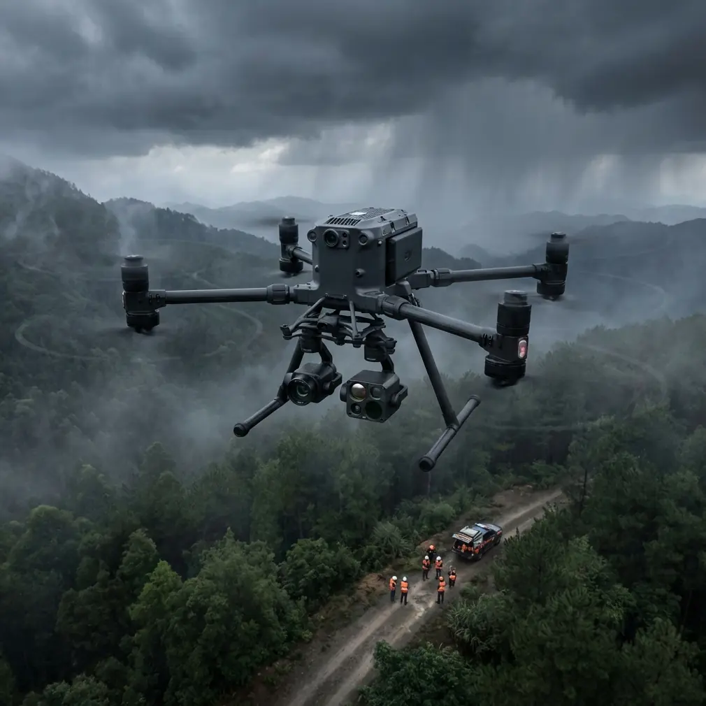
The Matrice 400 is compelling for urban construction capture because it speaks directly to workflow resilience, not just image acquisition.
Take hot-swap batteries. On paper, this sounds like a convenience feature. On a real site, it preserves mission rhythm. If you are capturing a phased excavation, facade progress set, or stockpile and haul-road update, reducing downtime between sorties protects lighting consistency and team timing. That matters more than many operators expect. A broken mission rhythm usually means more than a few lost minutes; it can mean re-flying sections under changed shadows, altered site traffic, or new equipment positions.
Then there is O3 transmission. In urban environments, link confidence is productivity. Dense materials, reflective surfaces, and changing obstructions can make operators cautious even when they are competent and current. A stronger transmission system helps stabilize the practical side of close-in commercial capture: cleaner situational awareness, fewer unnecessary interruptions, and better confidence when working around partially obstructed geometry.
Security also deserves more attention than it typically gets in construction discussions. Large developments routinely involve sensitive site layouts, utility staging, structural sequencing, and subcontractor coordination. AES-256 is not just a checkbox for IT-minded readers. It matters whenever captured data has commercial sensitivity, especially on projects where imagery and map products move across multiple stakeholders.
Photogrammetry is still the center of the job
No aircraft, however capable, can rescue weak field methodology. The Matrice 400 makes execution easier, but urban construction teams still need disciplined capture logic.
That begins with photogrammetry planning. Overlap strategy, altitude selection, camera angle, and timing should reflect the site’s geometry, not habit. Urban sites are vertical and discontinuous. Roof edges, facade recesses, lift cores, scaffold zones, and stockpile shadows all challenge standard nadir-only assumptions.
It also means using GCPs intelligently. In constrained city projects, you may not have the luxury of ideal distribution. But the principle remains: if you want outputs that stand up in engineering review, your control strategy has to match the precision expectation of the project. The reclamation case underlines this from a different angle. The study’s outputs—orthophotos, DEMs, and line drawings—were valuable because they were accurate enough to guide land transformation. Construction teams should hold themselves to the same standard. A pretty surface model is not enough. The model has to be defensible.
And then there is temporal repeatability. The true advantage of an enterprise platform on a live site is not a single impressive capture. It is the ability to return, repeat, compare, and quantify. If a Matrice 400 workflow is set up well, the site stops being a collection of disconnected flights and becomes a measurable timeline.
Thermal has a place, even when mapping is the primary mission
Urban construction capture is often discussed as if RGB photogrammetry is the whole story. It is not.
There are projects where thermal signature data adds practical context: identifying moisture-related anomalies on building envelopes, checking roof conditions, reviewing drainage behavior after rain events, or examining uniformity across certain installed systems during commissioning support. Thermal is not a replacement for engineering diagnosis, but it can be an efficient screening layer when paired with visual site data.
That pairing matters. A project team may start with progress mapping but quickly realize that a recurring water issue, facade inconsistency, or rooftop concern needs a second lens. A platform that adapts to this broader inspection logic saves organizational friction. The aircraft becomes more than a mapper. It becomes a field data platform.
What the reclamation numbers really teach us
The strongest detail in the source material is not simply the 10% increase in cultivated land area—from 38 km² to 41.8 km². It is what that increase implies about UAV-derived mapping quality.
For a land-reclamation program to produce that kind of measurable change, the survey data had to support real grading and land-use decisions. Likewise, the finding that former slope land was reclaimed into flatter terrain is not just a descriptive note. It points to the practical power of elevation intelligence. Terrain modeling changed the physical usability of the site.
Urban construction teams should read those facts as a validation of drone-derived surface data when it is collected and used properly. On a city project, flattening a mine slope is not the task. But verifying a subgrade, checking pad readiness, assessing drainage falls, confirming embankment work, or comparing designed versus built topography absolutely is.
The mining study also notes that reclaimed land quality improved, supported by engineering and biological restoration measures. Translated into construction language, this is a reminder that drone data creates the clearest value when it feeds a broader execution system. Aerial capture alone does not solve site problems. It works when integrated into design review, quantity analysis, scheduling, and field verification.
Matrice 400 and the move toward scalable site intelligence
The phrase BVLOS often attracts attention, but in civilian commercial operations its significance is broader than range alone. It points toward scalable oversight of large or segmented project environments, subject to regulatory approval and operational controls. For urban contractors managing distributed assets—multiple staging yards, linear utility works, or connected development zones—the ability to think beyond short, isolated flights changes planning.
Even when missions remain within visual line of sight, the discipline that comes with enterprise-level flight systems matters. Better transmission, cleaner battery transitions, stronger data protection, and more reliable repeatability all push the workflow toward scale.
That is what many teams miss when comparing aircraft. They compare cameras. They should be comparing decision systems.
A practical deployment mindset for urban projects
If I were setting up a Matrice 400 program for a city construction team today, I would not start by asking how beautiful the imagery looks. I would ask five harder questions:
- Can the team reproduce the same capture pattern every week?
- Are GCPs or other control methods sufficient for engineering-grade interpretation?
- Does the battery workflow preserve timing across changing light conditions?
- Is transmission confidence strong enough to reduce hesitant, fragmented flying?
- Are outputs being used for action—grading checks, progress validation, facade review, drainage assessment—or merely archived?
That final question separates mature drone programs from expensive hobbyism inside a corporate shell.
If your team is evaluating how to build a workflow around the Matrice 400 for dense construction environments, it helps to compare mission design and payload strategy with someone who has dealt with real site constraints; a quick way to start that conversation is message our field team here.
The real takeaway
The bauxite reclamation case is valuable because it shows a complete chain from UAV data capture to physical land improvement. Low-altitude drone mapping produced orthophotos, elevation models, and linework that guided reclamation accurately and quickly enough to change the site’s usable future. Cultivated area increased. Sloped land became flatter and more practical. Land productivity improved.
For urban construction professionals considering the Matrice 400, that is the benchmark worth paying attention to.
Not whether the drone can fly.
Whether the data can carry enough trust to shape what gets built next.
On modern city sites, the Matrice 400 stands out when the mission is not a one-off aerial survey but a repeatable, secure, high-confidence field workflow. Hot-swap batteries reduce operational drag. O3 transmission supports steadier capture in obstructed urban settings. AES-256 aligns with the reality of sensitive project data. Photogrammetry and GCP discipline turn images into defensible models. Thermal expands the platform from mapping into diagnostic support.
That is how a drone stops being a gadget and becomes part of the jobsite’s decision infrastructure.
Ready for your own Matrice 400? Contact our team for expert consultation.