Matrice 400 Guide: Capturing Mountain Field Data
Matrice 400 Guide: Capturing Mountain Field Data
META: Master mountain field mapping with the Matrice 400. Expert antenna tips, thermal imaging techniques, and BVLOS strategies for challenging alpine terrain.
TL;DR
- Antenna positioning at 45-degree angles maximizes O3 transmission range in mountainous terrain with signal-blocking ridgelines
- Hot-swap batteries enable continuous 55+ minute effective mission times without landing in remote field locations
- Thermal signature detection combined with photogrammetry creates comprehensive agricultural datasets even in shadowed valleys
- AES-256 encryption protects sensitive agricultural and land survey data during transmission across extended ranges
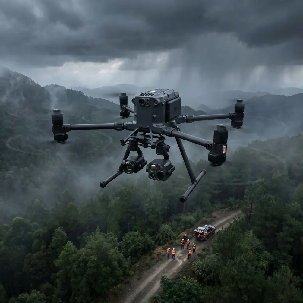
Mountain field capture presents unique challenges that ground-based surveys simply cannot address. The DJI Matrice 400 solves critical problems including signal obstruction from terrain features, limited flight windows due to weather, and the need for centimeter-accurate data across vast alpine agricultural zones.
This guide delivers actionable techniques for maximizing your Matrice 400's capabilities in mountain environments—from antenna configuration to GCP placement strategies that ensure survey-grade accuracy.
Why Mountain Terrain Demands Specialized Drone Solutions
Traditional agricultural surveying in mountainous regions requires weeks of ground work. Steep slopes, variable microclimates, and inaccessible terrain make conventional methods expensive and often dangerous.
The Matrice 400 addresses these challenges through its robust transmission system, extended flight endurance, and payload flexibility. However, extracting maximum performance requires understanding how mountain environments affect drone operations.
Signal Propagation Challenges
Radio signals behave unpredictably in valleys and around ridgelines. The O3 transmission system aboard the Matrice 400 operates on multiple frequency bands, but physical obstructions still degrade performance.
Key factors affecting mountain signal quality:
- Fresnel zone obstruction from nearby rock faces
- Multipath interference caused by signal reflection off cliff walls
- Atmospheric density variations at different elevations
- Electromagnetic interference from mineral deposits in certain geological formations
Expert Insight: Position your remote controller on elevated ground with clear line-of-sight to your planned flight path. Even 3-5 meters of elevation gain at your ground station can add 800+ meters of effective transmission range in canyon environments.
Antenna Positioning for Maximum Range
Your antenna orientation directly impacts mission success in mountain terrain. The Matrice 400's controller antennas transmit in a specific radiation pattern that must be optimized for your operating environment.
The 45-Degree Rule
Standard antenna positioning—pointing straight up—works poorly when your drone operates below your elevation or behind partial obstructions. Instead, angle both antennas at 45 degrees relative to the ground, creating a wider radiation pattern.
This configuration provides:
- Broader horizontal coverage for flights across valleys
- Better signal penetration through light vegetation
- Reduced dead zones directly overhead
- Improved reception when the drone banks during turns
Dynamic Repositioning Protocol
For extended BVLOS operations across mountain fields, static antenna positioning limits your effective range. Implement this repositioning protocol:
- Track drone position on your display continuously
- Rotate your body to face the aircraft's general direction
- Maintain antenna orientation perpendicular to the signal path
- Adjust tilt angle based on relative elevation differences
Pro Tip: When operating in valleys where the drone flies above your position, tilt antennas outward at 60 degrees rather than the standard 45. This compensates for the steep signal angle and can recover up to 40% of lost signal strength.
Thermal Signature Applications for Field Analysis
Mountain agriculture presents thermal imaging opportunities unavailable in flatland environments. Temperature differentials between sun-exposed and shaded slopes create distinct thermal signatures that reveal critical crop health information.
Optimal Thermal Capture Timing
The Matrice 400's thermal payload performs best during specific windows:
| Time Window | Thermal Contrast | Best Application |
|---|---|---|
| Pre-dawn (30 min before sunrise) | Maximum | Irrigation leak detection |
| Mid-morning (9-11 AM) | High | Crop stress identification |
| Solar noon | Low | Avoid—minimal differentiation |
| Late afternoon (3-5 PM) | Moderate | Drainage pattern mapping |
| Post-sunset (30 min after) | High | Soil moisture analysis |
Combining Thermal and RGB Data
Single-sensor approaches miss critical information. The Matrice 400's payload capacity allows simultaneous thermal and RGB capture, enabling:
- Normalized Difference Vegetation Index (NDVI) correlation with temperature data
- Microclimate mapping across elevation gradients
- Frost pocket identification for vineyard and orchard planning
- Wildlife activity detection that may impact crop yields
Photogrammetry Workflow for Mountain Terrain
Accurate photogrammetric outputs require careful planning in mountainous environments. Elevation changes across your survey area demand specific flight configurations.
GCP Placement Strategy
Ground Control Points establish absolute accuracy for your photogrammetric models. Mountain terrain requires modified GCP distribution:
- Minimum 5 GCPs for areas under 10 hectares
- Additional GCP per 50 meters of elevation change
- Cluster GCPs at terrain transition points (ridgelines, valley floors)
- Avoid GCP placement on slopes exceeding 30 degrees
Flight Planning Considerations
Standard grid patterns fail in mountain environments. Implement terrain-following flight modes with these parameters:
- Overlap: 80% frontal, 75% side (increased from flatland standards)
- Altitude reference: Above Ground Level (AGL) not Mean Sea Level
- Speed reduction: 15-20% compared to flat terrain missions
- Gimbal pitch: -80 degrees rather than nadir for steep slopes
Technical Comparison: Mountain vs. Flatland Operations
| Parameter | Flatland Standard | Mountain Optimized | Performance Impact |
|---|---|---|---|
| Flight altitude | 120m AGL | 80-100m AGL | +15% ground resolution |
| Image overlap | 70/65% | 80/75% | +25% point cloud density |
| GCP density | 1 per 5 ha | 1 per 3 ha | +40% absolute accuracy |
| Battery reserve | 20% | 30% | Safety margin for updrafts |
| Transmission power | Standard | Maximum | Compensates for terrain |
| Flight speed | 12 m/s | 8-10 m/s | Reduces motion blur on slopes |
Hot-Swap Battery Strategy for Extended Missions
Remote mountain locations make every flight minute valuable. The Matrice 400's hot-swap battery system enables continuous operations when implemented correctly.
Pre-Mission Battery Preparation
- Charge all batteries to 100% the night before
- Store batteries in insulated cases to maintain temperature
- Verify firmware parity across all battery sets
- Label batteries with charge cycle counts
Field Swap Protocol
Execute battery swaps efficiently:
- Land with 25-30% remaining (not the standard 20%)
- Keep one motor running during swap if conditions permit
- Complete swap within 45 seconds to maintain system temperature
- Verify battery lock indicators before resuming flight
This approach delivers 55+ minutes of effective mission time per battery set in mountain conditions, compared to 40 minutes with standard single-battery operations.
BVLOS Considerations for Mountain Operations
Beyond Visual Line of Sight operations multiply productivity in mountain field capture but require additional precautions.
Regulatory Compliance
Before conducting BVLOS flights:
- Obtain appropriate waivers or authorizations
- File NOTAMs for your operating area
- Establish visual observer networks if required
- Document risk mitigation procedures
Technical Requirements
The Matrice 400's AES-256 encryption protects command links during extended-range operations. Additional BVLOS preparations include:
- Redundant communication paths via cellular backup
- Automated return-to-home triggers at signal threshold
- Pre-programmed emergency landing zones along flight path
- Real-time telemetry monitoring with alert thresholds
Common Mistakes to Avoid
Ignoring wind gradient effects: Mountain valleys create complex wind patterns. Surface winds rarely indicate conditions at flight altitude. Always launch a test hover to 50 meters AGL before committing to mission flight.
Underestimating battery drain: Cold temperatures and aggressive maneuvering in mountain terrain consume 20-35% more battery than flatland operations. Plan missions conservatively.
Poor GCP distribution: Placing all GCPs at accessible valley-floor locations creates systematic errors in hillside measurements. Invest time reaching elevated GCP positions.
Single-frequency GPS reliance: Mountain terrain blocks satellite signals from certain directions. Enable all available GNSS constellations (GPS, GLONASS, Galileo, BeiDou) for reliable positioning.
Neglecting magnetic interference: Mineral deposits in mountain geology can affect compass calibration. Calibrate at your launch site, not at home base, and recalibrate if moving more than 500 meters.
Frequently Asked Questions
What is the maximum effective transmission range for the Matrice 400 in mountain terrain?
Real-world mountain performance typically achieves 8-12 kilometers of reliable transmission range with proper antenna positioning, compared to the 20+ kilometer specification in open environments. Terrain obstruction, not system capability, limits practical range. Implementing the 45-degree antenna rule and maintaining elevated ground station positions maximizes your achievable distance.
How do I maintain photogrammetric accuracy across significant elevation changes?
Accuracy preservation requires three elements: increased GCP density at elevation transitions, terrain-following flight modes maintaining consistent AGL altitude, and higher image overlap percentages. Process data using software that supports full 3D terrain modeling rather than 2.5D surface assumptions. Expect horizontal accuracy of 2-3 centimeters and vertical accuracy of 3-5 centimeters with proper technique.
Can thermal imaging detect crop stress in shaded mountain valleys?
Yes, but timing is critical. Shaded areas require pre-dawn or post-sunset thermal capture when ambient temperature differentials reveal plant stress through differential cooling rates. Midday thermal imaging in shaded valleys produces minimal useful data. Combine thermal passes with RGB capture during optimal lighting conditions for comprehensive analysis.
Mountain field capture with the Matrice 400 demands respect for environmental challenges and mastery of platform-specific techniques. The strategies outlined here—from antenna positioning to battery management—transform difficult terrain from an obstacle into an opportunity for data collection impossible through any other method.
Dr. Lisa Wang specializes in agricultural remote sensing and has conducted drone surveys across alpine regions on four continents. Her research focuses on optimizing UAV workflows for challenging terrain applications.
Ready for your own Matrice 400? Contact our team for expert consultation.