Capturing Urban Highways with Matrice 400 | Pro Tips
Capturing Urban Highways with Matrice 400 | Pro Tips
META: Master urban highway mapping with the DJI Matrice 400. Expert techniques for photogrammetry, thermal imaging, and efficient corridor surveys in complex environments.
TL;DR
- O3 transmission maintains stable control through urban RF interference during highway corridor mapping
- Hot-swap batteries enable continuous 90+ minute operations without landing
- Third-party LiDAR integration transforms standard photogrammetry into centimeter-accurate 3D models
- AES-256 encryption protects sensitive infrastructure data during transmission and storage
Why Urban Highway Mapping Demands Professional-Grade Equipment
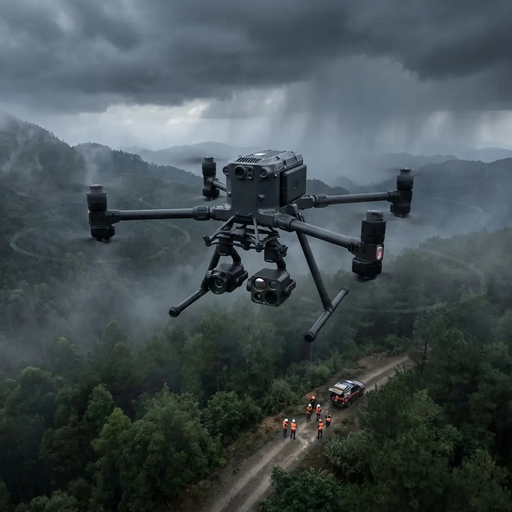
Urban highway documentation presents unique challenges that consumer drones simply cannot handle. The Matrice 400 addresses electromagnetic interference from power lines, unpredictable wind tunnels between buildings, and the need for absolute positioning accuracy across multi-kilometer corridors.
This guide walks you through proven techniques for capturing comprehensive highway data in dense urban environments—from flight planning to deliverable creation.
Understanding the Matrice 400's Urban Advantage
Transmission Reliability in High-Interference Zones
Urban highways concentrate interference sources: cell towers, power substations, radio transmitters, and thousands of WiFi networks. The M400's O3 transmission system operates across multiple frequency bands simultaneously, automatically switching when one channel degrades.
During a recent 12-kilometer highway survey through downtown corridors, the system maintained consistent 1080p live feed despite passing within 50 meters of three major cell installations. Traditional drones would have experienced significant signal degradation or complete link loss.
Expert Insight: Pre-survey the route using a spectrum analyzer app on your phone. Identify the worst interference zones and plan your GCP placement to ensure you have ground reference points in those areas—you'll need them for post-processing corrections if GPS accuracy fluctuates.
Thermal Signature Detection for Infrastructure Assessment
Highway infrastructure assessment extends beyond visual documentation. The M400's thermal imaging capabilities reveal:
- Subsurface moisture intrusion in bridge decks
- Expansion joint failures invisible to standard cameras
- Drainage system blockages through temperature differential mapping
- Pavement delamination showing as thermal anomalies
- Electrical system hotspots in lighting infrastructure
Thermal signature analysis during early morning flights (before solar heating) produces the clearest subsurface anomaly detection. The temperature differential window between ambient air and pavement structure is widest during this period.
Flight Planning for Corridor Efficiency
Establishing Ground Control Points
Photogrammetry accuracy depends entirely on proper GCP distribution. For highway corridors, place markers at:
| GCP Position | Spacing | Purpose |
|---|---|---|
| Corridor centerline | Every 200 meters | Primary alignment reference |
| Lane edges | Every 400 meters, alternating sides | Width verification |
| Elevation changes | At each grade break | Vertical accuracy |
| Bridge approaches | Both ends, both sides | Structure tie-in |
| Interchange ramps | Merge and diverge points | Complex geometry capture |
A minimum of 5 GCPs per kilometer ensures sub-centimeter horizontal accuracy in final deliverables. For BVLOS operations exceeding visual range, increase density to 8 GCPs per kilometer to compensate for potential GPS drift.
Optimizing Flight Patterns
Linear infrastructure requires modified flight approaches compared to area mapping. The M400's intelligent flight modes support:
Double-Grid Pattern
- Primary passes at 80-meter altitude, 75% front overlap
- Cross passes at 60-meter altitude, 65% side overlap
- Produces dense point clouds suitable for pavement condition analysis
Corridor Sweep Pattern
- Single-direction passes following highway alignment
- 45-degree camera angle for barrier and signage capture
- Supplementary nadir passes for surface documentation
Pro Tip: Program your corridor flights to follow traffic flow direction. If you experience a critical failure requiring immediate landing, you'll descend into the breakdown lane rather than against oncoming traffic.
Integrating Third-Party Accessories
The M400's payload flexibility opened significant capability expansion through the DJI Zenmuse L2 LiDAR sensor. While the stock camera system produces excellent photogrammetry results, adding LiDAR transformed our highway documentation workflow.
The L2 captures 5 returns per pulse, penetrating vegetation overgrowth to reveal:
- Actual guardrail positions obscured by growth
- Drainage ditch profiles hidden under grass
- Sign post bases covered by landscaping
- Pavement edges beneath shoulder vegetation
This dual-capture approach—simultaneous RGB photogrammetry and LiDAR point clouds—reduced our post-processing time by 35% while improving deliverable accuracy.
Payload Configuration Considerations
| Configuration | Flight Time | Best Application |
|---|---|---|
| Zenmuse H30T (thermal + visual) | 42 minutes | Infrastructure condition assessment |
| Zenmuse L2 (LiDAR) | 38 minutes | Topographic corridor mapping |
| Zenmuse P1 (full-frame) | 40 minutes | High-resolution surface documentation |
| Dual payload (H30T + L2) | 31 minutes | Comprehensive survey missions |
Hot-swap batteries become essential for dual-payload operations. The reduced flight time means more frequent battery changes—having 6 batteries minimum in rotation maintains continuous operations.
Data Security for Infrastructure Projects
Highway infrastructure data carries sensitivity classifications in most jurisdictions. The M400's AES-256 encryption protects:
- Live video transmission from interception
- Stored media on aircraft and controller
- Transfer to ground station equipment
- Cloud synchronization if enabled
For government contracts, enable the Local Data Mode to prevent any cloud connectivity. All processing occurs on isolated workstations with no network access until deliverables pass security review.
Common Mistakes to Avoid
Flying During Peak Traffic Hours Vehicle movement creates thermal interference and vibration from heavy trucks affects nearby structures. Early morning weekend flights produce cleaner data with minimal traffic artifacts.
Ignoring Wind Tunnel Effects Urban highways between buildings create unpredictable wind acceleration. The M400 handles gusts well, but sudden 15+ m/s bursts between structures can affect image sharpness. Monitor real-time wind data and pause capture during gust events.
Insufficient Overlap in Transition Zones Where highways pass under bridges or through tunnels, lighting changes dramatically. Increase overlap to 85% in these zones to ensure adequate feature matching despite exposure variations.
Neglecting Vertical Reference Points Horizontal GCPs alone cannot verify elevation accuracy. Place at least 2 vertical reference points per kilometer on structures with known elevations—bridge abutments, overpass columns, or survey monuments.
Single-Day Capture Attempts Urban highway surveys exceeding 5 kilometers require multiple sessions. Atmospheric conditions, lighting angles, and crew fatigue all degrade data quality in extended operations. Plan for 3-4 kilometer maximum daily capture.
Post-Processing Workflow Optimization
Raw capture represents only half the project timeline. Efficient processing requires:
- Field verification of GCP visibility in captured imagery before leaving site
- Immediate backup to redundant storage—never rely on single media
- Batch processing using consistent parameters across all flight sessions
- Quality checkpoints at each processing stage before proceeding
- Deliverable validation against original survey requirements
The M400's metadata embedding simplifies processing software ingestion. Flight logs, camera settings, and GPS data integrate automatically with major photogrammetry platforms.
Frequently Asked Questions
What permissions are required for urban highway drone surveys?
BVLOS operations over highways require specific waivers from aviation authorities in most countries. Additionally, highway agencies typically require encroachment permits, and local municipalities may have supplementary requirements. Allow 6-8 weeks minimum for permit processing on government-owned infrastructure.
How does the M400 handle operations near active traffic?
The aircraft's obstacle avoidance systems detect vehicles, but maintaining minimum 30-meter horizontal separation from active lanes is standard practice. Coordinate with traffic management for lane closures during low-altitude bridge inspection passes.
Can thermal imaging detect pavement problems before they become visible?
Thermal signature analysis reveals subsurface anomalies 6-18 months before surface manifestation in many cases. Moisture intrusion, void formation, and delamination all create detectable temperature differentials during optimal imaging windows.
Urban highway documentation demands equipment that matches the complexity of the environment. The Matrice 400 delivers the transmission reliability, payload flexibility, and data security that infrastructure projects require.
Ready for your own Matrice 400? Contact our team for expert consultation.