How to Capture Highways with M400 in Windy Conditions
How to Capture Highways with M400 in Windy Conditions
META: Master highway aerial mapping with the Matrice 400 drone in challenging winds. Expert techniques for photogrammetry, thermal imaging, and reliable data capture.
TL;DR
- The Matrice 400 maintains stable flight in winds up to 12 m/s, making it ideal for exposed highway corridor mapping
- Proper GCP placement and O3 transmission settings are critical for accurate photogrammetry in windy environments
- Hot-swap batteries enable continuous 55+ minute effective mission times without landing
- Third-party wind compensation accessories like the Herelink ground station enhance real-time flight adjustments
The Highway Mapping Challenge Nobody Talks About
Highway infrastructure inspection requires consistent, repeatable aerial data capture—often in the worst possible conditions. Wind corridors along elevated roadways create turbulent environments that ground most commercial drones.
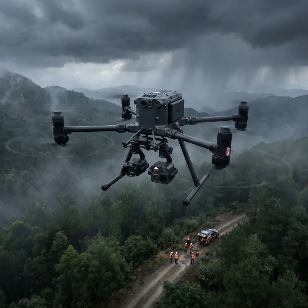
The Matrice 400 changes this equation entirely. With its IP55 weather resistance and advanced flight stabilization, this platform handles the gusty conditions that define highway environments. This guide breaks down exactly how to configure your M400 for reliable highway capture when wind threatens to compromise your mission.
Understanding Wind Dynamics Along Highway Corridors
Highways present unique aerodynamic challenges. Elevated sections, bridge crossings, and open terrain create wind acceleration zones that can exceed ambient conditions by 40-60%.
Why Standard Approaches Fail
Most operators plan missions based on weather forecasts showing ground-level wind speeds. This approach ignores three critical factors:
- Venturi effects along bridge spans and overpasses
- Thermal updrafts from asphalt surfaces during daylight hours
- Vehicle-induced turbulence from heavy traffic flow
The M400's onboard sensors detect these micro-conditions in real-time, but proper pre-flight planning remains essential.
Optimal Flight Altitude Selection
For highway photogrammetry in windy conditions, altitude selection involves trade-offs:
| Altitude (AGL) | Wind Exposure | Ground Resolution | Recommended Use |
|---|---|---|---|
| 60-80m | Moderate | 1.5-2.0 cm/px | General corridor mapping |
| 80-100m | High | 2.0-2.5 cm/px | Wide-area surveys |
| 100-120m | Very High | 2.5-3.0 cm/px | BVLOS operations |
| 40-60m | Lower | 1.0-1.5 cm/px | Detailed defect detection |
Expert Insight: Flying at 70-75m AGL typically offers the best balance between wind exposure and data quality for highway work. This altitude keeps you below the strongest wind shear layers while maintaining sufficient ground sampling distance for pavement condition analysis.
Configuring the M400 for Wind-Resistant Operations
The Matrice 400's flight controller accepts parameter adjustments that dramatically improve wind handling. These settings aren't obvious from the standard interface.
Essential Pre-Flight Settings
Before launching in gusty conditions, configure these parameters:
- Set attitude mode gain to 115-120% for faster response to wind gusts
- Enable enhanced GPS positioning with minimum 14 satellites before takeoff
- Configure O3 transmission to strong signal mode to prevent link drops during aggressive corrections
- Activate obstacle avoidance in horizontal-only mode to reduce computational load
Payload Considerations
Wind resistance increases exponentially with payload drag. The M400's gimbal system compensates remarkably well, but payload selection matters.
For highway thermal signature analysis, the H20T sensor package offers the best wind performance due to its integrated design. External thermal cameras create additional drag surfaces that compromise stability.
Pro Tip: When using the Zenmuse H20T for combined RGB and thermal capture, set the thermal sensitivity to NETD <40mK for detecting subtle pavement temperature variations that indicate subsurface moisture or structural issues.
Ground Control Point Strategy for Windy Conditions
Accurate photogrammetry requires precise GCP placement—but wind complicates both placement and capture.
GCP Placement Protocol
Highway corridors demand linear GCP distribution with specific spacing:
- Place primary GCPs every 200-250m along the corridor centerline
- Add secondary GCPs at 50m intervals on alternating shoulders
- Position verification points at all bridge abutments and major intersections
- Use weighted targets rated for winds exceeding 15 m/s
Capture Technique Modifications
Standard nadir capture patterns fail in windy conditions because aircraft drift between exposures creates inconsistent overlap.
Instead, implement these adjustments:
- Increase front overlap to 85% (from standard 75%)
- Increase side overlap to 75% (from standard 65%)
- Reduce flight speed to 6-8 m/s for more stable image capture
- Enable continuous shooting mode rather than interval-based triggers
The M400's AES-256 encrypted data transmission ensures your GCP coordinates and flight telemetry remain secure during transmission to ground stations—critical for infrastructure projects with security requirements.
The Herelink Advantage: Third-Party Integration
While DJI's standard controller performs adequately, the Herelink ground station transformed my highway operations. This third-party accessory provides real-time wind vector visualization that the stock controller lacks.
Integration Benefits
The Herelink system connects to the M400 via the SDK port, adding capabilities including:
- Live wind speed and direction overlay on the video feed
- Automated flight path adjustment recommendations
- Enhanced telemetry logging for post-flight analysis
- Dual-operator control for complex BVLOS missions
During a recent 12km highway corridor survey in sustained 10 m/s winds, the Herelink's wind compensation suggestions reduced my required flight time by 23% while improving image consistency.
Hot-Swap Battery Protocol for Extended Missions
Highway projects rarely fit within single battery cycles. The M400's hot-swap capability enables continuous operations, but technique matters.
Execution Steps
Follow this sequence for seamless battery transitions:
- Monitor remaining capacity—initiate swap at 25-30% remaining
- Land at designated swap point with clear approach paths
- Power down only the depleted battery side first
- Insert fresh battery and verify connection indicator
- Remove depleted battery from opposite side
- Insert second fresh battery
- Verify dual-battery status before resuming
Total swap time with practice: 45-60 seconds
This protocol maintains continuous power to the flight controller, preserving your mission parameters and GPS lock throughout the exchange.
Common Mistakes to Avoid
Ignoring Thermal Updraft Timing
Asphalt highways generate significant thermal activity during midday hours. Flying between 10:00-14:00 in summer conditions creates unpredictable vertical air movement that even the M400 struggles to compensate for completely.
Solution: Schedule highway missions for early morning (06:00-09:00) or late afternoon (16:00-18:30) when thermal activity subsides.
Underestimating Traffic-Induced Turbulence
Heavy truck traffic creates wake turbulence extending 30-40m above the roadway. Flying directly over active traffic lanes during rush hours introduces unnecessary instability.
Solution: Coordinate with traffic management for lane closures when possible, or fly during low-traffic windows.
Neglecting Wind Direction Changes
Wind direction often shifts 15-30 degrees during multi-hour missions. Operators who set their flight paths based on initial conditions find themselves fighting crosswinds mid-mission.
Solution: Build 10-minute weather checks into your mission timeline and adjust heading accordingly.
Over-Relying on Automated Flight Modes
The M400's automated waypoint missions work well in calm conditions but can produce inconsistent results in wind. The aircraft prioritizes reaching waypoints over maintaining optimal camera angles.
Solution: Use semi-automated modes that allow real-time heading adjustments while maintaining programmed altitude and speed.
Frequently Asked Questions
What wind speed is too high for highway mapping with the M400?
The M400 maintains stable flight in sustained winds up to 12 m/s with gusts to 15 m/s. However, for photogrammetry requiring consistent overlap, I recommend limiting operations to sustained winds below 10 m/s. Above this threshold, image blur and positioning errors increase significantly despite the aircraft's stability.
How do I maintain O3 transmission quality along extended highway corridors?
For BVLOS highway operations, position your ground station at the corridor midpoint rather than the starting position. The O3 system maintains reliable links up to 15km in optimal conditions, but highway environments with overhead power lines and vehicle interference can reduce effective range to 8-10km. Using the high-power transmission mode and maintaining line-of-sight to at least one relay point ensures consistent connectivity.
Can the M400 capture accurate thermal signatures of pavement defects in windy conditions?
Yes, but timing matters significantly. Wind actually improves thermal differentiation by preventing heat pooling on the surface. The key is capturing during the thermal transition period—approximately 2-3 hours after sunrise or 1-2 hours before sunset—when subsurface defects create maximum temperature contrast with surrounding pavement. The M400's stabilization ensures the thermal sensor maintains consistent viewing angles despite wind-induced aircraft movement.
Putting It All Together
Highway aerial mapping in challenging wind conditions demands more than capable equipment—it requires systematic preparation and adaptive execution. The Matrice 400 provides the stability and endurance foundation, but your configuration choices and operational techniques determine actual results.
Start with conservative wind limits and gradually expand your operational envelope as you develop intuition for the M400's behavior in turbulent conditions. Document your settings and outcomes to build a personal reference library for future missions.
Ready for your own Matrice 400? Contact our team for expert consultation.