Matrice 400: Mastering Vineyard Mapping in Mountains
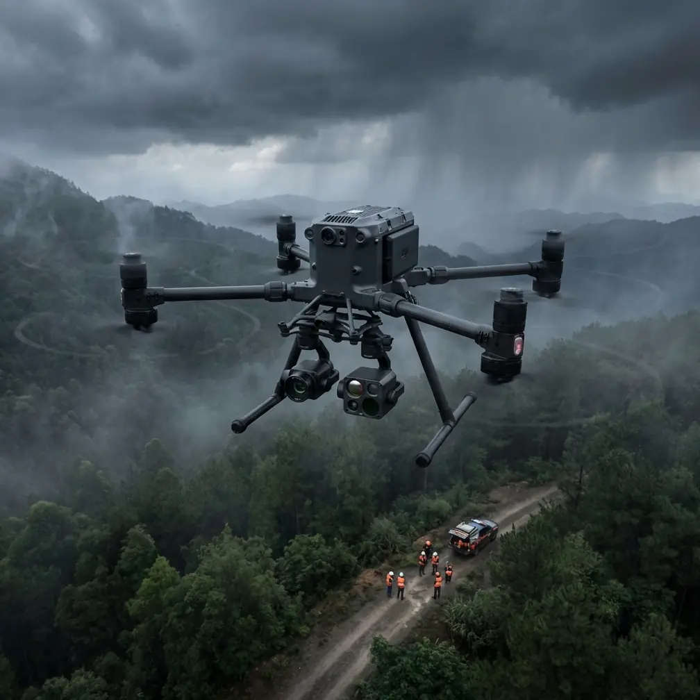
Matrice 400: Mastering Vineyard Mapping in Mountains
META: Discover how the Matrice 400 transforms mountain vineyard mapping with precision photogrammetry, thermal imaging, and reliable O3 transmission for steep terrain.
TL;DR
- O3 transmission maintains stable control across mountain valleys with 20km range and automatic frequency hopping
- Hot-swap batteries enable continuous vineyard surveys without landing between steep terraced sections
- Integrated thermal signature detection identifies irrigation issues and vine stress invisible to standard RGB cameras
- Third-party GCP markers from Propeller Aero boost photogrammetry accuracy to sub-centimeter precision
Why Mountain Vineyards Demand Specialized Drone Solutions
Steep vineyard terrain breaks conventional drone workflows. The Matrice 400 solves three critical challenges: maintaining signal through valley interference, covering large acreage without multiple battery landings, and generating survey-grade maps that viticulturists actually trust.
This tutorial walks you through a complete mountain vineyard capture workflow—from pre-flight GCP placement to final orthomosaic delivery. You'll learn the exact settings, flight patterns, and third-party integrations that professional agricultural surveyors use.
Understanding the Matrice 400's Mountain-Ready Architecture
Signal Reliability in Challenging Terrain
Mountain environments create natural signal barriers. Ridgelines, dense canopy, and mineral-rich soil all interfere with standard drone communications.
The Matrice 400's O3 transmission system addresses this through:
- Triple-frequency redundancy across 2.4GHz, 5.8GHz, and DBS bands
- Automatic obstacle penetration algorithms that boost signal when terrain interference is detected
- 20km maximum range providing substantial buffer for valley operations
- AES-256 encryption protecting your proprietary vineyard data during transmission
Expert Insight: When flying in mountain vineyards, position your controller on the highest accessible point—even a 3-meter elevation gain dramatically improves signal consistency through the entire flight envelope.
Power Management for Extended Coverage
Terraced mountain vineyards often span 50+ hectares across multiple elevation zones. Traditional drones require landing, swapping batteries, and relaunching—wasting 15-20 minutes per cycle.
The Matrice 400's hot-swap battery system eliminates this bottleneck. With one battery maintaining flight while you replace the depleted unit, continuous operation becomes standard practice.
Practical benefits include:
- Zero interruption during critical morning light windows
- Consistent overlap without mid-mission gaps
- Reduced pilot fatigue from fewer launch/recovery cycles
- Lower risk of landing damage on uneven terrain
Pre-Flight Setup: GCP Placement Strategy
Ground Control Points transform good photogrammetry into survey-grade deliverables. For mountain vineyards, GCP placement requires strategic thinking.
Optimal GCP Distribution Pattern
Standard flat-terrain GCP patterns fail in mountainous environments. Elevation variation demands a modified approach:
- Place markers at elevation extremes—highest and lowest vineyard blocks
- Position GCPs on stable, permanent features like concrete irrigation structures
- Avoid vine canopy shadows that reduce marker visibility
- Use high-contrast targets visible from 120m AGL
Pro Tip: Propeller Aero's AeroPoints provide RTK-corrected positioning without manual surveying. For mountain vineyards, their autonomous base station mode compensates for the lack of cellular coverage, delivering 8mm horizontal accuracy even in remote locations.
RTK Base Station Configuration
The Matrice 400 supports network RTK and local base station modes. In mountain environments, local base stations typically outperform network solutions due to cellular limitations.
Configure your base station with these parameters:
- Minimum 30-minute initialization before flight operations
- Clear sky view of at least 270 degrees
- Stable mounting on tripod rated for wind gusts
- Known benchmark or post-processed positioning
Flight Planning for Terraced Terrain
Terrain-Following vs. Fixed Altitude
The Matrice 400 offers both terrain-following and fixed-altitude modes. For mountain vineyards, terrain-following is essential.
Fixed altitude problems:
- Ground sampling distance varies with elevation
- Steep sections appear at lower resolution
- Photogrammetry software struggles with inconsistent overlap
Terrain-following advantages:
- Consistent GSD across entire survey area
- Uniform overlap regardless of slope
- Better thermal signature detection at standardized distances
Recommended Flight Parameters
| Parameter | RGB Mapping | Thermal Survey | Combined Mission |
|---|---|---|---|
| Altitude AGL | 80m | 60m | 70m |
| Speed | 8 m/s | 5 m/s | 6 m/s |
| Front Overlap | 80% | 85% | 82% |
| Side Overlap | 75% | 80% | 78% |
| Gimbal Angle | -90° | -90° | -90° |
| Image Interval | 2 sec | 1.5 sec | 2 sec |
BVLOS Considerations
Mountain vineyard operations frequently require Beyond Visual Line of Sight flight. The Matrice 400's redundant systems support BVLOS operations where regulations permit.
Key BVLOS preparation steps:
- File appropriate waivers with aviation authorities
- Establish visual observer positions at terrain high points
- Configure automatic return-to-home triggers
- Test O3 transmission range before committing to extended operations
Thermal Signature Analysis for Vine Health
Detecting Irrigation Deficiencies
Thermal imaging reveals what RGB cameras miss. Water-stressed vines exhibit distinct thermal signatures that indicate irrigation system failures before visible symptoms appear.
The Matrice 400's thermal payload captures:
- Canopy temperature differentials indicating blocked drip lines
- Soil moisture patterns showing underground leak locations
- Microclimate variations across elevation zones
- Disease stress indicators preceding visible infection
Optimal Thermal Capture Timing
Thermal surveys require specific environmental conditions:
- Pre-dawn flights capture accumulated overnight stress
- Solar noon reveals active transpiration differences
- Avoid windy conditions that mask temperature variations
- Overcast skies reduce solar heating interference
Post-Processing Workflow
Photogrammetry Software Integration
The Matrice 400 outputs industry-standard formats compatible with major photogrammetry platforms. For vineyard applications, processing priorities differ from construction or mining surveys.
Recommended software settings:
- High point cloud density for individual vine detection
- Vegetation-optimized color correction preserving chlorophyll signatures
- Terrain mesh smoothing appropriate for agricultural analysis
- Orthomosaic resolution matching GSD specifications
Deliverable Formats for Viticulturists
Agricultural clients require specific outputs:
- Georeferenced orthomosaics in GeoTIFF format
- Digital elevation models showing drainage patterns
- NDVI vegetation indices from multispectral data
- Thermal anomaly maps highlighting stress zones
- 3D terrain models for erosion analysis
Common Mistakes to Avoid
Flying during midday thermal inversions. Mountain valleys experience temperature inversions that create turbulent conditions. Schedule flights for early morning or late afternoon when air masses stabilize.
Ignoring magnetic interference from mineral deposits. Mountain soils often contain iron-rich minerals that affect compass calibration. Always calibrate on-site, away from vehicles and metal structures.
Underestimating battery consumption on steep terrain. Terrain-following modes consume 15-25% more power than fixed-altitude flights due to constant altitude adjustments. Plan conservative battery reserves.
Skipping GCP verification shots. Always capture dedicated nadir images of each GCP at low altitude before beginning the survey pattern. These verification shots dramatically improve tie-point accuracy.
Using default camera settings for vineyard canopy. Vine foliage requires exposure compensation. Underexpose by 0.7 stops to preserve highlight detail in reflective leaf surfaces.
Frequently Asked Questions
What accuracy can I expect from Matrice 400 vineyard surveys?
With proper GCP placement and RTK correction, the Matrice 400 delivers horizontal accuracy of 1-2cm and vertical accuracy of 2-3cm. These specifications meet survey-grade requirements for precision agriculture applications, including variable-rate irrigation planning and yield estimation modeling.
How many hectares can I cover on a single battery set?
Under typical mountain vineyard conditions with terrain-following enabled, expect 35-45 hectares per battery pair at 80m AGL with 80% overlap. Hot-swap capability extends this indefinitely, limited only by available battery inventory and pilot endurance.
Does the O3 transmission work reliably in deep valleys?
The O3 system maintains connection in valleys where competing drones lose signal. Its automatic frequency hopping and multi-path rejection algorithms handle reflections from cliff faces and dense vegetation. Position your controller at elevation when possible, but the system tolerates significant terrain obstruction.
Bringing It All Together
Mountain vineyard mapping demands equipment that matches the terrain's complexity. The Matrice 400 delivers the transmission reliability, power flexibility, and payload integration that professional agricultural surveyors require.
Combined with third-party accessories like Propeller Aero's AeroPoints, the platform achieves photogrammetry accuracy that transforms vineyard management decisions. Thermal signature detection adds another dimension, revealing vine stress weeks before visible symptoms appear.
Ready for your own Matrice 400? Contact our team for expert consultation.