M400 Solar Farm Delivery Tips for High Altitude
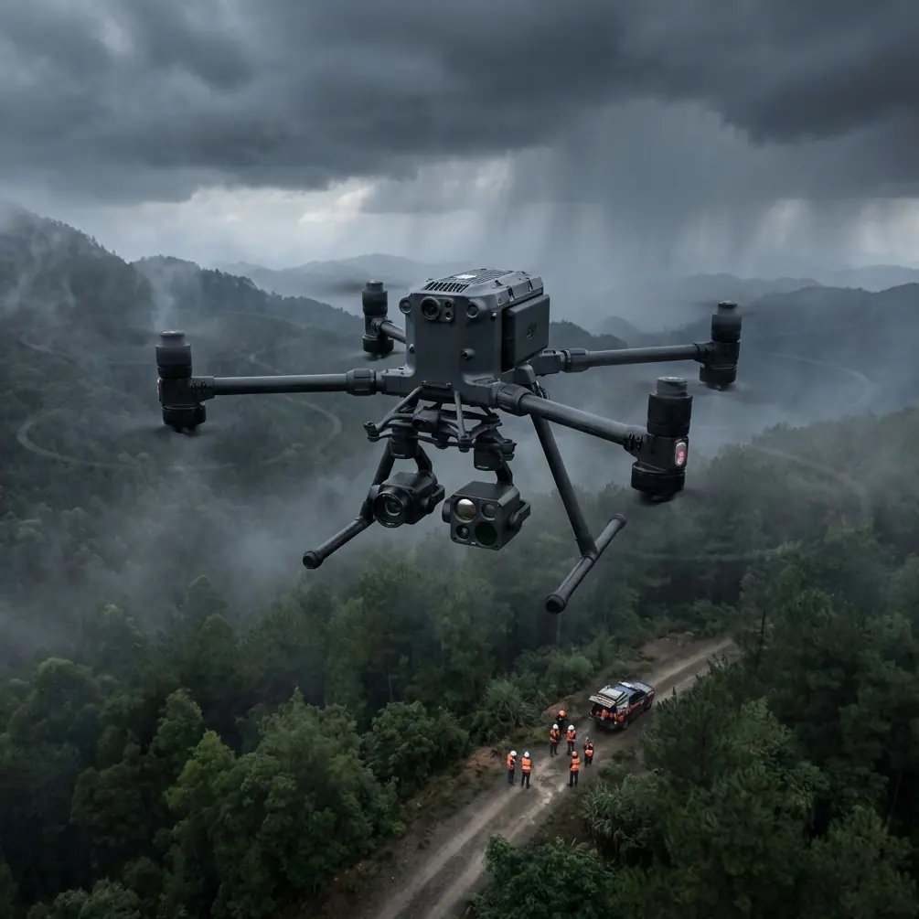
M400 Solar Farm Delivery Tips for High Altitude
META: Learn how to deliver solar farm inspections at high altitude with the DJI Matrice 400. Expert tips on antenna positioning, thermal imaging, and BVLOS ops.
By James Mitchell | Drone Operations Expert
TL;DR
- Antenna positioning is the single biggest factor in maintaining O3 transmission link quality during high-altitude solar farm missions with the Matrice 400.
- Hot-swap batteries and proper altitude calibration are non-negotiable for sites above 3,000 meters.
- Thermal signature analysis paired with photogrammetry workflows can reduce solar panel inspection time by up to 50%.
- AES-256 encrypted data transmission keeps your client's infrastructure data secure throughout every flight.
Why High-Altitude Solar Farm Inspections Demand a Different Approach
Solar farm inspections above 2,500 meters break the assumptions most pilots carry from low-altitude work. Thinner air reduces propulsion efficiency. Temperature swings distort thermal signature readings. RF signals behave unpredictably against barren, reflective terrain.
The DJI Matrice 400 was built for exactly this kind of punishment. But the drone alone doesn't guarantee results—your workflow, configuration, and field habits do.
This guide walks you through the exact process for delivering reliable, high-quality solar farm inspection data at altitude using the M400. You'll learn antenna positioning strategies, battery management protocols, payload configuration, and the common mistakes that ruin otherwise solid missions.
Step 1: Pre-Mission Planning for High-Altitude Sites
Understand Your Density Altitude
Density altitude—not just elevation—determines how your M400 performs. A site at 3,500 meters on a hot afternoon can have a density altitude exceeding 4,200 meters. This directly impacts:
- Maximum takeoff weight (reduce payload if necessary)
- Flight time per battery cycle (expect 15–20% reduction)
- Motor responsiveness during aggressive maneuvers
- Maximum climb rate and hover stability
Use a density altitude calculator before every mission. Input actual temperature, pressure, and humidity readings from your ground station.
Set Ground Control Points (GCPs) Strategically
For photogrammetry accuracy on large solar arrays, GCP placement is critical. At high-altitude sites where terrain is often flat and featureless, follow these guidelines:
- Place a minimum of 5 GCPs per 10 hectares of solar array
- Position GCPs at array corners and at elevation change points
- Use high-contrast targets (black and white checkerboard, minimum 60 cm × 60 cm)
- Survey each GCP with an RTK receiver for sub-centimeter accuracy
Pro Tip: At sites above 3,000 meters, thermal expansion can shift GCP markers by several millimeters over the course of a day. Place and survey your GCPs during the same 2-hour window you plan to fly. This eliminates drift between your ground truth and aerial data.
Step 2: Antenna Positioning for Maximum O3 Transmission Range
This is where most pilots lose link quality—and where the M400 separates itself from lesser platforms.
The O3 transmission system on the Matrice 400 delivers robust, low-latency video and control signals. But RF performance at high altitude, especially over highly reflective solar panel surfaces, requires intentional antenna management.
The Ground Station Antenna Rules
- Always keep the controller antennas perpendicular to the drone's position. The flat face of each antenna should point directly at the aircraft.
- Never fly directly overhead. The antenna null zone is directly above the controller. Maintain a minimum 30-degree angle from vertical at all times.
- Elevate your ground station. Use a tripod or vehicle roof to raise the controller 1.5–2 meters above ground level. This reduces multipath interference from solar panel reflections.
- Orient the controller away from metal structures. Inverter stations, transformer housings, and mounting racks all create RF shadows.
Dealing with Solar Panel RF Reflections
Solar panels are essentially large, flat, metallic reflectors. At certain angles, they bounce your control signal in unpredictable directions. To mitigate this:
- Position your ground station at the upwind edge of the array (you'll likely launch from here anyway)
- Fly systematic grid patterns moving away from the controller, not toward it
- Monitor link quality in real time—if signal drops below 80%, pause and reposition
Expert Insight: On large arrays exceeding 50 hectares, I set up a relay system using a second controller in relay mode at the array's midpoint. This effectively doubles reliable O3 transmission range and eliminates the dead zones caused by panel reflections. The M400's AES-256 encryption ensures both control links remain secure.
Step 3: Battery Management and Hot-Swap Protocol
High altitude drains batteries faster. Cold temperatures compound the problem. The M400's hot-swap battery system is your lifeline for maintaining mission continuity.
Pre-Flight Battery Preparation
- Pre-warm all batteries to at least 25°C before flight. Use insulated battery bags with heat packs in cold conditions.
- Charge to 100% the night before. Check voltage balance across all cells morning-of.
- Bring a minimum of 6 battery sets for a full-day solar farm inspection. At altitude, plan for 20–25 minutes of effective flight time per set.
Hot-Swap Execution
The hot-swap process should take under 60 seconds with practice:
- Land the M400 on a clean, flat surface (carry a portable landing pad)
- Release the first battery while the system remains powered by the second
- Insert the fresh, pre-warmed battery
- Repeat for the second battery
- Confirm telemetry, GPS lock, and payload status before resuming
Never hot-swap in wind exceeding 8 m/s. The brief single-battery period reduces stability margins.
Step 4: Thermal and Photogrammetry Payload Configuration
Thermal Signature Capture Settings
For solar panel defect detection, your thermal payload configuration matters as much as your flight plan:
- Set emissivity to 0.85–0.90 for standard polycrystalline and monocrystalline panels
- Fly during peak irradiance hours (typically 10:00–14:00 local time) when thermal contrast is highest
- Maintain a consistent AGL altitude of 30–40 meters for sub-5 cm thermal resolution
- Use radiometric TIFF output rather than JPEG for post-processing accuracy
RGB Photogrammetry Settings
For visual inspection and 3D model generation:
- 80% frontal overlap, 70% side overlap minimum
- Shutter speed priority: 1/1000s or faster to eliminate motion blur
- Capture in RAW format for maximum post-processing flexibility
- Fly at 50–60 meters AGL for photogrammetry passes
Technical Comparison: M400 vs. Common Alternatives for High-Altitude Solar Inspection
| Feature | Matrice 400 | Competitor A | Competitor B |
|---|---|---|---|
| Max Service Ceiling | 7,000 m | 5,000 m | 4,500 m |
| Transmission System | O3 (Triple Channel) | OcuSync 2.0 | Standard Wi-Fi |
| Encryption Standard | AES-256 | AES-128 | None |
| Hot-Swap Batteries | Yes | No | No |
| Max Flight Time | 50 min (sea level) | 42 min | 38 min |
| BVLOS Capability | Built-in compliance tools | Limited | Not supported |
| Payload Capacity | Up to 2.7 kg | 1.5 kg | 2.0 kg |
| Wind Resistance | Up to 15 m/s | 12 m/s | 10 m/s |
BVLOS Operations at Solar Farm Scale
Large solar installations often exceed 100 hectares—well beyond visual line of sight. The Matrice 400 supports BVLOS operations with several built-in features:
- ADS-B receiver for airspace awareness
- Redundant GPS and IMU systems for navigation integrity
- Automated return-to-home with obstacle sensing
- Real-time telemetry logging for regulatory compliance documentation
Before conducting BVLOS flights, ensure you hold the appropriate waivers or authorizations from your national aviation authority. Document your operational risk assessment, communication protocols, and contingency procedures.
Common Mistakes to Avoid
- Flying without density altitude calculations. Assuming sea-level performance specs apply at 3,500 meters is how you crash a drone into a solar array.
- Ignoring battery temperature. Cold batteries sag under load. A battery showing 40% charge at 5°C can cut out without warning. Always pre-warm.
- Poor GCP distribution. Clustering all your ground control points in one section of the array creates geometric distortion in your photogrammetry model. Spread them evenly.
- Skipping the antenna orientation check. Pilots get lazy after takeoff and forget to track the antenna-to-drone angle as the aircraft moves across the site. Assign a spotter specifically for link monitoring.
- Flying thermal passes at the wrong time of day. Early morning or late afternoon thermal passes produce weak thermal signatures and miss micro-cracks, hot spots, and bypass diode failures. Fly during peak solar irradiance.
- Neglecting AES-256 encryption verification. On infrastructure projects, clients require proof that data was transmitted securely. Verify encryption is active in your controller settings before every mission.
Frequently Asked Questions
How does altitude affect M400 flight time during solar farm inspections?
At 3,000 meters, expect approximately 15–20% reduced flight time compared to sea-level specs. The motors work harder to generate lift in thinner air, drawing more current from the batteries. At 4,500 meters, this reduction can reach 25–30%. Plan your mission segments conservatively and always carry extra hot-swap battery sets.
What is the best antenna position for O3 transmission over solar panels?
Keep your controller antennas perpendicular to the drone's direction, with the flat face aimed at the aircraft. Elevate the controller 1.5–2 meters off the ground to reduce multipath reflections from the panel surfaces. Avoid positioning your ground station near inverter stations or metal racking, and never allow the drone to fly directly overhead where the antenna null zone exists.
Can the Matrice 400 conduct BVLOS inspections on large solar farms?
Yes. The M400 includes ADS-B airspace awareness, redundant navigation systems, and comprehensive telemetry logging that support BVLOS operations. You must obtain the appropriate regulatory approvals for your jurisdiction before flying beyond visual line of sight. The O3 transmission system and AES-256 encryption provide the reliable, secure command-and-control link that regulators require for BVLOS authorization.
Ready for your own Matrice 400? Contact our team for expert consultation.