Delivering Vineyard Data with Matrice 400 | Low Light Tips
Delivering Vineyard Data with Matrice 400 | Low Light Tips
META: Master low-light vineyard deliveries with the Matrice 400. Expert antenna positioning, thermal imaging techniques, and flight strategies for precision agriculture success.
TL;DR
- Optimal antenna positioning at 45-degree angles maximizes O3 transmission range across vineyard terrain
- Thermal signature analysis during dawn/dusk flights reveals irrigation inefficiencies invisible to standard RGB sensors
- Hot-swap batteries enable continuous coverage of 200+ acre vineyards in single sessions
- AES-256 encryption protects proprietary crop data during transmission to ground stations
Why Low-Light Vineyard Operations Demand Specialized Equipment
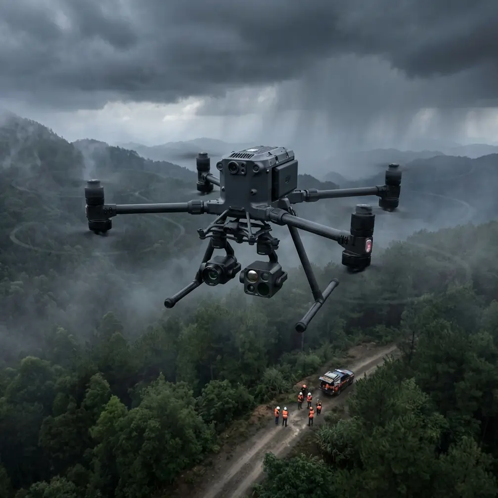
Vineyard managers lose critical data windows every day. The Matrice 400 solves this with enhanced low-light sensors and robust transmission capabilities that extend operational hours by 3-4 hours daily—capturing thermal signatures when temperature differentials peak.
Traditional drone operations restrict flights to midday hours. This limitation misses the most valuable data collection periods: early morning when plant stress becomes visible through thermal imaging, and late evening when irrigation patterns reveal themselves through soil temperature variations.
The M400's 1/1.8-inch CMOS sensor captures usable imagery down to 3 lux, equivalent to deep twilight conditions. Combined with its thermal imaging payload options, vineyard operators gain access to data previously requiring expensive manned aircraft surveys.
Antenna Positioning for Maximum Range Across Vineyard Terrain
Your antenna orientation determines whether you maintain solid links at 500 meters or push beyond 8 kilometers in BVLOS operations.
The 45-Degree Rule
Position your remote controller antennas at 45-degree angles relative to the ground, creating a cone-shaped radiation pattern. This configuration accounts for the M400's typical flight altitude of 30-50 meters AGL over vineyard canopy.
Expert Insight: Never point antenna tips directly at your aircraft. The signal radiates from the flat sides of the antennas, not the ends. Pointing tips toward the drone creates a signal dead zone exactly where you need coverage most.
Terrain Compensation Strategies
Vineyard topography creates unique challenges:
- Hillside vineyards: Position yourself at the highest accessible point
- Valley operations: Maintain line-of-sight by flying waypoint missions that account for terrain masking
- Row orientation: Fly parallel to rows when possible to minimize signal interference from dense canopy
The O3 transmission system handles multipath interference well, but physical obstructions still degrade signal quality. Pre-mission planning using photogrammetry data from previous flights helps identify potential dead zones.
Thermal Signature Analysis: Reading Vineyard Health
Low-light operations excel at thermal data collection. The temperature differential between healthy and stressed vines reaches maximum contrast during the golden hours—the first two hours after sunrise and last two hours before sunset.
What Thermal Signatures Reveal
| Signature Pattern | Indication | Action Required |
|---|---|---|
| Cool spots in row centers | Adequate irrigation | Maintain current schedule |
| Hot spots at row ends | Irrigation system pressure drop | Check emitter flow rates |
| Random hot clusters | Root disease or pest damage | Ground-truth inspection |
| Uniform warm bands | Soil compaction | Mechanical intervention |
| Cool streaks across rows | Underground water movement | Drainage assessment |
Optimal Flight Parameters for Thermal Capture
Configure your M400 for thermal missions using these proven settings:
- Altitude: 40-60 meters AGL for 10cm/pixel thermal resolution
- Speed: 5-7 m/s to prevent motion blur in thermal imagery
- Overlap: 75% front, 65% side for accurate photogrammetry stitching
- Gimbal angle: -90 degrees (nadir) for mapping, -45 degrees for canopy inspection
Pro Tip: Schedule thermal flights when ambient temperature sits between 15-25°C. Extreme temperatures compress the dynamic range of thermal sensors, reducing your ability to detect subtle plant stress signatures.
GCP Placement Strategy for Vineyard Photogrammetry
Ground Control Points transform good aerial data into survey-grade deliverables. Vineyard environments present unique GCP challenges that require strategic placement.
Recommended GCP Distribution
For vineyards under 50 acres, deploy a minimum of 5 GCPs in this pattern:
- One at each corner of the survey area
- One at the geometric center
- Additional points at significant elevation changes
For larger operations exceeding 100 acres, increase density to one GCP per 15-20 acres, with extra points along vineyard block boundaries.
Low-Light GCP Visibility
Standard black-and-white checkerboard targets become difficult to detect in twilight conditions. Upgrade to retroreflective targets that return light from your M400's obstacle avoidance LEDs, maintaining visibility down to 10 lux.
Alternatively, use thermal GCP markers—small heating elements that create distinct thermal signatures visible regardless of ambient light conditions.
Hot-Swap Battery Protocol for Extended Operations
The M400's hot-swap capability eliminates the most significant limitation of agricultural drone operations: battery-induced mission interruptions.
Maximizing Flight Time
Each battery pair provides approximately 45 minutes of flight time under optimal conditions. Vineyard operations typically see 35-40 minutes due to:
- Frequent altitude changes following terrain
- Wind resistance from canopy turbulence
- Payload power consumption from thermal sensors
Swap Procedure Best Practices
Execute battery swaps without landing using this sequence:
- Hover at 10 meters AGL over a clear area
- Remove the first depleted battery
- Insert fresh battery within 90 seconds
- Remove second depleted battery
- Insert final fresh battery
- Verify power system status before resuming mission
Maintain 3 battery sets minimum for continuous operations. This rotation allows adequate cooling between cycles, extending overall battery lifespan by 20-30%.
Data Security During Transmission
Vineyard data carries significant commercial value. Crop health information, yield predictions, and irrigation efficiency metrics represent competitive intelligence worth protecting.
AES-256 Encryption Implementation
The M400's transmission system applies AES-256 encryption to all data streams by default. Verify encryption status before each flight by checking the security indicator in DJI Pilot 2.
For operations requiring additional security:
- Enable local data mode to prevent cloud synchronization
- Use dedicated SD cards that never leave your possession
- Implement post-flight data wipes on aircraft storage
Secure Data Handling Workflow
Transfer data from aircraft to processing workstation using encrypted USB drives rather than wireless methods. Process sensitive vineyard data on air-gapped systems when client contracts require maximum security.
Common Mistakes to Avoid
Flying too fast in low light: Reduced shutter speeds require slower flight speeds. Exceeding 8 m/s in twilight conditions produces motion blur that ruins photogrammetry accuracy.
Ignoring temperature calibration: Thermal sensors require 15-minute warmup periods before capturing accurate data. Cold-starting a thermal payload produces unreliable readings for the first several minutes of flight.
Neglecting GCP documentation: Recording GCP coordinates without photographic documentation creates processing headaches. Photograph each GCP with a smartphone showing GPS coordinates before flight.
Underestimating canopy interference: Dense vineyard canopy during growing season absorbs and reflects radio signals unpredictably. Reduce expected range by 25-30% when operating over mature vines.
Skipping pre-flight sensor checks: Low-light operations stress sensors differently than daylight flights. Verify thermal calibration and camera ISO settings before each mission, not just at the start of each day.
Frequently Asked Questions
What minimum light level supports effective vineyard mapping with the M400?
The M400 captures usable RGB imagery down to approximately 3 lux, equivalent to late civil twilight. Thermal imaging operates independently of visible light, functioning effectively in complete darkness. For combined RGB and thermal missions, plan flights during the 30-minute windows after sunset or before sunrise when both sensor types perform optimally.
How does BVLOS operation change antenna positioning requirements?
BVLOS vineyard operations require elevated antenna positioning to maintain line-of-sight with aircraft operating beyond visual range. Mount antennas on 3-5 meter masts with clear sightlines across the entire operational area. Consider using directional antenna upgrades for operations exceeding 5 kilometers from the pilot station.
Can the M400 handle morning dew conditions common in vineyards?
The M400 carries an IP45 rating, providing protection against water spray from any direction. Morning dew on vineyard canopy does not pose operational risks. However, avoid flying through active fog or mist, which can deposit moisture on optical surfaces and degrade image quality. Allow 30 minutes after fog dissipation before beginning thermal surveys to ensure accurate temperature readings.
Ready for your own Matrice 400? Contact our team for expert consultation.