Filming Coastlines in Urban Areas With Matrice 400
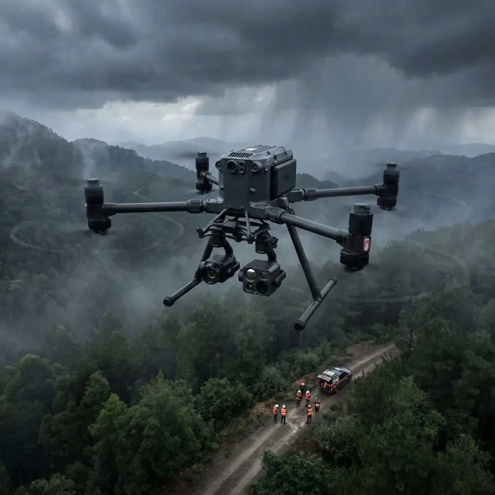
Filming Coastlines in Urban Areas With Matrice 400: What Actually Matters in the Field
META: Expert tips for using Matrice 400 to film coastlines in urban environments, with practical advice on antenna positioning, transmission stability, battery strategy, thermal workflows, and urban mission planning.
Coastline filming in a city looks simple from a distance. Water on one side, architecture on the other, dramatic light overhead. In practice, it is one of the messiest environments you can hand to a drone crew.
You are dealing with reflective water, signal clutter from dense buildings, gusty airflow around towers and seawalls, moving vessels, pedestrians, restricted takeoff options, and long lateral tracking shots that tempt pilots to push farther than they should. Add a deliverable that might mix cinematic footage, thermal signature checks, and photogrammetry passes for shoreline documentation, and the platform has to do more than just fly well. It has to stay readable, stable, and predictable.
That is where the Matrice 400 earns attention.
Not because it is simply “large” or “enterprise.” Those labels do not help you when the aircraft is skimming parallel to a harbor district and the video feed starts to suffer as it crosses behind a concrete facade. What matters is how the aircraft supports real urban-coastal workflows: maintaining a reliable transmission link, handling payload flexibility, supporting longer operational windows, and fitting into teams that may need both visual production and technical data capture on the same day.
The real problem with urban coastline shoots
Most failed coastline missions do not fail because of image quality. They fail because the environment slowly chips away at the mission.
A route that looked clean on a map becomes unpredictable once you are on site. The sea surface throws glare into the camera. Salt-laden air and wind coming off open water behave differently near marinas, bridge pylons, and glass towers. Radio conditions are rarely clean. Even before the aircraft reaches the edge of your intended route, the city itself starts interfering with your control and confidence.
For crews filming in urban coastal corridors, transmission reliability is often the deciding factor. If your live feed degrades, framing suffers first. Then timing. Then safety margins. That is why the conversation around the Matrice 400 is not just about payload or endurance. It is about whether the aircraft remains usable when the environment gets complicated.
The LSI terms people throw around—O3 transmission, AES-256, BVLOS, hot-swap batteries, thermal signature, GCP, photogrammetry—only matter if they improve decisions in the field. On a coastline mission, they can.
Why transmission discipline matters more than people expect
The single most overlooked habit on urban shoreline operations is antenna positioning.
Pilots often obsess over route planning and camera settings, then hold the controller in whatever orientation feels comfortable. That is a mistake. On a coastline route, especially one that runs parallel to high-rise structures, your link can weaken not because you are “too far,” but because your antenna geometry is wrong for the aircraft’s position.
With O3-class transmission workflows in mind, the practical rule is straightforward: keep the broad face of the antennas oriented toward the aircraft’s path, not the antenna tips pointed directly at it. The strongest part of the signal pattern is generally not coming off the end like a laser pointer. Treating it that way costs range and feed stability.
On an urban coast shoot, this becomes operationally significant in two ways.
First, lateral tracking shots often create a false sense of proximity. The drone may still look visually close over water, but if it is offset by buildings, cranes, signage structures, or a promenade canopy, your link may be fighting partial obstruction and multipath reflections at the same time. Proper antenna alignment gives you more margin before that instability appears.
Second, your body position matters. If you are standing under a metal awning, beside a service vehicle, or too close to a reinforced concrete wall, you may be degrading your own signal environment. Step into a cleaner launch position with better line of sight, then orient the antennas to the aircraft’s travel corridor, especially when the route bends around a harbor edge or cuts near a tower cluster.
This sounds basic. It is not. Good antenna discipline is one of the cheapest performance upgrades available, and on a long waterfront track it often determines whether you get a clean, uninterrupted take.
Coastline filming is not just cinematography anymore
A lot of urban coastal work has become hybrid work.
A city authority may want promotional footage of a redeveloped waterfront in the morning, then ask for thermographic review of roof edges, seawall interfaces, or drainage anomalies later in the day. A developer may want a cinematic reveal of a mixed-use marina project, then request orthomosaic or facade-linked mapping support for documentation. This is where a platform like the Matrice 400 makes sense: it can sit in the overlap between film production and industrial utility instead of forcing teams to split aircraft unnecessarily.
Thermal signature work is one example. Along coastlines, thermal imaging can help identify moisture intrusion patterns, roof insulation irregularities, HVAC stress near corrosive marine air exposure, or temperature differences across infrastructure interfaces. That is a very different task from filming a golden-hour tracking shot, but in the same urban coastal zone, crews are increasingly asked to do both.
The significance is not just payload compatibility. It is workflow efficiency. If the same aircraft platform can support visual and thermal tasking in one operational envelope, you reduce re-briefing, simplify logistics, and maintain a single mission architecture around airspace, takeoff zones, and site safety.
Battery strategy is a coastline issue, not just a convenience issue
Urban waterfront missions have a way of wasting time. Access routes are longer than expected. Landing zones are constrained. You may have to hold for pedestrians, vessel movement, construction noise windows, or changing light conditions reflected off the water.
That is why hot-swap batteries matter operationally.
On a normal field job, swapping packs is routine. On a constrained shoreline project, it changes how much useful momentum your team keeps between sorties. When the aircraft supports hot-swap battery procedures, crews can reduce downtime and keep the mission moving while preserving continuity in site conditions, lighting rhythm, and team coordination.
That is especially valuable when filming coastlines in urban districts where the best conditions may last 20 or 30 minutes before cloud cover, glare angle, or localized wind changes shift the scene. Losing too much time on the ground can break a carefully planned sequence.
The number to remember is not flight time marketing language. It is how many transitions your team can execute cleanly in a day. Every minute saved between flights matters more when you are operating from narrow urban launch points with limited setup flexibility.
Photogrammetry on the coast needs more discipline than inland mapping
If your coastline project includes photogrammetry, do not assume a standard urban mapping workflow will transfer neatly over water-adjacent terrain.
Coastal surfaces create gaps and distortions in reconstruction because water is a poor subject for consistent feature matching. The built environment next to it may be highly textured, but the shoreline itself can produce uneven results unless the mission is designed carefully. That is where GCP planning becomes useful. Ground control points are not glamorous, but they are often the difference between a visually impressive map and one that stands up to engineering review.
In an urban coastline environment, GCP placement must account for sightlines, pedestrian safety, and tidal context. If your control points are too close to reflective edges, blocked by street furniture, or inconsistently visible due to shadows from towers, your dataset quality suffers. The Matrice 400’s value here is not that it magically solves poor survey design. It gives teams a platform suited to mixed missions where mapping, inspection, and visual capture can be coordinated under one operational system.
That matters when a shoreline redevelopment client wants progress imagery, volumetric context, and georeferenced outputs from the same mobilization.
Security and link integrity are part of client confidence
Urban coastline projects often involve sensitive infrastructure-adjacent settings: ports, utility corridors, commercial towers, transportation links, and private developments. Even when the work is fully civilian, clients increasingly ask basic questions about data protection and transmission security.
This is where AES-256 enters the conversation as a practical, not abstract, detail.
If your transmission and data handling stack supports strong encryption, that helps reassure clients that live feeds and operational data are being handled with a security baseline appropriate for commercial infrastructure work. For crews working near high-value real estate, industrial waterfront assets, or proprietary construction sites, that is not a minor box-tick. It can affect access approvals and internal sign-off.
No one hires a drone team because they love encryption terminology. They hire the team because they want fewer surprises. Secure transmission practices are part of delivering that.
What BVLOS means in this context
BVLOS is one of those terms that gets used loosely. For urban coastline filming, the practical issue is not bragging about distance. It is understanding where mission ambition starts to outrun operational reality.
Even if your planning framework includes BVLOS pathways where regulations and approvals allow, urban waterfronts remain obstacle-heavy, reflective, and operationally dynamic. The Matrice 400 can support serious professional workflows, but long coastal routes still need conservative route design, clear contingency points, and an honest reading of signal behavior.
That brings us back to antenna positioning. Many “range problems” are really geometry problems. Before blaming the platform, check your stance, your launch point, your antenna orientation, and the route’s relationship to buildings. Those are the first corrections I would make on any urban harbor assignment.
A field setup that works better than the usual improvisation
If I were briefing a team for a Matrice 400 coastline shoot in a city, I would keep the setup disciplined:
- Launch from a point with true lateral visibility along the route, not just a pretty staging area.
- Avoid standing close to metal barriers, parked vehicles, utility cabinets, or concrete overhangs.
- Face the controller antenna surfaces toward the aircraft’s expected flight corridor.
- Rehearse route segments in shorter blocks instead of one ambitious continuous pass.
- Reserve one battery cycle for a technical pass if the client may request thermal or mapping output after visual capture.
- Pre-plan GCP visibility if photogrammetry is part of the day’s work.
- Build turn-back points based on feed quality, not only distance.
That last point matters. Coastline crews sometimes get seduced by the open water side of the frame and assume the route is “clear.” Meanwhile, the urban side is the real transmission hazard. The drone may have sky above and water below, but your link still has to survive the city.
Why the Matrice 400 fits this particular reader scenario
For someone filming coastlines in urban areas, the Matrice 400 is compelling because it supports layered work rather than a single-purpose flight profile.
You can think cinematically without giving up operational robustness. You can capture waterfront architecture and marine-edge visuals, then pivot into thermal signature tasks or mapping support when the project scope expands. You can keep the mission moving with hot-swap battery workflows. You can work within secure commercial expectations through features associated with AES-256-level protection. And if you understand O3 transmission behavior well enough to position antennas correctly, you give yourself a better chance of preserving feed quality where many pilots struggle.
That is the difference between reading a specification sheet and actually succeeding on a seawall, marina, or harborfront assignment.
The platform matters. Technique matters more.
If you are planning a specific urban coastline workflow and want a practical discussion about payload fit, transmission setup, or mission design, you can message a Matrice 400 specialist here.
A final thought from the field: the best urban coastline flights are rarely the most aggressive ones. They are the most controlled. Good crews protect the link, protect the route, and protect optionality. The Matrice 400 gives you room to do that—if you use it like a professional tool instead of a long-range toy.
Ready for your own Matrice 400? Contact our team for expert consultation.