Matrice 400 for Coastline Work: What Actually Matters
Matrice 400 for Coastline Work: What Actually Matters in Salt, Wind, and Long Linear Missions
META: Expert take on using the Matrice 400 for coastline filming and survey work, including pre-flight cleaning, transmission reliability, hot-swap battery planning, thermal workflows, and photogrammetry considerations.
By Dr. Lisa Wang, Specialist
Coastlines expose weaknesses fast.
A drone that behaves perfectly inland can become unreliable the moment you bring it near salt spray, gust fronts, reflective water, and long stretches of terrain with very few safe landing options. That is why the Matrice 400 deserves to be discussed in terms of mission design, not just specifications. For coastal filming and shoreline documentation, the aircraft’s value comes from how its systems work together under pressure: stable transmission, secure data handling, practical power management, and payload flexibility that lets one platform handle both visual storytelling and technical survey work.
If your job is filming coastlines in coastal environments, the real problem is rarely just “Can the drone fly far enough?” The bigger problem is continuity. Can you maintain a clean video feed over uneven terrain? Can you transition from cinematic passes to thermal signature review when a site manager wants erosion seepage or heat anomalies checked along coastal infrastructure? Can you keep the aircraft mission-ready after repeated exposure to salt-laden air without compromising sensors and safety features?
That is where a disciplined Matrice 400 workflow makes the difference.
The coastal problem: salt, glare, distance, and interrupted access
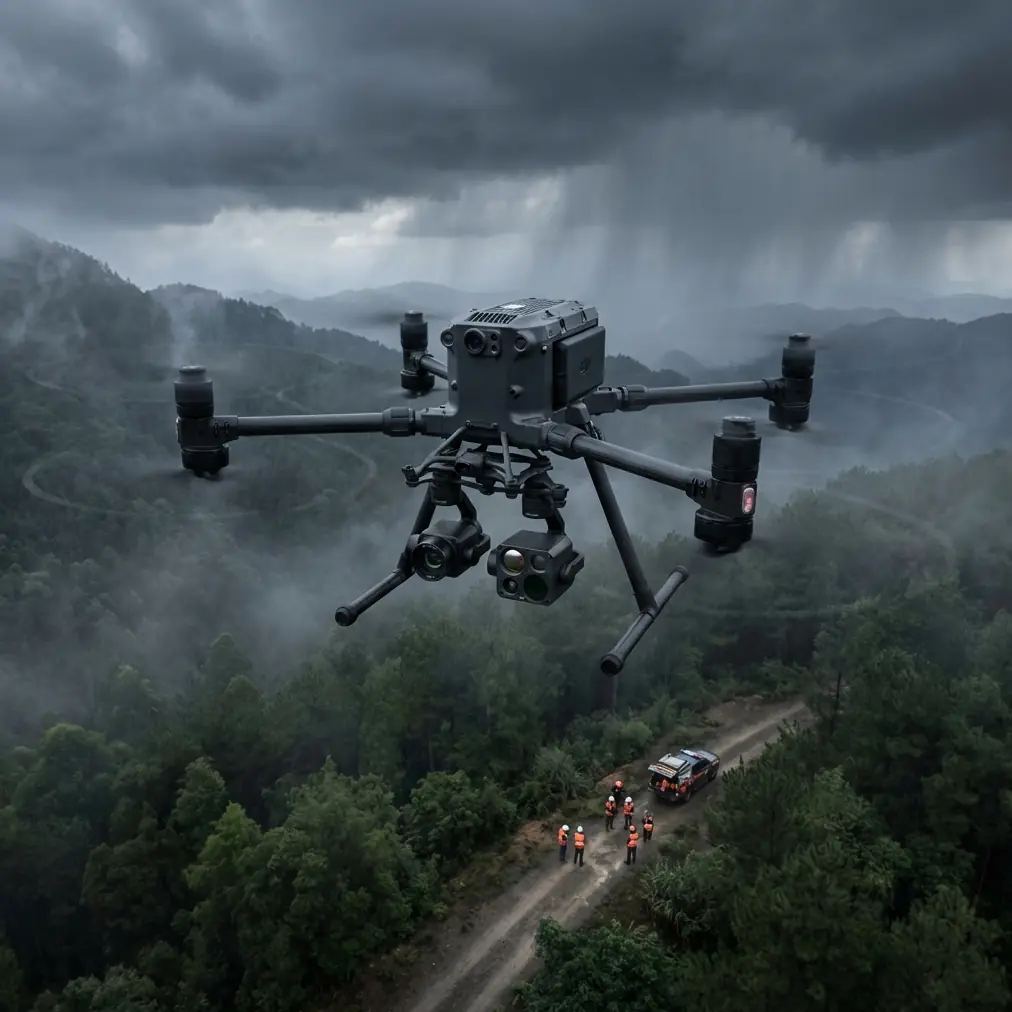
Shoreline operations are awkward by nature. You may launch from a narrow access road, a harbor edge, a dune path, or an industrial coastal facility with restricted movement. Once airborne, the scene looks open, but operationally it is full of traps.
Water surfaces interfere with visual judgment. Bright sun and reflected glare reduce detail in live view. Wind near cliffs and breakwaters can shift abruptly. Cellular coverage may be patchy. And because coastlines tend to be long and linear, your mission profile often pushes farther from the launch point than a compact site inspection would.
That last point matters more than many crews admit. A coastal mission is not just a flight; it is a chain of decisions stretched over distance. Every weak link becomes more expensive once the aircraft is several kilometers downshore.
The Matrice 400 fits this environment because it is built as a serious enterprise platform rather than a short-hop imaging tool. In practical terms, that means it supports the kind of payload options and operational discipline required for mixed coastal work: video capture, mapping, thermal review, and repeatable documentation in one ecosystem.
Start with the least glamorous step: pre-flight cleaning
Before discussing transmission, batteries, or photogrammetry, start with something crews often rush through when the light is good and the tide window is narrow: cleaning.
For coastal work, a pre-flight cleaning step is not housekeeping. It is a safety procedure.
Salt residue is the quiet enemy of reliable drone operation. Even when there is no visible spray on the aircraft, a fine saline film can settle on airframe surfaces, landing gear, connectors, vents, and especially the areas around obstacle sensing and vision-related components. If those surfaces are hazy, spotted, or lightly crusted, safety features may not perform as intended. A false read or degraded sensor clarity near rocks, piers, or uneven cliff faces is not a minor inconvenience.
My preferred pre-flight routine for coastline work is simple and repeatable:
- Visually inspect the airframe under angled light, not straight overhead light.
- Check camera glass and all sensing windows for salt haze, moisture marks, or dried residue.
- Wipe approved exterior surfaces with the right materials rather than using shirt sleeves or random cloths that leave oils.
- Inspect battery contacts and payload mounting interfaces for contamination.
- Confirm cooling paths are clear, especially after previous flights in humid or sandy conditions.
This matters because the Matrice 400 is typically chosen for missions where one aborted flight can delay an entire field schedule. If your obstacle sensing or positioning support is compromised by contamination, you are not getting the aircraft you planned for. You are flying a degraded system and hoping the conditions stay forgiving.
Hope is not a coastal operating method.
O3 transmission is not just a convenience over water
For coastline filming, link stability is operationally decisive. DJI’s O3 transmission ecosystem matters here because water-adjacent flights create a peculiar mix of visibility and signal complexity. You may have long visual corridors, but the shoreline itself is irregular. Rock faces, harbor infrastructure, buildings, vessels, and terrain bends can interfere with a clean path.
A robust transmission link matters for two reasons.
First, it protects image quality in the moment. Directors, inspectors, engineers, and survey leads make decisions from the live feed. If the link drops in quality every time the aircraft rounds a headland or tracks along a marina edge, you lose confidence and waste flight time re-running passes.
Second, it supports safer flight management. A stable control and video link is not just about what looks good on screen. It gives the pilot cleaner situational awareness during low-altitude shoreline tracking and lateral runs along structures such as seawalls, revetments, jetties, and coastal roads.
In a coastal setting, that can be the difference between smooth progress and a mission slowed by hesitation.
If your team is planning a more advanced coastal workflow and wants to compare link planning, payload choices, or site-specific setup, this is a useful place to start the conversation: message a Matrice specialist.
Why AES-256 matters more than people think
Coastal work often involves infrastructure, industrial frontage, ports, energy assets, private developments, or environmentally sensitive areas. In these contexts, the Matrice 400’s support for AES-256 is not a technical footnote. It is part of professional data discipline.
Teams working on shoreline erosion studies, contractor progress capture, resort development monitoring, or utility inspections are often handling material that should not be casually exposed through weak workflows. Secure transmission and data practices matter when stakeholders expect controlled access to imagery and operational data.
From an SEO content perspective, plenty of articles mention security because it sounds sophisticated. In field operations, the significance is plain: trust. If a coastal client is asking for repeated flights over sensitive assets, they need to know the platform belongs in an enterprise environment. AES-256 helps place the Matrice 400 in that category.
Hot-swap batteries solve a very specific coastal problem
Battery strategy is where many shoreline missions either become efficient or become chaotic.
The term hot-swap batteries gets repeated often, but for the coast it has a very practical advantage: reduced turnaround disruption. On long linear missions, especially when you are working from a cramped launch zone, the ability to keep operations moving without a full cold restart workflow can preserve momentum and reduce time lost to battery changes.
That is not just about convenience. It matters because coastal light changes fast. Cloud breaks shift exposure. Tides alter the visual line of the shore. Human activity on beaches, promenades, and marinas changes the scene minute by minute. When you can cycle power more efficiently and keep your aircraft workflow organized, you protect consistency across mission segments.
For technical users, battery continuity also helps when the mission includes repeat passes for photogrammetry. Coastal mapping is unforgiving when coverage gaps appear. If your team is building shoreline models, erosion baselines, or asset condition records, battery interruptions that break route consistency can undermine data quality.
A Matrice 400 configured for disciplined battery management gives you a better chance of keeping those route segments coherent.
Thermal signature work changes the value of a coastline mission
Many operators still think of a coastal drone mission as either “cinematic” or “mapping.” In reality, some of the best Matrice 400 deployments are hybrid operations.
You may begin with standard visual footage for shoreline context and public-facing reporting. Then the client asks a more technical question: Is there hidden moisture intrusion along a sea-facing wall? Are there drainage outfalls behaving abnormally? Is there uneven heat behavior on rooftop equipment near salt-exposed facilities? That is where thermal signature analysis becomes useful.
Thermal is especially relevant in coastal industrial and infrastructure environments because water movement, moisture retention, sun loading, and material differences produce patterns that are often invisible in RGB imagery. On a Matrice 400-class workflow, the significance is not simply that thermal is possible. It is that the platform can support a mission architecture where thermal is part of the same operational day, not a separate mobilization with a different aircraft category.
That saves time. It also improves interpretation, because the thermal review is grounded in the same flight context as the visual data.
For coastal asset owners, that means fewer blind spots.
Photogrammetry along the shore: where GCP discipline still wins
There is a common misconception that a premium enterprise drone can brute-force perfect mapping results regardless of site conditions. Coastlines are good at exposing why that is false.
Photogrammetry in shoreline zones is difficult because homogeneous sand, moving water, wet reflective surfaces, vegetation transitions, and irregular elevation shifts can all weaken reconstruction quality. This is why GCP placement still matters.
Ground Control Points are not old-fashioned baggage. They are one of the simplest ways to improve positional confidence when you need your coastal model to be useful for engineering, environmental comparison, or repeat surveys over time. If you are documenting dune retreat, seawall movement, coastal path degradation, or construction progress near the shore, good GCP strategy turns a pretty map into a defensible dataset.
The Matrice 400 is valuable here because it can support serious capture workflows rather than casual image collection. But the aircraft does not remove the need for survey discipline. It rewards it.
For best results, coastal photogrammetry teams should think carefully about:
- GCP visibility against bright or low-contrast surfaces
- Tide timing so target placement remains valid during the mission
- Wind effects on low-altitude consistency
- Reflective water boundaries that can confuse model edges
- Repeatable flight geometry for change detection over time
When those factors are handled well, the Matrice 400 becomes more than a camera carrier. It becomes a reliable data acquisition platform for shoreline management.
BVLOS thinking, even when you are not flying full BVLOS
BVLOS is one of those terms that attracts attention for obvious reasons, but its operational lesson is useful even for missions that remain within applicable visual and regulatory limits.
The lesson is planning depth.
Coastline jobs benefit from BVLOS-style thinking because they tend to involve long corridors, limited recovery points, and changing environmental conditions. Even if the mission is conducted under local line-of-sight requirements, crews should plan as if the route could stress communication, battery timing, return paths, and emergency decision-making.
That means identifying alternate landing areas before takeoff. It means setting conservative thresholds for coastal wind change. It means ensuring observers and pilots understand where terrain or structures may interrupt clean awareness. And it means respecting that a shoreline is not an empty buffer zone just because the map looks open.
The Matrice 400 is a platform that rewards this level of planning. Used casually, it is still capable. Used with corridor-mission discipline, it becomes far more effective.
The real strength of the Matrice 400 on the coast
The best reason to choose the Matrice 400 for coastline work is not any single headline feature.
It is the way several enterprise functions reinforce each other.
O3 transmission helps preserve command confidence and live-view clarity during long, uneven shoreline runs. AES-256 supports professional handling of sensitive coastal imagery and infrastructure documentation. Hot-swap batteries reduce interruptions that can break continuity on linear flights. Thermal signature capability expands a mission from visual capture into diagnostic inspection. And photogrammetry workflows become more credible when paired with proper GCP planning and repeatable route execution.
Put differently, the Matrice 400 makes sense on the coast because coastlines punish fragmented workflows. This aircraft supports a more integrated one.
That integrated approach begins with something very basic: clean the aircraft properly before launch, especially the surfaces tied to sensing and safety support. From there, build a mission around transmission reliability, secure data handling, power continuity, and capture discipline.
Do that, and the Matrice 400 becomes exactly what a shoreline team needs it to be: not just a drone that can survive a hard environment, but a platform that can produce dependable results in one.
Ready for your own Matrice 400? Contact our team for expert consultation.