Filming Windy Power Line Corridors with Matrice 400
Filming Windy Power Line Corridors with Matrice 400: A Field Report on Control Margin, Altitude Choice, and What Actually Matters
META: Field-tested insights for using Matrice 400 around power lines in wind, including optimal flight altitude logic, control-system lessons from civil aircraft design, and safer inspection-focused workflow planning.
By Dr. Lisa Wang, Specialist
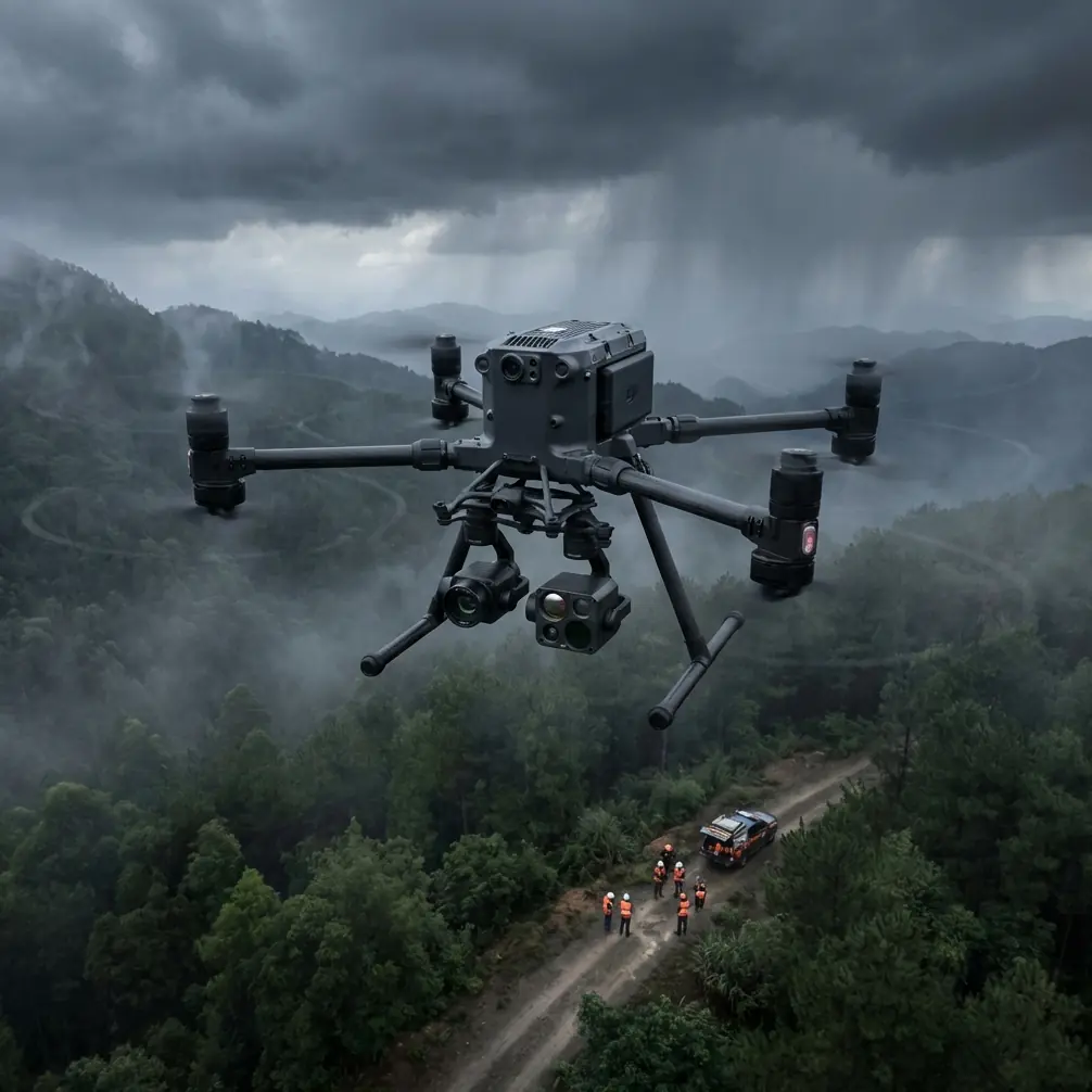
Power-line filming in wind looks simple until the aircraft starts fighting three things at once: corridor turbulence, lateral drift, and the visual temptation to fly lower than the shot really requires.
This is where most crews make the wrong decision. They chase proximity, not stability.
For a Matrice 400 operator working a utility corridor, the better question is not “How close can I get?” but “At what altitude does the aircraft hold the cleanest line while preserving detail, transmission confidence, and escape margin?” That changes the quality of the footage more than almost any camera setting.
The references behind this article come from civil aircraft flight-control design and helicopter ground-dynamics analysis, not from a product brochure. That matters. They point to a deeper operational truth: when the environment becomes dynamic, system architecture and restraint strategy are what keep the mission predictable. For windy power-line filming, that lesson translates directly.
Why windy power-line work punishes weak planning
Power lines rarely sit in smooth air. Towers, tree breaks, hillsides, substations, and road cuttings all disturb airflow. In open country the wind may seem steady at launch, but near the line itself you often see mechanical turbulence and directional shifts. The aircraft can still fly the route, but the shot starts to degrade: tiny heading corrections become visible, framing breathes, and standoff distance changes enough to complicate repeatable inspection imagery.
Operators often respond by descending. It feels intuitive. Lower altitude can appear to reduce exposure, especially below a ridgeline. Yet for line filming, dropping too low introduces a different penalty set: cluttered backgrounds, harder vertical obstacle separation, stronger apparent speed across the frame, and less time to recover if gusts push the aircraft toward conductors or tower steel.
So the practical target is not minimum altitude. It is the lowest altitude that still produces stable, readable imagery without sacrificing corridor awareness.
For Matrice 400 missions in windy utility corridors, a very workable starting point is to fly slightly above conductor height when documenting the run longitudinally, rather than level with the line or below it. In many cases, a buffer in the range of roughly 10 to 20 meters above the top line gives a better mix of control stability, sightline clarity, and obstacle margin. That is not a universal rule; terrain, span geometry, and local regulations still govern. But operationally, this band often reduces the visual chaos that comes from background trees and terrain while letting the aircraft track a cleaner path parallel to the route.
The significance is straightforward: from this offset, the gimbal can look slightly downward, which tends to make conductor spacing, insulator strings, and tower attachment points easier to read in moving footage than a flatter side-on view in gusting conditions. It also preserves room for lateral correction if the aircraft gets bumped.
What civil flight-control design teaches a drone crew
One reference describes a civil aircraft fly-by-wire control system built around fault tolerance at multiple layers. It uses two main flight-control computers with dissimilar three-channel architecture, independent actuator electronics, and three separate 28VDC power supplies plus backup batteries. Hydraulic supply is also separated into three independent systems, with the design objective that a single electrical or hydraulic failure does not cause loss of primary control.
A Matrice 400 is not a 150-seat transport aircraft, obviously. But the design philosophy is the part worth borrowing into field practice.
The lesson is redundancy is not a spec-sheet ornament. It is what allows stable behavior when real-world disturbances stack up.
For a drone crew filming power lines in wind, the operational equivalent is layered resilience:
- independent battery health checks before launch
- sensor validation before entering the corridor
- transmission path awareness along the route
- a preplanned bailout direction that does not cross the line
- repeatable waypoint structure for a second pass if the first run degrades
The civil aircraft reference also cites digital data transmission over fiber media and a reliability target around 1 × 10^-? per hour in the source extract, along with a projected maintenance interval figure of 92,700 hours MTBMMA. Even allowing for the source’s legacy formatting and context, the core message is unmistakable: robust control systems are engineered around separation, monitoring, and graceful fault handling.
That has direct relevance to Matrice 400 missions using O3 transmission and encrypted links such as AES-256. In windy infrastructure corridors, link quality is not just about video convenience. It affects decision timing. If the aircraft gets displaced during a gust event, the value of a stable downlink and command path is immediate: you see the movement early, you correct earlier, and you avoid over-controlling. This is one reason to avoid flying low and deep into a cluttered side of the corridor when a slightly higher and cleaner geometry would preserve both the shot and the radio environment.
The altitude insight most crews learn late
Here is the field rule I give new utility-filming teams:
When wind is active, choose an altitude for line readability and recovery space, not for dramatic closeness.
For Matrice 400, start by treating the line corridor as a control problem first and an image problem second. Once you do that, the altitude choice becomes less emotional.
A few patterns show up consistently:
1. Slightly above the conductors is usually more stable than level with them
Level-with-line flights can tempt the pilot into micro-corrections because the wires dominate the frame and every drift looks worse on screen. A modest altitude advantage relaxes that pressure and improves conductor-to-background separation.
2. Too low makes gust response feel bigger than it is
Near vegetation and terrain, the same lateral push appears more violent because the visual references move quickly. Pilots then correct aggressively, which shows up in the footage. A little more altitude smooths the visual workload.
3. Higher is not always safer for image quality
Climbing too far above the corridor reduces defect visibility and can flatten depth cues, especially if you need to read hardware alignment or thermal anomalies. If thermal signature work is part of the sortie, excessive altitude also weakens your ability to isolate small hot spots from surrounding scene clutter.
For that reason, windy power-line filming often works best with two profiles, not one. First pass: a stable overview run slightly above conductor height for continuity footage and route context. Second pass: shorter targeted segments or tower orbits at closer standoff for hardware detail, timed during calmer moments or approached from the less turbulent side.
Why the helicopter reference matters more than it first appears
The second reference deals with helicopter ground resonance under tethered conditions. On paper, that seems far removed from a multirotor power-line mission. But one passage is highly relevant: when a helicopter is restrained by slack cables and then transitions into a loaded state, its original dynamic behavior changes, and nonlinear effects can appear. The reference stresses that poor restraint conditions can create instability and that practical mitigation requires thoughtful restraint design and operating procedure.
For drone crews, the parallel is not literal tethering during flight. It is this: badly conceived constraints create instability.
In a power-line shoot, those constraints might be:
- trying to hold an unnecessarily tight lateral offset in gusts
- forcing the route to stay low because the client asked for a dramatic angle
- launching from a location that channels wind across structures
- insisting on one uninterrupted pass when the air clearly supports only segmented runs
The helicopter text also distinguishes between loose and pre-tensioned restraint states because system behavior changes dramatically between them. The drone equivalent is mission setup discipline. A crew that launches into a windy corridor without defined altitude gates, standoff distances, and turn points is effectively operating in the “slack” condition: once the aircraft gets loaded by gusts, the mission becomes reactive. A crew that establishes those limits before takeoff is operating in the “pre-tensioned” condition: the mission stays bounded.
That is why I recommend writing down a hard floor and a preferred working band before launch. For example:
- hard floor: never descend below a specific clearance relative to top conductor height
- preferred filming band: maintain the aircraft in a narrow vertical envelope above the line except during dedicated detail captures
- breakaway heading: predetermined direction away from towers and conductors if control workload spikes
This sounds basic. In wind, it is the difference between neat footage and messy improvisation.
Matrice 400 workflow for this scenario
A strong Matrice 400 power-line workflow in wind should combine cinematography, inspection logic, and systems discipline.
Pre-flight
Check the corridor on a map first, but do not trust map calm. Utility routes produce local effects. Walk the launch area and watch vegetation movement at several heights if possible. If the mission includes photogrammetry, define where GCP-backed accuracy is truly necessary and where video-only documentation is enough. Not every windy corridor sortie should be forced into a mapping workflow.
If the task includes thermal signature review, schedule that pass separately from your main cinematic run when possible. Wind changes thermal interpretation, and the ideal imaging angle for heat anomalies is not always the best angle for smooth footage.
Link and control
Use the cleanest line-of-sight geometry available for O3 transmission. A slightly elevated launch point with open corridor visibility usually beats a concealed roadside position. If the operation permits BVLOS or extended linear coverage under proper procedures and local rules, build relay logic and observer placement around terrain breaks, not around convenience parking.
AES-256 matters here not because the line crew cares about encryption as a slogan, but because utility imagery can be sensitive operational data. Secure transmission is part of professional handling, especially when documenting substations, switching structures, or critical right-of-way assets.
Battery strategy
Hot-swap batteries are more than a convenience on long corridor days. In wind, repeated setup, hover stabilization, and repositioning cost more energy than crews expect. Quick battery turnover helps preserve rhythm and reduces the temptation to “stretch one more segment” on a tired pack. That is when rushed decisions happen near obstacles.
Flight profile
Start with a reconnaissance leg at safer standoff. Identify where the aircraft is getting bumped. Tower shoulders, ravines, and abrupt canopy edges often create repeat turbulence zones. Then run your hero pass with a stable groundspeed, keeping yaw inputs minimal. If the footage requires a parallel move, let the route do the composition work; don’t over-fly the gimbal.
For teams building repeatable SOPs around this kind of utility work, I usually suggest documenting the exact altitude band, gimbal angle, wind direction, and whether the aircraft was above, level with, or below conductor height on the best take. That gives you a usable baseline for the next corridor.
If you need a practical benchmark for setting up that workflow, this direct field support channel can help: message our utility drone team.
When to switch from filming mode to inspection mode
A windy day often reveals whether the client actually needs cinematic continuity or analytical evidence.
If your footage begins to show repeated drift corrections, stop pretending the mission is purely visual storytelling. Reframe it as an inspection capture. Hold position farther out. Take shorter clips. Use oblique stills. Record thermal only where it adds value. If a structure needs measurable geometry later, plan a separate photogrammetry pass when the air allows tighter consistency, ideally with GCP support if survey-grade alignment matters.
That shift in mindset saves missions. The Matrice 400 should be used as a platform, not as a single-shot machine.
The real standard for a good windy-corridor flight
The best power-line footage in wind is rarely the closest or most dramatic. It is the footage that stays calm enough to be trusted.
That trust comes from layered control thinking. The civil aircraft reference shows why distributed architecture, independent power paths, and fault-tolerant control matter. The helicopter reference shows how unstable behavior emerges when constraints are poorly designed. Put those together and the message for Matrice 400 crews is clear: build margin into the mission before the air takes it away.
So if you are filming power lines in wind, start a bit higher than instinct suggests. Keep the aircraft slightly above the conductors on the main run. Protect your transmission path. Use hot-swap discipline to avoid rushed battery decisions. Separate cinematic passes from thermal or photogrammetric tasks when needed. And above all, define your operating envelope before takeoff.
That is how you get footage that looks deliberate rather than lucky.
Ready for your own Matrice 400? Contact our team for expert consultation.