Matrice 400 at Altitude: A Practical Filming Workflow
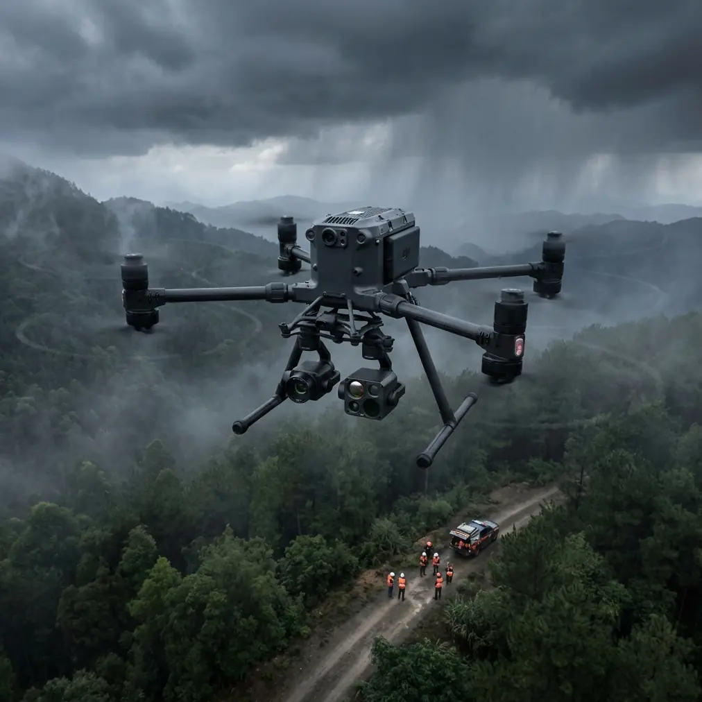
Matrice 400 at Altitude: A Practical Filming Workflow for Solar Farms That Don’t Look Flat
META: Expert Matrice 400 filming tutorial for high-altitude solar farms, covering composition, pre-flight cleaning, thermal workflow, photogrammetry planning, transmission reliability, and battery discipline.
High-altitude solar farms are deceptively hard to film well.
On paper, they should be easy: long repeating rows, clean geometry, open sky, plenty of light. In the field, they often turn into footage that is technically correct and visually dead. Exposure looks fine. Focus is sharp. The aircraft flies clean lines. Yet the result feels thin, almost diagrammatic. No scale. No atmosphere. No sense of what the site actually is.
That problem has less to do with camera hardware than many crews admit. A recent photography piece aimed at beginners made a point that applies directly to UAV work: properly exposed, sharply focused images can still feel flat if the composition is weak. Its central recommendation was simple but powerful—use foreground elements to build depth, because a stronger image usually comes from compositional thinking, not from expensive equipment. It defined the frame as a three-layer structure: foreground, midground, and background.
For a Matrice 400 operator filming solar farms in thin mountain air, that is not a beginner tip. It is one of the fastest ways to improve deliverables without changing aircraft, sensor, or mission profile.
This tutorial walks through how I would approach a high-altitude solar farm shoot with the Matrice 400, especially when the job needs both visual storytelling and useful operational data such as thermal signature review or photogrammetry support. I’ll also tie in one less glamorous detail that matters more than people think: a pre-flight cleaning step for safety-critical surfaces and sensors.
Why solar farm footage goes flat so easily
Solar sites create a visual trap. Repeating panel rows compress into patterns, especially when you fly too high or shoot everything perpendicular to the array. At altitude, the air can be extraordinarily clear, which sounds ideal, but that clarity can strip away atmospheric separation. The camera records every line. The viewer still feels nothing.
The photography article’s three-layer idea is the cure.
- Foreground: the nearest visual layer to the lens
- Midground: the main subject
- Background: the wider environment that explains place
On a solar farm, the midground is usually obvious: panel blocks, inverter stations, service roads, substations, or tracker systems. The weak point is usually the missing foreground. If every shot starts with empty air and immediately lands on the rows, the frame reads as a flat surface.
With the Matrice 400, your mission planning should include deliberate foreground hunting before takeoff. That means identifying objects that can sit close to the lens while the actual site remains the subject. At a mountain solar installation, workable foreground layers include:
- a perimeter fence post
- a maintenance road crest
- wild grasses or scrub near the launch point
- an access gate frame
- a warning sign at the edge of the site
- a line of snow or scree if the facility sits near alpine terrain
These are not props. They are framing tools.
Fly low enough on the opening pass that one of those elements occupies the first plane of the image, let the arrays remain in the middle plane, and allow the distant ridgeline or sky mass to form the back plane. The effect is immediate: scale appears, the geometry gains context, and the farm stops looking like a printed texture.
The pre-flight cleaning step crews skip too often
Before composition, before route planning, before you think about BVLOS corridors or thermal payload setup, clean the aircraft properly.
Not cosmetically. Functionally.
High-altitude solar farms are often dusty, windy, and dry. Fine particles settle on obstacle sensing windows, camera glass, thermal optics covers, landing gear contact points, battery interfaces, and cooling inlets. If there was a snowfall or morning frost followed by strong sun, you may also get moisture residue and mineral spotting. Any of that can compromise safety systems or image quality.
This matters because aerospace standards have long treated surface condition as a real performance variable, not a housekeeping issue. One aircraft design handbook section explicitly links surface roughness with process behavior and even discusses how roughness affects fatigue resistance, fit, and sealing performance. Another section dives into threaded interfaces and sealing standards. The lesson for drone operations is straightforward: when surfaces or interfaces degrade, reliability follows.
You do not need to turn a Matrice 400 pre-flight into an engineering lab. But you do need discipline.
My field cleaning sequence for a mountain solar shoot is:
Lens and payload windows first
Remove dust from visible and thermal optics using air bulb and clean cloth appropriate for coated glass. A small haze on the lens may go unnoticed on a bright monitor and still reduce local contrast.Obstacle sensing and navigation surfaces
Wipe sensor windows and check for caked dust. At a site full of reflective panel surfaces, your aircraft already has enough visual complexity to process. Don’t handicap the sensing stack.Battery contacts and hot-swap mating surfaces
If your Matrice 400 mission plan depends on hot-swap batteries to maintain tempo, inspect and clean contact zones. Contaminated electrical interfaces are the sort of tiny issue that turns into an avoidable interruption at the worst time.Cooling vents and air paths
Thin air reduces cooling efficiency. Dust makes it worse. If you are flying repeated climbs or carrying a heavy payload package, airflow matters.Landing gear and ground-contact points
Mountain sites are uneven. Grit around moving components can create unnecessary wear and unreliable deployment behavior over time.
That cleaning pass is not glamorous content for a brochure. It is exactly the sort of practice that keeps a full shooting day on schedule.
Build two missions, not one
A lot of crews treat a solar farm assignment as a single capture task. That is usually a mistake.
With the Matrice 400, especially in a professional inspection environment, you should separate the mission into two distinct products:
1. Visual cinema/documentary flight
This is where the foreground composition idea earns its keep. Your goal is not just coverage but readability. Investors, EPC stakeholders, O&M teams, and public-facing communications teams all need footage that explains the site clearly.
2. Data capture flight
This is where photogrammetry, thermal signature review, and repeatable geometry matter more than aesthetics. If your client wants orthomosaics, site progression evidence, or thermal anomaly mapping, that mission should be designed with consistency, overlap, and reference quality in mind.
Trying to force one flight to do both usually produces compromised outputs.
For example, a dramatic low oblique pass with a foreground fence line can make a great opener. It is not a substitute for a disciplined photogrammetry grid with proper overlap and GCP integration. If the assignment includes mapping, establish your GCPs, verify visibility, and keep your geometry clean. Solar arrays are full of repeating patterns that can challenge reconstruction if planning is sloppy.
The Matrice 400 becomes more useful when you stop asking one flight to solve every problem.
Thermal work at altitude: what actually changes
High-altitude solar farms are often ideal for thermal inspection windows, but they introduce their own complications.
First, the thermal story on a solar site is rarely about one dramatic hotspot. It is more often about pattern deviation: a string behaving differently, a cluster of modules reading inconsistently, a combiner area presenting an abnormal signature. That means the job is partly technical and partly interpretive.
Second, environmental contrast can be sharp. Cold ambient air, strong sun, wind exposure, and angle-dependent reflectivity all influence what you see. So your thermal signature workflow has to be structured.
A few practical rules:
Do not rely on a single altitude for all thermal passes.
A higher pass gives context. A lower pass helps isolate anomalies and reduce ambiguity.Separate thermal interpretation from marketing footage.
A cinematic angle may look beautiful while being poor for thermal consistency.Use visible context frames with every anomaly set.
Operations teams need to know exactly where the signature sits within the array.Log time, sun position, and wind conditions.
High-altitude sites can shift quickly, and comparison without context is weak evidence.
If the Matrice 400 configuration includes robust transmission and secure data handling, features such as O3-class transmission reliability and AES-256 encrypted links matter less as bullet points than as workflow enablers. In mountain terrain, transmission stability can make the difference between a clean remote monitoring session and a stop-start operation riddled with confidence loss. Secure links also matter when inspection data is commercially sensitive, especially for utility-scale operators who do not want plant imagery and asset condition data drifting into the wrong channels.
Composition rules that work specifically on solar farms
The beginner photography article singled out foreground composition because it is easy to apply and has an outsized effect. On solar farms, here is how to use that insight without forcing it.
Start one sequence from the ground’s point of view
Lift off from a position where the first few seconds include a near object. The nearest layer should not dominate the frame, but it should be visible enough to establish depth. A scrub patch, post, or road shoulder works.
Use diagonal entry rather than straight-on symmetry
Perfectly square panel rows can become abstract too quickly. Enter the frame on a diagonal to stretch the geometry across space.
Let the background explain altitude
If the site is genuinely high up, show that. Distant ridges, snow lines, cloud shadow, or valleys help viewers understand why the site is operationally different from a lowland installation.
Reserve top-down shots for specific purposes
Top-down frames are excellent for layout clarity, string organization, and mapping support. They are often poor as your main storytelling angle because they flatten everything by design.
Introduce scale anchors
A service truck, inverter pad, technician walkway, or substation edge can tell the viewer how big the site really is. Without a scale cue, even a huge plant can look strangely miniature.
This is where the three-layer logic from the source article becomes useful beyond aesthetics. Foreground gives the eye a starting point. Midground defines the subject. Background situates the site in terrain and climate. That is exactly how you keep utility infrastructure from looking anonymous.
Battery and flight tempo in thin air
High-altitude operations punish casual energy planning.
You feel it during climbs, in headwinds, and during repeated repositioning over a large site. If your Matrice 400 setup supports hot-swap batteries, that should shape your field rhythm. The objective is not merely to stay airborne longer. It is to preserve continuity between planned mission blocks.
I prefer to divide the day into short, intention-specific sorties:
- visual establishing shots
- structured thermal pass
- photogrammetry block
- low-altitude detail capture
- contingency revisit window
That rhythm makes battery swaps more predictable and reduces the temptation to “squeeze in one more pass” on a diminishing pack. In thin air, conservative planning is not wasted time. It is clean operations.
Transmission, security, and mountain terrain
Solar farms in elevated terrain often create line-of-sight surprises. A route that looks open from the launch point can produce signal variability once the aircraft drops beyond a service ridge or aligns with reflective infrastructure.
That is why I treat transmission design as part of image planning. If your Matrice 400 workflow relies on long-range monitoring, O3 transmission stability is not just a spec-sheet talking point. It allows the crew to maintain confidence while executing repeatable passes over large sites. Add AES-256 protection to that environment and you have a more credible workflow for clients who care about operational confidentiality.
If you are planning extended corridors or controlled BVLOS-style operations where local rules and approvals allow it, transmission robustness and disciplined route design become inseparable. The aircraft may be capable, but terrain still writes the script. Respect it.
A sample shot list for a high-altitude solar farm
Here is a practical sequence I would use:
- Low reveal with foreground scrub or fence post
- Rising diagonal pass over first panel blocks
- Wide oblique showing site against the mountain backdrop
- Top-down block for layout clarity
- Thermal context sweep at moderate altitude
- Lower thermal verification pass on suspect sections
- Photogrammetry grid with confirmed GCP visibility
- Infrastructure inserts: inverter stations, access roads, substation edge
- Closing pullback showing full site in terrain
If you are refining this kind of mission and want to compare notes with a specialist team, you can reach out here: message a Matrice workflow expert on WhatsApp.
The real takeaway
The most useful lesson in the source photography article was not “use foreground” as an isolated trick. It was the larger point behind it: a strong image depends more on compositional thought than on expensive gear. That is just as true for a Matrice 400 flying over a mountain solar plant as it is for a beginner with a handheld camera.
At the same time, the aircraft-design references remind us that details at the surface and interface level matter. Surface condition affects performance in the engineering world; in drone fieldwork, the practical version of that truth is pre-flight cleaning, clean contacts, clear sensors, and disciplined handling of the aircraft’s exposed systems.
Put those two ideas together and you get a better operating philosophy:
- Think in layers, not just flight paths.
- Respect surfaces, not just software.
- Separate cinema capture from technical data collection.
- Use thermal, photogrammetry, GCP planning, transmission reliability, and battery management as parts of one coherent workflow.
That is how the Matrice 400 stops being just a platform and becomes a dependable tool for high-altitude solar farm production.
Ready for your own Matrice 400? Contact our team for expert consultation.