Matrice 400 for Mountain Vineyard Filming: The Altitude
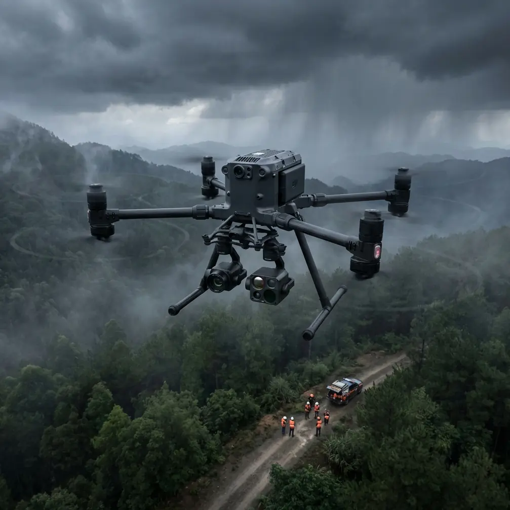
Matrice 400 for Mountain Vineyard Filming: The Altitude, Payload, and Flight Planning Choices That Actually Matter
META: Expert advice on using the Matrice 400 for mountain vineyard filming, including optimal flight altitude, terrain-aware planning, transmission reliability, thermal workflows, photogrammetry, and battery strategy.
Filming a vineyard in the mountains sounds cinematic until you are the one responsible for the aircraft, the light, the terrain, and the footage quality. Steep slopes distort visual depth. Vine rows create repetitive patterns that can confuse exposure and autofocus decisions. Wind behaves differently at the ridge than it does near the vines. Add changing elevation, patchy GNSS visibility near rock faces, and the pressure to capture both beauty shots and useful operational data, and the mission gets complicated fast.
This is exactly where the Matrice 400 becomes interesting. Not because it is simply “more powerful,” but because mountain vineyard work demands three things at once: stable flight over uneven terrain, dependable transmission when the aircraft is not always in ideal line of sight, and enough endurance to capture long contour-following passes without constantly breaking rhythm for battery changes.
For that kind of mission, the real question is not whether the Matrice 400 can fly in the mountains. It is how to use its strengths intelligently.
The core problem: mountain vineyards punish generic flight plans
A flat-field flight strategy fails quickly in vineyard terrain. If you keep a fixed altitude relative to the takeoff point, your drone can be dangerously close to the canopy as it climbs the hillside, then too high above the vines as it crosses downhill. The result is inconsistent framing, uneven ground sampling distance for mapping, and footage that feels disjointed because the apparent scale keeps changing.
In production terms, that ruins visual continuity.
In inspection or agronomy support terms, it affects usefulness. Thermal signature interpretation, for example, becomes less reliable when your standoff distance swings too much from pass to pass. A block that seems cooler may simply have been captured from a different height or angle.
With the Matrice 400, the smarter approach is to build the mission around terrain behavior first, camera work second.
Optimal flight altitude for mountain vineyard filming
If I were planning a cinematic vineyard mission in steep terrain, I would not start with one fixed altitude. I would start with a target clearance above the canopy.
For most mountain vineyard filming, a practical working range is 20 to 35 meters above vine canopy for your hero tracking shots and contour-following passes. That range usually gives you three advantages:
- It preserves row definition without flattening the geometry.
- It keeps the aircraft close enough to reveal texture in the vines and terraces.
- It avoids the overly compressed look that often happens when you film too high above steep slopes.
When the goal shifts from cinematic footage to mapping or vineyard condition review, I would usually move higher, often into the 50 to 80 meter above canopy range, depending on sensor choice, overlap requirements, and local operating constraints. The reason is simple: photogrammetry needs consistency more than drama. A terrain-aware plan at a stable canopy-relative height gives cleaner overlap and more predictable reconstruction, especially when you are tying the dataset to GCP placements for higher positional confidence.
That canopy-relative logic matters far more than a single universal altitude number.
The mistake I see most often is operators flying 60 meters from takeoff altitude across a mountain block and calling it safe because the app says it is within limits. Safe from a compliance standpoint is not the same as operationally correct. On vineyard slopes, that shortcut often creates poor framing and needless risk near crest transitions.
Why the Matrice 400 fits this scenario
The Matrice 400 is well suited to this type of work because mountain vineyard missions are rarely one-dimensional. A client may ask for scenic footage in the morning, a thermal check of irrigation uniformity later, and a quick terrain dataset for planning access roads or drainage review before the day ends.
That is where a platform built for serious commercial workflow stands apart.
Long endurance matters, but in mountain vineyards, endurance is not just about staying airborne longer. It is about preserving continuity. If you are flying a sequence along a terraced slope during narrow golden-hour light, every interruption costs you. A platform that supports hot-swap batteries reduces downtime between sorties and helps you keep momentum when the light window is brief. On ridge-and-valley sites, that can be the difference between one coherent sequence and a stitched-together compromise.
Transmission reliability matters even more. Vineyard properties in mountainous areas often create partial masking from terrain, tree lines, utility structures, and stone outbuildings. A robust O3 transmission link is operationally significant here because your mission may include lateral movement behind a contour or a temporary angle where direct visibility is less than ideal. That does not remove the need to operate legally or responsibly, but it does improve confidence in maintaining image feed stability and command responsiveness in a landscape that naturally challenges radio performance.
And if the operation includes sensitive farm data, from crop health imagery to site layout documentation, AES-256 support is not a minor technical footnote. It matters because commercial vineyard operators increasingly treat geospatial and thermal datasets as proprietary business information. A secure transmission and data handling posture helps protect that operational intelligence.
The mountain wind problem is usually underestimated
People tend to focus on slope and signal, but wind is the factor that quietly ruins more vineyard flights than either. Mountain vineyards generate layered airflow. You can launch in calm conditions near the tasting facility and hit a rough crossflow halfway up the block. Saddles, ridges, and retaining walls all redirect air in ways that make the aircraft work harder than expected.
This affects your footage in two ways.
First, the aircraft may remain stable while the gimbal is doing extra correction work, and the resulting motion can feel subtly tense rather than smooth. Second, battery consumption rises faster on uphill return legs or broadside contour passes where the aircraft is continuously resisting drift.
With the Matrice 400, the practical response is not to fight the landscape with brute force. It is to design the route so the aircraft is not wasting energy. Plan your longest lateral passes where the wind is most predictable. Save close-in reveal shots for the calmer periods near sunrise or late afternoon. Use the aircraft’s endurance advantage strategically rather than casually.
Thermal work in vineyards: useful, but only when flown properly
The mention of thermal signature in this scenario is not decorative. Vineyard operators use thermal imaging for several legitimate civilian purposes: spotting irrigation inconsistency, identifying stress zones, checking drainage behavior after weather events, and understanding microclimate variation across elevation.
But thermal flights in mountain vineyards can go wrong fast if the capture geometry is inconsistent.
If your altitude swings dramatically due to terrain, your thermal interpretation becomes less trustworthy. If one row segment is captured at 18 meters above canopy and another at 55, apparent differences in heat distribution can be skewed by angle, pixel footprint, and atmospheric effects. That is why Matrice 400 missions with thermal objectives should be terrain-referenced whenever possible, and flown with repeatability in mind.
This is one of the strongest arguments for combining visual planning with a disciplined geospatial workflow. If you are building a useful dataset rather than just pretty footage, maintain repeatable altitude over canopy, repeatable speed, and repeatable timing. The aircraft is capable; the value comes from operator discipline.
Photogrammetry in vineyards is about more than making a nice 3D model
Mountain vineyards are perfect candidates for photogrammetry because they are hard to understand from the ground. Terraces, access tracks, drainage lines, retaining structures, and planting geometry all interact in ways that become much clearer in an accurate model.
The Matrice 400 is valuable here because it can serve dual roles in a single site visit. You can gather cinematic footage for marketing and then switch into a structured capture pattern for mapping. If the project requires tighter positional reliability, bring in GCP strategy instead of relying solely on airborne data. In steep terrain, GCPs can help anchor the model where elevation changes and repeating vine patterns might otherwise challenge reconstruction quality.
Operationally, this matters because vineyard owners are often not interested in “a map” in the abstract. They want answers:
- Where is runoff collecting?
- Which blocks are hardest to access with equipment?
- How do terrace edges actually sit relative to planned improvements?
- Which sections deserve follow-up thermal review?
A photogrammetry workflow that feeds these decisions is far more valuable than a visually attractive but loosely controlled model.
BVLOS comes up often, but the smarter conversation is mission design
The term BVLOS gets thrown around whenever people discuss large agricultural properties or mountain estates. In a vineyard context, the temptation is obvious. Long narrow blocks and hilly terrain encourage operators to think about extended routes beyond easy direct observation.
The useful way to frame this with the Matrice 400 is not as a shortcut, but as a planning discipline. Even if your operation remains within standard visual constraints, mountain properties demand BVLOS-style thinking: route segmentation, terrain assessment, communication planning, contingency landing options, and signal awareness.
That mindset improves safety and output quality whether or not the mission formally qualifies for BVLOS approval under local rules.
A practical flight profile for this scenario
If I were filming a mountain vineyard with the Matrice 400, I would divide the job into three separate flight intents rather than trying to do everything in one sortie.
1. Establishing and terrain-reading pass
Fly higher, roughly 60 to 80 meters above canopy, to understand ridge shape, sun angle, shadow movement, and wind behavior. This is not the beauty pass. It is reconnaissance for the shots that follow.
2. Cinematic contour passes
Bring the aircraft down to around 20 to 35 meters above canopy. Follow the slope, not the takeoff altitude. Keep speed moderate. Let the rows produce motion naturally in frame. If the terrain tightens near a terrace wall or rocky shoulder, gain a little altitude before you gain speed.
3. Data capture pass
If the client also needs orthomosaic or surface modeling, fly a separate photogrammetry mission at a more consistent mapping altitude, often 50 to 80 meters above canopy, with proper overlap and GCP support where needed.
This separation is operationally cleaner. It also helps battery planning. Use your strongest light and calmest conditions for the cinematic pass. Use the Matrice 400’s endurance and hot-swap batteries to turn around quickly for the more methodical mapping mission.
Security and professionalism are part of the deliverable
Commercial vineyard clients are increasingly sophisticated. They care about image quality, but they also care about process. Who has access to the data? How secure is the transmission? Can the mission be repeated later in the season under comparable parameters?
That is why details such as AES-256 are worth mentioning. Not as marketing filler, but as part of a professional operating standard. If you are capturing thermal imagery, photogrammetry outputs, or proprietary crop-performance visuals, secure handling becomes part of the service.
The same applies to communication. If you need to coordinate a mission profile, payload strategy, or site-specific altitude plan for a mountain vineyard job, it makes sense to discuss the exact terrain and workflow in advance through direct mission planning support.
The real value of the Matrice 400 in vineyards
The Matrice 400 is not interesting because it can do one dramatic thing. It is interesting because it handles the messy overlap between cinematography, terrain management, mapping logic, and commercial reliability.
For mountain vineyard filming, the biggest performance gain usually comes from one adjustment: stop thinking in flat-earth altitude. Fly relative to the canopy and the slope. Use lower passes, around 20 to 35 meters above the vines, when you want texture and immersion. Move higher, often 50 to 80 meters above canopy, when you need repeatable data or broad visual context. Treat transmission, battery changes, and security as mission-critical, not secondary.
That is where the platform earns its place. Not in theory. On the hillside, where every meter of elevation changes the shot and every minute of usable light counts.
Ready for your own Matrice 400? Contact our team for expert consultation.