Matrice 400 at High Altitude: A Practical Field Tutorial
Matrice 400 at High Altitude: A Practical Field Tutorial for Wildlife Filming
META: Expert tutorial on using Matrice 400 for high-altitude wildlife filming, with antenna positioning, thermal workflow, transmission reliability, battery strategy, and mission planning.
High-altitude wildlife work exposes every weak decision in a drone workflow.
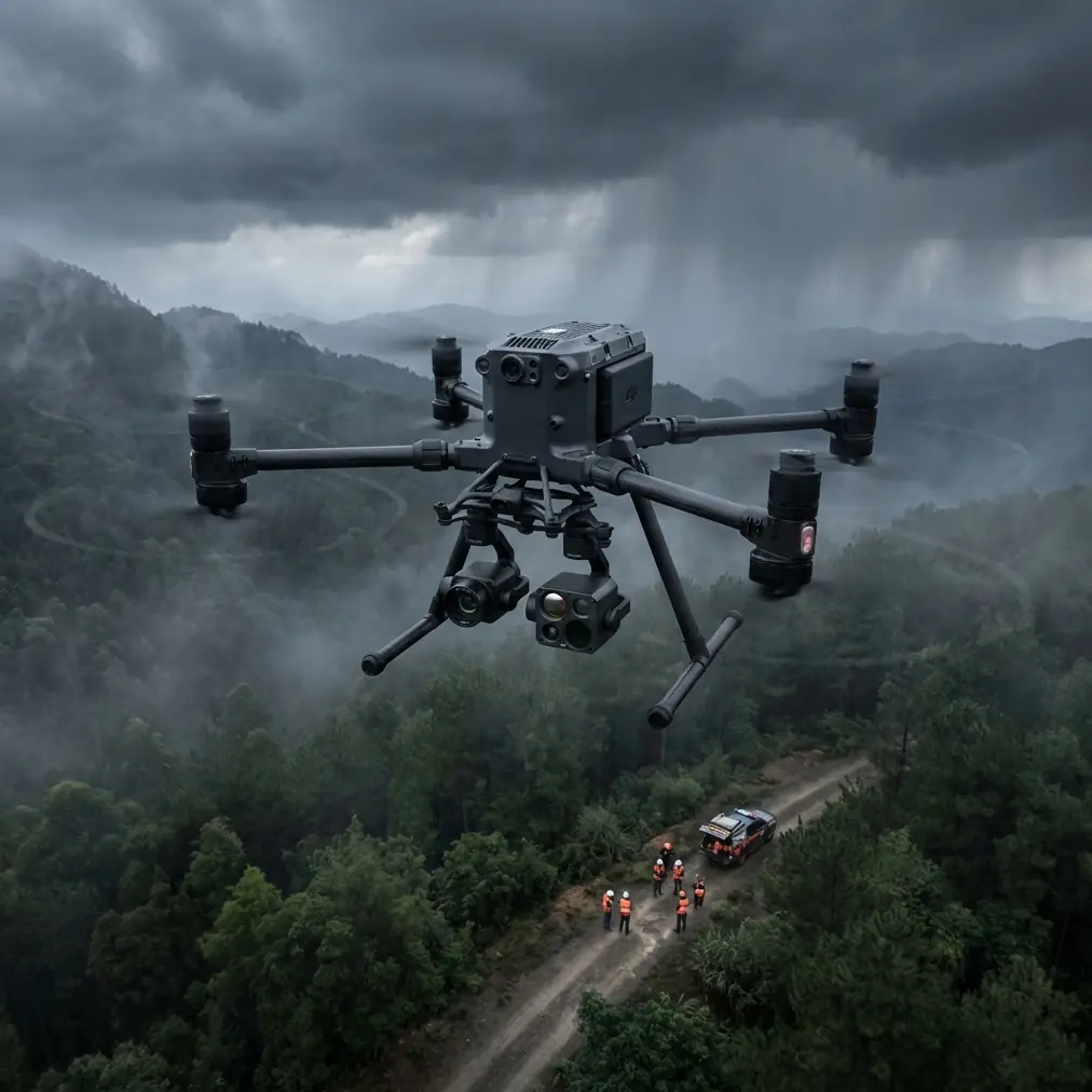
Thin air changes climb behavior. Cold affects endurance. Mountain terrain interrupts signal paths. Animals often appear at long stand-off distances, which means your imaging choices and antenna setup matter just as much as your piloting skill. If you are planning to use the Matrice 400 for wildlife filming in alpine terrain, ridgelines, or elevated plateaus, the job is not just about getting beautiful footage. It is about building a stable system that keeps image quality, transmission integrity, and aircraft reliability intact when conditions are working against you.
I want to approach this the way a real field operator would. Not as a generic product overview. As a mission tutorial.
What makes this especially relevant is that high-altitude operations have a lot in common with the old engineering tradeoffs found in aircraft system design. One reference point from aircraft environmental control engineering is surprisingly useful here: when a system needs to maintain airflow or pressure across changing engine states, designers often avoid overly complex continuously variable mechanisms because they add mechanical complexity, consume meaningful power, and can reduce overall efficiency. In the source material, the preference for two-speed or three-speed transmission concepts over continuously variable systems is presented as a practical compromise because fully variable systems can be mechanically complex and power-hungry.
That matters for drone operators because it points to a larger operational truth: in harsh environments, simple and robust usually wins. When you configure a Matrice 400 for wildlife filming at elevation, every accessory, payload choice, and flight profile should be judged by that same standard. Do not build a fragile stack. Build a stable one.
Start with the mission, not the camera
Wildlife filming at altitude usually falls into three categories:
- Observation and behavior capture
- Thermal location work at dawn, dusk, or shaded terrain
- Habitat documentation and terrain reconstruction through photogrammetry
Each of those puts different demands on the Matrice 400.
If your priority is behavior filming, your first question is standoff distance. You want enough separation to avoid disturbing the animal while still maintaining a clean visual. That immediately brings O3 transmission performance and antenna positioning into the conversation. If your priority is thermal signature detection, terrain masking and line-of-sight matter even more, because thermal work often happens in lower-light conditions when safe visual orientation is harder. If you are building habitat models, then photogrammetry discipline becomes the limiting factor, not just flight skill. You need repeatable overlap, careful GCP placement where permitted, and stable mission geometry despite altitude-induced wind shifts.
The mistake I see most often is trying to treat all three jobs as one flight. On paper, it sounds efficient. In the field, it creates compromise. Split the mission.
Use one sortie for detection and scouting. Another for cinematic capture. Another, if needed, for mapping-grade data collection.
Why high altitude punishes bad system design
The aircraft handbook reference also highlights another detail with real field significance: components mounted near engine accessory gearboxes in aircraft are subjected to severe vibration and require substantial mechanical testing before they can be considered reliable over a long service life. Translate that into drone operations and the lesson is obvious. Elevated terrain often means turbulent air, rotor loading changes, abrupt gusts near rock faces, and repeated transport over rough access routes. Even if the Matrice 400 itself is designed for professional duty, the weak point is often what the operator adds to it or how the aircraft is handled over time.
A high-altitude wildlife setup should be checked like a professional inspection rig:
- Payload lock confirmed before every launch
- Propellers inspected more often than usual
- Gimbal damping and horizon stability reviewed after transport
- Antennas, mounts, and battery seating checked in the cold
- Landing gear and contact surfaces examined after rocky field deployments
This is not overcaution. It is what keeps a sophisticated aircraft acting like a reliable tool instead of a temperamental one.
Antenna positioning advice for maximum range
Let’s get to the part that often decides whether a mountain shoot succeeds or becomes frustrating: antenna orientation.
O3 transmission is only as good as the path you give it. In high-altitude wildlife filming, the most common range problem is not actual distance. It is terrain interruption and poor antenna geometry.
Here is the field rule I teach:
Do not point the antenna tips directly at the aircraft. Present the antenna faces to the aircraft instead.
Most operators know this in theory, but under pressure they revert to “aiming” the controller like a flashlight. That reduces link quality. The broadside of the antenna pattern is what you want aligned toward the aircraft’s expected operating zone.
Practical mountain setup
If you are filming across a valley:
- Stand where you can see both the takeoff area and the likely animal movement corridor.
- Hold the controller so the antenna faces are oriented toward the drone’s lateral working area, not the ridgeline behind you.
- Keep your own body from blocking the path. A half-step sideways can improve the link more than people expect.
- If you move during tracking, pause and deliberately re-square your antenna orientation before continuing deeper into the route.
If you are filming upslope:
- Avoid standing directly below a steep face if the aircraft will crest above you.
- Gain a little elevation on your own position when possible. Even a modest rise can improve line-of-sight dramatically.
- As the drone transitions from below-horizon terrain to sky-backed exposure, recheck orientation instead of assuming the link will self-correct.
If you are operating near sparse trees or rock outcrops:
- Do not launch from the most sheltered spot if it has poor signal geometry.
- A cleaner RF position is often better than the most comfortable pilot position.
When teams ask me for a quick remote briefing before a field trip, I usually suggest they send over a map and route sketch first through our WhatsApp planning channel. A five-minute terrain review can save an hour of trial and error on location.
Thermal signature work in cold, thin air
Wildlife in alpine conditions is often easier to detect thermally than visually, especially against shaded scree, patchy snow edges, or brush-covered slopes. But thermal signature work is not the same as cinematic filming.
The first objective is not prettiness. It is detection confidence.
At altitude, the atmosphere is cleaner but the terrain background can be more deceptive. Sun-warmed rocks, mixed snow fields, and strong temperature gradients near sunrise can create false positives or flatten subject contrast depending on the angle. The Matrice 400 becomes more valuable here when you use thermal as a scouting layer and not as a standalone storytelling tool.
A smart workflow looks like this:
- Launch for thermal detection during the best temperature contrast window
- Mark subject location and movement direction
- Back off and reposition for visual capture using the least disruptive route
- Avoid repeatedly crossing over the same area
This matters for wildlife behavior. The aircraft should help you find the subject without turning the whole mountain basin into a noise event.
Battery management: hot-swap is operational, not just convenient
Hot-swap batteries are one of those features people describe casually until they work in the cold.
In high-altitude wildlife filming, the best moments are often short: a herd crossing, a bird taking a thermal, an animal emerging from shadow into open terrain. If your turnaround between flights is slow, you miss the sequence. Hot-swap support shortens that gap and helps keep your aircraft in the workflow rather than on the ground while the scene changes.
But this only pays off if you manage batteries correctly.
- Keep replacement packs temperature-managed before use
- Rotate batteries methodically instead of grabbing whichever pair is nearest
- Log which sets were exposed longest to cold ambient conditions
- Do not assume a battery that performed well at lower elevation will behave identically on a frigid ridge
Again, the aircraft handbook logic is useful here. Systems that consume “considerable power” through unnecessary complexity lose margin. In drone terms, aggressive maneuvering, repeated altitude changes, and poor route design can waste the margin you need for a safe reserve. Smooth flying is not only cinematic. It is efficient.
Building a safer BVLOS-adjacent mindset, even when staying within regulations
Many wildlife operators are interested in BVLOS workflows, or at least in adopting the planning discipline associated with them. Even when the mission remains within your local visual-line-of-sight rules, that mindset improves results.
What does that mean on a Matrice 400 mission?
- Define communications procedures before takeoff
- Establish terrain checkpoints and abort points
- Pre-brief expected animal movement corridors
- Mark transmission risk zones where ridges or tree bands may interfere
- Plan a conservative battery return threshold based on climb and wind, not on a flat-land estimate
If your team uses AES-256-secured data handling for media protection or sensitive ecological survey work, integrate that into the mission chain from the start. Wildlife researchers, reserve managers, and conservation contractors often need secure handling of location-sensitive footage. Security is not a luxury detail when the data itself may reveal nesting sites, migration staging areas, or fragile habitats.
Photogrammetry and GCP use for habitat documentation
The Matrice 400 is not only a filming platform. For many field teams, the same deployment may support habitat mapping, erosion tracking, or seasonal vegetation analysis.
This is where operators need to shift mental gears. Cinematic instincts and photogrammetry discipline are not identical.
If you are documenting a wildlife area for repeatable analysis:
- Fly a separate mapping mission
- Keep altitude and overlap consistent
- Use GCPs where authorization and site conditions allow
- Record environmental conditions, especially wind and light variability
- Avoid mixing oblique cinematic passes into mapping datasets
GCPs matter because high-relief terrain can exaggerate small alignment errors. At altitude, the landscape often contains steep slopes, repeated textures, and abrupt elevation changes. Good control points improve confidence in the final model and help preserve value over time if the dataset will be compared seasonally.
The key idea is this: one Matrice 400 mission can support both storytelling and science, but only if you respect the different requirements of each.
Field positioning for wildlife ethics
A technically successful flight can still be a poor wildlife operation.
Keep these principles front and center:
- Approach from routes that minimize disturbance
- Avoid hovering directly overhead
- Watch behavior cues more carefully than your monitor aesthetics
- End the shot early if the animal changes movement, posture, or grouping due to aircraft presence
The stronger your transmission link and the better your optics workflow, the less pressure you feel to push closer. That is the real operational value of proper antenna positioning, stable O3 performance, and a disciplined imaging plan. Better technique creates more ethical distance.
A sample high-altitude mission flow
Here is a clean structure I would use with the Matrice 400 for wildlife filming above tree line:
1. Pre-scout
Review topography, likely wind channels, launch zone options, and emergency landing alternatives.
2. RF setup
Choose a pilot position for line-of-sight first, comfort second. Align antennas broadside to the intended flight area.
3. Thermal detection sortie
Fly a short pattern to identify thermal signatures and movement.
4. Visual capture sortie
Reposition for the strongest line, best light angle, and lowest disturbance path.
5. Battery turnover
Use hot-swap efficiency to relaunch quickly while maintaining battery temperature discipline.
6. Mapping pass if needed
Run a separate photogrammetry mission with proper overlap and GCP workflow.
7. Post-flight reliability review
Inspect payload seating, prop condition, vibration indicators, and landing gear contact points before packing out.
That last step may sound mundane, but it echoes the aircraft reference point about vibration and long-life reliability. Harsh mechanical environments do not announce damage politely. They accumulate it.
What actually makes the Matrice 400 effective in this role
For high-altitude wildlife filming, the Matrice 400 is not defined by one headline feature. Its value comes from how multiple capabilities reinforce each other:
- O3 transmission supports cleaner stand-off operation
- Hot-swap batteries keep short wildlife windows usable
- Thermal signature workflows improve detection efficiency
- Secure handling such as AES-256 supports sensitive ecological projects
- Photogrammetry and GCP-compatible mission planning extend usefulness beyond video capture
That is the real story. Not just a drone in the mountains, but a platform that can move between observation, documentation, and research support if the operator brings discipline to the mission.
High altitude rewards preparation. It also punishes improvisation that should have been solved on the ground. If you want the Matrice 400 to perform well in wildlife filming, do not think only about flight. Think about system design, signal geometry, mission separation, and reliability under vibration, cold, and terrain pressure.
That is how you turn a difficult environment into repeatable results.
Ready for your own Matrice 400? Contact our team for expert consultation.