Matrice 400 Guide: Mountain Construction Site Inspections
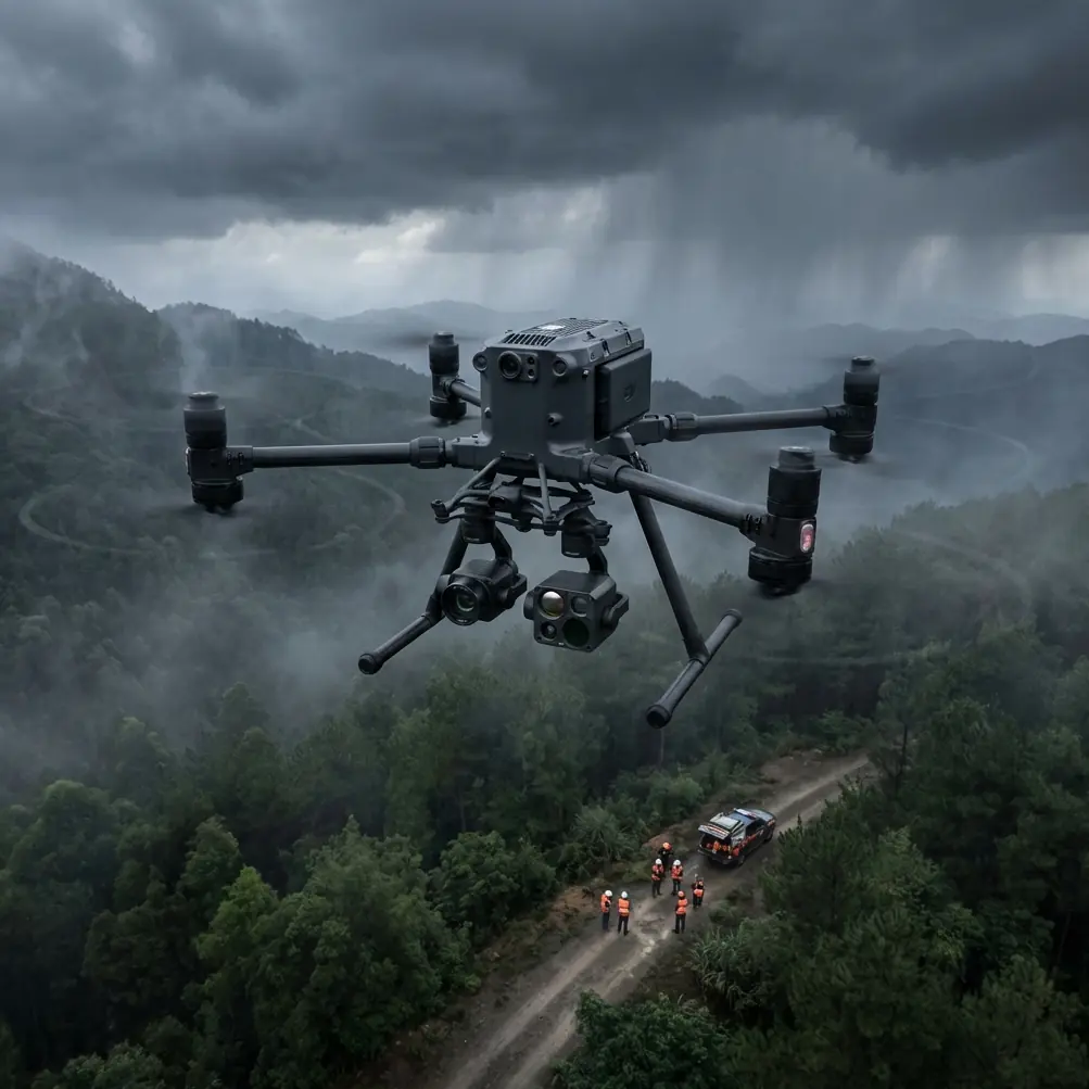
Matrice 400 Guide: Mountain Construction Site Inspections
META: Master mountain construction inspections with the Matrice 400. Learn expert flight techniques, thermal imaging tips, and safety protocols for challenging terrain.
TL;DR
- Optimal flight altitude of 80-120 meters AGL provides the best balance between photogrammetry accuracy and terrain clearance in mountainous construction zones
- O3 transmission technology maintains reliable video feeds even behind ridgelines and through signal-challenging valleys
- Hot-swap batteries enable continuous inspection coverage across sprawling mountain sites without returning to base
- AES-256 encryption protects sensitive construction data and proprietary site information during transmission
The Mountain Construction Challenge
Construction site inspections in mountainous terrain present unique obstacles that ground-based surveys simply cannot overcome. Steep gradients, unstable access roads, and rapidly changing weather conditions make traditional inspection methods dangerous, time-consuming, and often incomplete.
The Matrice 400 addresses these challenges directly. This guide breaks down the exact techniques, settings, and protocols that professional surveyors use to capture comprehensive site data in the most demanding mountain environments.
Why Mountain Sites Demand Specialized Drone Solutions
Terrain Complexity Creates Blind Spots
Mountain construction sites rarely sit on flat ground. Excavation areas, retaining walls, and foundation work often span multiple elevation changes within a single project boundary.
Traditional inspection methods miss critical details:
- Slope stability indicators hidden behind equipment or temporary structures
- Drainage patterns that only become visible from elevated angles
- Material stockpile volumes that appear distorted from ground level
- Access road conditions obscured by vegetation or terrain features
The Matrice 400's waypoint mission planning allows operators to pre-program flight paths that account for these elevation changes, ensuring consistent overlap for photogrammetry processing.
Signal Challenges in Valley Environments
Radio frequency behavior changes dramatically in mountainous terrain. Valley walls reflect and absorb signals unpredictably, creating dead zones that can cause lesser drones to lose connection.
Expert Insight: When inspecting sites in narrow valleys, position your launch point on elevated terrain whenever possible. The Matrice 400's O3 transmission system handles multipath interference effectively, but starting from a high point reduces the signal complexity the system must overcome.
The O3 transmission technology built into the Matrice 400 uses dual-frequency communication and intelligent switching to maintain 15+ kilometer theoretical range even in challenging RF environments. Real-world mountain performance typically delivers 8-10 kilometers of reliable control distance.
Optimal Flight Parameters for Mountain Construction
Altitude Selection Strategy
Flight altitude directly impacts both data quality and operational safety. Too low, and you risk collision with equipment or structures. Too high, and ground sampling distance suffers.
For mountain construction inspections, the 80-120 meter AGL sweet spot delivers:
- Ground sampling distance of 2-3 cm/pixel with standard payload configurations
- Sufficient terrain clearance for unexpected obstacles
- Reduced flight time compared to lower altitude missions requiring more passes
- Better thermal signature differentiation for identifying heat anomalies
| Altitude (AGL) | GSD (cm/pixel) | Coverage Rate | Best Use Case |
|---|---|---|---|
| 40-60m | 1.0-1.5 | Slow | Detailed crack detection |
| 80-120m | 2.0-3.0 | Moderate | General site surveys |
| 150-200m | 3.5-5.0 | Fast | Large area mapping |
GCP Placement in Challenging Terrain
Ground Control Points transform good aerial data into survey-grade deliverables. Mountain sites require strategic GCP placement that accounts for elevation variation.
Minimum GCP requirements for mountain sites:
- 5 GCPs minimum for sites under 10 hectares
- Additional GCP per 50 meters of elevation change within the survey area
- Edge placement priority on the highest and lowest points of the site
- Visible markers that contrast with typical construction materials
Pro Tip: Use high-visibility orange or pink GCP targets rather than standard black and white checkerboards. Mountain construction sites often feature dark excavated soil and light-colored concrete that can camouflage traditional targets in aerial imagery.
Thermal Imaging Applications for Construction Monitoring
Identifying Hidden Issues Before They Escalate
Thermal signature analysis reveals problems invisible to standard RGB cameras. The Matrice 400's payload flexibility allows operators to mount professional-grade thermal sensors for comprehensive site assessment.
Common thermal applications on mountain construction sites:
- Concrete curing verification through heat differential monitoring
- Water infiltration detection in foundation areas
- Equipment overheating identification before mechanical failure
- Subsurface void detection through temperature anomaly mapping
Best Practices for Mountain Thermal Surveys
Temperature differentials behave differently at altitude. Lower air pressure and increased UV exposure affect both the thermal sensor and the materials being inspected.
Optimal thermal inspection conditions:
- Early morning flights (within 2 hours of sunrise) for maximum temperature differential
- Overcast days reduce solar loading interference
- Wind speeds below 15 km/h prevent rapid surface temperature equalization
- Minimum 30-minute wait after rain for surface moisture evaporation
BVLOS Considerations for Extended Mountain Operations
Beyond Visual Line of Sight operations unlock the full potential of the Matrice 400 for large mountain construction projects. However, regulatory compliance and safety protocols require careful planning.
Regulatory Framework
BVLOS operations require specific authorizations in most jurisdictions. Mountain construction sites often qualify for operational waivers due to:
- Limited ground access reducing risk to non-participants
- Defined project boundaries with controlled airspace
- Professional operator requirements already standard in construction
- Enhanced safety systems built into enterprise-grade platforms
Technical Requirements for Safe BVLOS
The Matrice 400 includes several features that support BVLOS operations:
- Redundant GPS/GLONASS positioning with RTK correction capability
- Automatic return-to-home with intelligent obstacle avoidance
- Real-time telemetry for continuous aircraft status monitoring
- AES-256 encrypted command links preventing unauthorized interference
Data Security for Sensitive Construction Projects
Mountain construction often involves infrastructure projects with significant security implications. Roads, bridges, utilities, and communication installations require data protection throughout the inspection workflow.
Encryption and Access Control
The Matrice 400's AES-256 encryption protects both command signals and video transmission. This military-grade encryption prevents:
- Signal interception by unauthorized parties
- Video feed hijacking during live operations
- Command injection attacks that could compromise aircraft control
- Data extraction from stored flight logs
Secure Data Handling Workflow
Post-flight data security checklist:
- Transfer imagery to encrypted storage immediately after landing
- Clear SD cards using secure deletion protocols
- Maintain chain of custody documentation for regulatory compliance
- Use secure file transfer methods for client deliverables
Common Mistakes to Avoid
Underestimating Weather Windows
Mountain weather changes rapidly. A clear morning can become an unsafe flying environment within 30 minutes. Always check multiple weather sources and build buffer time into mission planning.
Ignoring Density Altitude Effects
Higher elevations mean thinner air. The Matrice 400 compensates automatically, but operators should expect:
- Reduced hover time by approximately 3-5% per 1000 meters of elevation
- Decreased maximum payload capacity at extreme altitudes
- Modified handling characteristics requiring smoother control inputs
Skipping Pre-Flight Compass Calibration
Magnetic anomalies are common in mountainous regions due to mineral deposits. Always calibrate the compass at each new launch location, even if the site was surveyed previously.
Neglecting Hot-Swap Battery Protocols
The hot-swap battery system enables continuous operations, but improper technique causes mission interruptions. Practice the swap procedure until it becomes automatic, and always verify battery lock engagement before resuming flight.
Insufficient Overlap for Photogrammetry
Mountain terrain requires higher overlap percentages than flat sites. Use 75% frontal overlap and 65% side overlap minimum for reliable 3D reconstruction across elevation changes.
Frequently Asked Questions
What is the maximum wind speed for safe mountain operations with the Matrice 400?
The Matrice 400 handles sustained winds up to 15 m/s with gusts to 20 m/s. However, mountain environments create localized turbulence near ridgelines and in valleys that may exceed these thresholds unpredictably. Reduce operational limits by 25-30% when flying near terrain features that generate mechanical turbulence.
How many batteries should I bring for a full-day mountain inspection?
Plan for 6-8 battery sets for a full day of mountain operations. Reduced air density at altitude decreases flight time by approximately 10-15% compared to sea-level performance. Cold temperatures common at elevation further reduce capacity. The hot-swap capability means you can maintain continuous operations with proper battery rotation.
Can the Matrice 400 operate effectively in light rain or snow?
The Matrice 400 features IP45 weather resistance, allowing operations in light precipitation. However, moisture on camera lenses degrades image quality significantly. For photogrammetry missions requiring high accuracy, postpone flights until conditions improve. Thermal inspections are less affected by light moisture but still benefit from dry conditions.
Maximizing Your Mountain Inspection Results
Successful mountain construction inspections combine the right equipment with proper technique and thorough planning. The Matrice 400 provides the technical foundation, but operator expertise determines final deliverable quality.
Focus on understanding your specific site challenges before each mission. Review previous flight data, consult with site managers about recent changes, and always have contingency plans for weather deterioration.
The investment in proper training and mission planning pays dividends through higher quality data, safer operations, and more satisfied clients.
Ready for your own Matrice 400? Contact our team for expert consultation.