Matrice 400 Best Practices for Windy Highway Inspections
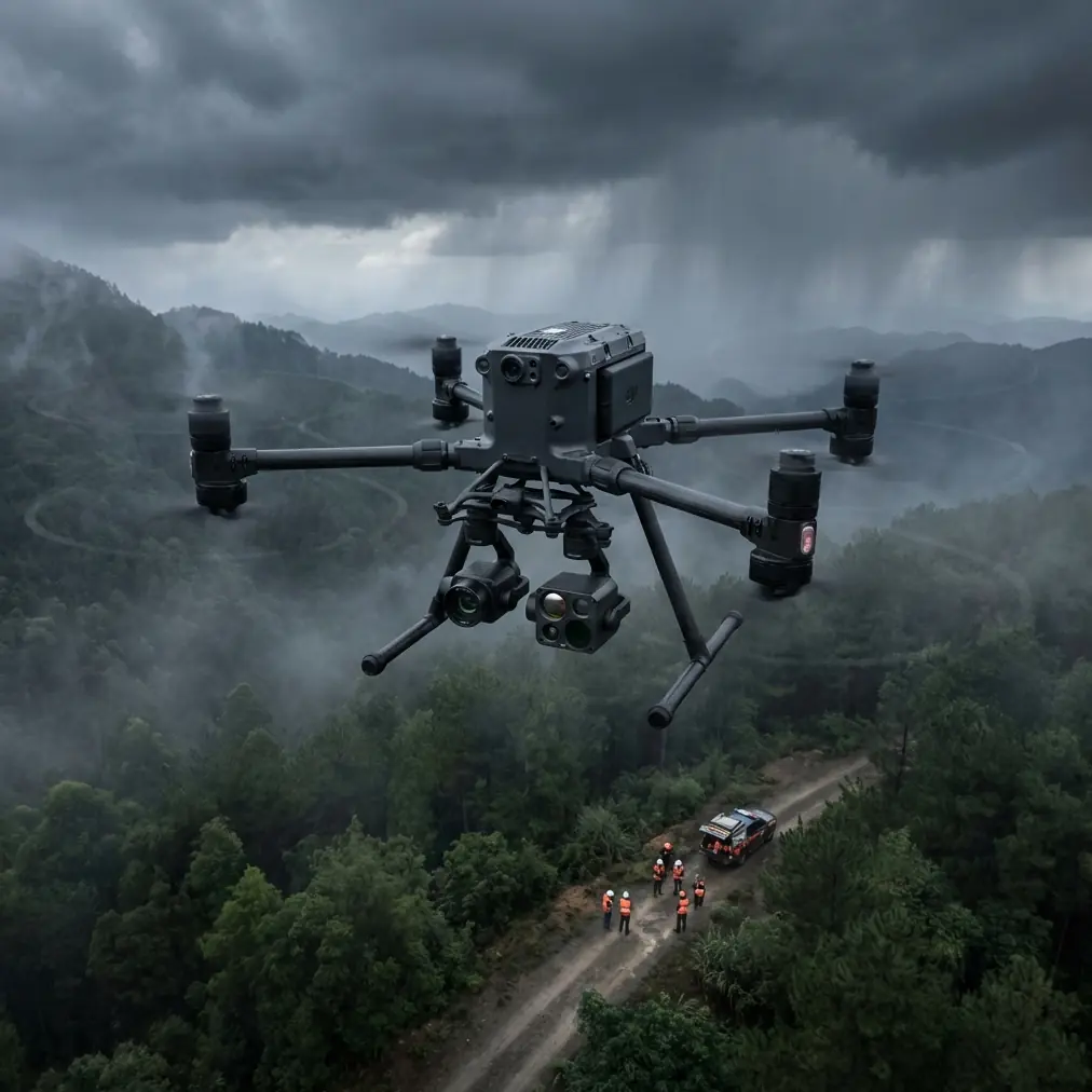
Matrice 400 Best Practices for Windy Highway Inspections
META: A field-focused how-to on using the Matrice 400 for highway inspection in windy conditions, covering payload planning, O3 transmission, AES-256 security, thermal workflows, photogrammetry, GCP use, hot-swap batteries, and antenna adjustment under electromagnetic interference.
Highway inspection is where aircraft capability stops being a spec-sheet discussion and turns into an operations problem. Wind funnels through overpasses. Heat shimmer distorts imagery above asphalt. Steel structures, utility lines, traffic systems, and roadside communications hardware all compete for signal integrity. If your platform cannot hold a stable flight path, preserve a clean link, and support repeatable data capture, the mission becomes expensive very quickly.
For teams evaluating the Matrice 400 for this kind of work, the right question is not whether it is “powerful.” The better question is whether it can keep image quality, transmission stability, and inspection continuity intact when the environment is working against you. That is the lens I recommend using.
This article is written from the perspective of a highway inspection workflow in wind, with a focus on practical field decisions: payload configuration, thermal signature capture, photogrammetry accuracy, antenna handling under electromagnetic interference, and battery management for long corridor missions.
Start with the mission, not the aircraft
A highway job is rarely one task. It usually blends several:
- deck and support structure inspection
- pavement distress review
- slope and drainage observation
- thermal anomaly checks on joints, electrical cabinets, or bridge-adjacent infrastructure
- orthomosaic or 3D reconstruction for documentation
That matters because the Matrice 400 should be configured around the data requirement first. If the deliverable is a measurable corridor model, your flight geometry and GCP strategy matter more than pure endurance. If the goal is thermal screening for heat-related defects, then timing, sun angle, and sensor stabilization become the operational center of gravity.
The most common mistake I see in windy highway inspections is trying to collect every data layer in a single pass. It sounds efficient. Usually it is not. Wind changes aircraft attitude, attitude changes camera geometry, and mixed mission profiles create inconsistent datasets. The Matrice 400 is better used with deliberate segmentation: one mission profile for photogrammetry, another for thermal signature review, and a third for close visual inspection if needed.
Wind changes everything about corridor planning
Highway work often creates long, linear routes with very little shelter. Wind can be steady, gusting, or mechanically turbulent near sound barriers, embankments, bridge abutments, and moving traffic. That affects not just safety margins, but whether the data is usable.
With the Matrice 400, plan for wind from three angles:
1. Ground speed consistency
Photogrammetry depends on predictable overlap. In a crosswind, the aircraft may still hold the route, but yaw and lateral corrections can introduce image inconsistency. For mapping runs, avoid flying at the highest tolerable speed just because the route is long. Build in margin so the aircraft can absorb gusts without degrading overlap.
2. Camera angle discipline
Wind-induced pitch changes can subtly alter the look angle, especially when the route transitions over rises or bridges. For corridor mapping, this can create reconstruction artifacts. If your output requires strong dimensional reliability, pair your flight planning with GCPs at selected intervals along the route. GCP use is not glamorous, but on long highway stretches it is often the difference between a pretty map and a defensible survey-grade deliverable.
3. Repeatability for change detection
Highway asset teams often compare conditions over time. Wind makes repeat flights less repeatable unless the flight path, altitude, and capture timing are standardized. The Matrice 400 becomes most valuable here when you build a repeatable inspection template rather than improvising each sortie.
Why O3 transmission matters on a highway corridor
For highway inspection, transmission is not just about range. It is about link quality in cluttered infrastructure corridors. A long route can pass beneath gantries, near cellular installations, next to high-voltage distribution, and around concrete-and-steel structures that create reflections or partial signal shadowing.
This is where O3 transmission deserves operational attention. A stronger, more resilient live link gives the pilot and payload operator better continuity when the aircraft is moving through complex RF conditions. That does two things in practice:
First, it reduces the temptation to overcompensate with unnecessary repositioning. When the live feed and control link stay stable, the crew can maintain the planned route instead of stopping and restarting segments.
Second, it improves confidence in close inspection work near structures where signal reflections can be misleading. During bridge-adjacent operations, a stable transmission system helps preserve command fidelity when the aircraft is not in a clean open-sky RF environment.
If your client requires data protection or your own operating procedures demand stronger communications hygiene, AES-256 encryption is not a minor checkbox. It is operationally significant. Highway inspections often involve critical infrastructure imagery, maintenance records, and geolocated asset data. AES-256 support helps organizations align the flight operation with internal data security policies, especially when captured footage and telemetry are part of a regulated infrastructure workflow.
Handling electromagnetic interference: antenna adjustment in the real world
Electromagnetic interference around highways is common enough that crews should treat it as a normal planning factor, not a rare event. Sources can include utility lines, roadside electronics, communications towers, traffic monitoring systems, and temporary worksites.
The first rule is simple: do not assume signal issues are always caused by distance.
When interference appears, many operators instinctively climb or move closer. Sometimes that helps. Sometimes it puts the aircraft in a less favorable geometry. What often makes the bigger difference is antenna orientation.
For the Matrice 400, field crews should rehearse antenna adjustment as part of normal link management. Keep the controller antennas aligned to the aircraft’s position rather than treating them as fixed. If the route bends, if the aircraft descends along a slope, or if a bridge deck begins blocking part of the path, the operator should actively reorient for the strongest link geometry.
Operationally, this matters because interference rarely shows up as a dramatic total disconnect at first. More often you see softer symptoms:
- intermittent video breakup
- delayed image refresh
- telemetry hesitation
- inconsistent control feel near specific structures
Those are early warnings. Antenna correction can often restore stability before the situation escalates into an aborted segment. The crews who handle RF interference well are usually the ones who notice trends early and respond with small corrections rather than waiting for a major problem.
If your team wants to compare field setups or discuss a corridor inspection workflow, I suggest sharing route details and payload goals directly through this project chat line.
Thermal signature capture: where timing matters more than resolution
Thermal work on highways gets oversimplified. People talk about seeing “hot spots,” but the real value comes from thermal context. Is the anomaly structural, electrical, moisture-related, friction-related, or just a result of solar loading?
The Matrice 400 becomes especially useful when thermal signature collection is integrated into a disciplined time window. On asphalt-heavy sites, midday heat can flatten useful contrast. Early morning or late-day operations often produce cleaner separation between materials and defects. Expansion joints, drainage patterns, and certain electrical enclosures near roadway assets can present more readable thermal behavior when the sun is not overwhelming the scene.
In wind, thermal interpretation gets even trickier. Airflow can cool surfaces unevenly, especially on elevated structures and bridge components. That means the crew should avoid jumping to conclusions from a single pass. Use thermal imagery to identify candidate anomalies, then validate with visual inspection or a second thermal angle where practical.
The aircraft is only one piece of the equation. The workflow is what turns thermal data into maintenance value.
Photogrammetry on long highway sections: the discipline of boring accuracy
Photogrammetry is not forgiving when operators get casual. A highway corridor may look simple from above, but it includes repetitive textures, moving vehicles, reflective surfaces, and elevation variation. Add wind, and image consistency becomes harder to maintain.
A few field principles matter here:
Use GCPs where they materially improve the model
You do not need to overbuild the site with markers, but strategic GCP placement along critical intervals can anchor the dataset and reduce drift across long corridors. This is especially relevant when the output is meant for engineering review rather than simple visual reference.
Separate mapping passes from inspection passes
A mapping run should be flown for geometry and overlap, not for dramatic close-ups. Then come back for targeted inspections. Trying to produce survey-friendly photogrammetry while also chasing visual details in one mission usually weakens both outputs.
Watch traffic shadows and glare
Vehicles create moving occlusions. Wet pavement and road markings can reflect strongly. In gusty conditions, waiting for a cleaner light window may save hours of post-processing frustration.
The Matrice 400 fits this workflow best when operators respect the difference between “we flew it” and “we captured a dataset that can actually be trusted.”
Hot-swap batteries and why they matter on highway jobs
Corridor inspections reward continuity. Breaking the mission every time power runs low can create gaps, inconsistent lighting, and rework. Hot-swap batteries are therefore not just a convenience feature. They directly support operational flow.
On a highway inspection, battery replacement often happens from a shoulder access point, a maintenance pull-off, or a temporary staging area with limited time and space. The ability to hot-swap lets teams keep the aircraft workflow moving with less disruption, especially when mission continuity matters for lighting consistency or route segmentation.
There is also a crew management benefit. When battery procedures are fast and predictable, teams are less likely to rush pre-flight checks on the relaunch. That may sound small, but rushed relaunches are where preventable mistakes show up.
For long corridor work, organize batteries around route logic, not just percentage remaining. Pair each segment with a defined reserve threshold and recovery point. Wind can turn a comfortable energy margin into a thin one faster than expected, especially on return legs.
BVLOS potential, and the reality around it
BVLOS is one of the most discussed concepts in corridor inspection because highways are inherently linear assets. The appeal is obvious: fewer repositionings, longer continuous coverage, and better overall efficiency.
But BVLOS is not simply a matter of aircraft capability. It is a system issue involving regulation, risk controls, communications reliability, detect-and-avoid procedures where required, crew training, and mission design. The Matrice 400 may support the broader operational ambitions of corridor teams, yet the practical value comes only when the operation itself is mature enough to use that capability responsibly and legally.
For most organizations, the near-term win is not “full BVLOS deployment tomorrow.” It is building flights, logs, RF discipline, data handling, and crew coordination that make future advanced operations feasible.
A practical field sequence for windy highway inspection
If I were setting a standard operating pattern for a Matrice 400 highway mission in wind, it would look like this:
- Run a site RF check before launch. Identify towers, overhead lines, traffic systems, and reflective structures.
- Brief antenna handling explicitly. Make one crew member responsible for monitoring link behavior and adjusting orientation as the route evolves.
- Fly the photogrammetry segment first if the light is stable and traffic conditions are manageable.
- Use GCPs on critical sections where dimensional confidence matters most.
- Switch to thermal in the best time window, not merely the most convenient one.
- Use hot-swap battery procedures to maintain tempo without cutting corners on relaunch checks.
- Review a sample dataset on site before leaving. Wind-related errors are cheaper to correct immediately than after demobilization.
That sequence is not flashy. It is effective.
The bigger picture
The Matrice 400 makes sense for highway inspection when the operator needs one platform that can support secure transmission, advanced imaging workflows, and long-route field discipline in difficult conditions. O3 transmission matters because highway corridors are messy RF environments. AES-256 matters because infrastructure data is sensitive. Hot-swap batteries matter because corridor work punishes stop-start inefficiency. GCP-backed photogrammetry matters because maintenance teams need outputs they can rely on, not just attractive maps. And antenna adjustment under electromagnetic interference matters because the job does not happen in a clean lab.
That is the real story. Not just what the aircraft can do, but how it behaves when the inspection route is windy, reflective, electrically noisy, and unforgiving.
Ready for your own Matrice 400? Contact our team for expert consultation.