Matrice 400 Field Report: Coastal Venue Inspection Lessons
Matrice 400 Field Report: Coastal Venue Inspection Lessons from Mountain Mapping Discipline
META: A field-tested look at how Matrice 400 workflows for coastal venue inspection benefit from high-precision GCP planning, photogrammetry discipline, pre-flight cleaning, and stable data capture in challenging environments.
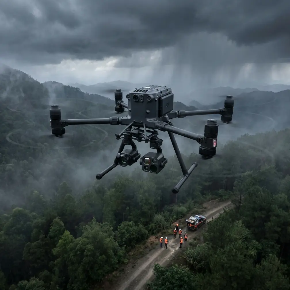
When people talk about inspecting coastal venues with a Matrice 400, the conversation usually drifts toward payloads, flight time, or transmission range. Those matter. But in real survey work, the better question is this: what actually protects data quality when the site is awkward, windy, elongated, reflective, and logistically messy?
That is where an older lesson from UAV water conservancy mapping in mountainous terrain becomes unexpectedly useful.
A technical paper on UAV aerial surveying for mountain water projects makes a blunt point: because each image covers a relatively small area while maintaining high resolution, UAV operations demand stricter image control than traditional photogrammetry. Not just better accuracy in ground control points, but denser placement as well. It also recommends a full-field setup where possible, using a plane-elevation network layout and ensuring that every flight strip has connecting control points.
Those ideas were written for mountain water conservancy work, not coastal venue inspection. Still, the operational logic carries over almost perfectly.
I’ve seen this firsthand on waterfront event grounds, marina-adjacent complexes, open-air stadium districts near the shoreline, and long, irregular hospitality properties facing the sea. Coastal venues often behave less like tidy commercial rooftops and more like narrow, uneven survey corridors. They stretch along seawalls, promenades, access roads, drainage edges, utility runs, temporary structures, and staging zones. That geometry is exactly where casual drone habits start to fail.
The Matrice 400 is capable enough to make these sites look easy. That can be deceptive.
Why coastal venues create the same headaches as difficult mountain corridors
The source material describes water project survey areas as irregular and elongated. That single detail matters more than it first appears. When a site is long rather than compact, your overlap patterns stop being neat in practice. The paper also notes that UAV imagery in these conditions can suffer from irregular forward and side overlap, which then contributes to visible distortion and more difficult geometric correction during processing.
Swap a mountain valley for a coastal venue and the same pattern shows up fast.
A venue along the coast is rarely one simple block. You may have a main structure, parking overflow, pedestrian routes, stormwater channels, temporary fencing, lighting masts, roof sections, service alleys, shoreline retaining structures, and sponsor installations spread in a thin ribbon. If you try to fly it as though it were a square parcel, your photogrammetry model often tells on you later. You see weak edge reconstruction, inconsistent tie points, warped features near the margins, or alignment drift between separate flight lines.
The fix starts before takeoff.
With a Matrice 400, I treat coastal venue inspection less as a simple capture mission and more as corridor-quality acquisition. That means designing flight strips with deliberate continuity, maintaining reliable lateral connection between strips, and planning for control where the geometry is most likely to break down. The mountain mapping paper’s recommendation to ensure connecting control points between each strip is not academic housekeeping. It is a practical defense against long-site instability.
If your venue runs parallel to the shoreline, each strip needs to “talk” to the next one. If it does not, even strong onboard positioning and good transmission won’t save a weak reconstruction.
The underappreciated role of dense, accurate GCPs
One of the strongest technical takeaways from the source is that UAV image control requirements are higher than in traditional photogrammetry because of the combination of small single-image coverage and high resolution. That sounds counterintuitive to some crews. High resolution feels like certainty. It isn’t. High resolution simply means errors become easier to notice.
On coastal inspections, especially for venue condition assessment, drainage review, roof deformation checks, facade modeling, and temporary infrastructure documentation, the tolerance for positional sloppiness is low. If the goal is to compare conditions over time, support engineering review, or validate contractor work, your GCP strategy cannot be an afterthought.
This is where Matrice 400 operators can distinguish themselves.
Use the aircraft’s capture capability as part of a system, not a substitute for control. Denser GCP placement matters because coastal venues create visual traps: repeated paving patterns, reflective surfaces, lightweight structures, fabric coverings, and water-adjacent glare can all make automated matching less robust than expected. Add wind and you have another variable affecting aircraft attitude and image geometry. The paper specifically points out that small, lightweight UAVs are easily influenced by wind, causing deviations in flight posture and route, which then complicates geometric correction. That is not just a mountain problem. Along the coast, it may be the defining problem of the day.
A Matrice 400 can hold a mission far better than many smaller platforms, but the principle still stands: when wind nudges acquisition away from the ideal, ground truth becomes your insurance policy.
For venue work, I prefer GCP distribution that supports the ends, the bends, and the transitions. Corners alone are not enough on a long coastal property. You want control near linear infrastructure, changes in elevation, narrow connectors, and any segment where one strip might otherwise be weakly tied to another. The paper’s emphasis on higher precision and denser layout should be read literally. Not “some control.” Enough control to hold the model together where the site itself wants to pull it apart.
The practical sequence that saves time on site
The source text includes a procedural point that deserves more attention than it gets: with high-resolution UAV imaging, the field team generally places and marks the control points first, then flies afterward. The authors argue this is simpler than the traditional workflow where staff identify points on the aerial photos later.
For Matrice 400 venue inspection, that workflow is still the right instinct.
Walk the site first. Mark control. Validate visibility. Check whether any planned markers will disappear against decorative paving, painted zones, salt-stained concrete, or temporary branding graphics. Then fly.
This is also the right moment for the pre-flight cleaning step that too many teams skip. Before launch, I want the visual sensors, thermal sensor surfaces if installed, obstacle sensing windows, and landing gear contact areas inspected and cleaned. Coastal venues leave salt residue, airborne moisture film, dust, and fine grit on everything. That contamination can degrade obstacle sensing confidence, affect image clarity, and in thermal work can compromise the consistency of subtle heat patterns on roofs, electrical cabinets, HVAC runs, or utility enclosures.
A clean aircraft is not vanity maintenance. It is flight safety and data quality management.
I also check battery contact surfaces and confirm hot-swap readiness if the job will be split into sequential sorties. On large coastal venues, hot-swap batteries can preserve mission flow and keep light conditions more consistent across datasets. That matters when you are building a photogrammetry output meant to compare one venue zone against another without obvious lighting discontinuities.
Why live transmission still needs disciplined capture planning
The mountain mapping reference praises UAV technology for real-time video transmission and the ability to reach high-risk areas efficiently. That remains one of the biggest strengths of the Matrice 400 in civilian inspection. For venue teams working near rooftops, lighting gantries, facade edges, shoreline barriers, or restricted service corridors, a strong live view changes decision-making in the field.
This is where O3 transmission becomes operationally useful rather than just a spec-sheet talking point. In coastal environments with structural clutter, temporary event installations, and reflective surfaces, stable transmission supports better shot verification and faster corrections while the aircraft is still in the air. If an access canopy, banner structure, or shoreline service platform needs a second pass, you catch it immediately.
But live video does not replace survey discipline.
I’ve seen crews rely on the confidence of a strong downlink and forget that mapping quality is decided later, in the processing stage. The source material is clear that interior processing and geometric correction become difficult when flight routes drift and overlap is inconsistent. That is the warning worth carrying into every Matrice 400 mapping mission: a mission can look great on the controller and still produce avoidable reconstruction problems.
So use the transmission link for verification, not complacency.
Thermal signature work at coastal venues needs context
The user scenario here is venue inspection, and many teams now combine visible-light photogrammetry with thermal signature review. On waterfront properties, thermal can reveal roof moisture patterns, insulation failures, overloaded electrical elements, and HVAC irregularities. Yet coastal conditions complicate interpretation. Wind, reflective water nearby, changing cloud cover, and sun-heated surfaces can all distort what a thermal image seems to say.
That makes a well-registered visual model even more valuable.
If your thermal observations are tied back to a solid photogrammetric base supported by properly distributed GCPs, you spend less time arguing over location and more time understanding the anomaly itself. That is another reason the mountain mapping lesson matters. Dense, accurate control is not just for beautiful orthomosaics. It supports multi-layer inspection confidence.
Weather discipline is not optional near the sea
The source paper mentions a familiar problem in mountain regions: weather interference, especially low cloud layers that can create cloud shadow and damage image quality. Coastal venues bring their own version of that instability. Marine haze, moving cloud bands, glare off water, and sudden brightness shifts can change the scene within a single mission block.
The operational takeaway is simple. If you are inspecting a coastal venue with a Matrice 400, build missions around stable light windows whenever possible. If conditions are changing, split flights into logical sections and document the sequence. That helps later when reviewing photogrammetry outputs and comparing thermal or visual datasets. It also reduces the temptation to force a “complete” mission under bad visual conditions just because the aircraft is still flyable.
Flyability and data suitability are not the same thing.
Security and remote workflows matter more than many venue operators realize
Large venues often involve third-party stakeholders: facilities teams, engineering consultants, event planners, insurers, and maintenance contractors. If your Matrice 400 workflow includes remote coordination or file transfer planning, security is not an abstract IT issue. It is part of professional operations.
That is where encrypted handling and controlled communications make practical sense. If a site team wants to coordinate before a capture window, I prefer a direct line for mission planning, and if you need one, you can message the operations desk here. For data moving between field and office, safeguards such as AES-256 level protection fit naturally into venue workflows where site layouts, infrastructure conditions, and maintenance findings may be sensitive business information.
This is not about secrecy for its own sake. It is about handling commercial inspection data responsibly.
What Matrice 400 operators should borrow from mountain survey teams
The source document closes with a useful tension: in difficult terrain, it is often hard to place enough high-accuracy ground control points, yet processing still demands them. That contradiction feels very familiar on venue sites. The areas that most need reliable control are often the least convenient to access—service roofs, edge corridors, fenced infrastructure zones, temporary crowd-control layouts, or waterfront margins.
Experienced Matrice 400 teams do not solve this by pretending the contradiction doesn’t exist. They solve it by planning around it.
Walk more before flying. Place control earlier. Clean sensors before launch. Respect wind. Design strip continuity for long properties. Use transmission to verify, not to excuse weak acquisition. Keep thermal interpretation anchored to reliable geometry. Protect the data after capture.
That is the kind of discipline that turns a drone flight into inspection-grade work.
The Matrice 400 is a serious platform. For coastal venues, its value shows up most clearly when the operator brings survey thinking to the mission. And some of the best survey thinking available still comes from environments where the terrain, weather, and logistics are unforgiving. Mountain water conservancy mapping may seem far removed from a seafront venue, but the core lesson is exactly the same: the hard part is not getting airborne. The hard part is building a capture workflow that holds up when the site refuses to behave like a clean textbook map.
Ready for your own Matrice 400? Contact our team for expert consultation.