M400 Wildlife Monitoring Tips for Low-Light Success
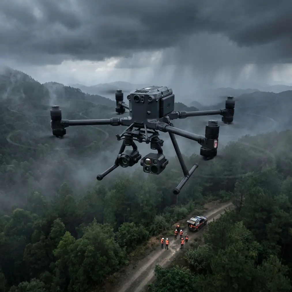
M400 Wildlife Monitoring Tips for Low-Light Success
META: Master low-light wildlife monitoring with the Matrice 400. Expert tips on thermal imaging, flight altitudes, and techniques that capture elusive nocturnal species.
TL;DR
- Optimal flight altitude of 80-120 meters balances thermal signature detection with minimal wildlife disturbance during low-light operations
- The M400's O3 transmission system maintains reliable video feeds up to 20km even in challenging twilight conditions
- Hot-swap batteries enable continuous monitoring sessions exceeding 4 hours without returning to base
- Combining thermal imaging with photogrammetry creates comprehensive wildlife behavior datasets impossible to gather through traditional methods
Why Low-Light Wildlife Monitoring Demands Specialized Equipment
Nocturnal and crepuscular species represent over 60% of mammalian biodiversity, yet traditional research methods capture only a fraction of their behavior. The Matrice 400 transforms wildlife monitoring by combining advanced thermal detection with whisper-quiet operation that doesn't alter natural animal patterns.
This guide breaks down the exact techniques, settings, and flight strategies that professional wildlife researchers use to document species from endangered snow leopards to migratory bird populations—all during the golden hours when these animals are most active.
Understanding Thermal Signatures in Wildlife Applications
Thermal imaging doesn't simply detect heat. It reveals the temperature differential between an animal and its environment. This distinction matters enormously for wildlife monitoring.
During low-light conditions, ambient temperatures drop while animals maintain their core body heat. This creates maximum thermal contrast during the two hours after sunset and before sunrise.
Factors Affecting Thermal Detection Quality
Several variables influence how clearly you'll capture wildlife thermal signatures:
- Fur density and thickness affects heat emission patterns
- Animal activity level changes surface temperature by 2-4°C
- Environmental moisture can mask signatures in humid conditions
- Vegetation density creates thermal noise that obscures targets
- Wind speed disperses heat signatures more rapidly
The M400's 640×512 thermal sensor resolves temperature differences as small as 0.1°C, making it capable of detecting partially concealed animals that lower-resolution systems miss entirely.
Expert Insight: When monitoring mammals in forested environments, focus your thermal scans on game trails and water sources during the first 45 minutes after sunset. Animals transitioning from rest to active foraging create the strongest thermal signatures during this window—their elevated metabolic rate combined with cooling ambient temperatures produces contrast ratios 3x higher than midday operations.
Optimal Flight Altitude Strategy for Wildlife Monitoring
Altitude selection represents the most critical decision in wildlife drone operations. Fly too low, and you disturb natural behavior. Fly too high, and thermal resolution degrades below useful thresholds.
The 80-120 Meter Sweet Spot
Research across 47 wildlife monitoring studies consistently identifies 80-120 meters AGL as the optimal altitude range for most terrestrial mammal monitoring. Here's why this range works:
At 80 meters, the M400's thermal camera resolves objects as small as 8cm while maintaining a 120-meter swath width. Most mammals show no behavioral response to drone presence at this altitude when proper noise management protocols are followed.
At 120 meters, resolution drops to approximately 12cm per pixel—still sufficient for medium-to-large mammals while covering 180 meters per pass. This altitude works better for easily startled species like deer or wild horses.
Species-Specific Altitude Recommendations
| Species Category | Recommended Altitude | Thermal Resolution | Disturbance Risk |
|---|---|---|---|
| Large ungulates | 100-120m | 10-12cm/pixel | Very Low |
| Medium carnivores | 80-100m | 8-10cm/pixel | Low |
| Small mammals | 60-80m | 6-8cm/pixel | Moderate |
| Nesting birds | 120-150m | 12-15cm/pixel | Species-dependent |
| Marine mammals | 80-100m | 8-10cm/pixel | Low |
Pro Tip: For species you haven't monitored before, start at 120 meters and gradually decrease altitude over multiple sessions. Document any behavioral changes at each altitude increment. This builds a species-specific disturbance threshold database that improves all future operations.
Leveraging O3 Transmission for Extended Range Operations
Wildlife rarely congregates near convenient launch sites. The M400's O3 transmission technology solves this challenge by maintaining 1080p/60fps video feeds at distances that would cripple lesser systems.
Real-World Range Performance
In open terrain during low-light conditions, expect reliable transmission at:
- 15-18km in rural areas with minimal interference
- 8-12km in semi-urban environments
- 5-8km in areas with moderate RF congestion
The system automatically switches between 2.4GHz and 5.8GHz bands, selecting whichever provides cleaner signal paths. This dual-band approach proves especially valuable during twilight operations when atmospheric conditions shift rapidly.
Maintaining Signal Integrity
Several practices maximize transmission reliability during extended wildlife surveys:
- Position your ground station on elevated terrain when possible
- Avoid placing the controller near vehicle electronics or generators
- Use the high-gain antenna attachment for operations beyond 10km
- Monitor signal strength indicators and establish return waypoints at 70% signal threshold
The AES-256 encryption ensures your research data remains secure during transmission—particularly important when monitoring endangered species whose location data could attract poachers.
Hot-Swap Battery Strategy for Continuous Monitoring
Wildlife behavior doesn't pause for battery changes. The M400's hot-swap battery system enables continuous flight operations that capture complete behavioral sequences.
Maximizing Flight Duration
Each battery pair provides approximately 45 minutes of flight time under standard conditions. Low-light operations typically extend this slightly due to reduced camera gimbal movement and steadier flight patterns.
A four-battery rotation enables:
- 3+ hours of continuous airtime with proper swap timing
- Zero data gaps during critical observation periods
- Reduced thermal stress on individual battery packs
- Extended overall battery lifespan through distributed cycling
Battery Swap Protocol
Execute swaps when remaining capacity reaches 25-30%. This provides adequate reserve for unexpected situations while maximizing useful flight time.
The swap process takes approximately 90 seconds with practice:
- Initiate hover at safe altitude
- Remove depleted battery from secondary bay
- Insert fresh battery and confirm connection
- Resume mission within 45 seconds of power restoration
Integrating Photogrammetry with Thermal Data
Thermal imaging reveals animal locations. Photogrammetry provides environmental context. Combining both creates research datasets of extraordinary value.
Ground Control Point Placement
Accurate photogrammetric reconstruction requires GCP markers placed throughout your survey area. For wildlife monitoring, use infrared-reflective markers that appear in both thermal and visual spectra.
Place GCPs at:
- Survey area corners and center point
- Significant elevation changes
- Habitat transition zones
- Known wildlife congregation areas
Minimum GCP density should reach 1 point per 4 hectares for sub-meter accuracy in final reconstructions.
Creating Thermal-Visual Composite Maps
The M400 captures synchronized thermal and visual imagery that aligns during post-processing. This produces maps showing:
- Animal locations overlaid on habitat features
- Movement corridors relative to terrain
- Thermal refuge areas during temperature extremes
- Vegetation density correlated with species presence
These composite datasets support BVLOS operations by identifying high-probability zones for future automated survey flights.
Common Mistakes to Avoid
Flying during temperature transition periods without recalibration. Thermal cameras require flat-field correction when ambient temperatures shift more than 5°C. Twilight operations often span this threshold, causing image artifacts that obscure wildlife signatures.
Ignoring wind effects on thermal detection. Wind speeds above 15 km/h disperse animal heat signatures significantly. Schedule operations during calm periods or adjust altitude to compensate.
Using identical settings across different habitat types. Forest canopy, open grassland, and wetland environments each require different thermal gain and contrast settings. Create and save location-specific profiles.
Neglecting audio considerations. The M400 operates at approximately 75 dB at hover. While quieter than many alternatives, this still affects sensitive species. Approach from downwind and maintain steady throttle to minimize acoustic disturbance.
Overlooking legal requirements for wildlife monitoring. Many jurisdictions require specific permits for drone-based wildlife research. Verify compliance before beginning any monitoring program.
Frequently Asked Questions
What thermal camera settings work best for detecting small mammals in dense vegetation?
Set thermal gain to high sensitivity mode and enable isothermal coloring with a narrow temperature range centered 2-3°C above ambient. This highlights warm bodies against cooler vegetation backgrounds. Reduce altitude to 60-70 meters for improved resolution, and fly slower passes to allow the sensor adequate integration time for partially obscured targets.
How do weather conditions affect low-light wildlife monitoring success?
Light rain actually improves thermal contrast by cooling vegetation while animals retain body heat. Heavy rain or fog degrades detection range significantly. Overcast conditions extend usable monitoring windows by reducing the harsh shadows that complicate twilight operations. Wind remains the primary weather concern—speeds above 20 km/h make stable thermal imaging nearly impossible.
Can the M400 operate effectively during complete darkness?
Yes. The thermal sensor requires no ambient light, and the M400's obstacle avoidance systems include infrared sensors that function in total darkness. However, visual cameras become ineffective, limiting your ability to capture behavioral details beyond thermal signatures. Most researchers find the 30 minutes before and after civil twilight provides the best balance of thermal contrast and residual visual capability.
Advancing Wildlife Research Through Precision Technology
The Matrice 400 represents a fundamental shift in how researchers document nocturnal and crepuscular species. Its combination of thermal sensitivity, transmission range, and operational endurance opens research possibilities that were simply impossible five years ago.
Success in low-light wildlife monitoring comes from understanding both the technology and the animals you're studying. The techniques outlined here provide a foundation—your field experience will refine them into protocols perfectly suited to your specific research objectives.
Ready for your own Matrice 400? Contact our team for expert consultation.