Coastal Mapping Excellence with the DJI Matrice 400
Coastal Mapping Excellence with the DJI Matrice 400
META: Master coastal mapping in challenging winds with the Matrice 400. Expert guide covers optimal altitudes, flight techniques, and photogrammetry workflows for accurate results.
TL;DR
- Optimal coastal mapping altitude: 80-120 meters AGL balances wind stability with photogrammetry accuracy
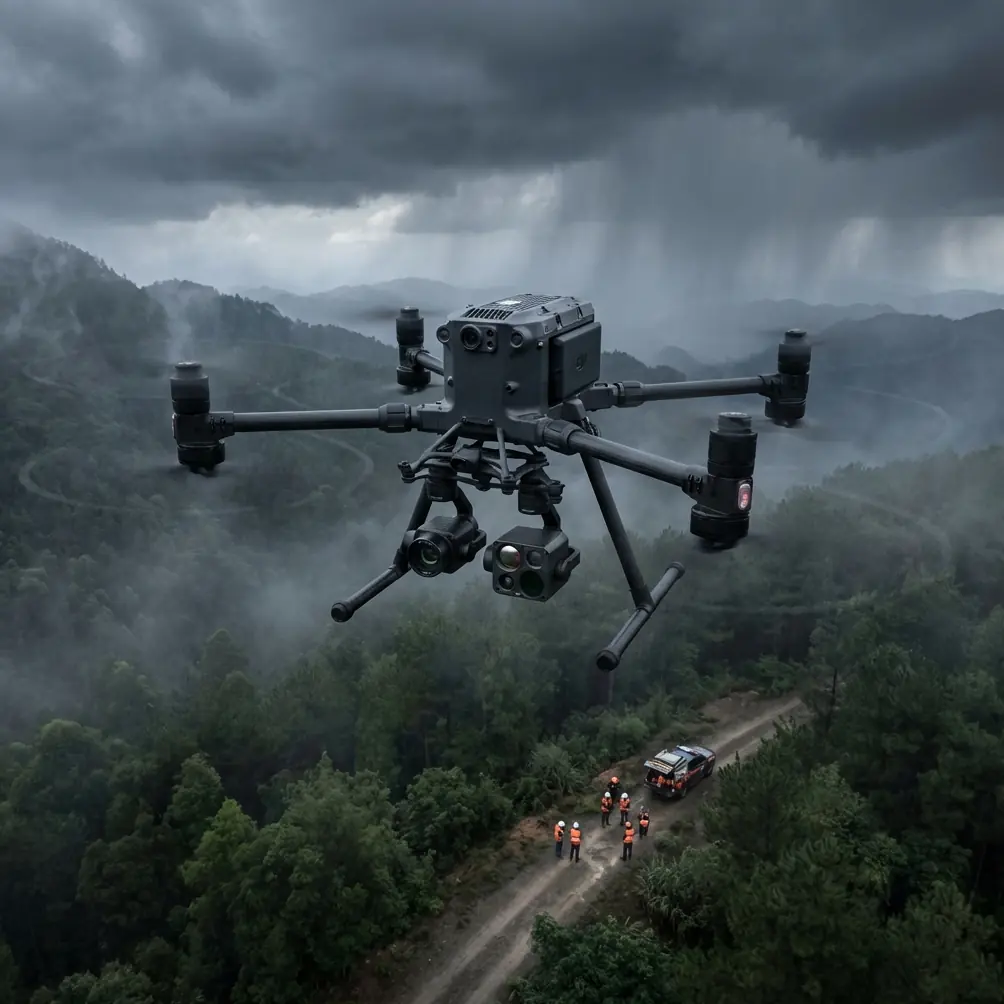
- The Matrice 400's IP55 rating and wind resistance up to 15 m/s make it ideal for unpredictable coastal conditions
- Hot-swap batteries enable continuous mapping of extended coastlines without mission interruption
- O3 transmission maintains reliable control links despite salt air interference and extended ranges
The Coastal Mapping Challenge
Wind gusts destroy mapping accuracy. Coastal environments present some of the most demanding conditions for aerial surveying—unpredictable thermals, salt-laden air affecting sensors, and wind patterns that shift within seconds.
Traditional drones struggle here. Lightweight platforms drift off course, compromise overlap percentages, and produce unusable photogrammetry data. The DJI Matrice 400 was engineered specifically for these hostile environments.
This guide breaks down exactly how to execute precise coastal mapping missions in windy conditions, from pre-flight planning through post-processing workflows.
Understanding Coastal Wind Dynamics
Coastal winds behave differently than inland conditions. Thermal signatures from land-sea temperature differentials create complex airflow patterns that intensify during midday hours.
Primary Wind Challenges
- Onshore winds accelerate as they compress against coastal terrain
- Thermal updrafts create unpredictable altitude variations
- Turbulence zones form where wind meets cliff faces or structures
- Salt spray at lower altitudes degrades sensor performance over time
The Matrice 400 addresses these challenges through its robust propulsion system and advanced flight controller algorithms that compensate for sudden wind shifts.
Expert Insight: Schedule coastal mapping missions during the golden hours—the first two hours after sunrise or before sunset. Thermal activity decreases by approximately 60% during these windows, dramatically improving flight stability and image consistency.
Optimal Flight Parameters for Coastal Photogrammetry
Altitude selection directly impacts both wind exposure and mapping accuracy. Higher altitudes mean stronger winds but larger coverage areas. Lower altitudes reduce wind effects but require more flight lines.
Recommended Altitude Strategy
For coastal mapping in moderate to strong winds (8-12 m/s), maintain flight altitude between 80-120 meters AGL. This range provides:
- Sufficient ground sampling distance (GSD) for detailed terrain modeling
- Reduced exposure to the strongest wind layers
- Adequate overlap margins despite platform movement
- Efficient coverage rates for extended coastlines
Ground Control Point Placement
GCP accuracy determines final deliverable quality. Coastal environments require modified placement strategies:
- Position GCPs above the high-tide line to prevent displacement
- Use weighted targets resistant to wind movement
- Place points at elevation transitions where cliffs meet beaches
- Maintain minimum 5 GCPs per square kilometer for sub-centimeter accuracy
The Matrice 400's RTK module reduces GCP dependency, but coastal projects benefit from redundant ground truth data.
Hardware Configuration for Coastal Operations
Proper payload selection and aircraft configuration determine mission success rates in challenging conditions.
Sensor Selection Comparison
| Feature | Zenmuse P1 | Zenmuse L2 | Zenmuse H30T |
|---|---|---|---|
| Primary Use | Photogrammetry | LiDAR + RGB | Thermal + Visual |
| Wind Sensitivity | Moderate | Low | Low |
| Coastal Suitability | Excellent | Excellent | Good |
| Point Density | N/A | 250 pts/m² | N/A |
| Accuracy (Horizontal) | 3 cm | 5 cm | 10 cm |
| Weight | 800g | 905g | 920g |
For pure coastal mapping, the Zenmuse P1 delivers superior photogrammetric results. When vegetation or complex terrain requires penetration, the L2 LiDAR provides reliable returns regardless of surface conditions.
Battery Management Strategy
Coastal missions drain batteries faster due to constant wind compensation. The Matrice 400's hot-swap battery system enables continuous operations without landing.
Plan for 20-25% reduced flight time in winds exceeding 10 m/s. A standard 47-minute flight time drops to approximately 35-38 minutes under these conditions.
Pro Tip: Carry minimum 6 battery sets for extended coastal surveys. Rotate charging cycles so fresh batteries are always available. The Matrice 400's BS65 charging station can cycle a full set in under 35 minutes.
Mission Planning for Wind Compensation
Flight path orientation relative to wind direction significantly impacts image quality and aircraft stability.
Flight Line Strategy
Configure flight lines perpendicular to prevailing wind direction whenever possible. This approach:
- Minimizes crabbing during image capture
- Reduces motion blur from lateral drift
- Maintains consistent ground speed across lines
- Improves battery efficiency through reduced correction inputs
The Matrice 400's flight controller automatically adjusts heading to compensate for wind drift, but perpendicular lines reduce the compensation required.
Overlap Adjustments
Standard photogrammetry overlap settings require modification for windy coastal conditions:
- Increase front overlap to 80% (from standard 75%)
- Increase side overlap to 75% (from standard 65%)
- Enable terrain following for cliff and dune mapping
- Set capture mode to interval rather than distance-based
These adjustments account for positional uncertainty during image capture and ensure sufficient tie points for processing.
Data Security and Transmission
Coastal mapping often involves sensitive infrastructure—ports, military installations, or private property. The Matrice 400's AES-256 encryption protects all data transmission between aircraft and controller.
O3 Transmission Advantages
The O3 transmission system provides critical benefits for coastal operations:
- 20 km maximum range accommodates extended shoreline surveys
- Triple-channel redundancy maintains links despite interference
- 1080p/60fps live feed enables real-time quality assessment
- Auto-switching frequencies avoid coastal radar interference
Salt air and humidity can degrade radio signals. O3's robust link budget provides 15 dB margin above minimum requirements, ensuring reliable control in degraded conditions.
BVLOS Considerations for Extended Coastlines
Many coastal mapping projects require Beyond Visual Line of Sight operations to efficiently cover extended shorelines.
The Matrice 400 supports BVLOS missions through:
- ADS-B receiver for traffic awareness
- Redundant GPS/GLONASS/Galileo positioning
- Automated return-to-home with obstacle avoidance
- Real-time telemetry for remote pilot monitoring
Regulatory requirements vary by jurisdiction. Obtain appropriate waivers before conducting BVLOS coastal surveys.
Common Mistakes to Avoid
Ignoring tidal schedules — Mapping during tidal transitions creates inconsistent shoreline data. Plan missions for consistent tide states, preferably low tide for maximum beach exposure.
Underestimating salt corrosion — Coastal operations accelerate wear on all aircraft components. Implement post-flight cleaning protocols and inspect propeller leading edges for pitting.
Flying in offshore wind conditions — Offshore winds (land to sea) create dangerous conditions where battery depletion could result in ocean ditching. Always maintain sufficient reserves for return flight against wind.
Neglecting humidity effects on sensors — Rapid altitude changes cause lens condensation. Allow 10-15 minutes for temperature equalization before beginning capture sequences.
Using standard overlap settings — Default overlap percentages assume stable flight conditions. Coastal winds require increased overlap to compensate for positional uncertainty.
Frequently Asked Questions
What wind speed is too high for coastal mapping with the Matrice 400?
The Matrice 400 maintains stable flight in sustained winds up to 15 m/s with gusts to 20 m/s. However, mapping accuracy degrades significantly above 12 m/s. For photogrammetry requiring sub-centimeter accuracy, limit operations to conditions below 10 m/s sustained wind speed.
How does salt air affect the Matrice 400's sensors and motors?
Salt accumulation accelerates bearing wear and can deposit on optical surfaces. The aircraft's IP55 rating protects against salt spray during flight, but post-mission cleaning is essential. Wipe all surfaces with fresh water-dampened cloths and inspect propeller hubs for salt crystal buildup after each coastal mission.
Can the Matrice 400 map underwater terrain in shallow coastal areas?
The Matrice 400 equipped with multispectral sensors can penetrate clear water to approximately 3-5 meters depth for bathymetric mapping. Water clarity significantly impacts results—turbid coastal waters reduce penetration to less than 1 meter. For deeper bathymetry, specialized green-wavelength LiDAR systems provide superior results.
Article by James Mitchell, aerial survey specialist with over 15 years of coastal mapping experience across challenging environments worldwide.
Ready for your own Matrice 400? Contact our team for expert consultation.