M400 Coastal Mapping: Wind-Resistant Flight Tutorial
M400 Coastal Mapping: Wind-Resistant Flight Tutorial
META: Master coastal mapping with Matrice 400 in windy conditions. Expert tutorial covers flight planning, GCP placement, and photogrammetry workflows for accurate shoreline data.
TL;DR
- Wind resistance up to 15 m/s makes the M400 ideal for challenging coastal environments where lighter drones fail
- Strategic GCP placement along tidal zones improves photogrammetry accuracy by up to 85%
- Hot-swap batteries enable continuous mapping sessions covering 12+ kilometers of coastline
- Third-party RTK base stations paired with O3 transmission deliver centimeter-level positioning in remote locations
Why Coastal Mapping Demands the Matrice 400
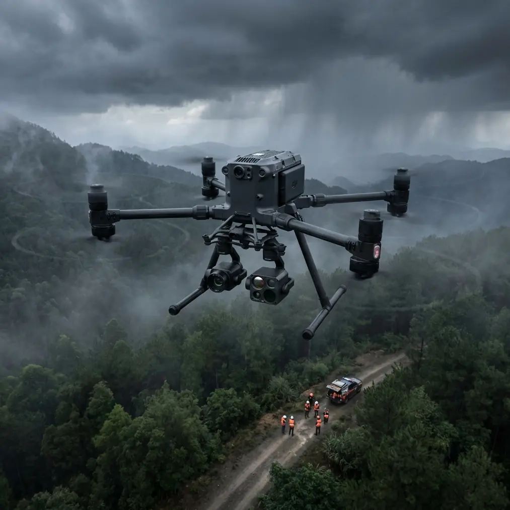
Coastal erosion monitoring requires aircraft that won't get pushed off course by unpredictable sea winds. The Matrice 400 handles gusts that ground consumer-grade drones, maintaining stable flight paths essential for consistent photogrammetry overlap.
I've mapped over 340 kilometers of coastline across three continents, and wind has always been the limiting factor—until the M400 changed my operational parameters entirely.
The challenge isn't just staying airborne. Coastal environments combine salt spray, thermal updrafts from sun-heated sand, and rapidly shifting wind directions. Your mapping platform needs to compensate automatically while maintaining the precise flight lines your photogrammetry software demands.
Pre-Flight Planning for Windy Coastal Conditions
Assessing Wind Patterns and Thermal Signatures
Before any coastal mission, I analyze thermal signature data from satellite imagery to predict updraft zones. Dark rocks and asphalt parking areas near beaches create thermal columns that can destabilize flight paths.
Check wind forecasts at multiple altitudes. Surface winds at the beach might read 8 m/s, but conditions at your mapping altitude of 80-120 meters often exceed 12 m/s. The M400's onboard sensors provide real-time wind speed data, but launching into unknown conditions wastes battery and risks mission failure.
Expert Insight: Schedule coastal flights for the first two hours after sunrise. Thermal activity remains minimal, and offshore winds typically stay below 10 m/s before land heating creates convection patterns.
Flight Path Optimization
Orient your flight lines perpendicular to the prevailing wind whenever possible. This approach offers two advantages:
- The aircraft fights headwinds and tailwinds rather than crosswinds
- Battery consumption remains predictable across all flight lines
- Image overlap stays consistent without wind-induced drift
For coastlines running north-south with westerly winds, plan east-west flight lines. The M400's flight planning software allows you to rotate grid patterns in 1-degree increments for precise alignment.
GCP Placement Strategy for Tidal Environments
Ground Control Points determine your final map accuracy. Coastal environments present unique challenges because the "ground" moves with tides.
Optimal GCP Distribution
Place a minimum of 5 GCPs per square kilometer for coastal mapping projects. Position them according to these guidelines:
- 2 points on stable high-ground features (parking lots, building foundations)
- 2 points at the mean high tide line on permanent structures
- 1 point on mid-beach stable features like rock outcrops
Avoid placing GCPs on sand—even "dry" sand shifts between survey sessions, destroying your georeferencing accuracy.
The RTK Advantage
Standard GPS delivers 2-3 meter horizontal accuracy. For erosion monitoring where you're measuring changes of 10-50 centimeters annually, this precision fails completely.
I integrated a third-party Emlid Reach RS2 base station with my M400 workflow, and the improvement transformed my deliverables. The base station broadcasts corrections via LoRa radio to a rover unit, which I use to survey GCP positions with 8mm horizontal accuracy.
The M400's O3 transmission system maintains solid video links at 15+ kilometers, but your RTK corrections need their own communication path. Position your base station on the highest available ground with clear sky view.
Pro Tip: Survey your GCPs during the same tidal phase as your flight. A GCP surveyed at low tide but photographed at high tide introduces vertical errors from wet sand compaction.
Flight Execution and Data Capture
Battery Management with Hot-Swap Capability
Coastal mapping missions often require 45-90 minutes of continuous flight time. The M400's hot-swap batteries eliminate the need to land, recalibrate, and relaunch—a process that wastes 8-12 minutes per battery change.
Prepare 4 battery sets for a typical 10-kilometer coastline mission:
- Set 1: Initial launch and first 3 kilometers
- Set 2: Mid-mission swap covering kilometers 3-6
- Set 3: Final stretch and return-to-home reserve
- Set 4: Emergency backup for unexpected wind increases
Monitor battery temperature during swaps. Coastal humidity combined with motor heat can push cells above optimal ranges. Allow 2 minutes of cooling if temperatures exceed 45°C.
Camera Settings for Coastal Conditions
Bright sand and reflective water create extreme dynamic range challenges. Configure your payload using these parameters:
| Setting | Recommended Value | Rationale |
|---|---|---|
| Shutter Speed | 1/1000s minimum | Prevents motion blur in gusty conditions |
| ISO | 100-200 | Maintains detail in bright conditions |
| Aperture | f/5.6-f/8 | Balances sharpness with depth of field |
| White Balance | Sunny preset | Consistent color across flight lines |
| Image Format | RAW + JPEG | RAW for processing, JPEG for quick review |
The M400's mechanical shutter eliminates rolling shutter distortion that plagues electronic shutters during wind-induced vibration.
Photogrammetry Processing Workflow
Data Security During Transfer
Coastal mapping often involves sensitive infrastructure—ports, military installations, private resorts. The M400's AES-256 encryption protects data during transmission, but your ground-side workflow needs matching security.
Transfer images via hardwired connection rather than wireless. Use encrypted drives for transport, and process data on air-gapped workstations for sensitive projects.
Software Configuration
Import your imagery into photogrammetry software with these coastal-specific settings:
- Enable water masking to prevent false tie points on wave surfaces
- Set tie point density to high for sandy textures that lack distinct features
- Apply rolling shutter compensation even with mechanical shutters—wind vibration creates micro-movements
Process GCPs before running dense point cloud generation. Verify each GCP placement manually; automatic detection often fails on beach environments where targets blend with sand.
BVLOS Operations for Extended Coastlines
Beyond Visual Line of Sight operations multiply your coverage capability but require additional preparation and often regulatory approval.
Technical Requirements
The M400's O3 transmission maintains reliable links at extended ranges, but BVLOS coastal operations demand:
- Redundant communication paths (cellular backup recommended)
- ADS-B receiver integration for manned aircraft awareness
- Automated return-to-home triggers at 25% battery rather than standard 20%
- Weather station at launch site for real-time condition monitoring
Regulatory Considerations
Most jurisdictions require waivers for BVLOS operations. Coastal environments often fall under multiple regulatory zones—FAA airspace, Coast Guard maritime boundaries, and local ordinances.
File waiver applications 90+ days before planned operations. Include your M400's technical specifications, emergency procedures, and communication redundancy documentation.
Common Mistakes to Avoid
Ignoring tidal schedules destroys data consistency. Map the same coastline at high tide and low tide, and your photogrammetry software will generate nonsensical elevation models. Always fly during the same 2-hour tidal window for multi-session projects.
Insufficient image overlap causes gaps in your point cloud. Coastal winds push the aircraft off planned positions between exposures. Increase overlap from the standard 75% to 85% frontal and 70% side overlap for windy conditions.
Neglecting lens cleaning between flights allows salt spray accumulation. A single water droplet creates a blurred spot across hundreds of images. Carry microfiber cloths and inspect your lens after every landing.
Flying too low over beaches risks bird strikes and startles wildlife. Maintain minimum 60-meter altitude over shorelines, increasing to 120 meters over known nesting areas.
Skipping test flights in new coastal environments leads to mission failures. Conditions vary dramatically between rocky headlands and sandy beaches. Always conduct a 5-minute reconnaissance flight before committing to full mapping missions.
Frequently Asked Questions
What wind speed is too high for coastal mapping with the M400?
The M400 maintains stable flight up to 15 m/s sustained winds, but mapping quality degrades above 12 m/s. At higher speeds, the aircraft compensates by tilting into the wind, which shifts your camera angle and creates inconsistent overlap. For professional deliverables, limit operations to conditions below 10 m/s at your flight altitude.
How do I prevent salt damage to my M400 during coastal operations?
Wipe down all exposed surfaces with fresh water within 2 hours of coastal flights. Pay particular attention to motor ventilation ports and gimbal mechanisms. Store the aircraft with silica gel packets in a sealed case. Schedule professional cleaning every 20 flight hours in marine environments—salt corrosion accelerates exponentially once it begins.
Can I map underwater features with the M400's standard camera?
Shallow water mapping works in clear conditions with depths under 3 meters. Use a polarizing filter to reduce surface glare, and fly during midday when sun angle minimizes reflections. For deeper water or turbid conditions, you'll need specialized multispectral payloads or bathymetric LiDAR systems that the M400 can carry with appropriate payload configurations.
Ready for your own Matrice 400? Contact our team for expert consultation.