Mapping Mountain Coastlines with the Matrice 400
Mapping Mountain Coastlines with the Matrice 400: Field Tips That Actually Matter
META: Practical Matrice 400 advice for mapping coastlines in mountain terrain, including antenna positioning, photogrammetry workflow, thermal use, GCP strategy, O3 transmission, AES-256, hot-swap batteries, and BVLOS planning.
Coastal mapping in mountain terrain is where clean spec sheets stop being useful.
On paper, a shoreline survey sounds straightforward: fly a route, collect imagery, build an orthomosaic, extract the linework, repeat when erosion or slope movement changes the edge. In reality, mountain coastlines create one of the messiest operating environments a commercial drone team will face. You are dealing with sudden elevation shifts, cliff shadow, salt-heavy air, unstable GNSS behavior near steep rock faces, and line-of-sight that disappears the moment the aircraft rounds a headland.
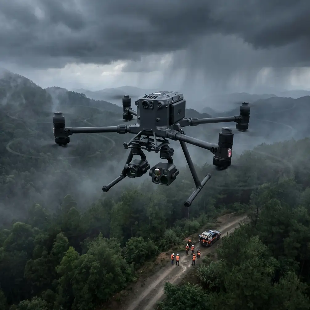
That is exactly why the Matrice 400 deserves to be discussed as a field platform, not just a product name. If your job is photogrammetry over rugged shoreline, the aircraft has to do more than stay airborne. It needs to maintain link stability when terrain is working against you, support fast turnaround between sorties, and carry sensors that let you validate what the visible map does not show.
This article is for crews mapping coastlines in mountain regions who want practical decisions, not brochure language.
Why mountain coastlines are harder than they look
A flat beach survey usually fails in predictable ways. A mountain coastline adds layered failure points.
First, terrain interrupts your command and video link. You can have a perfectly planned route on the screen, then lose geometry as the aircraft drops below the ridge line or tracks along a cliff base. Second, lighting changes quickly. A bright water surface can sit beside a dark rock wall, which complicates image consistency and tie point generation in photogrammetry. Third, the area you need to model is rarely a single surface. You may need to represent the beach, cliff face, drainage cuts, road shoulder above the coast, and debris fans that feed into shoreline change.
That means your Matrice 400 workflow must be built around three things:
- Link discipline
- Terrain-aware image collection
- Efficient battery rotation
If any one of those breaks down, your deliverable quality drops with it.
Start with the mission design, not the sensor menu
A common mistake is choosing the payload first. For mountain coastlines, begin with the output.
Are you producing a 2D orthomosaic for shoreline compliance work? A 3D surface model for slope movement analysis? A thermal pass to identify seepage, drainage patterns, or wet zones around unstable faces? These are different jobs, even if they happen on the same stretch of coast.
For most coastline mapping tasks, the backbone is still photogrammetry. The Matrice 400 should be planned around a visible-light mapping mission with enough overlap to survive inconsistent texture. Water edges, wet rock, and shadow bands reduce feature matching. You cannot assume inland settings will transfer cleanly to this environment.
My rule in mountain coastal work is simple: if the terrain is visually complex but geometrically unforgiving, collect more overlap than your minimum comfort level. Give the reconstruction software room to work when sections of the frame contain glinting water or feature-poor shadow.
Then add thermal only if it answers a separate question. Thermal is not a replacement for mapping imagery. It is a second layer. It can reveal thermal signature differences along the cliff base, drainage outlets, persistent moisture paths, or void-related cooling on damaged structures near the coast. That matters if your client cares about seepage, instability, or infrastructure risk—not just the shoreline line itself.
GCP placement in a place that fights back
If you map enough coastlines, you learn quickly that GCP strategy is often more important than flying style.
Mountain shorelines tempt teams into poor control distribution because access is limited. They place targets where it is easy to walk, not where the model needs stability. Then the dataset warps slightly along the long axis of the coast or loses vertical confidence where cliffs dominate the view.
For Matrice 400 coastal work, spread control in a way that reflects the landform, not the parking area. That means:
- Put points at both ends of the survey corridor.
- Include elevation variation, not just horizontal spacing.
- Add control near transitions: beach to rock, slope toe to upper bench, road edge to cliff shoulder.
- Use check points away from the easiest-access target cluster.
Operationally, this matters because shoreline products are often used for change detection. A model that is “close enough” for a one-time visual map can still fail badly when compared month to month. If you are trying to quantify retreat, slump movement, or sediment redistribution, weak control geometry will cost you long after the flight is done.
Antenna positioning advice for maximum range
This is the part crews often skip until they have a bad day.
In mountain coastal terrain, your transmission performance depends as much on how you hold the controller and place yourself in the landscape as on the aircraft system itself. The Matrice 400’s O3 transmission capability is valuable, but mountain topography can still choke a link if your antenna orientation is wrong.
Here is the practical approach I give field teams:
1. Think in planes, not points
Do not aim the antenna tips directly at the aircraft like a flashlight. Most controller antennas radiate strongest off the broad side, not the end. You want the face of the antenna pattern presented toward the aircraft’s expected operating area.
2. Raise your body position if terrain is masking the route
If the aircraft will run along a cliff-lined coast, standing ten meters higher on a stable overlook can matter more than almost anything else you do. Small elevation gains at the pilot position can restore line-of-sight over terrain breaks.
3. Reposition before the link degrades
Do not wait for repeated signal warnings. On a headland mission, move your control point as the aircraft’s route geometry changes. The best place for launch is not always the best place for the full operation.
4. Keep the aircraft in front of the antenna broadside during long corridor legs
For shoreline mapping, many flights are elongated corridors rather than circular area captures. Set up so the route stays within the strongest part of the antenna pattern for as much of the leg as possible.
5. Respect reflective and absorptive clutter
Vehicles, metal railings, wet surfaces, and rock walls can all complicate signal behavior. A clean pilot position with a better horizon is worth seeking out.
This is where O3 matters operationally: it gives your Matrice 400 a stronger foundation for image and control continuity, but only if you treat transmission as part of mission planning. Stronger transmission does not cancel bad geometry.
And if your team wants a quick field checklist for antenna setup before a mountain coastline job, share your route and terrain profile here: send the details on WhatsApp.
When hot-swap batteries save more than time
Battery management in rugged coastal areas is not just about endurance. It is about maintaining the survey window.
Wind often builds through the day on exposed coasts. Light angles change fast near cliffs. Tides can alter the visible shoreline and access zones. If your aircraft supports hot-swap batteries, that is more than a convenience. It lets the crew keep momentum between sorties without dragging the workflow back to zero every time power is changed.
Operationally, hot-swap capability matters in three ways:
- You preserve mission continuity. The crew can maintain rhythm while the site conditions remain favorable.
- You reduce setup churn. Less downtime means fewer chances to lose the exact logic of your corridor segmentation, overlap plan, or terrain-following assumptions.
- You support safer repositioning. When launch points are awkward ridge pullouts or narrow coastal access areas, minimizing full reset cycles is a real advantage.
On mountain coastlines, I often break long jobs into linked flight blocks that correspond to terrain sections: open beach, broken cliff line, headland bend, upper slope shoulder. Efficient battery turnover makes those segments easier to execute consistently.
Thermal is useful, but only if you assign it a job
Thermal data gets oversold in coastal work. It should not be in the air unless you know what you want from it.
For a Matrice 400 operator, thermal becomes valuable when mapping work overlaps with asset inspection or geohazard screening. Along a mountain coast, a thermal pass may help reveal:
- Groundwater seepage through cliff faces
- Wet fracture zones
- Drain outlet paths hidden in vegetation
- Differential heating on damaged retaining structures
- Moisture concentration behind coastal infrastructure
That is operationally significant because these features often influence erosion behavior or slope stability. A visible orthomosaic may show where failure has already happened. Thermal can sometimes suggest where conditions remain active.
Just remember that thermal and photogrammetry answer different questions. If your client wants survey-grade coastline geometry, prioritize your visible mapping acquisition first. Thermal should support interpretation, not replace measurement.
AES-256 and why data security belongs in the conversation
Coastal mapping is not always sensitive in a dramatic sense, but it is often operationally sensitive. You may be surveying private infrastructure, utility corridors, ports, roads at cliff edge, or facilities where route details and image content should not be casually exposed.
That is why AES-256 matters here. Not as a buzzword, but as part of risk management.
If your team is moving high-resolution datasets from difficult sites, a secure transmission environment helps protect survey content and client trust. The significance is simple: coastline missions often combine visual mapping, thermal review, and repeated revisits over the same corridor. That creates a detailed operational picture over time. Security is not abstract when your deliverables show infrastructure condition and access patterns.
For commercial operators, this also supports cleaner internal governance. The more professional your data handling looks from capture onward, the easier it is to work with infrastructure owners, engineering consultants, and environmental stakeholders.
BVLOS thinking without pretending every site allows it
The phrase BVLOS gets thrown around casually, but mountain coastlines are exactly where people need to be honest about what it really means.
A long coastal corridor can look ideal for beyond visual line of sight operations. In practice, terrain masking, recreational air traffic near scenic coastline, changing weather, and sparse emergency landing options complicate the picture. If your operation has legal authorization and a robust safety case, the Matrice 400 can fit into advanced corridor workflows. But the planning burden is real.
Even when you are not flying BVLOS, think with BVLOS discipline:
- Build segmented routes with clear contingency logic
- Identify terrain-induced communication blind spots
- Establish visual observer positions where needed
- Define return and diversion options before launch
- Tie launch points to route geometry, not convenience
This mindset improves even fully visual operations. It forces the team to understand the coastline as an operational system, not just a pretty background.
A practical field sequence for the Matrice 400 on a mountain shoreline
If I were briefing a crew for this job, the sequence would look like this:
Pre-field
Review topography, tidal state, sun angle, and access constraints. Divide the coastline into flight blocks that match terrain behavior. Mark possible pilot positions with line-of-sight advantage.
On-site setup
Confirm safe launch and recovery area. Check wind behavior at your elevation and at the shoreline. Orient controller antennas based on the actual route, not your standing direction.
Control and checks
Deploy GCPs with elevation diversity. Place independent checks away from the easy cluster.
Visible mapping pass
Run the primary photogrammetry mission with conservative overlap and terrain-aware planning. Watch cliff-shadow transitions and water-edge consistency.
Secondary thermal pass
Only after the mapping set is secure. Use it for seepage, drainage, structure condition, or moisture interpretation.
Battery turnover
Use hot-swap workflow to move quickly between terrain blocks while conditions remain stable.
Data review in the field
Inspect image sharpness, overlap continuity, and any sections where terrain may have degraded the link or forced route compromise. Re-fly weak segments immediately if needed.
That last step matters more than people admit. In mountain coastal work, returning to fix a missed corridor section is rarely efficient.
The real value of the Matrice 400 here
The Matrice 400 is not interesting because it exists in a catalog. It is interesting because this category of coastline mission exposes whether an aircraft can hold together as a complete field tool.
You need transmission performance that stays useful when ridgelines and headlands break the geometry. You need secure handling for infrastructure-grade mapping data. You need battery workflows that support fast, disciplined sortie sequencing. You need payload flexibility without losing focus on the actual deliverable. And you need enough operational maturity in the platform to support corridor-style missions where the terrain never gives you an easy answer.
For mountain coastline mapping, those details are not side notes. They are the difference between a dataset you can defend and one that just looks good from a distance.
Ready for your own Matrice 400? Contact our team for expert consultation.