Matrice 400 Guide: Mapping Coastlines When Conditions Turn
Matrice 400 Guide: Mapping Coastlines When Conditions Turn Against You
META: Expert tutorial on using Matrice 400 for coastline mapping in extreme temperatures, with practical insight on flight simulation discipline, control limits, lightning resilience, and operational planning.
Coastline mapping looks clean on paper. Draw the polygon. Set overlap. Confirm GCP strategy. Launch.
The shoreline usually has other ideas.
Wind bends around bluffs. Salt haze softens contrast. Reflections break clean image stitching. Temperature shifts hit battery behavior and sensor consistency. Then weather moves in halfway through the sortie, and the whole mission stops being a simple photogrammetry exercise and starts becoming a test of aircraft design, pilot discipline, and system resilience.
That is where a Matrice 400 workflow needs to be judged. Not by a calm demo flight, but by what happens when environmental variables stack up fast.
This tutorial is built around two reference ideas that matter more than they first appear. The first comes from a flight simulation training source that flags its software as “recommended for advanced users” and directs the operator to consult the operating manual. The second comes from civil aircraft design guidance discussing two specific control and survivability issues: pitch and roll attitude limits, and lightning-related system integrity, including a multiple-strike environment described as 24 pulses within 2 seconds. Those facts were written for very different aviation contexts, but together they reveal something useful for Matrice 400 crews mapping coastlines in extreme temperatures: good outcomes depend on disciplined human preparation and on aircraft logic that stays predictable when the environment becomes hostile.
Why coastline mapping punishes weak mission design
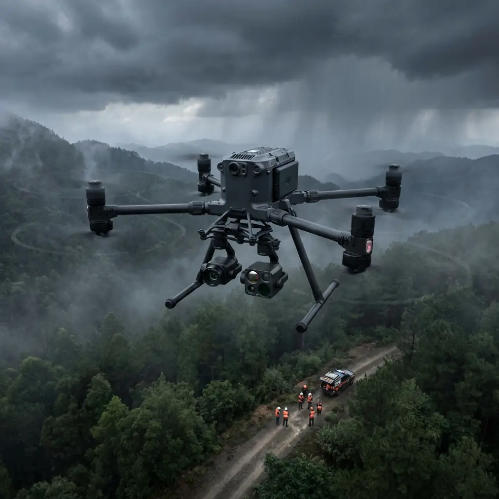
A coastal mission compresses several difficult variables into one flight area. You are dealing with land-water contrast, moving wave texture, uneven terrain transitions, and often poor places to stage from. In hot conditions, surface shimmer can distort visual assessment and reduce confidence in real-time framing. In cold conditions, battery performance, hand dexterity, and setup time all become practical constraints rather than footnotes.
For Matrice 400 operators running photogrammetry, thermal signature collection, or mixed payload inspections along the shore, this matters because the mission is rarely just about image capture. It is about preserving consistent geometry, stable speed, reliable link quality, and enough contingency margin to return with useful data when the weather changes before your grid is complete.
That is why I do not treat preflight rehearsal as optional.
The “advanced users” lesson applies directly to Matrice 400 crews
One of the source references is not about the Matrice platform at all. It is a simulator training page that contains a blunt note: the package is recommended for advanced users, and the user should consult the operating manual before proceeding. That sounds basic. It is not.
In professional drone operations, especially over coastlines, the crews who skip formal familiarization usually make mistakes that have nothing to do with stick skill. They misread wind layering. They set altitude for legal clearance but not for terrain-induced turbulence. They fail to account for glare over water during a mapping leg. They improvise battery timing instead of building hard return thresholds.
The simulator reference captures a mindset that transfers well to Matrice 400 operations: advanced platforms reward operators who train the edge cases before the mission day. If your work includes BVLOS planning, thermal payload integration, or corridor mapping along cliffs and tidal zones, the aircraft manual and simulation-based rehearsal should be treated as operational tools, not administrative paperwork.
For a coastline mapping team, that means practicing at least four things before deployment:
- Loss-of-contrast navigation scenarios over water and wet sand
- Wind-shift responses during autonomous mapping legs
- Manual takeover discipline if terrain or weather invalidates the planned route
- Battery change sequencing, especially if hot-swap batteries are part of the workflow
That last point is especially useful on the Matrice 400. Hot-swap capability can compress turnaround time between sorties, which is a major advantage when tide windows, light angles, and weather gaps are narrow. But speed only helps if your handoff process is clean. A rushed battery exchange in salt-laden air can cost more time than it saves.
What pitch and roll limits mean in real shoreline work
The second reference comes from a civil aircraft design text discussing pitch and roll attitude limiters. One requirement is especially revealing: the limiter should not interfere with normal maneuvering until the maximum pitch needed for normal operation is reached, and it should not prevent the aircraft from reaching substantial roll angles required for maneuvering.
Translated into drone operations, the principle is this: protection logic should guard against unsafe attitudes without getting in the way of legitimate control authority when the aircraft has to deal with real conditions.
That matters a lot on a Matrice 400 mapping coastlines.
When you fly parallel to a shoreline, the air mass is rarely uniform. Wind may be stronger above rock faces, weaker behind structures, and turbulent where warm land air meets cooler marine flow. During an automated mapping run, the aircraft needs to maintain track accurately enough for usable overlap, but it also needs the freedom to make meaningful corrections without entering unstable or inefficient attitudes.
This is not just about safety. It is about data quality.
If the aircraft overreacts or is too constrained, your ground sampling consistency suffers. If attitude changes become excessive, image geometry degrades, and the photogrammetry set may show uneven tie-point quality along the water boundary where matching is already difficult. If the control system balances stability and authority well, the result is cleaner flight lines, more predictable overlap, and fewer ugly gaps near breakwaters, jetties, and cliff edges.
For operators, the practical takeaway is simple: do not evaluate the Matrice 400 solely by how still it hovers in benign air. Evaluate it by how well it preserves a mapping line when the coastline starts generating crosswind and vertical disturbance.
The weather change that separates theory from field reality
On one cold-water coastal survey profile, the mission can start with workable visibility and modest winds, then degrade in ten minutes. You launch expecting a standard photogrammetry grid over a beach and adjacent rock shelf. Mid-flight, cloud cover thickens, wind shifts offshore, and the sea surface loses visual uniformity. At the same time, temperature drops enough to change how the aircraft feels on the sticks and how fast you want to complete the next leg before recovery.
This is exactly where aircraft design and operator discipline intersect.
A stable command-and-control link matters. O3 transmission performance matters because coastal topography can be deceptive: line of sight from the pilot station does not always equal a clean RF path once you introduce cliff geometry, structures, and shifting aircraft orientation. Secure communications matter too. AES-256 may sound like an IT checkbox, but on infrastructure or environmental survey work it has operational value because your telemetry and mission data path should not become a weak point in a professional workflow.
Then there is the sensor side. If you are collecting both visible imagery for photogrammetry and thermal signature data for erosion studies, drainage analysis, or asset checks along sea walls, the weather shift complicates both streams differently. Visible imagery may lose contrast. Thermal readings may improve in some zones and become less interpretable in others depending on surface wetting and solar loading. The Matrice 400 crew needs a decision framework before launch: continue, modify altitude, shorten the route, or terminate.
That framework should be rehearsed, not invented in the air.
Lightning guidance sounds distant from drones. It should still shape your coastal SOP
The aircraft design reference also discusses lightning effects on fly-by-wire and avionics systems. One detail stands out: a modeled external multiple-strike environment of 24 pulses in 2 seconds, including a major component followed by lower-amplitude repeated strikes. The text also emphasizes that systems whose failure would reduce aircraft capability must continue performing their intended functions after a lightning encounter.
A Matrice 400 coastline crew should not read that as a cue to fly into storms. Quite the opposite.
The operational significance is that environmental electrical risk deserves structured thinking, especially over exposed shorelines where storm development can be fast and misleading. Even when your drone class and certification context differ radically from crewed aircraft, the engineering logic carries over: mission-critical systems must be assessed against real environmental threats, and operators must build procedures around what the aircraft can and cannot tolerate.
In practical terms:
- If convective activity is present or building, do not rationalize “one quick last leg.”
- Treat coastal weather radar, local storm cells, and static buildup indicators as mission inputs, not background noise.
- Keep diversion and recovery options open, especially if flying a long linear coastal route.
- Do not let pressure for full area coverage override system-risk judgment.
This is one of the clearest areas where professional drone teams separate themselves from casual operators. They understand that resilience is not bravado. It is conservative planning matched with an aircraft that stays predictable when conditions deteriorate short of no-go thresholds.
A field-ready Matrice 400 coastline workflow
If I were building a repeatable tutorial for extreme-temperature coastline mapping on the Matrice 400, I would structure it like this.
1. Build the mission around changing conditions, not average conditions
Plan the route for the worst likely segment of the weather window. Along coastlines, that usually means the most exposed leg, not the easiest launch point. Set your overlap, speed, and altitude around maintaining photogrammetry quality when turbulence picks up, not when the air is calm.
2. Use GCPs where they truly improve certainty
GCP strategy matters near shoreline transitions where water edges, wet sand, and rock textures can confuse reconstruction. Well-placed control points on stable, clearly visible ground features strengthen the model and reduce the temptation to overcorrect later in software.
3. Pre-brief manual intervention points
Automated mapping is efficient until it isn’t. Identify the exact locations or triggers that justify manual takeover: a sudden wind shift, unexpected bird activity, degraded visual contrast, or a sensor anomaly. That briefing should be explicit.
4. Separate thermal and photogrammetry objectives when needed
Trying to optimize both in one pass is often where data quality starts to erode. Thermal signature work benefits from understanding surface temperature behavior, while photogrammetry cares deeply about geometry and overlap. The Matrice 400 can support sophisticated payload workflows, but the operator still has to decide whether one compromised flight is worse than two clean ones.
5. Exploit hot-swap batteries intelligently
Hot-swap batteries are a serious operational advantage on long coastal projects. Use them to preserve sortie tempo during a short weather opening, but never let the faster turnaround degrade your post-flight checks. Salt exposure, windblown grit, and temperature shifts make rushed resets risky.
6. Protect the data path
If the mission involves critical shoreline documentation, infrastructure records, or environmental baseline capture, treat transmission security and data handling as part of mission assurance. AES-256 and disciplined workflow hygiene belong in the same sentence.
What the references really tell us about Matrice 400 operations
These two source documents are unusual companions. One is a simulator-related page reminding the user to read the manual and warning that the tool is for advanced users. The other is a civil aircraft certification text discussing control limiters and lightning survivability, including that striking 24-pulse threat model.
Together, they point to a truth that fits the Matrice 400 extremely well.
Advanced aircraft demand advanced thinking. Not aggressive flying. Not blind faith in automation. Advanced thinking.
For coastline mapping in extreme temperatures, that means respecting the aircraft’s control logic, understanding when automation supports the mission and when it needs intervention, and building procedures around environmental threats before launch. It also means recognizing that platform capability alone does not produce usable coastal data. Reliable outcomes come from matching that capability with rehearsed decision-making.
If you are planning a Matrice 400 coastline workflow and want to compare mission architecture, payload choices, or weather-contingency setup, you can message a flight planning specialist here.
The real test of a Matrice 400 program is not whether it can fly a coastline route on a perfect morning. It is whether the crew can still bring back defensible mapping data when the temperature swings, the wind changes over the surf line, and the mission no longer matches the neat plan you built at the desk.
That is where serious operators earn their results.
Ready for your own Matrice 400? Contact our team for expert consultation.