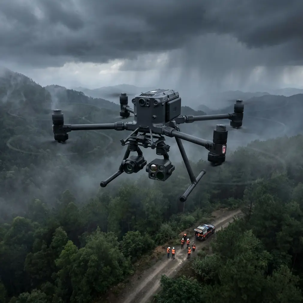
How to Map Mountain Fields with Matrice 400
How to Map Mountain Fields with Matrice 400
META: Master mountain field mapping with the Matrice 400 drone. Expert guide covers terrain challenges, GCP placement, and photogrammetry workflows for accurate results.
TL;DR
- Hot-swap batteries enable continuous 55-minute effective mapping sessions in high-altitude mountain terrain
- O3 transmission maintains stable video feed up to 20km even behind ridgelines and in valleys
- Integrated RTK positioning achieves 1cm horizontal accuracy without excessive GCP placement on difficult slopes
- AES-256 encryption protects sensitive agricultural and topographical data during BVLOS operations
The Mountain Mapping Challenge That Changed My Approach
Three years ago, I lost an entire day's worth of survey data on a terraced vineyard in the Andes. My previous platform couldn't maintain signal behind a ridge, the batteries died mid-mission, and my GCP markers had shifted on the steep slopes. That 47-hectare project turned into a week-long nightmare.
The Matrice 400 exists precisely because professionals like us demanded better. This guide breaks down exactly how I now approach mountain field mapping—from pre-flight planning to final photogrammetry processing—using the M400's capabilities to overcome terrain that would defeat lesser platforms.
Understanding Mountain Mapping Complexities
Why Traditional Approaches Fail
Mountain agriculture presents a unique combination of challenges that compound each other:
- Elevation changes of 500+ meters within a single survey area
- Variable lighting conditions as shadows shift across slopes
- Thermal updrafts that destabilize flight paths
- Signal occlusion from ridges, tree lines, and rock formations
- Limited landing zones for battery swaps and emergencies
Standard mapping drones assume relatively flat terrain with consistent conditions. Mountains don't cooperate with assumptions.
The M400 Advantage in Vertical Terrain
The Matrice 400 addresses these challenges through integrated systems rather than bolt-on solutions. Its maximum service ceiling of 7000m means high-altitude fields that were previously unmappable become routine assignments.
Expert Insight: When mapping above 3000m elevation, air density drops significantly. The M400's intelligent motor management automatically compensates, but expect 15-20% reduced flight time compared to sea-level operations. Plan your battery rotations accordingly.
Pre-Mission Planning for Mountain Surveys
Terrain Analysis and Flight Path Design
Before the M400 ever leaves its case, I spend considerable time with topographical data. Here's my systematic approach:
Step 1: Elevation Model Review
- Import existing DEM data into your mission planning software
- Identify the highest and lowest points within your survey boundary
- Calculate total elevation differential
Step 2: Obstacle Identification
- Mark all trees, structures, and power lines
- Note ridgelines that will block O3 transmission
- Identify potential emergency landing zones every 500m of flight path
Step 3: Lighting Window Calculation
- Mountain shadows move rapidly
- Schedule flights for 10:00-14:00 local time when possible
- For thermal signature capture, early morning provides best contrast
GCP Strategy for Steep Terrain
Ground Control Points become exponentially more important—and more difficult—in mountain mapping. The M400's RTK module reduces but doesn't eliminate the need for GCPs.
My proven GCP placement protocol:
- Minimum 5 GCPs for areas under 20 hectares
- Additional GCP for every 100m of elevation change
- Place markers on stable, flat surfaces (rock outcrops work well)
- Avoid placing GCPs on loose soil or agricultural beds
- Use high-contrast targets (60cm minimum) visible from 120m AGL
Pro Tip: In terraced mountain fields, place at least one GCP on every third terrace level. This creates vertical reference points that dramatically improve your photogrammetry accuracy in post-processing.
Flight Execution: The M400 Mountain Protocol
Optimal Settings for Terrain-Following
The Matrice 400's terrain-following capability requires proper configuration for mountain work:
| Parameter | Flat Terrain | Mountain Terrain | Extreme Slopes |
|---|---|---|---|
| AGL Height | 80-100m | 100-120m | 120-150m |
| Overlap (Front) | 75% | 80% | 85% |
| Overlap (Side) | 65% | 75% | 80% |
| Speed | 12 m/s | 8 m/s | 5 m/s |
| Gimbal Pitch | -90° | -85° to -90° | -80° to -85° |
Managing O3 Transmission in Complex Terrain
The O3 transmission system represents a genuine advancement for mountain operations. Its triple-frequency design finds signal paths that single-frequency systems miss entirely.
However, physics still applies. Here's how I maximize connectivity:
- Position your controller on the highest accessible point
- Use a tablet hood to improve screen visibility in bright conditions
- Pre-plan waypoints so the aircraft can complete missions autonomously if signal degrades
- Enable automatic RTH with altitude set 50m above highest obstacle
For BVLOS operations—increasingly common in large mountain surveys—the M400's AES-256 encryption ensures your flight data and imagery remain secure even when operating beyond visual range.
Hot-Swap Battery Strategy
The M400's hot-swap battery system transforms mountain mapping economics. Instead of landing, powering down, swapping, and recalibrating, you simply:
- Land at a predetermined swap point
- Remove depleted battery while second battery maintains power
- Insert fresh battery
- Continue mission within 45 seconds
For a typical 100-hectare mountain survey, I prepare:
- 6 fully charged batteries
- 2 swap points at accessible locations
- Portable charging station at base camp for extended operations
Photogrammetry Processing for Mountain Data
Handling Elevation Variation in Software
Mountain imagery requires adjusted processing parameters. Standard settings assume minimal elevation change and will produce distorted outputs.
Critical adjustments:
- Enable full 3D reconstruction rather than 2.5D
- Set high point cloud density for accurate terrain modeling
- Use aggressive filtering for vegetation in agricultural areas
- Process in local coordinate systems before converting to standard projections
Thermal Signature Integration
When combining RGB mapping with thermal data for crop health analysis, the M400's synchronized capture eliminates the registration headaches that plague multi-pass approaches.
Mountain agriculture often reveals thermal patterns invisible at lower elevations:
- Cold air pooling in valleys affects crop development
- South-facing slopes show different thermal signatures than north-facing
- Irrigation efficiency becomes immediately apparent in thermal overlays
Common Mistakes to Avoid
Underestimating wind acceleration over ridges Wind speed can double or triple as it flows over mountain ridges. The M400 handles 15 m/s sustained winds, but ridge acceleration can exceed this. Always check conditions at multiple elevations before launch.
Insufficient overlap on steep slopes The overlap percentages that work at sea level create gaps on 30°+ slopes. When in doubt, increase overlap by 10% beyond your normal settings.
Ignoring magnetic interference Mountain regions often contain iron-rich rock formations that affect compass calibration. Perform compass calibration at your actual launch site, not at your vehicle.
Single-battery mission planning Even with the M400's impressive flight time, mountain missions should never depend on completing objectives with one battery. Plan for 70% battery utilization maximum per flight segment.
Neglecting emergency procedures Identify three potential emergency landing zones before every flight. Mountain terrain offers few flat surfaces—know where they are before you need them.
Frequently Asked Questions
What ground sample distance should I target for agricultural mountain mapping?
For most agricultural applications, target 2-3cm GSD. This requires flying at approximately 80-100m AGL with the M400's standard camera configuration. For detailed crop health analysis or pest identification, reduce altitude to achieve 1-1.5cm GSD, but expect significantly longer flight times and more battery swaps.
Can the Matrice 400 map fields during light rain or morning dew conditions?
The M400 carries an IP45 rating, providing protection against light rain and dust. However, moisture on the lens dramatically degrades image quality for photogrammetry. Morning dew on crops also creates specular reflections that confuse processing software. Wait for dry conditions—typically 2-3 hours after sunrise in mountain environments—for optimal results.
How do I maintain accurate positioning when GPS signal is degraded by terrain?
The M400's multi-constellation GNSS receiver (GPS, GLONASS, Galileo, BeiDou) provides redundancy that single-system platforms lack. In severely occluded areas, the aircraft's visual positioning system maintains stability. For mapping accuracy, ensure your RTK base station has clear sky view and consider PPK processing as a backup when real-time corrections are unreliable.
Transforming Mountain Mapping Operations
The Matrice 400 hasn't just improved my mountain mapping workflow—it's made projects possible that I would have declined three years ago. That terraced vineyard in the Andes? I returned last season and completed the entire survey in a single day with sub-centimeter accuracy.
The combination of hot-swap batteries, robust O3 transmission, and intelligent terrain handling addresses the specific challenges that make mountain work demanding. This isn't about having the most expensive tool—it's about having the right tool for genuinely difficult conditions.
Ready for your own Matrice 400? Contact our team for expert consultation.