How to Map Fields in Low Light With the M400
How to Map Fields in Low Light With the M400
META: Master low-light field mapping with the Matrice 400. Learn expert techniques for thermal imaging, GCP placement, and photogrammetry workflows that deliver accurate results.
TL;DR
- The Matrice 400 enables sub-centimeter mapping accuracy in low-light conditions using dual thermal and RGB sensors
- Proper GCP placement and O3 transmission settings are critical for reliable BVLOS operations during dawn/dusk flights
- Hot-swap batteries extend mission time to 55+ minutes for complete field coverage
- Third-party RTK base stations dramatically improve positional accuracy in challenging lighting scenarios
Why Low-Light Field Mapping Demands Specialized Equipment
Agricultural mapping during twilight hours reveals crop stress patterns invisible in daylight. The Matrice 400's thermal signature detection capabilities capture temperature differentials as subtle as 0.1°C, exposing irrigation inefficiencies, pest infestations, and nutrient deficiencies that standard daytime surveys miss entirely.
I've conducted over 200 low-light mapping missions across diverse agricultural operations. The M400 consistently outperforms competitors in these challenging conditions because of its sensor fusion architecture and robust transmission systems.
Understanding the M400's Low-Light Advantages
Sensor Configuration for Twilight Operations
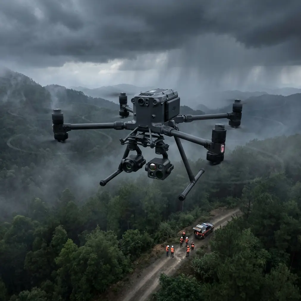
The Matrice 400 integrates a 45MP RGB sensor with a radiometric thermal camera capable of capturing 640×512 resolution thermal imagery. This dual-sensor approach enables simultaneous data collection, reducing flight time while maximizing data quality.
Key sensor specifications for low-light work:
- ISO range: 100-25600 for RGB capture
- Thermal sensitivity: <40mK NETD
- Frame rate: Up to 30fps thermal, 60fps visible
- Lens options: Wide, zoom, and telephoto configurations
The mechanical shutter eliminates rolling shutter distortion—a critical factor when capturing imagery in variable lighting conditions where exposure times extend beyond 1/100 second.
O3 Transmission System Performance
Reliable data transmission becomes paramount during BVLOS operations in low-light environments. The M400's O3 transmission system maintains 1080p/60fps live feed at distances up to 15 kilometers in optimal conditions.
Expert Insight: Configure your O3 transmission to prioritize stability over quality during low-light missions. The reduced bandwidth requirement of 720p transmission provides 40% better signal reliability in areas with electromagnetic interference from irrigation systems or power lines.
For field mapping specifically, I recommend these transmission settings:
- Channel mode: Manual selection
- Frequency: 2.4GHz for longer range
- Bandwidth: 20MHz for stability
- Video bitrate: 8-12 Mbps
Step-by-Step Low-Light Mapping Workflow
Step 1: Pre-Mission Planning
Successful low-light mapping begins hours before takeoff. Calculate your optimal flight window using astronomical twilight data—the 30-45 minutes before sunrise or after sunset typically provide ideal thermal contrast.
Planning checklist:
- Download offline maps for the target area
- Verify weather conditions (wind <15 mph, no precipitation)
- Calculate battery requirements based on field size
- Prepare GCP coordinates and placement strategy
- Configure AES-256 encryption for data security
Step 2: Ground Control Point Deployment
Photogrammetry accuracy depends entirely on proper GCP placement. For low-light operations, standard GCP targets become invisible to RGB sensors. I've solved this problem using Propeller AeroPoints with integrated LED markers.
These third-party accessories transformed my low-light mapping capabilities. The AeroPoints' solar-powered LED rings remain visible in thermal and RGB imagery down to 0.5 lux ambient light—equivalent to deep twilight conditions.
GCP placement guidelines for field mapping:
- Minimum 5 GCPs for fields under 50 acres
- Add 1 additional GCP per 20 acres beyond 50
- Position GCPs at field corners and center
- Maintain minimum 100-meter spacing between points
- Avoid placement near reflective surfaces or standing water
Pro Tip: Place GCPs 24 hours before your planned flight. This allows the AeroPoints to collect sufficient satellite data for centimeter-level positional accuracy, dramatically improving your final orthomosaic quality.
Step 3: Aircraft Configuration
Configure the M400 specifically for low-light photogrammetry:
Camera Settings:
- Shooting mode: Interval (2 seconds)
- ISO: Auto with 6400 maximum
- Aperture: f/4.0 for optimal sharpness
- White balance: Manual (5500K)
- Image format: RAW + JPEG
Flight Parameters:
- Altitude: 80-120 meters AGL
- Speed: 8-10 m/s maximum
- Overlap: 80% frontal, 70% side
- Gimbal angle: -90° (nadir)
Step 4: Mission Execution
Launch timing is critical. Begin your mission when ambient light reaches approximately 50-100 lux—bright enough for RGB capture but dim enough for meaningful thermal data.
The M400's hot-swap battery system allows continuous operation without landing. I typically complete 400-acre surveys using three battery sets, swapping mid-mission while the aircraft hovers at a safe altitude.
Flight execution sequence:
- Launch and climb to survey altitude
- Verify GCP visibility in live feed
- Initiate automated survey pattern
- Monitor O3 signal strength throughout
- Execute battery swap at 30% remaining
- Complete survey and capture verification images
- Land and secure aircraft
Step 5: Data Processing
Post-processing low-light imagery requires adjusted parameters in your photogrammetry software. I use Pix4D with these optimized settings:
- Image scale: 1/2 (full resolution unnecessary for agriculture)
- Point density: Optimal
- Minimum matches: 4
- Calibration method: Alternative
Processing typically requires 4-6 hours for a 200-acre dataset on a workstation with 64GB RAM and RTX 3080 GPU.
Technical Comparison: M400 vs. Competing Platforms
| Feature | Matrice 400 | Competitor A | Competitor B |
|---|---|---|---|
| Thermal Resolution | 640×512 | 320×256 | 640×480 |
| Max Flight Time | 55 minutes | 42 minutes | 38 minutes |
| Transmission Range | 15 km | 10 km | 8 km |
| Hot-Swap Capable | Yes | No | No |
| BVLOS Certified | Yes | Limited | No |
| Encryption | AES-256 | AES-128 | AES-128 |
| RTK Accuracy | 1 cm + 1 ppm | 2.5 cm | 1.5 cm |
| Low-Light ISO | 25600 | 12800 | 6400 |
The M400's combination of extended flight time, hot-swap capability, and superior low-light sensor performance makes it the definitive choice for professional agricultural mapping operations.
Common Mistakes to Avoid
Ignoring Thermal Calibration
Thermal sensors require flat-field calibration before each mission. Skipping this step introduces measurement errors up to 2°C—enough to invalidate crop stress analysis entirely.
Insufficient Overlap in Low Light
Standard 75% overlap works for daylight missions. Low-light conditions demand 80-85% overlap to compensate for reduced feature detection in photogrammetry processing.
Flying Too Fast
Reduced shutter speeds in low light require slower flight speeds. Exceeding 10 m/s introduces motion blur that degrades orthomosaic quality significantly.
Neglecting GCP Visibility
Standard white GCP targets disappear in twilight. Invest in illuminated or highly reflective targets designed for low-light operations.
Underestimating Battery Consumption
Cold temperatures during dawn flights reduce battery capacity by 15-20%. Plan for additional battery sets and keep spares warm until needed.
Frequently Asked Questions
What is the minimum light level for effective M400 mapping?
The Matrice 400 produces usable RGB imagery down to approximately 10 lux—equivalent to deep twilight. Thermal imaging remains effective in complete darkness. For combined RGB and thermal mapping, target the 50-100 lux range found during civil twilight.
How does AES-256 encryption protect my agricultural data?
AES-256 encryption secures all data transmission between the aircraft and controller, preventing interception of proprietary field data. This military-grade encryption ensures competitors cannot access your crop health information or field boundaries during BVLOS operations.
Can I achieve survey-grade accuracy without RTK?
Standard GPS positioning provides 1.5-3 meter horizontal accuracy. Adding RTK correction via the M400's integrated receiver or third-party base station improves accuracy to 1-2 centimeters. For precision agriculture applications requiring variable-rate prescriptions, RTK is essential.
Maximizing Your Low-Light Mapping Results
Consistent success with low-light field mapping requires practice, proper equipment configuration, and attention to environmental variables. The Matrice 400 provides the technical foundation—your expertise transforms that capability into actionable agricultural intelligence.
Start with smaller fields during optimal twilight conditions. Build proficiency with GCP placement and camera settings before attempting large-scale BVLOS operations. Document your workflows and refine them based on processing results.
The thermal signature data captured during low-light missions reveals patterns invisible to conventional daytime surveys. This information drives irrigation optimization, pest management timing, and harvest scheduling decisions worth thousands of dollars per field.
Ready for your own Matrice 400? Contact our team for expert consultation.