Matrice 400 Guide: Highway Mapping in Low Light Conditions
Matrice 400 Guide: Highway Mapping in Low Light Conditions
META: Discover how the DJI Matrice 400 transforms low-light highway mapping with thermal imaging, extended flight time, and precision photogrammetry capabilities.
TL;DR
- Optimal flight altitude of 80-120 meters delivers the best balance between thermal signature clarity and photogrammetric accuracy for highway mapping
- The Matrice 400's O3 transmission system maintains stable data links up to 20km, critical for linear infrastructure surveys
- Hot-swap batteries enable continuous operations during the narrow low-light windows at dawn and dusk
- AES-256 encryption protects sensitive infrastructure data throughout BVLOS highway corridor missions
The Low-Light Highway Mapping Challenge
Highway mapping during twilight hours presents unique advantages that daytime operations simply cannot match. Traffic volumes drop by 60-75%, thermal contrast between pavement and surroundings peaks, and surface defects become dramatically more visible under oblique lighting angles.
The DJI Matrice 400 addresses these demanding conditions with a sensor suite and flight platform specifically engineered for infrastructure professionals. This case study examines real-world deployment strategies that have reduced highway survey costs by 35% while improving defect detection rates.
Why Low-Light Operations Transform Highway Surveys
Traditional daytime highway mapping faces three persistent obstacles: traffic interference, thermal uniformity, and harsh shadows that obscure surface details. Operating during the golden hours—the 90-minute windows after sunrise and before sunset—eliminates these issues.
Thermal Signature Advantages
Asphalt retains heat differently based on subsurface conditions. During low-light periods, this differential becomes measurable:
- Subsurface voids appear as cold spots due to air pocket insulation
- Moisture infiltration zones display distinct thermal gradients
- Pavement delamination creates visible temperature boundaries
- Recent repairs show clear thermal contrast against original surfaces
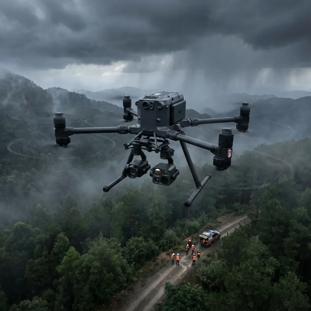
The Matrice 400's thermal payload captures these signatures with 640×512 resolution at temperature sensitivities of ±0.1°C, making subtle defects immediately apparent.
Expert Insight: Flight altitude directly impacts thermal signature detection. At 80 meters, individual crack patterns become distinguishable. At 120 meters, you gain broader coverage while maintaining sufficient resolution for structural assessment. Going higher than 150 meters significantly degrades thermal detail for pavement analysis.
Mission Planning for Highway Corridors
Linear infrastructure surveys demand different planning approaches than area mapping. Highway corridors stretch for kilometers while maintaining relatively narrow widths, creating unique challenges for flight path optimization.
Flight Path Configuration
The Matrice 400's mission planning software supports corridor-specific parameters:
- Terrain following maintains consistent ground sampling distance over elevation changes
- Adaptive speed control slows the aircraft over complex interchanges
- Waypoint density increases at bridge approaches and exit ramps
- Gimbal angle programming captures both nadir and oblique perspectives
For a typical 10km highway segment, expect to program 45-60 waypoints with altitude adjustments every 500 meters to account for terrain variation.
GCP Placement Strategy
Ground Control Points remain essential for survey-grade accuracy, even with the Matrice 400's RTK capabilities. For highway mapping, GCP distribution follows specific patterns:
| GCP Placement Zone | Spacing Interval | Purpose |
|---|---|---|
| Straight segments | Every 800m | Baseline accuracy verification |
| Curves and bends | Every 400m | Geometric correction |
| Bridge approaches | 50m before/after | Elevation transition accuracy |
| Interchange areas | 200m grid pattern | Complex geometry capture |
| Survey boundaries | Minimum 3 points | Edge accuracy assurance |
Pro Tip: Place GCPs on the shoulder rather than active lanes. The Matrice 400's camera resolution allows accurate targeting from 15cm markers, eliminating the need for larger targets that require lane closures.
Technical Specifications That Matter for Highway Work
The Matrice 400 platform includes numerous specifications, but highway mapping professionals should focus on capabilities that directly impact corridor survey success.
Transmission and Control
The O3 transmission system delivers 1080p/60fps live feed at distances up to 20km with automatic frequency hopping across 2.4GHz and 5.8GHz bands. For linear infrastructure work, this translates to:
- Single-launch coverage of 15km+ highway segments
- Reliable video feed for real-time defect identification
- Consistent telemetry for precise flight path execution
- Reduced mission count for long corridor surveys
Power Management
Highway mapping during low-light windows creates time pressure. The Matrice 400's hot-swap battery system addresses this constraint directly:
- 47-minute maximum flight time per battery set
- Battery changes without powering down avionics
- Continuous payload operation during swaps
- Pre-heated battery option for cold morning operations
A typical dawn survey window of 90 minutes allows completion of 25-30km of highway corridor with a single battery swap.
Data Security
Highway infrastructure data carries sensitivity classifications in most jurisdictions. The Matrice 400's AES-256 encryption protects:
- Real-time video transmission
- Stored imagery on aircraft media
- Flight logs and telemetry records
- Mission planning files
This encryption standard meets FIPS 140-2 requirements, satisfying most government infrastructure survey contracts.
Photogrammetry Processing Workflow
Raw imagery from low-light highway missions requires specific processing approaches to achieve optimal results.
Image Capture Parameters
Configure the Matrice 400 payload for low-light conditions:
- ISO 400-800 for twilight operations
- Shutter speed minimum 1/500s to prevent motion blur
- Aperture f/4-f/5.6 for depth of field balance
- Overlap 80% frontal, 70% side for reliable tie points
- Interval shooting at 2-second intervals for continuous coverage
Processing Considerations
Low-light imagery presents unique processing challenges:
- Noise reduction becomes critical at higher ISO settings
- Color correction requires careful white balance adjustment
- Shadow detail recovery improves feature extraction
- Thermal-RGB alignment enables comprehensive analysis
Modern photogrammetry software handles these adjustments automatically, but manual verification improves final deliverable quality.
BVLOS Operations for Extended Corridors
Beyond Visual Line of Sight operations unlock the Matrice 400's full potential for highway mapping. Regulatory requirements vary by jurisdiction, but the platform supports compliant BVLOS missions through:
- Detect and avoid integration capabilities
- Remote ID broadcast compliance
- Redundant communication links
- Automated return-to-home with obstacle avoidance
For highway corridors exceeding 5km, BVLOS authorization reduces mission complexity from multiple launches to single continuous flights.
Common Mistakes to Avoid
Ignoring wind patterns during twilight hours. Temperature inversions at dawn and dusk create unpredictable wind shear at 50-100 meter altitudes. Monitor conditions continuously rather than relying on pre-flight forecasts.
Insufficient overlap on curved sections. Highway curves require 85-90% frontal overlap rather than standard settings. The Matrice 400's adaptive speed control helps, but manual verification prevents data gaps.
Neglecting thermal calibration. Thermal sensors require 15-minute warmup periods for accurate readings. Launching immediately after power-on produces unreliable temperature data during the critical first segment.
Overlooking shadow direction. Even during low-light operations, shadow angles affect surface defect visibility. Plan flight direction to maximize shadow contrast on the pavement surface.
Skipping test flights on new corridors. Electromagnetic interference from highway infrastructure—lighting systems, traffic sensors, communication towers—varies unpredictably. A brief test flight identifies problem areas before committing to full survey operations.
Frequently Asked Questions
What flight altitude produces the best results for highway thermal surveys?
80-120 meters provides optimal balance between thermal signature resolution and coverage efficiency. Lower altitudes improve detail but dramatically increase flight time and data volume. Higher altitudes lose the subtle temperature differentials that indicate subsurface defects.
How does the Matrice 400 handle highway traffic during active operations?
The platform's obstacle sensing system detects vehicles, but proper mission planning eliminates conflicts entirely. Schedule operations during low-traffic windows—typically before 6:00 AM or after 8:00 PM—and coordinate with highway authorities for any necessary traffic management.
Can the Matrice 400 complete photogrammetry and thermal surveys in a single flight?
Yes, with appropriate payload configuration. The platform supports dual-sensor payloads that capture RGB and thermal imagery simultaneously. This approach reduces total flight time by 40% compared to separate missions while ensuring perfect spatial alignment between datasets.
Highway infrastructure demands precision documentation, and low-light operations with the Matrice 400 deliver results that daytime surveys cannot match. The combination of thermal imaging capabilities, extended transmission range, and robust data security creates a platform purpose-built for corridor mapping challenges.
Ready for your own Matrice 400? Contact our team for expert consultation.