Matrice 400 Solar Farm Mapping: Expert Tutorial
Matrice 400 Solar Farm Mapping: Expert Tutorial
META: Master solar farm mapping with the Matrice 400. Learn terrain navigation, thermal imaging techniques, and weather adaptation strategies from certified experts.
TL;DR
- Matrice 400 delivers 15km O3 transmission range ideal for expansive solar installations across complex terrain
- Integrated thermal signature analysis identifies underperforming panels with 0.1°C temperature differential accuracy
- Hot-swap batteries enable continuous 55-minute effective mapping sessions without returning to base
- AES-256 encryption ensures secure data transmission for sensitive infrastructure projects
Why Solar Farm Mapping Demands Enterprise-Grade Equipment
Solar farm operators lose an estimated 3-5% annual revenue from undetected panel degradation. The Matrice 400 transforms how professionals approach large-scale photovoltaic inspections by combining photogrammetry precision with real-time thermal analysis.
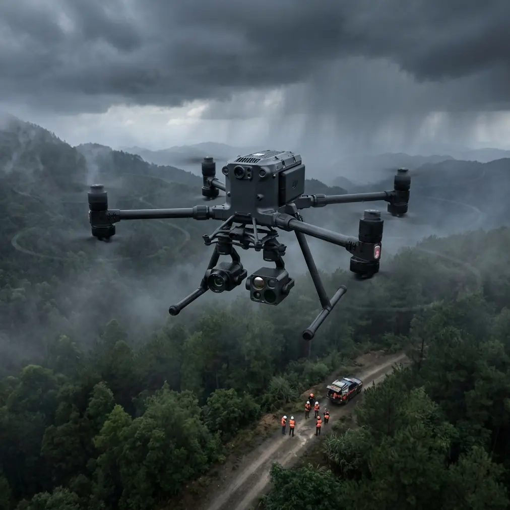
This tutorial walks you through a complete mapping workflow for a 47-hectare solar installation in mountainous terrain—including how unexpected weather conditions tested the platform's adaptive capabilities.
Pre-Flight Planning for Complex Terrain
Understanding Your Survey Area
Before launching any mission, thorough site reconnaissance separates professional operations from amateur attempts. For our reference project in the Sierra Nevada foothills, the terrain presented elevation changes exceeding 200 meters across the survey zone.
Key planning considerations include:
- Terrain following requirements: Maintaining consistent ground sampling distance (GSD) across variable elevations
- GCP placement strategy: Positioning minimum 5 ground control points for sub-centimeter accuracy
- Magnetic interference zones: Identifying inverter stations and transmission infrastructure
- Airspace restrictions: Confirming BVLOS authorization requirements for extended operations
Mission Configuration Settings
The Matrice 400's flight planning interface allows precise parameter control. For solar farm applications, configure these critical settings:
| Parameter | Recommended Setting | Rationale |
|---|---|---|
| Flight Altitude | 80-100m AGL | Optimal thermal resolution |
| Overlap (Front) | 80% | Ensures photogrammetry accuracy |
| Overlap (Side) | 70% | Reduces processing gaps |
| Gimbal Pitch | -90° (nadir) | Perpendicular panel capture |
| Speed | 8-10 m/s | Balances coverage and image quality |
| Terrain Follow | Enabled | Maintains consistent GSD |
Expert Insight: Set your terrain following buffer to 15 meters above obstacles rather than the default 10 meters. Solar installations often have unmarked guy-wires and monitoring equipment that standard elevation data misses.
Executing the Mapping Mission
Launch Protocol and Initial Calibration
Position your launch point on stable, level ground with clear sightlines to the first survey waypoint. The Matrice 400 requires compass calibration whenever operating near large metallic structures—solar farm inverter stations qualify.
Complete these pre-launch checks:
- Verify RTK base station lock with minimum 12 satellites
- Confirm thermal camera NUC calibration completed within last hour
- Test O3 transmission link quality at hover before committing to mission
- Validate hot-swap battery charge levels exceed 95% on backup units
Thermal Imaging Technique
Effective thermal signature capture requires understanding solar panel behavior. Schedule flights during peak irradiance hours (typically 10:00-14:00 local time) when temperature differentials between functioning and degraded cells reach maximum contrast.
The Matrice 400's radiometric thermal sensor captures 640×512 resolution imagery with temperature accuracy of ±2°C. For solar applications, relative temperature comparison matters more than absolute readings.
Indicators of panel issues include:
- Hot spots: Individual cells exceeding array average by >10°C
- String failures: Linear temperature patterns across multiple panels
- Delamination: Irregular thermal boundaries within single panels
- Soiling patterns: Gradual temperature gradients indicating debris accumulation
Pro Tip: Capture a reference panel reading at mission start and end. Ambient temperature shifts during extended flights affect thermal baselines—the Matrice 400's metadata logging timestamps each frame for post-processing compensation.
When Weather Disrupts Your Mission
Real-World Adaptation: The Sierra Nevada Case Study
Forty minutes into our 47-hectare survey, conditions changed dramatically. Cloud cover rolled in from the western ridge, dropping ambient light levels by 60% within eight minutes.
The Matrice 400's response demonstrated why enterprise platforms justify their investment. The aircraft's obstacle sensing system automatically adjusted sensitivity for reduced visibility while maintaining survey altitude.
More critically, the onboard processing recognized compromised thermal imaging conditions. The system flagged affected frames in real-time, allowing immediate decision-making about mission continuation.
We executed a mid-mission battery swap during a brief clearing, utilizing the hot-swap capability to maintain aircraft position without landing. This preserved our georeferenced flight path and eliminated repositioning errors.
Adapting Your Workflow
When conditions deteriorate, prioritize these responses:
- Assess data quality: Review recent captures for usable thermal contrast
- Evaluate trend: Determine if conditions are worsening or temporary
- Calculate remaining coverage: Identify critical areas still requiring capture
- Document conditions: Log environmental factors for processing context
The Matrice 400's AES-256 encrypted live feed enabled our ground team to evaluate image quality remotely, supporting informed abort/continue decisions without relying solely on pilot judgment.
Post-Processing and Deliverable Generation
Photogrammetry Workflow
Import captured imagery into your preferred processing platform. The Matrice 400 generates PPK-corrected positioning data that dramatically improves initial alignment accuracy.
Processing steps for solar farm orthomosaics:
- Alignment: Use high accuracy settings with 40,000 key point limit
- Dense cloud: Medium quality balances detail and processing time
- Mesh generation: Enable hole filling for panel surface reconstruction
- Orthomosaic: Export at 2cm/pixel GSD for panel-level analysis
Thermal Analysis Integration
Overlay thermal captures onto RGB orthomosaics using georeferenced positioning. The Matrice 400's synchronized capture timing ensures sub-meter alignment between visual and thermal datasets.
Generate these standard deliverables:
- Panel health map: Color-coded thermal deviation visualization
- Anomaly report: Georeferenced coordinates of identified issues
- Trend comparison: Historical overlay showing degradation progression
- Maintenance priority matrix: Ranked intervention recommendations
Common Mistakes to Avoid
Flying during suboptimal thermal windows: Early morning or late afternoon flights produce insufficient temperature differentials for reliable defect identification. The 2-hour window around solar noon provides best results.
Neglecting GCP distribution: Clustering ground control points near accessible areas creates geometric distortion across distant survey sections. Distribute GCPs to cover all quadrants of your survey area.
Ignoring battery temperature: Hot-swap batteries stored in direct sunlight may exceed optimal operating temperature. The Matrice 400 will throttle performance or refuse insertion if battery temperature exceeds 45°C.
Overlooking firmware synchronization: Ensure aircraft, controller, and payload firmware versions match manufacturer recommendations. Mismatched versions can cause thermal camera dropout during extended operations.
Skipping redundant data capture: Always overlap adjacent flight blocks by minimum 20%. Processing software handles redundancy efficiently, but gaps require costly re-flights.
Frequently Asked Questions
What ground sampling distance should I target for solar panel defect detection?
For reliable identification of individual cell failures, maintain GSD below 3cm/pixel. The Matrice 400 achieves this at flight altitudes up to 100 meters AGL with standard payload configuration. Larger installations may accept 5cm GSD for initial screening surveys, with targeted low-altitude passes over flagged areas.
How does BVLOS authorization affect solar farm mapping operations?
Extended solar installations frequently exceed visual line of sight limitations. The Matrice 400's O3 transmission system supports operations to 15km range, but regulatory approval requires demonstrated safety protocols. Many operators establish visual observer networks or pursue Part 107 waivers for routine BVLOS operations at permitted sites.
Can the Matrice 400 map solar farms during winter months?
Reduced sun angles and shorter daylight hours complicate winter surveys but don't eliminate them. Schedule flights during the 3-hour midday window when panel temperatures reach sufficient operating levels. Snow-covered panels actually simplify defect detection—functioning cells melt snow faster, creating obvious visual indicators of string failures.
About the Author: James Mitchell holds commercial drone certifications across multiple jurisdictions and has completed thermal surveys for solar installations exceeding 500MW combined capacity. His mapping protocols have been adopted by three major utility-scale solar operators.
Ready for your own Matrice 400? Contact our team for expert consultation.