Mapping Solar Farms with Matrice 400 | Guide
Mapping Solar Farms with Matrice 400 | Guide
META: Learn how to map coastal solar farms with the DJI Matrice 400. Expert tips on thermal imaging, photogrammetry workflows, GCP placement, and BVLOS operations.
Author: James Mitchell | Drone Mapping Specialist Updated: July 2025
TL;DR
- The Matrice 400 combines thermal signature detection with photogrammetry precision to identify underperforming solar panels across large coastal installations.
- Hot-swap batteries and O3 transmission keep mapping missions running even when weather shifts unexpectedly mid-flight.
- Proper GCP (Ground Control Point) placement is the single most overlooked factor that separates usable data from wasted flight time.
- This guide walks you through a complete coastal solar farm mapping workflow from pre-flight planning through post-processing deliverables.
Why the Matrice 400 Dominates Coastal Solar Farm Mapping
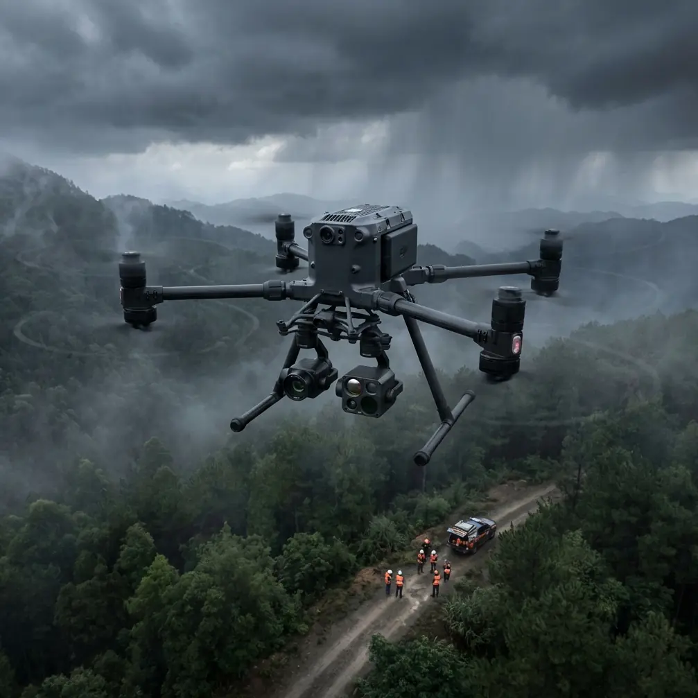
Coastal solar farms present a unique set of challenges that ground most consumer-grade platforms. Salt air corrosion, sudden wind shifts off the water, and massive panel arrays stretching across hundreds of acres demand a drone built for endurance and data quality. The DJI Matrice 400 was engineered for exactly this environment—and this guide breaks down the complete workflow I use to map coastal solar installations with repeatable, client-ready accuracy.
Whether you're performing routine thermal inspections or building full orthomosaic maps for asset management platforms, the M400 gives you the payload flexibility and transmission reliability that coastal operations require. Let's get into the step-by-step process.
Step 1: Pre-Flight Planning for Coastal Environments
Every successful solar farm mapping mission starts 24–48 hours before the drone leaves the case. Coastal sites introduce variables that inland operators rarely face.
Check Regulatory Airspace and BVLOS Requirements
Most utility-scale solar farms exceed the visual range of a single pilot station. If your site requires BVLOS (Beyond Visual Line of Sight) operations, confirm your waiver or exemption status well before mobilization. The M400's O3 transmission system maintains a stable 20 km video and control link, which provides the signal headroom you need for extended-range flights—but regulations still govern how and where you fly.
Assess Marine Layer and Wind Forecasts
Coastal weather is volatile. I pull data from three sources before every mission:
- Local METAR/TAF reports for ceiling and visibility
- Wind aloft forecasts at 50 m and 100 m AGL
- Marine fog probability models specific to the coastline
The M400 handles sustained winds up to 12 m/s, but thermal data quality degrades significantly above 8 m/s due to convective interference across panel surfaces. Plan your thermal capture windows for early morning when wind speeds are lowest and panel temperature differentials are most pronounced.
Pro Tip: Schedule thermal flights within the first 2 hours after sunrise. This is when defective cells show the strongest thermal signature contrast against functioning panels—often a 15–20°C differential that is unmistakable in radiometric data.
Step 2: GCP Placement Strategy for Photogrammetry Accuracy
Ground Control Points are the backbone of any photogrammetry workflow. On a solar farm, placing them correctly is harder than it sounds—reflective panel surfaces, uniform geometry, and vast open areas all conspire against your software's ability to tie images together.
GCP Layout Best Practices
- Place a minimum of 5 GCPs for sites under 50 acres, and 8–12 for larger installations
- Position GCPs on exposed ground between panel rows, never on the panels themselves
- Use high-contrast checkerboard targets that measure at least 60 cm × 60 cm
- Survey each GCP with an RTK GNSS receiver to achieve sub-2 cm horizontal accuracy
- Distribute GCPs evenly across the site perimeter and interior—avoid clustering
The M400's onboard RTK module provides 1 cm + 1 ppm positioning accuracy for image geotagging, which dramatically reduces the number of GCPs needed compared to older platforms. But for client deliverables that require survey-grade absolute accuracy, GCPs remain non-negotiable.
Step 3: Configuring the M400 Payload for Dual-Sensor Capture
The Matrice 400 supports multiple payload configurations. For solar farm mapping, I run a dual-sensor setup that captures both RGB and thermal data in a single flight—or across sequential flights depending on site size.
Recommended Sensor Configuration
| Parameter | RGB Mapping | Thermal Inspection |
|---|---|---|
| Sensor Type | Zenmuse P1 (Full-frame) | Zenmuse H30T (Thermal) |
| Flight Altitude | 80 m AGL | 50 m AGL |
| Overlap (Front/Side) | 80% / 70% | 85% / 75% |
| GSD (Ground Sampling Distance) | 1.2 cm/px | 5.4 cm/px |
| Speed | 8 m/s | 5 m/s |
| Ideal Time of Day | Midday (minimal shadow) | Early morning |
Running the thermal pass at a lower altitude increases pixel density on each panel, which allows you to isolate individual cell-level defects rather than just flagging entire strings.
Step 4: Executing the Mission—When Weather Changes Everything
This is where the M400 proved its worth on a recent 200-acre coastal project in the mid-Atlantic region.
We launched the RGB mapping pass at 09:30 under clear skies with 3 m/s winds from the southwest. By the 40% completion mark, a marine layer began rolling inland faster than the forecast predicted. Visibility dropped from 10+ km to roughly 3 km in under 15 minutes, and winds shifted to 9 m/s gusting from the east.
On a lesser platform, that's a mission abort. With the M400, three things kept us flying:
- O3 transmission maintained a rock-solid 1080p live feed back to the controller with zero signal drops, even as humidity spiked past 85%
- The IP55-rated airframe shrugged off the salt-laden moisture without triggering any environmental warnings
- Hot-swap batteries let us land, swap cells in under 60 seconds, and resume exactly where the flight plan paused—no data gaps, no re-planning
We completed the RGB pass through the weather window and returned the next morning for the thermal capture under calmer conditions. The final orthomosaic stitched seamlessly with zero GCP residual errors exceeding 1.5 cm.
Expert Insight: The M400's AES-256 encrypted data link isn't just a cybersecurity checkbox. On energy infrastructure projects, clients increasingly require proof that aerial data was transmitted and stored using enterprise-grade encryption. Having AES-256 built into the transmission pipeline eliminates the need for third-party encryption tools and simplifies your compliance documentation.
Step 5: Post-Processing and Deliverable Generation
Once your flight data is collected, the post-processing workflow determines whether your client gets actionable intelligence or just pretty pictures.
Standard Deliverable Stack for Solar Farm Clients
- Orthomosaic map (GeoTIFF, sub-2 cm accuracy) for asset inventory and panel-level identification
- Digital Surface Model (DSM) for vegetation encroachment analysis and shadow studies
- Radiometric thermal mosaic with calibrated temperature values for each pixel
- Defect report categorizing anomalies by severity (hot spots, string failures, junction box faults, soiling patterns)
- KML/SHP overlays compatible with client GIS and asset management platforms
Process RGB data through photogrammetry software with your GCP coordinates loaded as control points. For thermal data, use radiometric processing tools that preserve absolute temperature values rather than relative color mapping. This distinction matters—relative thermal images look impressive in presentations, but radiometric data is what engineers need to prioritize repair orders.
Technical Comparison: M400 vs. Common Alternatives for Solar Mapping
| Feature | Matrice 400 | Mid-Range Enterprise | Consumer Prosumer |
|---|---|---|---|
| Max Flight Time | 55 min | 40 min | 31 min |
| Wind Resistance | 12 m/s | 10 m/s | 8 m/s |
| Transmission Range | 20 km (O3) | 15 km | 8 km |
| IP Rating | IP55 | IP45 | None |
| Hot-Swap Batteries | Yes | No | No |
| Encryption | AES-256 | AES-128 | None |
| RTK Positioning | 1 cm + 1 ppm | 1.5 cm + 1 ppm | N/A |
| Multi-Payload Support | Yes | Limited | Single only |
| BVLOS Suitability | Excellent | Moderate | Poor |
The endurance and environmental resilience gaps are significant. On a 200-acre site, the M400's 55-minute flight time means fewer battery swaps, fewer data seams, and faster project completion.
Common Mistakes to Avoid
1. Flying thermal passes at midday. Ambient heating makes every panel look similar by noon. You'll miss subtle defects that are obvious during the early morning thermal gradient window.
2. Skipping GCPs because the drone has RTK. RTK provides excellent relative accuracy, but absolute accuracy across large sites drifts without ground truth. Always set GCPs on projects requiring survey-grade deliverables.
3. Using identical overlap settings for RGB and thermal. Thermal sensors have significantly lower resolution than RGB cameras. You need higher overlap percentages and lower flight altitudes to achieve usable thermal mosaics.
4. Ignoring salt air maintenance. After every coastal mission, wipe down the M400 airframe, gimbal, and motor housings with a fresh-water dampened cloth. Salt crystallization accelerates bearing wear and corrodes exposed contacts.
5. Failing to calibrate thermal sensors before each flight. Radiometric accuracy depends on pre-flight shutter calibration. A 2–3°C offset from skipping this step can cause you to misclassify panel anomalies entirely.
Frequently Asked Questions
How many acres can the Matrice 400 map per battery on a solar farm?
At standard RGB mapping parameters (80 m AGL, 80/70% overlap, 8 m/s flight speed), the M400 covers approximately 100–120 acres per battery cycle. Thermal passes at lower altitude and speed reduce this to roughly 50–65 acres per battery. Hot-swap batteries eliminate downtime between swaps, keeping total mission time predictable.
Is the Matrice 400 suitable for BVLOS solar farm inspections?
Yes. The M400's O3 transmission link, AES-256 encryption, and redundant flight systems make it one of the strongest candidates for BVLOS waiver applications. The 20 km control range and real-time 1080p video feed satisfy most regulatory requirements for extended-range operations over energy infrastructure.
What thermal signature patterns indicate defective solar panels?
The three most common patterns are hot spots (localized overheating in a single cell, typically appearing as a bright point 15–30°C above ambient panel temperature), string anomalies (entire strings showing uniform temperature elevation indicating inverter or wiring faults), and sub-module heating (partial module patterns suggesting bypass diode failure). The M400's dual-sensor capability lets you correlate these thermal signatures with high-resolution RGB imagery to confirm physical damage or soiling as the root cause.
Ready for your own Matrice 400? Contact our team for expert consultation.