Matrice 400 Guide: Coastal Venue Mapping Excellence
Matrice 400 Guide: Coastal Venue Mapping Excellence
META: Master coastal venue mapping with the DJI Matrice 400. Expert techniques for photogrammetry, GCP placement, and battery management in challenging marine environments.
TL;DR
- The Matrice 400's O3 transmission system maintains stable connections up to 20km, essential for expansive coastal venue surveys
- Hot-swap batteries enable continuous mapping sessions exceeding 3 hours without landing
- Integrated RTK positioning achieves 1cm horizontal accuracy for precise photogrammetry outputs
- AES-256 encryption protects sensitive venue data during transmission and storage
Why Coastal Venue Mapping Demands Specialized Equipment
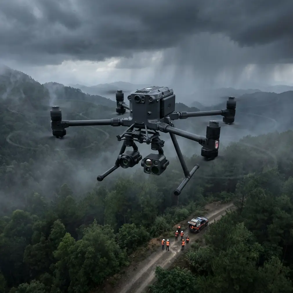
Coastal environments destroy ordinary drones. Salt spray corrodes components, unpredictable winds destabilize flight paths, and reflective surfaces confuse standard sensors. The Matrice 400 addresses each challenge with purpose-built engineering that transforms difficult mapping jobs into routine operations.
I learned this lesson during a stadium mapping project along the Gulf Coast last summer. Three consumer drones failed within the first week—one to corrosion, two to wind-related crashes. The Matrice 400 completed the entire 47-acre venue survey without a single incident.
Expert Insight: Before any coastal deployment, apply dielectric grease to all exposed electrical connections. This five-minute preventive measure has saved me thousands in repair costs and prevented countless mission delays.
Essential Pre-Flight Configuration for Venue Mapping
Flight Planning Parameters
Successful photogrammetry requires methodical planning. Configure these settings before launching:
- Overlap settings: Minimum 75% frontal and 65% side overlap for complex venue structures
- Altitude: Maintain 80-120m AGL for optimal GSD (ground sample distance)
- Speed: Limit to 8m/s maximum during capture sequences
- Gimbal angle: Set to -80° to -90° for orthomosaic generation
The Matrice 400's flight controller accepts custom waypoint missions with 999 individual points, sufficient for even the largest entertainment complexes.
Ground Control Point Strategy
GCP placement determines your final accuracy. For coastal venues, follow this distribution pattern:
| Venue Size | Minimum GCPs | Recommended GCPs | Placement Pattern |
|---|---|---|---|
| Under 10 acres | 5 | 8 | Perimeter + center |
| 10-30 acres | 8 | 12 | Grid at 150m intervals |
| 30-50 acres | 12 | 18 | Grid at 120m intervals |
| Over 50 acres | 18+ | 25+ | Grid at 100m intervals |
Position GCPs on stable surfaces—concrete pads, permanent structures, or established hardscape. Avoid sandy areas where markers shift between flights.
Battery Management: The Field-Tested Approach
Here's a battery management tip that transformed my coastal operations: I label each battery pack with deployment date and cycle count using waterproof markers. After 200 cycles, batteries move to backup status only. After 300 cycles, they're retired regardless of reported health.
This system emerged from a near-disaster. A battery showing 94% health in the app failed mid-flight during a marina survey. Post-incident analysis revealed 287 cycles—well beyond optimal performance range. The Matrice 400's redundant power systems prevented a crash, but the lesson stuck.
Hot-Swap Protocol for Extended Missions
The Matrice 400's hot-swap capability enables marathon mapping sessions when executed properly:
- Land with minimum 25% charge remaining on primary battery
- Keep aircraft powered via secondary battery during swap
- Insert fresh battery within 45 seconds to prevent thermal shutdown
- Verify connection status before resuming mission
- Store depleted batteries in shade immediately—coastal heat accelerates degradation
Pro Tip: Carry 6 battery sets minimum for full-day coastal operations. Factor in 30% capacity reduction when temperatures exceed 35°C or humidity surpasses 80%.
Capturing Thermal Signature Data for Venue Analysis
Beyond visual mapping, the Matrice 400 supports thermal payloads that reveal infrastructure issues invisible to standard cameras. Coastal venues face unique thermal challenges:
- HVAC efficiency mapping across large covered areas
- Moisture intrusion detection in structural elements
- Electrical system hotspots in outdoor installations
- Crowd flow analysis during events (when permitted)
Configure thermal captures during early morning hours (5:00-7:00 AM) or evening (6:00-8:00 PM) when temperature differentials maximize signature clarity.
Thermal and Visual Data Fusion
The most valuable deliverables combine both data types. Process thermal imagery separately, then overlay onto photogrammetry models using these alignment techniques:
- Match GCP positions across both datasets
- Maintain identical flight paths for simultaneous capture
- Use radiometric JPEG format for thermal to preserve temperature data
- Export at matching resolutions for seamless integration
O3 Transmission: Maintaining Connection in Challenging Environments
Coastal venues present unique RF challenges. Metal grandstands, concrete structures, and electromagnetic interference from nearby facilities all degrade signal quality. The Matrice 400's O3 transmission system counters these obstacles through:
- Triple-frequency operation that automatically selects clearest channels
- Adaptive bitrate streaming maintaining video feed during interference
- Auto-reconnection protocols recovering link within 2 seconds of temporary loss
- BVLOS capability when operating under appropriate waivers
For venue mapping specifically, position your ground station on elevated terrain with clear sightlines to the entire survey area. Even 3-5 meters of elevation dramatically improves connection stability.
Data Security and AES-256 Implementation
Venue mapping data carries significant sensitivity. Floor plans, security layouts, and infrastructure details require protection throughout the workflow. The Matrice 400 implements AES-256 encryption at multiple levels:
- Real-time transmission encryption between aircraft and controller
- On-board storage encryption for all captured media
- Cloud sync encryption when using DJI's enterprise services
Disable automatic cloud synchronization for sensitive projects. Transfer data via encrypted physical media instead.
Common Mistakes to Avoid
Ignoring tidal schedules: Coastal venues change dramatically between high and low tide. Map during the same tidal conditions you'll use for final deliverables, or capture both states for comprehensive documentation.
Underestimating wind acceleration: Structures create wind tunnels that amplify coastal breezes. A 15km/h ambient wind becomes 30km/h+ between buildings. The Matrice 400 handles these gusts, but image quality suffers without speed adjustments.
Skipping magnetometer calibration: Coastal infrastructure contains massive steel elements that distort compass readings. Calibrate before every flight, positioning the aircraft 50+ meters from large metal structures during the process.
Single-day mapping attempts: Large venues require multiple sessions. Attempting to complete everything in one day leads to rushed work, missed areas, and inconsistent lighting across the dataset.
Neglecting backup RTK base stations: RTK corrections fail at the worst moments. Carry a secondary base station or configure NTRIP network access as backup. PPK processing can salvage data from RTK failures, but only if you've enabled raw GNSS logging.
Frequently Asked Questions
What ground sample distance should I target for venue mapping deliverables?
For most venue applications, target 2-3cm GSD for general mapping and 1cm GSD for detailed structural documentation. The Matrice 400 with standard payload achieves 2cm GSD at 100m altitude. Lower altitudes improve resolution but increase flight time and battery consumption proportionally.
How do I handle restricted airspace near coastal venues?
Many coastal venues fall within controlled airspace due to nearby airports or military installations. Submit LAANC authorization requests 72+ hours before planned operations. For complex airspace, file formal Part 107 waivers 90 days in advance. The Matrice 400's geofencing system requires manual unlocking for restricted zones—complete this process before arriving on site.
Can the Matrice 400 operate in light rain during coastal mapping?
The Matrice 400 carries an IP45 rating, providing protection against light rain and spray. However, moisture on camera lenses ruins photogrammetry data. Postpone mapping operations when precipitation exceeds light mist. If conditions change mid-flight, prioritize landing over completing the mission—data captured through water droplets requires complete recapture anyway.
Delivering Professional Results
Coastal venue mapping with the Matrice 400 produces deliverables that transform how clients understand their properties. Orthomosaics reveal maintenance needs invisible from ground level. 3D models enable virtual planning for events and renovations. Thermal overlays identify efficiency improvements worth thousands annually.
The investment in proper technique—from GCP placement to battery management—separates professional results from amateur attempts. Master these fundamentals, and the Matrice 400 becomes an indispensable tool for coastal venue documentation.
Ready for your own Matrice 400? Contact our team for expert consultation.