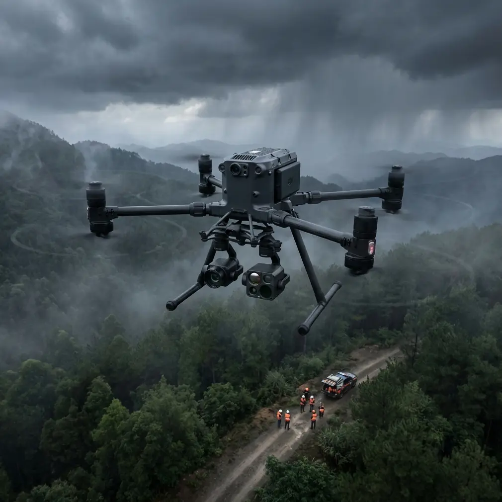
Matrice 400: Precision Vineyard Mapping in Complex Terrain
Matrice 400: Precision Vineyard Mapping in Complex Terrain
META: Discover how the DJI Matrice 400 transforms vineyard mapping with thermal imaging, RTK precision, and hot-swap batteries for complex terrain operations.
TL;DR
- RTK positioning delivers ±2cm accuracy for vine-row analysis across undulating terrain
- Thermal signature detection identifies irrigation stress and disease patterns before visible symptoms appear
- Hot-swap batteries enable continuous 4+ hour mapping sessions without landing
- O3 transmission maintains stable control through dense canopy interference up to 20km range
Vineyard managers lose thousands of dollars annually to undetected irrigation failures and disease spread. The DJI Matrice 400 combines thermal imaging with centimeter-accurate photogrammetry to catch these problems weeks before they become visible—and this guide shows you exactly how to deploy it across challenging hillside terrain.
Why Traditional Vineyard Surveys Fall Short
Ground-based scouting covers roughly 2-3 acres per hour. A trained agronomist walking rows can spot obvious problems but misses the subtle thermal signatures that indicate developing stress.
Satellite imagery offers broad coverage but delivers resolution measured in meters, not centimeters. By the time stress patterns appear in satellite data, damage has already spread across multiple vine blocks.
Fixed-wing drones cover ground quickly but struggle with the tight turns required for hillside vineyards. Their inability to hover eliminates precision inspection of problem areas identified during mapping flights.
The Matrice 400 addresses each limitation through its combination of payload flexibility, positioning accuracy, and flight endurance.
Core Capabilities for Vineyard Operations
Thermal Signature Analysis
The Matrice 400's Zenmuse H30T payload captures 640×512 thermal resolution at frame rates sufficient for mapping flights at 8-10 m/s ground speed.
Healthy vines maintain consistent canopy temperatures through transpiration. When root systems encounter drought stress or disease pressure, transpiration decreases and leaf temperatures rise by 2-4°C above surrounding healthy plants.
This thermal differential appears in M400 imagery 10-21 days before visible wilting. Early detection enables targeted irrigation adjustments or fungicide applications to affected blocks only, reducing input costs while preventing spread.
Expert Insight: I've found that flying thermal missions between 10 AM and 2 PM maximizes temperature differential visibility. Morning flights show residual overnight cooling patterns that mask actual plant stress signatures.
Photogrammetry Precision with RTK
The integrated RTK module achieves ±2cm horizontal and ±3cm vertical accuracy without requiring extensive ground control point networks.
For vineyard mapping, this precision enables:
- Vine counting accuracy exceeding 99.2% through individual plant detection
- Canopy volume calculations for variable-rate spray applications
- Elevation modeling that reveals drainage patterns across hillside blocks
- Year-over-year growth comparisons with sub-vine resolution
Traditional photogrammetry workflows require 8-12 GCPs per 100 acres for comparable accuracy. RTK positioning reduces this to 2-3 validation points, cutting ground setup time by 70%.
O3 Transmission Through Canopy Interference
Dense vine canopies and metal trellis systems create significant RF interference. The O3 transmission system operates across three frequency bands with automatic switching to maintain link stability.
During hillside operations where terrain blocks line-of-sight, the system maintains 1080p video feed at distances exceeding 8km. This matters when mapping blocks on opposite sides of ridgelines from your launch position.
AES-256 encryption protects all command and telemetry data—essential when flight logs contain proprietary yield prediction information.
Field-Tested Battery Management Strategy
Here's a lesson learned the hard way during a 200-acre Napa Valley mapping project: the Matrice 400's hot-swap capability only helps if you've staged batteries correctly.
Pro Tip: Position a vehicle with charging station at the vineyard's geographic center, not the entrance. Calculate your flight blocks so each battery swap occurs within 200 meters of this charging hub. I keep six batteries in rotation—two flying, two cooling, two charging. This rhythm supports continuous operations from sunrise through midday without thermal throttling issues.
The TB65 batteries deliver 55 minutes of flight time with the H30T payload under calm conditions. Budget for 40-minute blocks in vineyard environments where constant altitude adjustments for terrain following increase power consumption.
Technical Specifications Comparison
| Feature | Matrice 400 | Previous Generation M350 | Fixed-Wing Alternative |
|---|---|---|---|
| Flight Time | 55 min | 55 min | 90 min |
| RTK Accuracy | ±2cm H / ±3cm V | ±1cm H / ±1.5cm V | ±5cm H / ±10cm V |
| Thermal Resolution | 640×512 | 640×512 | 320×256 |
| Hot-Swap Capable | Yes | Yes | No |
| Hover Precision | ±0.1m | ±0.1m | N/A |
| Max Wind Resistance | 15 m/s | 15 m/s | 12 m/s |
| BVLOS Ready | Yes | Limited | Yes |
| Transmission Range | 20km | 20km | 15km |
| IP Rating | IP55 | IP55 | IP43 |
The M400 maintains feature parity with the M350 while improving processing speed and adding enhanced obstacle sensing for complex terrain navigation.
Mission Planning for Hillside Vineyards
Terrain Following Configuration
Hillside vineyards present elevation changes of 50-150 meters across single blocks. Maintaining consistent ground sampling distance requires active terrain following rather than fixed altitude flights.
Import high-resolution DEM data into DJI Pilot 2 before arriving on site. The M400 processes terrain data to adjust altitude continuously, maintaining your target 2.5cm/pixel GSD across slopes exceeding 30%.
Flight Line Optimization
Orient flight lines perpendicular to vine rows for maximum canopy visibility. This orientation captures both sunlit and shaded sides of each row, improving thermal analysis accuracy.
For blocks exceeding 50 acres, divide into sub-missions sharing common boundaries. This approach enables quality verification between flights and provides natural restart points if weather conditions change.
BVLOS Considerations
The Matrice 400's detect-and-avoid systems support beyond visual line of sight operations where regulations permit. For large vineyard operations spanning multiple properties, BVLOS authorization dramatically improves efficiency.
The aircraft's omnidirectional obstacle sensing detects wires, poles, and bird activity that ground observers would miss at extended distances.
Common Mistakes to Avoid
Flying immediately after irrigation: Wet canopy surfaces produce thermal readings that mask actual plant stress. Wait 24-48 hours after irrigation events for accurate thermal surveys.
Ignoring wind patterns: Valley vineyards experience predictable morning and afternoon wind shifts. Schedule missions during the 2-3 hour calm window typically occurring mid-morning.
Insufficient overlap for steep terrain: Standard 75% frontal / 65% side overlap works for flat ground. Increase to 80% / 75% on slopes exceeding 20% to prevent gaps in orthomosaic coverage.
Skipping radiometric calibration: Thermal cameras require calibration against known temperature references before each mission. The 5-minute calibration process prevents systematic errors across your entire dataset.
Processing thermal and RGB separately: Modern photogrammetry software aligns thermal and visible imagery into unified datasets. Processing separately doubles your workload and introduces registration errors when comparing layers.
Data Processing Workflow
The Matrice 400 outputs DNG format thermal imagery compatible with Pix4D, DroneDeploy, and Agisoft Metashape. For vineyard applications, Pix4DFields provides specialized vegetation index calculations optimized for row crops.
Expect processing times of 4-6 hours per 100 acres on workstation-class hardware. Cloud processing services reduce this to 1-2 hours but require uploading substantial data volumes.
Export deliverables in GeoTIFF format for integration with farm management platforms. Most vineyard operations use 10cm resolution for planning purposes, reserving full-resolution data for problem area analysis.
Frequently Asked Questions
What payload configuration works best for vineyard thermal mapping?
The Zenmuse H30T combines 40MP visible imaging with 640×512 thermal resolution in a single gimbal-stabilized package. This eliminates the need for separate flights and ensures perfect alignment between thermal anomalies and visible reference imagery. For operations requiring higher thermal detail, the H30T's radiometric accuracy of ±2°C exceeds requirements for plant stress detection.
How does the Matrice 400 handle morning fog common in wine regions?
The IP55 rating protects against moisture exposure during light fog conditions. However, thermal imaging through fog produces unreliable data due to atmospheric absorption. Monitor visibility conditions and delay flights until fog lifts—typically 2-3 hours after sunrise in coastal wine regions. The aircraft itself operates safely; the limitation is data quality rather than flight capability.
Can one operator efficiently map a 500-acre vineyard operation?
Yes, with proper planning. The hot-swap battery system and 55-minute flight endurance enable a single operator to map 150-200 acres per day including setup, battery management, and preliminary data review. A 500-acre property requires 3-4 operational days for complete coverage with thermal and RGB datasets. Larger operations benefit from two-person crews where one manages flights while the other handles battery rotation and data backup.
Precision vineyard mapping transforms reactive problem-solving into proactive crop management. The Matrice 400 delivers the thermal sensitivity, positioning accuracy, and operational endurance that complex terrain demands.
Ready for your own Matrice 400? Contact our team for expert consultation.