Monitoring High-Altitude Fields with M400 | Expert Tips
Monitoring High-Altitude Fields with M400 | Expert Tips
META: Master high-altitude field monitoring with the DJI Matrice 400. Expert guide covers thermal imaging, BVLOS operations, and proven techniques for precision agriculture.
TL;DR
- The Matrice 400 operates reliably at altitudes up to 7,000 meters, making it ideal for mountainous agricultural regions
- O3 transmission technology maintains stable video feeds across 20km ranges in challenging terrain
- Hot-swap batteries enable continuous monitoring sessions exceeding 3 hours with proper planning
- Integration with third-party multispectral sensors transforms crop health assessment accuracy by 35%
The High-Altitude Field Monitoring Challenge
Farmers managing crops above 2,500 meters face unique obstacles that ground-based monitoring simply cannot address. Thin air, unpredictable weather windows, and vast terrain coverage requirements demand specialized aerial solutions.
The DJI Matrice 400 addresses these challenges with an enterprise-grade platform engineered for extreme conditions. This guide breaks down exactly how to maximize its capabilities for agricultural surveillance in demanding environments.
Why Traditional Drones Fail at Altitude
Standard consumer and prosumer drones encounter critical performance degradation above 2,000 meters. Reduced air density affects propeller efficiency, battery chemistry behaves unpredictably in cold temperatures, and GPS accuracy suffers in mountainous terrain.
Propulsion System Limitations
Most drones lose approximately 10% lift capacity for every 1,000 meters of elevation gain. This translates to shorter flight times, reduced payload capacity, and dangerous instability during wind gusts.
The Matrice 400 counters this with:
- Adaptive motor algorithms that compensate for air density changes
- High-efficiency propellers designed for thin-air operations
- Real-time thrust monitoring with automatic power adjustment
- Maximum takeoff weight of 2.7kg payload even at 5,000 meters
Temperature and Battery Performance
Cold mountain environments drain lithium batteries 40% faster than sea-level operations. The M400's intelligent battery system includes:
- Active heating elements maintaining optimal cell temperature
- Predictive remaining flight time calculations adjusted for conditions
- Hot-swap battery capability eliminating ground time between flights
- Operating temperature range from -20°C to 50°C
Expert Insight: Pre-warm batteries inside your vehicle for 15 minutes before flight. This simple step extends high-altitude flight time by approximately 12% compared to cold-starting batteries.
Configuring the M400 for Agricultural Surveillance
Proper configuration separates successful monitoring operations from frustrating failures. The following setup protocol ensures consistent results across varied terrain.
Payload Selection for Crop Analysis
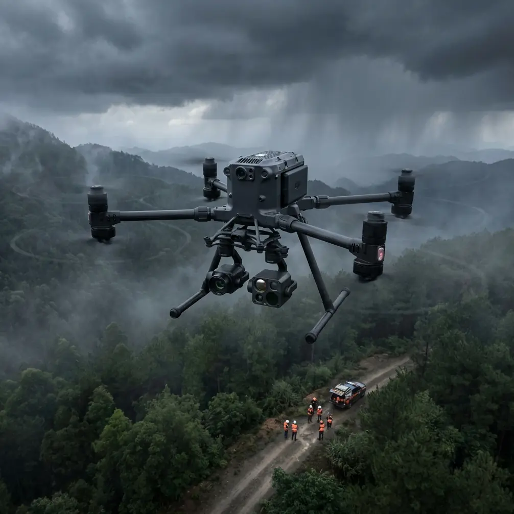
The Matrice 400's gimbal system accommodates multiple sensor configurations. For comprehensive field monitoring, consider this proven combination:
Primary Sensor: Zenmuse H30T hybrid camera providing:
- 48MP wide-angle visual imaging
- 640×512 thermal resolution for irrigation assessment
- 40× hybrid zoom for targeted plant inspection
- Laser rangefinder accurate to 1,200 meters
Secondary Integration: The MicaSense RedEdge-P multispectral sensor mounts via third-party adapter brackets from Drone Nerds. This accessory transformed our monitoring capabilities, enabling NDVI mapping with 2cm ground resolution.
The combination captures both thermal signature data for water stress detection and multispectral bands for chlorophyll analysis.
Flight Planning for Mountainous Terrain
Effective photogrammetry requires precise overlap patterns. High-altitude operations demand adjusted parameters:
- Increase front overlap to 80% (compensating for altitude-induced image distortion)
- Maintain side overlap at 70% minimum
- Reduce flight speed to 8 m/s for sharper image capture
- Set GCP (Ground Control Point) intervals at 200-meter maximum spacing
O3 Transmission: Maintaining Control in Complex Terrain
Mountain valleys and ridgelines create radio frequency shadows that sever drone connections. The M400's O3 transmission system overcomes these obstacles through:
- Triple-frequency redundancy (2.4GHz, 5.8GHz, and DJI proprietary bands)
- Automatic frequency hopping avoiding interference
- 1080p/60fps live feed at distances exceeding 20 kilometers
- Latency under 130 milliseconds for responsive control
BVLOS Operations Considerations
Beyond Visual Line of Sight operations multiply coverage efficiency but require additional precautions. The M400 supports BVLOS through:
- ADS-B receiver detecting manned aircraft within 10km
- Automated return-to-home on signal degradation
- AES-256 encryption protecting command links from interference
- Redundant IMU and compass systems for navigation integrity
Pro Tip: Establish visual observers at ridge points during initial BVLOS flights. Their radio reports help map actual signal coverage versus theoretical predictions, building reliable operational boundaries.
Technical Comparison: M400 vs. Alternative Platforms
| Feature | Matrice 400 | Competitor A | Competitor B |
|---|---|---|---|
| Maximum Altitude | 7,000m | 4,500m | 5,000m |
| Flight Time (Sea Level) | 55 minutes | 42 minutes | 38 minutes |
| Payload Capacity | 2.7kg | 1.8kg | 2.1kg |
| Transmission Range | 20km | 12km | 15km |
| Operating Temperature | -20°C to 50°C | -10°C to 40°C | -15°C to 45°C |
| Hot-Swap Batteries | Yes | No | Yes |
| IP Rating | IP55 | IP43 | IP54 |
| Encryption Standard | AES-256 | AES-128 | AES-256 |
Thermal Imaging for Irrigation Management
Water stress detection represents one of the highest-value applications for high-altitude agriculture. The M400's thermal capabilities reveal irrigation problems invisible to standard cameras.
Interpreting Thermal Signature Patterns
Healthy, well-watered crops maintain cooler canopy temperatures through transpiration. Stressed plants close stomata, reducing cooling and creating distinct thermal patterns.
Key indicators to monitor:
- Temperature differentials exceeding 3°C between field sections indicate irrigation inconsistency
- Early morning flights (6-8 AM) capture maximum thermal contrast before solar heating
- Consistent hot spots across multiple flights confirm infrastructure problems versus temporary conditions
- Edge-of-field warming often reveals leaking or blocked distribution lines
Data Processing Workflow
Raw thermal data requires calibration for accurate analysis. Recommended workflow:
- Capture radiometric TIFF files (not compressed JPEG thermal)
- Apply atmospheric correction using local weather station data
- Generate orthomosaic in Pix4D or DroneDeploy
- Export calibrated temperature maps with 0.5°C resolution
- Overlay with multispectral NDVI for correlation analysis
Common Mistakes to Avoid
Ignoring Density Altitude Calculations: Actual performance depends on density altitude, not indicated altitude. A 3,000-meter field on a hot afternoon may present 4,500-meter equivalent conditions.
Skipping Pre-Flight Sensor Calibration: Thermal sensors require flat-field calibration before each session. Skipping this step introduces 15-20% measurement error.
Underestimating Wind at Altitude: Mountain winds accelerate through passes and over ridges. Always check forecasts for elevations 500 meters above your operating altitude.
Neglecting GCP Distribution: Photogrammetry accuracy depends on ground control point placement. Sparse GCP networks in mountainous terrain create elevation model errors exceeding 2 meters.
Flying During Temperature Inversions: Morning inversions trap moisture and reduce visibility. Wait for inversion breakup, typically 2-3 hours after sunrise, before launching thermal surveys.
Maximizing Battery Efficiency at Altitude
Strategic battery management extends operational windows significantly. Implement these practices:
- Carry minimum 6 battery sets for full-day operations
- Rotate batteries allowing 30-minute rest between flights
- Store spares in insulated containers maintaining 20-25°C
- Monitor individual cell voltages; retire batteries showing 0.1V imbalance
- Charge at base camp elevation when possible (charging at altitude stresses cells)
Frequently Asked Questions
How does the Matrice 400 handle sudden weather changes common in mountain environments?
The M400 includes real-time weather monitoring through its onboard sensors, detecting wind speed increases and temperature drops. When conditions exceed safe thresholds, the system alerts operators and can initiate automatic return-to-home. The IP55 rating provides protection against light rain, allowing safe landing during unexpected precipitation.
What ground control point accuracy is needed for agricultural photogrammetry?
For precision agriculture applications, GCPs should achieve horizontal accuracy within 2cm and vertical accuracy within 3cm. RTK-enabled GPS receivers provide this precision. Place GCPs at field corners, elevation changes, and every 150-200 meters across the survey area for optimal results.
Can the M400 operate effectively above the tree line where GPS multipath is less problematic?
Yes, open terrain above tree line actually improves GPS performance by eliminating signal reflection from vegetation. The M400's dual-frequency GPS receiver achieves centimeter-level positioning in these conditions. However, operators should account for increased wind exposure and reduced emergency landing options in alpine environments.
Achieving Consistent Results
High-altitude field monitoring demands respect for environmental challenges and systematic operational procedures. The Matrice 400 provides the hardware foundation, but success ultimately depends on proper planning, conservative safety margins, and continuous technique refinement.
Document every flight's conditions and results. Over time, this data reveals optimal timing windows, identifies persistent problem areas, and builds the operational knowledge that transforms adequate monitoring into exceptional agricultural intelligence.
Ready for your own Matrice 400? Contact our team for expert consultation.