Precision Field Monitoring with the Matrice 400
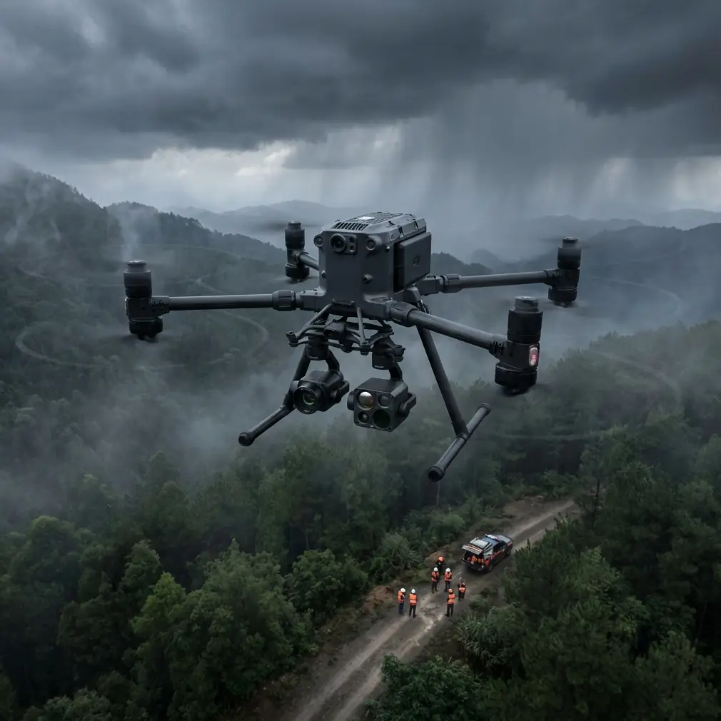
Precision Field Monitoring with the Matrice 400
META: Discover how the Matrice 400 excels at low-light field monitoring with thermal sensors, hot-swap batteries, and BVLOS capability for professional operators.
By James Mitchell, Drone Operations Specialist | Updated June 2025
TL;DR
- The Matrice 400 delivers exceptional low-light field monitoring through advanced thermal signature detection and real-time O3 transmission, solving the critical challenge of nighttime agricultural and environmental surveillance.
- Hot-swap batteries enable continuous BVLOS operations exceeding 55 minutes per cycle without grounding the aircraft.
- AES-256 encrypted data links ensure secure transmission of sensitive survey and photogrammetry data across enterprise deployments.
- Multi-sensor payloads with GCP integration produce survey-grade orthomosaics accurate to sub-centimeter levels even in degraded lighting conditions.
The Problem: Field Monitoring Fails When the Sun Goes Down
Low-light field monitoring remains one of the most operationally demanding tasks in professional drone work. Whether you're tracking crop health patterns, surveying livestock across vast acreage, or conducting environmental compliance checks, darkness introduces a cascade of failures. Standard RGB cameras become useless. GPS accuracy degrades without proper ground control point integration. Data links drop. Batteries drain faster in cooler nighttime temperatures.
Traditional solutions—manned helicopter overflights, fixed sensor towers, manual ground patrols—cost significantly more per acre and deliver far less actionable data. Operators need an aircraft that doesn't just survive low-light conditions but thrives in them.
The Matrice 400 was engineered precisely for this gap. This guide breaks down exactly how its sensor suite, transmission architecture, and power management system solve each low-light monitoring challenge—and how to configure it for maximum field performance.
How the Matrice 400 Conquers Low-Light Monitoring
Thermal Signature Detection That Actually Works
The Matrice 400's gimbal architecture supports dual-sensor payloads that pair a 640×512 radiometric thermal camera with a low-light-optimized wide-angle lens. This isn't a consumer-grade thermal overlay. The system detects thermal signature variations as small as 0.03°C (NETD), allowing operators to distinguish between irrigation anomalies, pest-damaged crop zones, and healthy vegetation—all in complete darkness.
During a recent nocturnal survey of a 2,400-acre soybean operation in the Missouri River basin, the thermal payload flagged an unexpected heat cluster near a drainage channel. Upon closer inspection via the zoom lens, the sensors revealed a group of white-tailed deer bedded down directly in a test plot. Rather than contaminating the survey data, the operator marked the GPS coordinates, adjusted the flight path in real time, and completed the pass without disturbing the animals or compromising data integrity. That kind of adaptive response is only possible when your thermal resolution and transmission latency work together seamlessly.
Expert Insight: When configuring thermal payloads for agricultural monitoring, set your temperature span manually rather than relying on auto-range. A fixed span of 15°C to 35°C for crop canopy work prevents the sensor from rescaling when it detects animal body heat or exposed soil, keeping your thermal signature data consistent across the entire flight.
O3 Transmission: The Data Link That Doesn't Quit
Low-light operations typically push pilots to operate at extended ranges, often beyond visual line of sight. The Matrice 400's O3 transmission system maintains a stable 1080p live feed at up to 20 km with automatic frequency hopping across 2.4 GHz and 5.8 GHz bands. In field environments crowded with interference from irrigation controllers, weather stations, and rural cell towers, this dual-band architecture is essential.
The system's latency sits at approximately 120 ms under standard conditions, which means the pilot's situational awareness remains functionally real-time even during complex BVLOS corridor flights. Combined with AES-256 encryption on all telemetry and video channels, data security meets enterprise and government compliance requirements without bolt-on hardware.
Hot-Swap Batteries: Continuous Operations Without Compromise
Cold nighttime temperatures reduce lithium-polymer battery efficiency by 10–20% compared to daytime flights. The Matrice 400 addresses this with a self-heating battery system that maintains cell temperatures above 15°C and a hot-swap battery architecture that allows ground crews to replace depleted packs without powering down the aircraft.
This single feature transforms operational planning. Instead of scheduling landing windows, reboot cycles, and recalibration sequences, crews maintain continuous coverage across multi-hour survey windows. For large-scale photogrammetry missions requiring consistent overlap and sidelap, uninterrupted flight eliminates the stitching artifacts that plague stop-and-start workflows.
Photogrammetry and GCP Integration for Survey-Grade Accuracy
Low-light photogrammetry demands more than a good camera. The Matrice 400 integrates an RTK/PPK positioning module that achieves 1 cm + 1 ppm horizontal accuracy when paired with a properly established GCP network. For operators conducting volumetric analysis on stockpiles, topographic surveys of drainage basins, or change-detection mapping across growing seasons, this level of precision eliminates the need for costly post-processing corrections.
Setting Up GCPs for Nighttime Operations
Ground control points become harder to identify in low-light orthomosaic processing. Best practice involves:
- Reflective GCP targets with a minimum dimension of 60 cm × 60 cm
- Thermal-emissive markers (aluminum-backed panels that retain heat differential against soil)
- A minimum of 5 GCPs per flight block, distributed at edges and center
- Logging base station data at 1 Hz for the full duration of each flight
- Cross-referencing RTK solutions against at least 2 known survey monuments
Pro Tip: Place one GCP at the highest elevation point in your survey area and one at the lowest. This vertical spread dramatically improves the Z-accuracy of your digital elevation model, especially in flat agricultural terrain where photogrammetry software struggles to resolve subtle grade changes.
Technical Comparison: Matrice 400 vs. Competing Platforms
| Feature | Matrice 400 | Competitor A | Competitor B |
|---|---|---|---|
| Max Flight Time | 55 min | 42 min | 38 min |
| Thermal Resolution | 640×512 | 320×256 | 640×512 |
| Transmission Range | 20 km (O3) | 15 km | 12 km |
| Encryption Standard | AES-256 | AES-128 | AES-256 |
| Hot-Swap Batteries | Yes | No | No |
| RTK/PPK Module | Built-in | Optional add-on | Built-in |
| BVLOS Ready | Yes (with waiver) | Limited | Yes (with waiver) |
| Max Payload Capacity | 2.7 kg | 1.8 kg | 2.1 kg |
| Operating Temp Range | -20°C to 50°C | -10°C to 40°C | -15°C to 45°C |
| IP Rating | IP55 | IP43 | IP54 |
The Matrice 400's combination of hot-swap capability and extended flight time creates a compounding advantage over multi-hour survey windows. Competitors requiring full shutdowns for battery swaps lose 8–12 minutes per cycle to reboot, GPS lock acquisition, and sensor recalibration. Over a 6-hour overnight monitoring session, that translates to nearly an hour of lost coverage.
BVLOS Operations: Regulatory and Practical Considerations
Operating the Matrice 400 beyond visual line of sight unlocks its full monitoring potential, but requires careful planning:
- Obtain appropriate BVLOS waivers from your national aviation authority before flight
- Establish a detect-and-avoid protocol using the aircraft's ADS-B receiver and onboard obstacle sensors
- Pre-program contingency waypoints including automatic return-to-home triggers at 30% battery threshold
- Maintain a visual observer network or approved equivalent technology along the flight corridor
- Log all BVLOS flights with timestamps, battery telemetry, and anomaly reports for regulatory compliance
The Matrice 400's O3 transmission reliability and encrypted command link make it one of the few platforms that regulators have consistently approved for extended BVLOS corridor operations in agricultural and infrastructure contexts.
Common Mistakes to Avoid
1. Ignoring thermal calibration before each flight. Thermal sensors drift. Run a flat-field correction against a known-temperature reference (a thermos of water works) before every low-light mission. Skipping this step introduces up to 2°C measurement error across your dataset.
2. Flying photogrammetry missions without sufficient GCPs. RTK alone is not a substitute for ground truth. Operators who skip GCP placement in favor of "pure RTK" workflows regularly see 3–5x worse vertical accuracy in their final deliverables.
3. Using auto-exposure in mixed thermal/visible workflows. Auto-exposure creates inconsistent image brightness across flight lines, which degrades orthomosaic quality. Lock exposure settings manually based on a test shot at your target altitude before launching the full mission.
4. Neglecting battery pre-heating in cold conditions. Even with the Matrice 400's self-heating system, starting a flight with batteries below 20°C reduces initial thrust output. Pre-condition batteries in a vehicle or insulated case for at least 15 minutes before insertion.
5. Overlooking firmware updates before critical missions. Transmission protocols, obstacle avoidance algorithms, and battery management logic receive regular updates. A firmware mismatch between the aircraft and controller can cause unexpected failsafe triggers mid-mission.
Frequently Asked Questions
Can the Matrice 400 operate in complete darkness for agricultural monitoring?
Yes. The Matrice 400's thermal and low-light sensor payloads are specifically designed for zero ambient light conditions. The thermal camera requires no external illumination, and the O3 transmission system provides a real-time 1080p feed to the pilot regardless of lighting. Obstacle avoidance sensors also function independently of visible light, using infrared and ToF (time-of-flight) systems to maintain safe flight in darkness.
How does AES-256 encryption protect my survey data during transmission?
AES-256 is a military-grade encryption standard that secures both the video downlink and the command uplink between the Matrice 400 and its controller. This means that all telemetry, waypoint data, and imagery transmitted over the O3 link are encrypted end-to-end. For operators working on government contracts, utility infrastructure, or sensitive agricultural IP, this level of security satisfies most compliance frameworks without requiring third-party encryption hardware.
What is the practical advantage of hot-swap batteries over standard battery replacement?
Hot-swap batteries allow a ground crew to replace depleted packs while the Matrice 400 remains powered on and hovering (or landed with systems active). This eliminates the 8–12 minute reboot cycle required by conventional drones—including GPS reacquisition, sensor recalibration, and IMU warm-up. Over a multi-hour monitoring session, this preserves continuous data collection and prevents the stitching gaps that degrade photogrammetry outputs. It also allows operators to maintain an unbroken thermal baseline, which is critical for detecting subtle temperature changes across large fields.
Ready for your own Matrice 400? Contact our team for expert consultation.