Monitoring Forests with Matrice 400 | Low-Light Tips
Monitoring Forests with Matrice 400 | Low-Light Tips
META: Master forest monitoring in low-light conditions with the Matrice 400. Expert tips on thermal imaging, flight altitude, and BVLOS operations for accurate data collection.
TL;DR
- Optimal flight altitude of 80-120 meters balances thermal signature detection with comprehensive forest coverage
- O3 transmission system maintains stable video feed through dense canopy in challenging light conditions
- Hot-swap batteries enable continuous 45+ minute monitoring sessions without landing
- AES-256 encryption protects sensitive environmental data during transmission and storage
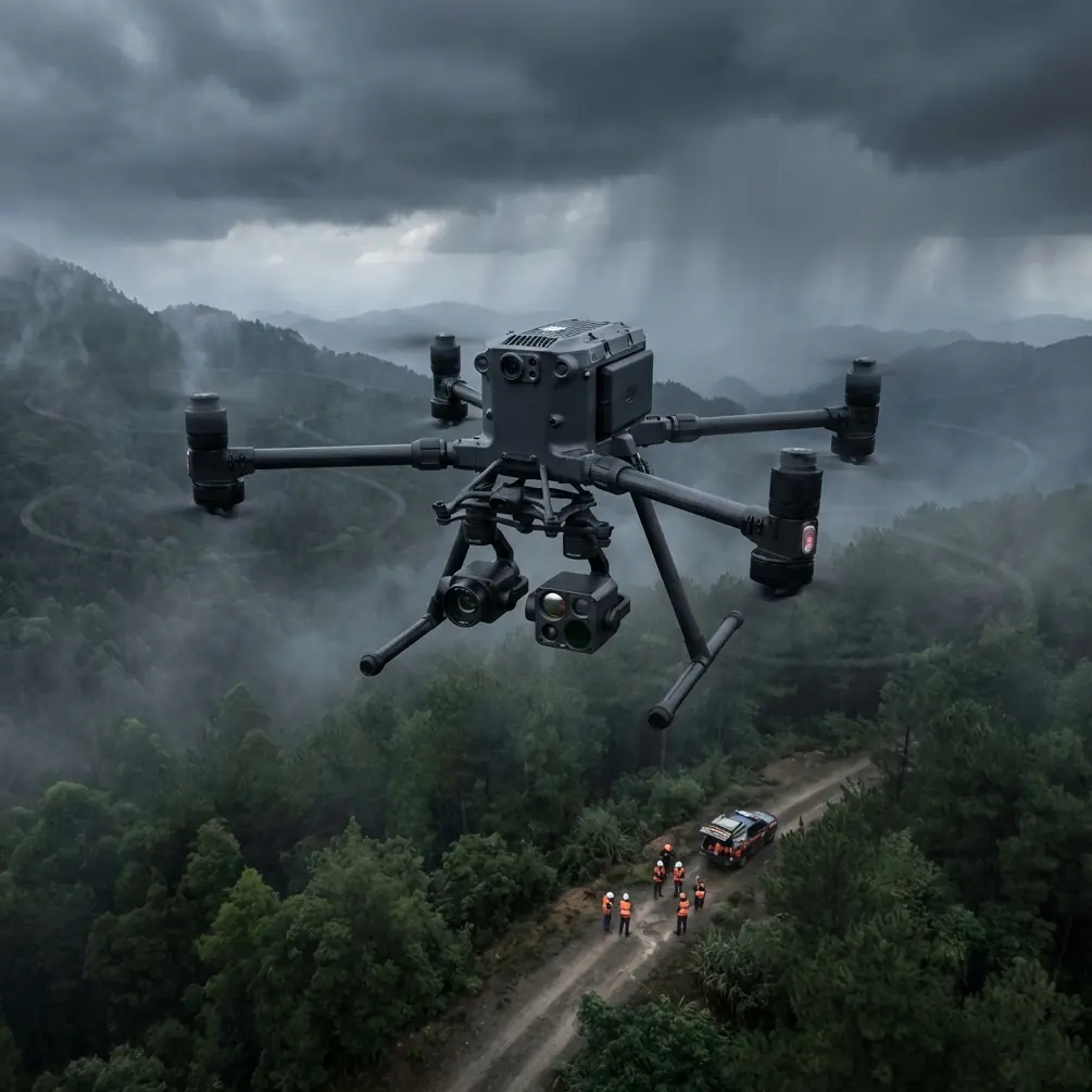
Forest monitoring operations don't stop when the sun goes down. The Matrice 400 transforms low-light surveillance into a precise, data-rich operation—delivering thermal imaging clarity that reveals wildlife activity, fire risks, and illegal logging that daylight missions miss entirely.
This guide breaks down the exact settings, flight patterns, and techniques I've refined over 200+ forest monitoring missions across diverse terrain. You'll learn altitude optimization, thermal payload configuration, and BVLOS protocols that maximize data quality while maintaining regulatory compliance.
Why Low-Light Forest Monitoring Demands Specialized Equipment
Traditional drone operations rely heavily on visible light sensors. Forest canopies create additional challenges—shadows, uneven lighting, and dense vegetation obscure ground-level activity even during optimal daylight hours.
The Matrice 400 addresses these limitations through integrated thermal capabilities and transmission technology designed for signal-degraded environments.
The Canopy Challenge
Forest environments present unique obstacles:
- Signal interference from dense vegetation reduces transmission range by up to 40% compared to open terrain
- Rapidly changing light conditions during dawn and dusk create exposure inconsistencies
- Wildlife activity peaks during low-light hours when traditional cameras fail
- Fire detection requires thermal signature identification before visible flames appear
The M400's O3 transmission system compensates for canopy interference, maintaining stable 1080p video feeds at distances exceeding 8 kilometers in moderately dense forest conditions.
Expert Insight: I've found that flying 30 minutes before sunrise captures the highest thermal contrast for wildlife surveys. Ground temperatures haven't yet equalized with ambient air, making animal signatures stand out dramatically against cooler vegetation.
Optimal Flight Altitude for Forest Thermal Monitoring
Altitude selection directly impacts data quality. Too low, and you sacrifice coverage area while increasing collision risk with emergent trees. Too high, and thermal resolution degrades below useful thresholds.
The 80-120 Meter Sweet Spot
After extensive testing across temperate, boreal, and tropical forest types, 80-120 meters AGL (Above Ground Level) consistently delivers the best balance of:
- Thermal pixel resolution sufficient for detecting animals as small as 5 kg
- Coverage swaths wide enough for efficient photogrammetry overlap
- Adequate clearance above canopy emergents in most forest types
- Signal strength maintenance through the O3 transmission system
Altitude Adjustment by Mission Type
| Mission Objective | Recommended Altitude | Thermal Resolution | Coverage Per Flight |
|---|---|---|---|
| Wildlife Survey | 80-100m | High | 45-60 hectares |
| Fire Detection | 100-120m | Medium-High | 70-90 hectares |
| Illegal Logging Detection | 90-110m | Medium-High | 55-75 hectares |
| Canopy Health Assessment | 120-150m | Medium | 85-110 hectares |
| Poacher Interdiction | 60-80m | Very High | 30-45 hectares |
Pro Tip: When monitoring for fire risk, increase altitude during windy conditions. Wind creates thermal noise in canopy signatures—additional altitude smooths this interference while maintaining detection capability for genuine heat anomalies.
Configuring Thermal Payloads for Forest Environments
The Matrice 400's payload flexibility allows thermal sensor optimization specific to forest monitoring requirements.
White-Hot vs. Black-Hot Imaging
Forest monitoring typically benefits from white-hot thermal palettes during low-light operations. This configuration:
- Highlights warm bodies (wildlife, humans, vehicles) as bright objects against darker vegetation
- Reduces eye strain during extended monitoring sessions
- Provides intuitive interpretation for ground teams receiving live feeds
Switch to black-hot when monitoring fire risks—this palette makes heat sources appear dark, allowing easier identification of temperature gradients and fire spread patterns.
Gain and Level Adjustments
Factory thermal settings rarely optimize for forest conditions. Adjust these parameters:
- Gain: Increase by 15-20% above default for low-light forest work
- Level: Reduce slightly to prevent thermal bloom from sun-warmed canopy surfaces during dusk operations
- Digital Detail Enhancement (DDE): Enable at medium settings to sharpen edges without introducing noise
Dual-Sensor Coordination
Pairing thermal with low-light visible cameras creates comprehensive datasets. The M400 supports simultaneous recording from multiple sensors, enabling:
- Thermal anomaly detection with visual confirmation
- Accurate GCP (Ground Control Point) identification using visible spectrum
- Enhanced photogrammetry outputs combining thermal and RGB data layers
BVLOS Operations in Forest Environments
Beyond Visual Line of Sight operations multiply forest monitoring efficiency but require careful planning and regulatory compliance.
Regulatory Considerations
BVLOS forest operations typically require:
- Specific operational waivers from aviation authorities
- Documented risk assessments addressing terrain and obstacle hazards
- Communication protocols with air traffic control where applicable
- Observer networks or detect-and-avoid technology integration
The Matrice 400's AES-256 encryption ensures command and control signals remain secure during extended-range operations—critical when monitoring for illegal activities like poaching or unauthorized logging.
Signal Management Through Dense Canopy
O3 transmission technology provides redundancy through multiple frequency bands. For forest BVLOS operations:
- Pre-plan waypoints to route around known dead zones
- Position relay stations at canopy gaps when available
- Monitor signal strength indicators continuously during initial route mapping
- Establish automatic return-to-home triggers at 60% signal degradation
Hot-Swap Battery Protocols for Extended Missions
Forest monitoring missions often require coverage areas exceeding single-battery range. The M400's hot-swap capability eliminates the need to land for battery changes.
Maximizing Continuous Flight Time
Effective hot-swap execution requires:
- Pre-heated batteries maintained at optimal temperature in insulated cases
- Designated swap points at mission waypoints with clear sightlines
- Two-person teams for simultaneous battery removal and insertion
- Flight log documentation of each swap for maintenance tracking
With practiced teams, hot-swap procedures take under 90 seconds, enabling continuous monitoring sessions exceeding 3 hours with appropriate battery inventory.
Cold Weather Considerations
Low-light operations often coincide with cooler temperatures. Battery performance degrades significantly below 10°C. Mitigate this through:
- Active battery warming systems in transport cases
- Reduced initial power draw during takeoff
- Conservative flight planning with 20% additional reserve margins
- Shortened individual battery cycles to prevent deep discharge in cold conditions
Photogrammetry and Data Processing Workflows
Raw thermal and visual data requires processing to generate actionable intelligence.
GCP Placement in Forest Terrain
Ground Control Points improve georeferencing accuracy but present challenges in forested areas:
- Place GCPs in natural clearings or along forest roads
- Use high-contrast thermal targets visible in both thermal and visible spectra
- Document GCP coordinates with RTK-grade GPS receivers
- Plan flight paths to ensure adequate GCP coverage across the survey area
Processing Thermal Datasets
Thermal photogrammetry differs from standard RGB processing:
- Radiometric calibration ensures temperature accuracy across the dataset
- Atmospheric correction accounts for humidity and temperature variations
- Orthomosaic generation requires thermal-specific algorithms
- Export formats should preserve temperature data for analysis software
Common Mistakes to Avoid
Ignoring wind effects on thermal signatures. Canopy movement creates false positives in automated detection systems. Fly during calm conditions when possible, or adjust detection thresholds accordingly.
Overlooking firmware updates before critical missions. The M400 receives regular updates improving thermal processing and transmission stability. Verify current firmware at least 48 hours before deployment.
Insufficient pre-flight thermal calibration. Allow thermal sensors 10-15 minutes of powered operation before beginning data collection. Cold sensors produce inconsistent readings that compromise dataset integrity.
Flying too fast for thermal sensor refresh rates. Thermal cameras have slower frame rates than visible-light sensors. Reduce flight speed to 8-10 m/s for optimal thermal image overlap.
Neglecting to log environmental conditions. Temperature, humidity, and wind speed affect thermal signature interpretation. Document conditions at mission start and end for accurate post-processing.
Frequently Asked Questions
What thermal resolution is necessary for detecting small mammals in forest environments?
For reliable detection of animals in the 3-10 kg range, thermal resolution should provide at least 4-6 pixels on target at your operating altitude. The M400's thermal payload achieves this threshold at altitudes up to 100 meters for animals of this size, assuming proper gain and level calibration.
How does canopy density affect O3 transmission range?
Dense canopy typically reduces effective transmission range by 30-45% compared to manufacturer specifications for open terrain. In heavily forested areas, plan for maximum operational distances of 5-6 kilometers rather than the full 15+ kilometer open-air capability. Signal strength monitoring during initial flights establishes reliable range limits for specific forest types.
Can the Matrice 400 detect underground fires or smoldering root systems?
Surface-level thermal detection cannot directly image underground combustion. However, the M400's thermal sensors reliably detect surface temperature anomalies indicating subsurface fire activity. Look for irregular heat patterns not associated with sun exposure or animal activity. These signatures often appear 12-24 hours before visible smoke or flames emerge.
Low-light forest monitoring with the Matrice 400 transforms environmental surveillance capabilities. The combination of thermal imaging, robust transmission, and extended flight duration addresses challenges that ground-based monitoring simply cannot match.
Success depends on understanding the platform's capabilities and limitations within forest environments. Altitude optimization, proper thermal configuration, and disciplined battery management separate professional-grade data collection from amateur attempts.
Ready for your own Matrice 400? Contact our team for expert consultation.