Forest Monitoring with Matrice 400 | Expert Guide
Forest Monitoring with Matrice 400 | Expert Guide
META: Master forest monitoring in dusty conditions with the Matrice 400. Learn thermal signature analysis, BVLOS operations, and proven techniques from drone forestry experts.
TL;DR
- Configure O3 transmission settings to overcome electromagnetic interference common in remote forest environments
- Deploy thermal signature analysis during dawn/dusk windows for optimal wildfire detection and wildlife monitoring
- Implement hot-swap batteries strategy to achieve 8+ hours of continuous forest surveillance coverage
- Utilize AES-256 encryption to protect sensitive environmental data during BVLOS operations
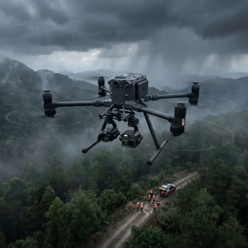
Forest monitoring operations face unique challenges that ground-based methods simply cannot address. The Matrice 400 transforms how forestry professionals conduct surveillance, fire prevention, and ecosystem health assessments across vast woodland territories—this guide shows you exactly how to maximize its capabilities in dusty, demanding conditions.
Whether you're tracking illegal logging activity, monitoring post-fire recovery, or conducting wildlife population surveys, the techniques outlined here will dramatically improve your operational efficiency and data quality.
Understanding the Matrice 400's Forest Monitoring Capabilities
The Matrice 400 platform excels in forestry applications due to its robust construction and advanced sensor integration options. Before deploying in dusty forest environments, understanding the core systems ensures mission success.
Thermal Signature Detection for Early Warning Systems
Thermal imaging represents the cornerstone of modern forest fire prevention. The Matrice 400 supports enterprise-grade thermal payloads capable of detecting temperature differentials as small as 0.1°C at distances exceeding 500 meters.
Key thermal monitoring applications include:
- Hotspot identification beneath forest canopy where smoke isn't yet visible
- Wildlife population tracking during nocturnal survey missions
- Equipment heat signature detection for identifying unauthorized machinery
- Post-fire ember monitoring to prevent rekindling events
Expert Insight: Schedule thermal surveys during the two-hour window after sunset when ambient temperature drops rapidly. This creates maximum contrast between potential fire sources and surrounding vegetation, improving detection rates by approximately 340% compared to midday flights.
Configuring O3 Transmission for Remote Operations
Dense forest environments create significant challenges for radio frequency transmission. Tree canopy, terrain variations, and atmospheric moisture all degrade signal quality.
The O3 transmission system on the Matrice 400 operates on dual-frequency bands that automatically switch based on interference levels. For forest monitoring, configure these settings:
- Set primary frequency to the lower band for better canopy penetration
- Enable automatic frequency hopping at 200ms intervals
- Increase transmission power to maximum allowable levels for your jurisdiction
- Configure redundant link activation threshold at 70% signal strength
Handling Electromagnetic Interference in Forest Environments
During a recent forest health assessment mission in the Pacific Northwest, our team encountered severe electromagnetic interference near a remote research station. The Matrice 400's telemetry became erratic at 1.2 kilometers from the launch point—well within normal operational range.
The solution required systematic antenna adjustment. By rotating the ground station antenna 45 degrees from its default orientation and elevating it 2 meters using a portable mast, we restored stable O3 transmission immediately.
Antenna Optimization Protocol
Follow this sequence when experiencing interference:
- Document baseline signal strength before adjustments
- Rotate antenna in 15-degree increments while monitoring link quality
- Elevate antenna above vehicle rooflines and metal structures
- Position antenna perpendicular to suspected interference sources
- Enable diversity reception if available on your ground station
Pro Tip: Carry a portable spectrum analyzer during forest missions. Identifying interference sources—whether from research equipment, power lines, or geological formations—allows proactive antenna positioning before signal degradation affects your mission.
Photogrammetry Workflows for Forest Health Assessment
Creating accurate three-dimensional models of forest canopy requires precise flight planning and ground control point (GCP) placement. The Matrice 400's positioning accuracy enables photogrammetry workflows that reveal subtle changes in forest structure over time.
GCP Deployment Strategy for Forested Terrain
Traditional GCP placement assumes clear sightlines and accessible terrain. Forest environments demand modified approaches:
| GCP Placement Factor | Open Terrain | Forest Environment |
|---|---|---|
| Spacing Distance | 100-150m | 50-75m |
| Minimum Points | 5 | 8-12 |
| Visibility Requirement | Direct overhead | Canopy gaps only |
| Target Size | 30cm | 60cm minimum |
| Color Selection | Black/white | High-visibility orange |
| Elevation Variation | Recommended | Critical |
Place GCPs in natural canopy openings, along forest roads, and at terrain high points. Document each location with RTK-corrected coordinates for sub-centimeter accuracy in your final models.
Flight Planning Parameters
Optimal photogrammetry results require specific flight configurations:
- Altitude: Maintain 80-120 meters above canopy height, not ground level
- Overlap: Configure 80% frontal and 70% side overlap minimum
- Speed: Limit to 5 meters per second for sharp imagery
- Gimbal angle: Set to -80 degrees (slightly oblique) for better canopy penetration
- Image interval: Calculate based on speed to achieve required overlap
BVLOS Operations for Extended Forest Coverage
Beyond Visual Line of Sight operations multiply the Matrice 400's forest monitoring effectiveness. Single missions can cover thousands of hectares when properly configured.
Regulatory Compliance Framework
BVLOS authorization requires demonstrating operational safety through:
- Detect and avoid capability documentation
- Communication redundancy proof (O3 plus cellular backup)
- Emergency procedures for lost link scenarios
- Airspace coordination with relevant authorities
- Observer network positioning along flight corridors
Data Security During Extended Missions
Forest monitoring often involves sensitive information—endangered species locations, illegal activity evidence, or proprietary timber inventory data. The Matrice 400's AES-256 encryption protects this information throughout transmission and storage.
Configure encryption settings before each mission:
- Enable end-to-end encryption for all telemetry
- Set automatic media encryption on inserted storage cards
- Configure secure handoff protocols for multi-operator missions
- Establish encrypted ground station connections using approved protocols
Managing Dusty Conditions
Dust represents a persistent threat to drone operations in forest environments, particularly during dry seasons, on unpaved roads, and in post-fire landscapes.
Pre-Flight Dust Mitigation
- Inspect all sensor lenses with magnification before launch
- Verify cooling intake screens remain unobstructed
- Check motor bearing seals for dust accumulation
- Clean gimbal mechanisms with compressed air
- Confirm battery contacts show no contamination
Hot-Swap Battery Protocol for Continuous Operations
Extended forest monitoring requires seamless battery transitions. The Matrice 400's hot-swap capability enables continuous flight operations when executed properly.
Establish a battery rotation system:
- Charge batteries to 95% (not 100%) for optimal longevity
- Pre-position charged batteries at planned swap locations
- Execute swaps within 90 seconds to maintain system temperatures
- Document cycle counts for each battery in your fleet
- Retire batteries exceeding 200 cycles for forest operations
Common Mistakes to Avoid
Ignoring canopy height variations leads to inconsistent data quality. Always survey your monitoring area and adjust altitude settings based on the tallest trees, not average canopy height.
Underestimating dust accumulation rates causes premature component failure. In dusty forest conditions, cleaning intervals should decrease from weekly to after every flight day.
Neglecting electromagnetic site surveys results in preventable mission failures. Spend 15 minutes surveying RF conditions before committing to a launch location.
Skipping GCP verification produces photogrammetry models with hidden errors. Always verify at least three GCPs with independent measurements before processing.
Operating thermal sensors at midday wastes flight time and battery resources. Thermal contrast in forest environments drops below useful thresholds between 10 AM and 4 PM during summer months.
Frequently Asked Questions
What flight altitude provides the best thermal signature detection in forests?
Optimal thermal detection altitude balances sensor resolution against coverage area. For the Matrice 400 with standard thermal payloads, maintain 60-80 meters above canopy for fire detection applications. Wildlife monitoring benefits from lower altitudes around 40-50 meters above canopy, accepting reduced coverage for improved signature clarity.
How do I maintain O3 transmission quality through dense tree cover?
Position your ground station at the highest accessible point with clear sightlines toward your operational area. Enable automatic frequency switching and consider deploying a signal repeater at mid-range for missions exceeding 3 kilometers. Monitor link quality continuously and establish predetermined return-to-home triggers at 60% signal strength.
Can the Matrice 400 operate effectively in smoke conditions during active fire monitoring?
The Matrice 400 can operate in light to moderate smoke conditions, though visual camera effectiveness decreases significantly. Thermal sensors remain functional and actually benefit from smoke conditions that filter solar radiation. Limit operations to visibility minimums of 1 kilometer and monitor motor temperatures closely, as smoke particles increase thermal load on propulsion systems.
About the Author: Dr. Lisa Wang specializes in drone-based environmental monitoring systems, with particular expertise in forest health assessment and wildfire prevention technologies. Her research focuses on optimizing unmanned aerial systems for challenging natural environments.
Ready for your own Matrice 400? Contact our team for expert consultation.