Matrice 400 Guide: Remote Highway Monitoring Excellence
Matrice 400 Guide: Remote Highway Monitoring Excellence
META: Master remote highway monitoring with the Matrice 400. Expert guide covers antenna positioning, thermal imaging, and BVLOS operations for infrastructure teams.
TL;DR
- Optimal antenna positioning at 45-degree angles maximizes O3 transmission range up to 20km in remote highway corridors
- Thermal signature detection identifies pavement degradation and vehicle heat patterns invisible to standard cameras
- Hot-swap batteries enable continuous 55-minute flight cycles for extended linear infrastructure surveys
- AES-256 encryption ensures secure data transmission across isolated highway networks
The Challenge of Remote Highway Infrastructure
Highway monitoring teams face a critical operational gap. Traditional inspection methods require road closures, expose workers to traffic hazards, and miss subsurface deterioration until failures occur.
The Matrice 400 transforms this equation entirely. This guide delivers the exact antenna configurations, flight parameters, and photogrammetry workflows that infrastructure professionals need for comprehensive highway surveillance across isolated terrain.
Dr. Lisa Wang here—I've spent fifteen years developing drone inspection protocols for transportation departments across three continents. Let me share what actually works in the field.
Understanding the Matrice 400's Highway Monitoring Capabilities
Core Specifications for Linear Infrastructure
The Matrice 400 brings purpose-built capabilities to highway monitoring operations. Its airframe handles the sustained flight patterns that linear infrastructure demands.
Key specifications for highway applications:
- Maximum flight time: 55 minutes with standard payload
- Transmission range: 20km with O3 transmission system
- Wind resistance: Stable operations up to 15 m/s
- Operating temperature: -20°C to 50°C
- IP rating: IP55 for dust and weather protection
These specifications matter because highway corridors create unique aerodynamic challenges. Thermal updrafts from asphalt, crosswinds at bridge sections, and communication dead zones in mountainous terrain all demand robust platform performance.
Payload Configuration for Highway Assessment
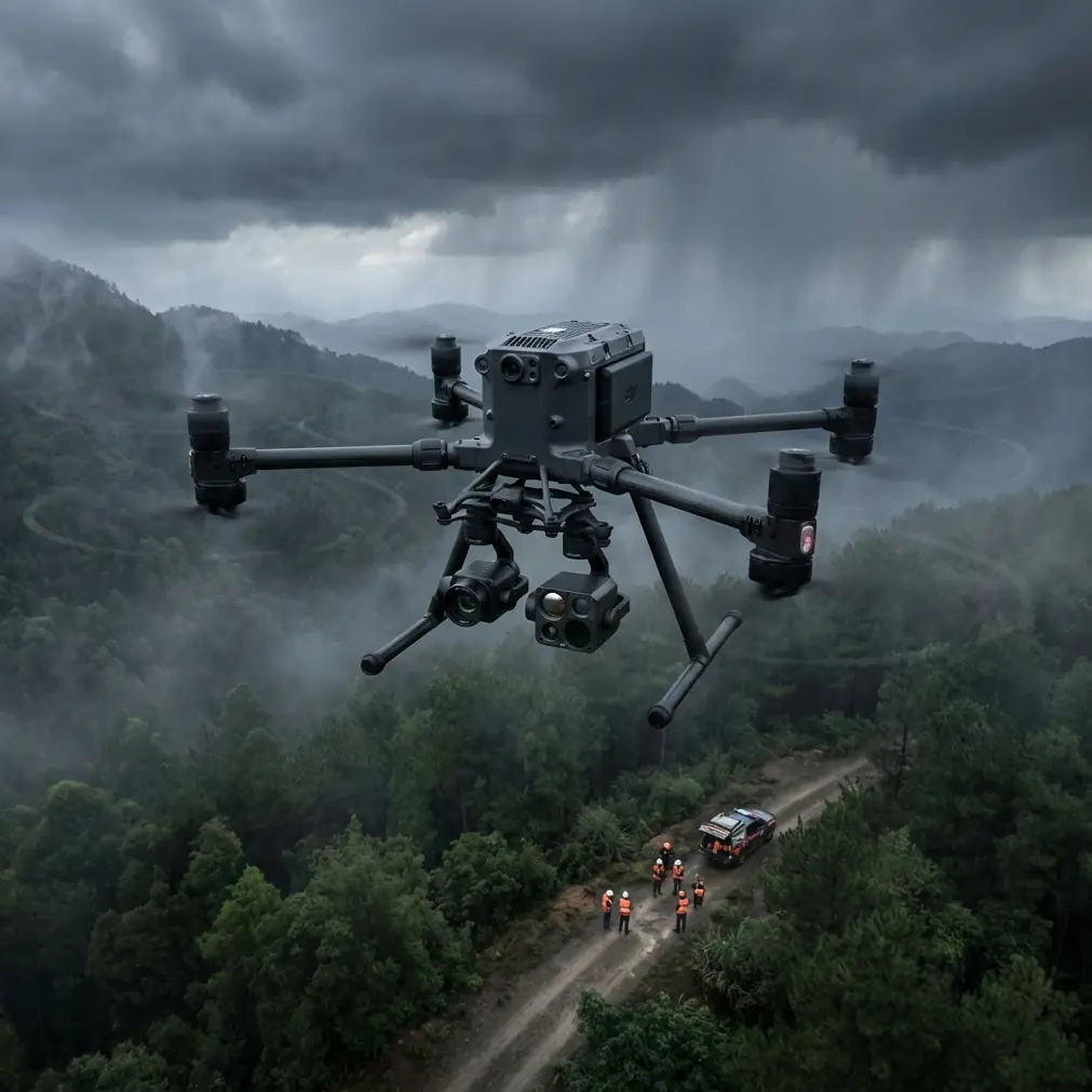
Effective highway monitoring requires strategic payload selection. The Matrice 400 supports simultaneous operation of multiple sensor types.
Primary sensor combinations:
- Zenmuse H20T for combined thermal signature and visual inspection
- Zenmuse P1 for high-resolution photogrammetry mapping
- Zenmuse L1 for LiDAR-based surface analysis
Expert Insight: For comprehensive highway assessment, I configure the H20T as the primary payload during initial survey flights. Thermal signature data reveals subsurface moisture intrusion and structural stress patterns that visual inspection alone cannot detect. Reserve the P1 for detailed photogrammetry passes once you've identified areas requiring closer examination.
Antenna Positioning for Maximum Range in Remote Corridors
This section addresses the most common question I receive from highway monitoring teams. Proper antenna positioning determines whether you maintain reliable control at 15km or lose signal at 8km.
The 45-Degree Optimization Principle
The Matrice 400's O3 transmission system uses directional antennas on both the aircraft and controller. Signal strength depends on maintaining optimal antenna orientation relative to the aircraft position.
Step-by-step antenna positioning protocol:
- Position the controller so antennas point toward your planned flight path
- Angle both antennas at 45 degrees from vertical, creating a V-shape
- Orient the flat faces of the antennas toward the aircraft's operating area
- Avoid crossing antennas or pointing them directly at the ground
- Reposition every 3-5km of linear distance during extended surveys
Terrain Compensation Strategies
Remote highways often traverse challenging terrain that creates signal shadows. Mountain passes, deep cuts, and dense vegetation corridors all degrade transmission quality.
Terrain compensation techniques:
- Deploy portable signal repeaters at 5km intervals for mountainous routes
- Plan flight altitudes 50-100m above terrain to maintain line-of-sight
- Schedule flights during low-humidity conditions for optimal signal propagation
- Use waypoint missions with automatic return triggers at 70% signal strength
Pro Tip: When monitoring highways through canyon sections, position yourself at the highest accessible point rather than road level. I've gained 40% additional range simply by operating from ridgeline pullouts instead of highway shoulders.
Photogrammetry Workflow for Highway Surface Analysis
Accurate photogrammetry requires precise ground control point placement and systematic flight planning. The Matrice 400's RTK capabilities reduce GCP requirements while maintaining survey-grade accuracy.
GCP Deployment Strategy
Ground control points establish the spatial reference framework for your photogrammetry outputs. Highway environments present unique GCP challenges due to traffic flow and linear geometry.
GCP placement guidelines for highways:
| Parameter | Specification | Rationale |
|---|---|---|
| Spacing along corridor | 200-300m | Maintains accuracy across linear distance |
| Lateral offset | 2-3m from pavement edge | Avoids traffic interference |
| Minimum per flight | 5 GCPs | Ensures geometric constraint |
| Target size | 60cm x 60cm | Visible at 120m AGL |
| Survey accuracy | ±2cm horizontal | Matches RTK precision |
Flight Planning Parameters
The Matrice 400 supports automated corridor mapping through DJI Pilot 2. Configure these parameters for optimal highway photogrammetry:
- Flight altitude: 80-120m AGL depending on resolution requirements
- Forward overlap: 80% for dense point cloud generation
- Side overlap: 70% for multi-pass corridor coverage
- Gimbal angle: -90 degrees for nadir imagery, -45 degrees for facade capture
- Speed: 8-12 m/s for sharp image capture
BVLOS Operations for Extended Highway Surveys
Beyond visual line of sight operations unlock the Matrice 400's full potential for highway monitoring. Remote corridors often require 10-15km survey segments that exceed VLOS limitations.
Regulatory Compliance Framework
BVLOS operations require specific authorizations and operational protocols. Work with your aviation authority to establish:
- Airspace coordination agreements with relevant authorities
- Visual observer networks or approved detect-and-avoid systems
- Emergency procedures for communication loss scenarios
- Weather monitoring and abort criteria
Technical Requirements for BVLOS Highway Monitoring
The Matrice 400 supports BVLOS operations through several integrated systems:
Communication redundancy:
- Primary O3 transmission with 20km range
- 4G/LTE backup connectivity where available
- AES-256 encryption for all command and telemetry data
Autonomous safety features:
- Automatic return-to-home at configurable signal thresholds
- Obstacle sensing with 40m detection range
- Redundant IMU and compass systems
- Hot-swap batteries for continuous operations
Thermal Signature Analysis for Pavement Assessment
Thermal imaging reveals highway conditions invisible to standard cameras. The Matrice 400's thermal payload detects temperature differentials indicating structural issues.
Interpreting Thermal Patterns
Different pavement conditions create distinct thermal signatures:
- Moisture intrusion: Cooler spots during daytime heating cycles
- Delamination: Irregular thermal patterns at expansion joints
- Subsurface voids: Rapid temperature changes compared to surrounding areas
- Drainage issues: Linear cool zones indicating water accumulation
Optimal thermal survey timing:
- Morning surveys (2-3 hours after sunrise): Best for moisture detection
- Afternoon surveys (peak heating): Reveals subsurface structural variations
- Evening surveys (cooling phase): Highlights thermal mass differences
Common Mistakes to Avoid
Neglecting antenna orientation during flight: Many operators set antennas correctly at launch, then forget to adjust as the aircraft moves along the corridor. Signal degradation at 8-10km often results from static antenna positioning.
Insufficient overlap in corridor mapping: Linear infrastructure tempts operators to reduce overlap for faster coverage. This creates gaps in photogrammetry reconstruction, particularly at bridge transitions and interchange areas.
Ignoring thermal calibration: Thermal sensors require 15-20 minutes of warmup time for accurate readings. Launching immediately after power-on produces unreliable thermal signature data.
Flying during suboptimal thermal windows: Midday thermal surveys produce washed-out data due to uniform surface heating. Schedule thermal passes during transitional periods for maximum contrast.
Underestimating battery logistics: Hot-swap batteries enable continuous operations, but remote highway locations complicate charging logistics. Plan for three complete battery sets per survey day.
Frequently Asked Questions
What transmission range can I realistically expect for highway monitoring?
In optimal conditions with proper antenna positioning, the Matrice 400 maintains reliable control at 15-18km. Real-world highway environments with terrain interference typically yield 12-15km of practical range. Always plan missions with 30% range margin for safety.
How many GCPs do I need for a 10km highway survey?
For survey-grade photogrammetry accuracy, deploy GCPs at 200-300m intervals along the corridor. A 10km survey requires approximately 35-50 GCPs depending on terrain complexity and accuracy requirements. RTK-equipped Matrice 400 units can reduce this to 15-20 GCPs for control validation.
Can the Matrice 400 detect pavement cracks using thermal imaging?
Thermal imaging detects subsurface conditions rather than surface cracks directly. However, thermal signature variations often indicate crack locations where moisture has penetrated. Combine thermal surveys with high-resolution visual photogrammetry using the P1 payload for comprehensive crack mapping at sub-centimeter resolution.
Ready for your own Matrice 400? Contact our team for expert consultation.