Matrice 400 for Low-Light Solar Farm Monitoring
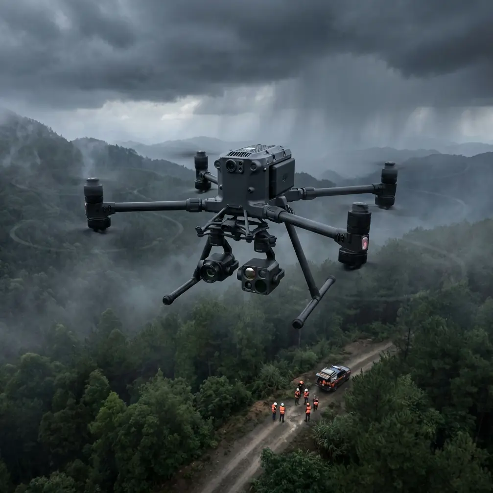
Matrice 400 for Low-Light Solar Farm Monitoring: A Field Case Study
META: Expert case study on how the Matrice 400 improves low-light solar farm inspections with thermal imaging, stable transmission, hot-swap batteries, secure data handling, and survey-grade workflow planning.
Solar farms look orderly from the access road. Long rows, clean geometry, predictable spacing. At sunrise or after dusk, that neatness becomes deceptive. The array is still there, but the useful visual cues flatten out, panel glare changes by the minute, and small thermal irregularities can hide inside a very large site.
That was the problem we kept running into on utility-scale inspections.
A conventional daytime visual pass could catch obvious soiling, cracked modules, vegetation encroachment, or damaged fencing. It could not always tell us which strings were underperforming early, which connectors were heating unevenly, or which inverter zone deserved immediate attention before the morning production curve ramped up. Low-light operations were where the job became more demanding. You needed stable flight, dependable payload data, and enough confidence in the aircraft-link-pilot chain to cover ground efficiently without turning the mission into guesswork.
That is where the Matrice 400 fits the real-world conversation.
This is not about headline features on a spec sheet. It is about whether a large multirotor can reduce friction in a solar O&M workflow when the light is poor, the site is expansive, and the inspection window is narrow.
The operational problem: why low light changes everything
Most people assume solar inspection is easiest under bright sun because the site is visible and easy to navigate. For general visual checks, that is true. For fault isolation, especially when thermal signature is part of the mission, low-light periods can be more revealing. Before full irradiance floods the array, temperature contrasts can present differently across modules, junctions, combiner areas, and cable routes. The challenge is not just detecting heat. It is capturing trustworthy thermal data while maintaining spatial context so the maintenance team can find the exact asset later.
That sounds simple until you scale it.
A large solar farm can contain thousands of modules organized into blocks that look nearly identical from the air. If your thermal image shows an anomaly but your geolocation is loose or your orthomosaic is weak, field crews waste time walking rows to verify the problem. The drone is no longer saving labor; it is just moving uncertainty around.
The Matrice 400 matters here because it supports a workflow, not just a flight.
What changed when we moved to a Matrice 400-based workflow
The first improvement was confidence in the link.
On solar sites, you often deal with long linear corridors, inverter stations, security infrastructure, and subtle terrain undulations that can complicate line-of-sight planning. A robust O3 transmission architecture makes a practical difference because it reduces the number of moments when the pilot starts questioning the feed instead of focusing on the data. That matters most in low light, when visual situational awareness is already less forgiving. Stable transmission is not glamorous, but it is foundational. If the downlink stutters while you are trying to confirm whether a thermal hotspot belongs to a module edge, a connector, or a nearby structural element, your inspection quality drops fast.
The second improvement was battery handling.
On large arrays, flight planning is often a compromise between ideal data capture and the reality of energy management. Hot-swap batteries sound like a convenience feature until you use them in a time-sensitive morning inspection window. Then they become operationally significant. Instead of powering down completely between sorties and losing momentum while crews reset the aircraft, you can turn aircraft cycles faster and preserve your workflow rhythm. Over the course of a multi-sortie inspection across several blocks, that translates into more consistent coverage during the exact low-light conditions you wanted in the first place.
For solar operators, the significance is straightforward: less downtime between flights means more usable data collected before site conditions change.
Thermal work is only useful if the thermal story is clear
Thermal signature interpretation on a solar farm is full of false confidence. A bright area in the image is not automatically a failing component. Angle, emissivity assumptions, residual heat, environmental conditions, and reflected sources can all complicate the read. A capable aircraft does not replace experience, but it does reduce the friction around acquiring clean thermal observations.
In one low-light mission profile, we used the Matrice 400 to cover sequential blocks before first full daylight washed out some of the subtler contrast we wanted to compare. The value was not just that the aircraft flew the route. The value was that it held the mission profile consistently enough for the thermal dataset to remain comparable from block to block.
That consistency is what lets you separate a one-off hot pixel from a pattern worth escalating.
For example, if several panels in the same electrical grouping show similar edge heating, you start thinking beyond isolated module damage. You investigate string-level behavior, connector integrity, or balance issues. If the thermal anomaly appears random and isolated, the maintenance response is different. Good flight execution supports good interpretation.
Where photogrammetry still matters on a thermal mission
A lot of teams treat thermal inspection and photogrammetry as separate jobs. On paper, that seems efficient. In practice, it can create handoff problems.
When we started tying thermal outputs more closely to photogrammetry, the site teams became faster at acting on what we found. A georeferenced visual layer gave technicians a clean map of the exact row, table, and surrounding access conditions. Instead of saying, “There is a hotspot in the northeast quadrant near inverter group three,” we could identify the physical location with much tighter precision.
That is where GCP strategy earns its keep.
Ground control points are not glamorous either, but they are often the difference between a map that looks good and a map that is operationally useful. If you are inspecting a massive solar installation where many strings appear nearly identical from above, even modest positional drift can slow a repair crew down. Building a Matrice 400 workflow that respects GCP placement and survey discipline means your thermal findings can be connected to a photogrammetric base layer that technicians trust.
The practical result is simple: fewer wasted footsteps, fewer misidentified rows, and faster verification in the field.
Security is not a side issue on energy infrastructure
When people discuss drones for solar inspection, they usually talk about sensors, endurance, and automation first. Fair enough. But energy operators also care deeply about how data moves and how access is controlled.
That is why AES-256 has real relevance in this kind of deployment.
A large solar farm is critical commercial infrastructure. Inspection imagery can reveal layout details, equipment locations, and operational conditions that owners do not want casually exposed. If your workflow includes remote collaboration, cloud transfer, or handoff between field and asset management teams, secure data handling is part of the system requirement, not an afterthought. AES-256 matters because it helps align drone operations with the cybersecurity expectations many infrastructure owners already apply to their other digital assets.
This is one of those details that rarely appears in marketing conversations but frequently appears in serious procurement and compliance discussions.
BVLOS changes the planning conversation, not just the flight envelope
BVLOS gets mentioned constantly in industry conversations, often without enough context. On a solar farm, the real significance of beyond visual line of sight is not that it sounds advanced. It is that it changes how you think about site-scale coverage, crew placement, and inspection economics.
Where regulations, waivers, and procedures allow, a Matrice 400 platform suited to BVLOS-style operational planning can reduce unnecessary repositioning across large properties. That means fewer interruptions, cleaner route continuity, and better consistency in your dataset. For low-light inspections, continuity matters because environmental conditions are shifting while you work. Every time you break the mission flow and move crews across a site, you widen the gap between the first area captured and the last.
That can make thermal comparison harder than it needs to be.
The aircraft alone does not solve BVLOS. The operator’s approvals, risk controls, and procedures do. Still, the Matrice 400 belongs in that discussion because it supports the kind of large-site workflow where BVLOS capability can have meaningful value.
A field lesson: the aircraft did not just save time, it reduced ambiguity
The most useful drone improvements are often not dramatic. They reduce ambiguity.
On one recurring solar inspection program, our old challenge was not merely finishing the flights. It was handing over findings that the asset team could convert into action without back-and-forth clarification. We would spot a probable issue, annotate the imagery, and still get follow-up calls asking for tighter location guidance or confirmation that the anomaly was not just a viewing artifact.
With the Matrice 400-centered workflow, those conversations became shorter.
Stable transmission through O3 gave the pilot more confidence to verify the shot in real time rather than guessing and reviewing later. Hot-swap battery handling let us maintain the inspection tempo during the narrow low-light window. Better discipline around photogrammetry and GCP use meant the map products were not just visually impressive but field-usable. And secure handling under AES-256 aligned better with the expectations of energy-sector stakeholders.
None of that is flashy. All of it matters.
That is why I would describe the Matrice 400 less as a new aircraft and more as a friction reducer for serious infrastructure work.
What solar operators should actually evaluate
If you are assessing whether the Matrice 400 is the right fit for low-light solar monitoring, ask questions that reflect the job rather than the brochure.
Can your team move from thermal detection to physical asset identification without confusion?
Can you keep sorties turning quickly enough to exploit the pre-sunrise or dusk window?
Will your link remain reliable enough across the geometry of the site to avoid hesitant flying and incomplete data capture?
Can your visual and thermal outputs be tied into a photogrammetry workflow with GCP support so the findings are actionable?
Does the security architecture meet the expectations of the asset owner?
Those are the issues that decide whether a drone program becomes part of routine O&M or remains an occasional demonstration.
Why this model stands out for the low-light solar niche
The Matrice 400 makes sense in this niche because low-light solar work is not a single-task mission. It is a chain. Aircraft stability affects image reliability. Transmission quality affects pilot confidence. Battery workflow affects how much of the low-light window you can actually use. Geospatial discipline affects whether the maintenance team can locate the fault. Data security affects whether the program is acceptable to the client.
Break any link in that chain and the mission gets weaker.
Get the chain right and the drone becomes something more valuable than a flying camera. It becomes an inspection system.
If you are building or refining a low-light solar farm workflow and want to compare notes on payload setup, route design, or data handoff, you can reach our field team directly on WhatsApp for practical deployment questions.
For me, that is the real story of the Matrice 400. Not hype. Not abstract capability. A better answer to a very specific problem: finding meaningful issues across a large solar site when the light is poor and the maintenance team needs precise, usable information.
Ready for your own Matrice 400? Contact our team for expert consultation.