Scouting Urban Coastlines with the Matrice 400 | Tips
Scouting Urban Coastlines with the Matrice 400 | Tips
META: Learn how to scout urban coastlines with the DJI Matrice 400. Expert tutorial covering thermal signatures, photogrammetry, BVLOS ops, and hot-swap battery workflows.
By James Mitchell, Drone Operations Specialist | 12 min read
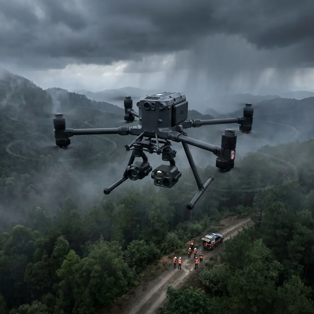
Urban coastline surveys demand a platform that handles salt air, shifting winds, and dense airspace without compromise. The Matrice 400 combines O3 transmission, AES-256 encryption, and hot-swap batteries to keep you flying when coastal conditions turn hostile—and this tutorial walks you through every step of planning, executing, and processing a professional shoreline scouting mission.
TL;DR
- The Matrice 400 is purpose-built for complex urban coastline scouting where reliable transmission, encrypted data, and extended endurance are non-negotiable.
- Hot-swap batteries enable continuous operations across long stretches of shoreline without landing or powering down sensors.
- O3 transmission maintains rock-solid video links even when flying around steel-and-concrete urban structures near the waterfront.
- Thermal signature detection and photogrammetry workflows let you capture both environmental data and centimeter-accurate 3D models in a single sortie.
Why the Matrice 400 Dominates Urban Coastal Operations
Coastlines that border urban environments present a unique collision of challenges. You're contending with electromagnetic interference from buildings, unpredictable thermals rising off concrete waterfronts, marine layer fog, and airspace restrictions that shrink your operational window.
The Matrice 400 was engineered for exactly this kind of complexity. Its IP55-rated airframe resists salt spray, while the O3 transmission system pushes stable, low-latency video feeds through environments saturated with Wi-Fi, cellular, and radio signals bouncing off high-rise structures.
During a recent survey of a harbor breakwater adjacent to a downtown district, our team's Matrice 400 thermal sensor flagged an anomalous thermal signature cluster on a concrete seawall. What appeared to be structural heat retention turned out to be a colony of nesting cormorants tucked into expansion joints—birds completely invisible to the naked eye and the RGB camera. The thermal payload identified them at 120 meters AGL, allowing us to reroute our flight path in real time and avoid disturbing a protected species while still completing the survey. That single sensor capability prevented a potential wildlife compliance violation and saved the project from a costly delay.
This is the kind of situational intelligence the Matrice 400 delivers as a matter of course.
Step 1: Pre-Mission Planning for Urban Coastlines
Airspace and Regulatory Clearance
Urban coastal zones often fall within controlled airspace. Before powering on:
- Check for NOTAM advisories covering port operations, helipad corridors, and military zones.
- File for BVLOS waivers if your shoreline transect exceeds visual line of sight—common on surveys stretching beyond 1.5 km.
- Confirm local municipality drone ordinances; waterfront parks and boardwalks often carry additional restrictions.
- Coordinate with harbor masters if your flight path crosses active shipping channels.
GCP Placement Strategy
Accurate photogrammetry on coastlines requires ground control points (GCPs) placed on stable, non-tidal surfaces. Position GCPs on:
- Concrete piers and jetties above the high-tide line
- Boardwalk intersections with fixed GPS coordinates
- Rooftop corners of waterfront structures (with permission)
Pro Tip: Place a minimum of 5 GCPs per 500-meter transect and survey each with an RTK GNSS receiver. Coastal photogrammetry without properly surveyed GCPs can introduce horizontal errors exceeding 15 cm—unacceptable for erosion monitoring or infrastructure assessment.
Aim for a GCP distribution that avoids clustering along a single axis. Stagger points inland and along the waterline to give your processing software strong geometric constraint in all directions.
Step 2: Configuring the Matrice 400 for Coastal Scouting
Payload Selection
The Matrice 400 supports dual-payload configurations. For urban coastline work, pair:
- A wide-angle RGB camera for photogrammetric mapping and visual documentation
- A radiometric thermal sensor for detecting thermal signatures in infrastructure, wildlife, and stormwater outflows
Transmission and Security Settings
Urban environments are noisy. Configure the O3 transmission system to auto-hop frequencies and maintain link integrity around steel structures and RF-dense waterfronts.
For government or sensitive infrastructure projects, enable AES-256 encryption on all data streams. This ensures that video feeds and telemetry cannot be intercepted—a growing requirement for port authority and municipal contracts.
Battery and Endurance Planning
A typical urban coastline transect of 3–5 km will exceed a single battery cycle. The Matrice 400's hot-swap battery system is critical here:
- Pre-stage 3–4 fully charged battery sets at your launch point
- Assign a dedicated crew member to battery management
- Swap batteries at 30% remaining capacity—never push to single digits in coastal wind conditions
- Log each battery's cycle count; degraded cells lose capacity faster in cold marine air
Step 3: Executing the Coastal Survey Flight
Flight Pattern and Altitude
For photogrammetric accuracy, fly a double-grid pattern at 80 meters AGL with:
- 80% frontal overlap
- 70% side overlap
- Consistent airspeed of 5–7 m/s to minimize motion blur
For thermal scouting, drop to 40–60 meters AGL on a separate pass. Thermal resolution degrades rapidly with altitude, and you need tight pixel pitch to distinguish between a warm stormwater outfall and sun-heated concrete.
Handling Urban Wind Corridors
Buildings flanking a waterfront create wind tunnels that can shift gusts by 15–20 km/h within seconds. The Matrice 400's advanced IMU and GPS fusion stabilization handles this aggressively, but smart piloting still matters:
- Approach tall structures from the windward side
- Avoid hovering in the lee of buildings where rotor-wash turbulence stacks
- Monitor the controller's real-time wind vector display—the O3 system overlays this data directly on the live feed
Expert Insight: Schedule urban coastal flights for 2 hours after sunrise or 2 hours before sunset. Not only do you get lower wind speeds, but the oblique sun angle dramatically improves thermal contrast for detecting subsurface water intrusion in seawalls and breakwaters. Midday sun heats all surfaces uniformly, washing out the subtle thermal signatures you're looking for.
Step 4: Post-Processing and Deliverables
Photogrammetric Processing
Import your geotagged images and GCP data into photogrammetry software. For urban coastline datasets, expect:
- Point cloud densities exceeding 200 points/m² at 80m AGL
- Orthomosaic resolution of approximately 2 cm/pixel
- DSM accuracy within 3–5 cm vertically when GCPs are properly distributed
Thermal Data Analysis
Thermal datasets should be processed with radiometric calibration applied. Key deliverables include:
- Heat maps of seawall and pier infrastructure identifying potential delamination
- Wildlife activity overlays showing nesting zones and haul-out areas
- Stormwater discharge temperature differentials mapped against tidal cycles
Technical Comparison: Matrice 400 vs. Common Coastal Survey Platforms
| Feature | Matrice 400 | Mid-Range Enterprise Drone | Fixed-Wing Mapper |
|---|---|---|---|
| Hot-Swap Batteries | Yes | No | No |
| O3 Transmission Range | 20 km | 8–12 km | 10–15 km |
| AES-256 Encryption | Yes | Varies | Rarely |
| IP Rating | IP55 | IP43–IP45 | IP43 |
| BVLOS Capable | Yes (with waiver) | Limited | Yes |
| Dual Payload Support | Yes | Single only | Fixed sensor |
| Max Wind Resistance | 15 m/s | 10–12 m/s | 14 m/s |
| Hover Precision | ±0.1 m (RTK) | ±0.3–0.5 m | N/A (no hover) |
The Matrice 400 occupies a unique position: it combines the endurance flexibility of hot-swap batteries with the payload versatility that fixed-wing platforms simply cannot offer in tight urban airspace.
Common Mistakes to Avoid
1. Ignoring Salt Corrosion After Flights Coastal operations expose your aircraft to salt-laden air. Wipe down the Matrice 400's motors, gimbal, and battery contacts with a lightly dampened microfiber cloth after every session. Salt crystallization on motor bearings accelerates wear exponentially.
2. Skipping GCP Verification Placing GCPs without post-survey verification introduces silent errors. Always re-occupy at least 2 GCPs with your RTK receiver after the flight to confirm they haven't shifted due to tidal action or foot traffic.
3. Flying a Single Pass for Both RGB and Thermal RGB and thermal sensors require different altitudes, speeds, and overlap settings. Attempting a combined single pass compromises both datasets. Fly dedicated passes for each payload configuration.
4. Underestimating BVLOS Complexity A 3 km coastline transect will take you well beyond visual line of sight. Operating BVLOS without proper waivers, visual observers, or detect-and-avoid protocols risks regulatory action and endangers manned aircraft operating in harbor zones.
5. Neglecting Battery Temperature Management Marine air can be significantly cooler than inland conditions. Cold batteries deliver less power and sag voltage earlier. Pre-warm battery sets to at least 20°C before insertion, and never hot-swap a battery that's been sitting in ocean breeze for over 30 minutes without checking its temperature.
Frequently Asked Questions
Can the Matrice 400 fly safely in coastal fog and light rain?
Yes. The IP55 rating protects the aircraft from water jets and heavy spray. Light rain and marine fog will not compromise flight safety. However, dense fog degrades the RGB camera's utility—switch to thermal-only operations when visibility drops below 500 meters and maintain a lower altitude to preserve your link with the O3 transmission system.
How many hot-swap battery cycles can I perform in a single urban coastline mission?
There is no hard limit on hot-swap cycles per mission. Teams routinely perform 6–8 swaps during extended shoreline surveys covering 5+ km. The key constraint is battery inventory and charging infrastructure. Bring a field charging station and rotate at least 4 battery sets to maintain continuous operations without downtime.
What photogrammetry accuracy can I expect without GCPs along a coastline?
Without GCPs, you're relying solely on the Matrice 400's onboard RTK positioning. This typically yields horizontal accuracy of 2–3 cm and vertical accuracy of 3–5 cm in ideal conditions. However, coastal environments introduce multipath GPS errors from water surface reflections. Adding properly surveyed GCPs tightens vertical accuracy to under 3 cm and eliminates systematic bowl-effect deformation common in long, linear survey corridors.
Ready for your own Matrice 400? Contact our team for expert consultation.