How to Scout Coastal Fields with the Matrice 400
How to Scout Coastal Fields with the Matrice 400
META: Master coastal field scouting with the Matrice 400 drone. Learn expert techniques for thermal imaging, flight planning, and data capture in challenging environments.
TL;DR
- Pre-flight cleaning protocols are essential for coastal operations where salt spray degrades sensors and gimbal mechanisms
- The Matrice 400's O3 transmission system maintains stable connections up to 20km in interference-heavy coastal environments
- Thermal signature analysis combined with RGB imaging reveals crop stress patterns invisible to the naked eye
- Hot-swap batteries enable continuous scouting sessions covering 400+ hectares without returning to base
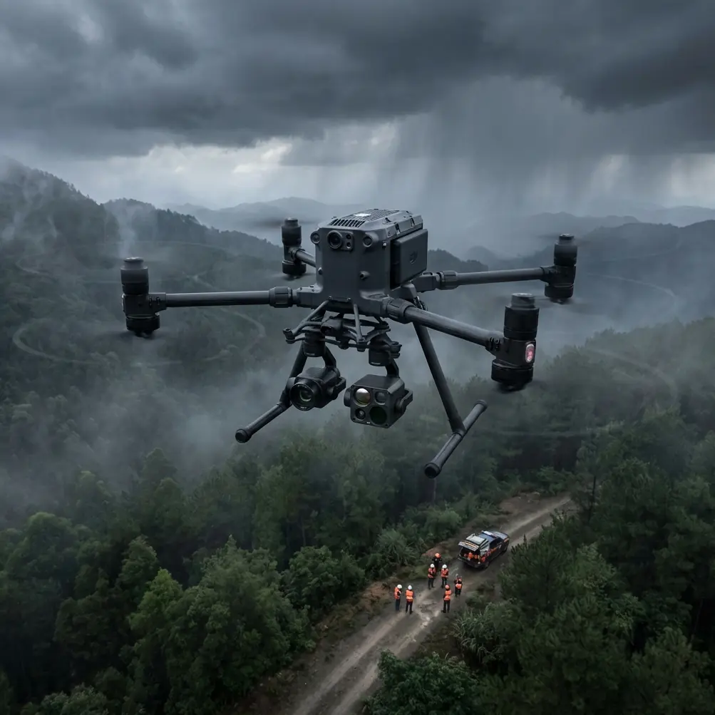
Coastal agricultural operations present unique challenges that ground-based scouting simply cannot address efficiently. The DJI Matrice 400 transforms how agronomists and farm managers assess field conditions in salt-air environments, delivering actionable data through advanced thermal imaging and photogrammetry capabilities. This guide walks you through the complete workflow for maximizing your M400's potential in coastal field scouting applications.
Why Coastal Field Scouting Demands Specialized Drone Solutions
Coastal agricultural zones face environmental pressures that inland farms rarely encounter. Salt intrusion, variable wind patterns, and unique pest populations create a complex monitoring challenge.
The Matrice 400 addresses these challenges with its IP55 weather resistance rating, allowing operations in light rain and high-humidity conditions common to coastal regions. Its robust construction withstands wind speeds up to 12 m/s, maintaining stable flight paths even when sea breezes intensify during midday operations.
Traditional scouting methods require agronomists to physically traverse fields, a time-consuming process that becomes impractical when managing hundreds of hectares across multiple coastal parcels. The M400's aerial perspective compresses days of ground work into hours of efficient flight time.
Pre-Flight Cleaning: Your First Line of Defense
Before discussing flight operations, let's address a critical safety and maintenance step that many operators overlook: pre-flight cleaning protocols for coastal environments.
Expert Insight: Salt crystallization on optical surfaces doesn't just degrade image quality—it creates false readings in thermal sensors that can lead to misdiagnosed crop stress. I've seen operators waste entire growing seasons chasing phantom problems because they neglected lens maintenance.
Essential Cleaning Checklist
Gimbal and Camera Assembly:
- Wipe all optical surfaces with microfiber cloths dampened with distilled water
- Inspect gimbal motors for salt residue accumulation
- Verify rubber seals remain intact and pliable
Propulsion System:
- Check propeller leading edges for salt pitting
- Clean motor ventilation ports with compressed air
- Inspect ESC cooling fins for debris
Sensor Array:
- Clean obstacle avoidance sensors with lens-safe solution
- Verify GPS antenna surfaces are free from contamination
- Test RTK module connections if using GCP workflows
Airframe:
- Wipe down all surfaces to prevent salt migration into internal components
- Check battery compartment contacts for corrosion
- Inspect landing gear for structural integrity
This cleaning routine adds 15-20 minutes to your pre-flight preparation but extends equipment lifespan dramatically in corrosive coastal environments.
Flight Planning for Coastal Field Scouting
Effective coastal scouting begins long before propellers spin. The Matrice 400's DJI Pilot 2 application provides comprehensive mission planning tools optimized for agricultural applications.
Establishing Ground Control Points
Accurate photogrammetry requires precise georeferencing. For coastal fields, deploy GCP markers at:
- Field corners and midpoints along boundaries
- Elevation transition zones where drainage patterns shift
- Areas with known soil composition changes
The M400's RTK positioning system achieves centimeter-level accuracy when properly configured, essential for creating actionable prescription maps.
Optimal Flight Parameters
| Parameter | Recommended Setting | Rationale |
|---|---|---|
| Altitude | 60-80 meters AGL | Balances resolution with coverage efficiency |
| Speed | 8-10 m/s | Prevents motion blur in thermal captures |
| Overlap (Front) | 80% | Ensures seamless orthomosaic generation |
| Overlap (Side) | 70% | Accounts for coastal wind drift |
| Gimbal Angle | -90° (nadir) | Standard for photogrammetry workflows |
| Image Format | RAW + JPEG | Preserves data for post-processing flexibility |
Wind Considerations
Coastal winds follow predictable patterns. Schedule flights during early morning hours when thermal convection remains minimal and sea breezes haven't developed. The M400's flight controller compensates for wind automatically, but calmer conditions yield sharper imagery and extended battery performance.
Thermal Signature Analysis for Crop Health Assessment
The Matrice 400's thermal imaging capabilities reveal plant stress indicators days or weeks before visual symptoms appear. Understanding thermal signature interpretation transforms raw data into actionable intelligence.
Interpreting Thermal Patterns
Healthy vegetation maintains cooler surface temperatures through active transpiration. When plants experience stress—whether from water deficit, nutrient deficiency, or disease pressure—stomatal closure reduces cooling efficiency, creating detectable thermal anomalies.
Key thermal indicators in coastal fields:
- Elevated canopy temperatures in irregular patterns suggest salt intrusion affecting root function
- Linear thermal gradients often indicate drainage issues or buried infrastructure
- Clustered hot spots may reveal pest infestation centers or localized disease outbreak origins
- Uniform temperature elevation across large areas typically points to irrigation system failures
Pro Tip: Capture thermal data during the 10:00-14:00 window when plant stress responses are most pronounced. Morning dew and afternoon shadows create thermal noise that complicates analysis.
Combining Thermal and RGB Data
The M400 supports simultaneous capture from multiple sensors, enabling powerful data fusion workflows. Overlay thermal anomalies on high-resolution RGB imagery to:
- Correlate temperature patterns with visible crop conditions
- Identify specific plant rows or zones requiring ground-truthing
- Create comprehensive field health reports for stakeholders
Data Security and Transmission Protocols
Agricultural data carries significant competitive value. The Matrice 400 implements AES-256 encryption for all transmitted data, protecting proprietary field information from interception.
The O3 transmission system delivers several advantages for coastal operations:
- Triple-channel redundancy maintains links through electromagnetic interference
- Auto-frequency hopping avoids congestion from nearby marine communications
- 20km maximum range supports BVLOS operations where regulations permit
- 1080p/60fps live feed enables real-time decision-making during flights
For operations requiring enhanced security, the M400 supports local data mode, preventing any cloud connectivity during sensitive missions.
Maximizing Coverage with Hot-Swap Batteries
Coastal field scouting often involves multiple parcels spread across significant distances. The Matrice 400's hot-swap battery system eliminates the productivity losses associated with complete shutdowns between flights.
Efficient Battery Management Strategy
Pre-mission preparation:
- Charge all batteries to 100% the night before operations
- Store batteries in climate-controlled containers during transport
- Allow batteries to acclimate to ambient temperature for 30 minutes before use
Field operations:
- Monitor battery temperature during flights; coastal humidity accelerates thermal buildup
- Swap batteries at 25-30% remaining to maintain safe reserves
- Rotate battery pairs to distribute charge cycles evenly
With six fully charged batteries, operators can maintain continuous flight operations for approximately 3 hours, covering extensive coastal acreage in single sessions.
Common Mistakes to Avoid
Neglecting compass calibration in new locations. Coastal areas often contain magnetic anomalies from underground infrastructure or mineral deposits. Calibrate before every session at new sites.
Flying during peak thermal inversion periods. Late afternoon temperature inversions common in coastal zones create false thermal readings. Stick to mid-morning flights for accurate data.
Ignoring salt accumulation between flights. Even brief coastal exposure deposits corrosive residue. Clean equipment after every flight day, not just when visible buildup appears.
Setting insufficient image overlap for windy conditions. Wind drift during capture creates gaps in coverage. Increase overlap settings by 10% beyond inland recommendations.
Forgetting to verify GCP visibility before launch. Vegetation growth can obscure ground control points. Confirm marker visibility from planned altitude before committing to full missions.
Storing equipment in vehicles overnight. Coastal temperature swings create condensation inside sealed cases. Allow equipment to breathe in climate-controlled environments.
Frequently Asked Questions
How does the Matrice 400 handle salt spray during coastal flights?
The M400's IP55 rating provides protection against salt spray and light rain, but this rating assumes proper maintenance. Salt crystallization occurs after exposure, not during flight. The critical protection comes from thorough post-flight cleaning protocols that remove salt residue before it can penetrate seals or corrode contacts. Operators in heavy salt environments should consider protective gimbal covers during transport and storage.
What ground sampling distance should I target for crop health analysis?
For general field scouting and stress detection, a GSD of 2-3 cm/pixel provides sufficient resolution while maintaining efficient coverage rates. This translates to flight altitudes of 60-80 meters with the M400's standard camera configuration. For detailed disease identification or plant counting applications, reduce altitude to achieve sub-centimeter GSD, accepting the tradeoff of reduced area coverage per flight.
Can I conduct BVLOS operations for large coastal farm surveys?
BVLOS capability depends entirely on local regulatory frameworks. The Matrice 400's technical specifications—including 20km O3 transmission range and robust autonomous flight modes—support extended-range operations. However, operators must obtain appropriate waivers or operate within approved BVLOS corridors. Many agricultural regions are developing streamlined approval processes for routine farm surveys. Consult your national aviation authority for current requirements.
Coastal field scouting with the Matrice 400 represents a significant advancement in agricultural monitoring capability. The combination of robust environmental protection, advanced thermal imaging, and efficient workflow tools enables agronomists to gather comprehensive field intelligence regardless of challenging coastal conditions.
Ready for your own Matrice 400? Contact our team for expert consultation.