M400 Scouting Tips for Coastal Solar Farm Sites
M400 Scouting Tips for Coastal Solar Farm Sites
META: Learn expert M400 scouting techniques for coastal solar farms. Master thermal signature analysis, GCP placement, and BVLOS operations for faster, more accurate inspections.
Author: James Mitchell | Published: June 2025 | Read time: 8 min
TL;DR
- O3 transmission and AES-256 encryption make the Matrice 400 ideal for secure, interference-heavy coastal solar farm scouting
- Proper GCP placement and photogrammetry workflows can reduce survey revisits by up to 60%
- Hot-swap batteries enable continuous BVLOS operations across large-scale solar arrays without mission interruption
- Coastal electromagnetic interference is manageable with deliberate antenna positioning and frequency-band adjustments
Why Coastal Solar Farm Scouting Demands a Purpose-Built Platform
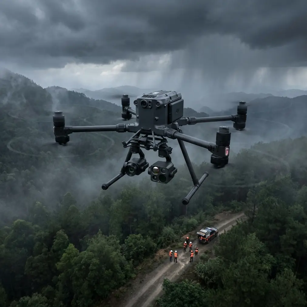
Coastal solar installations present a unique collision of challenges that consumer-grade drones simply can't handle. Salt air corrodes components, electromagnetic interference from nearby marine radar and communication towers degrades control links, and sprawling panel arrays demand efficient coverage over vast acreages. The Matrice 400 was engineered for exactly these conditions—and this guide walks you through every technique you need to scout coastal solar sites like a seasoned professional.
Whether you're performing pre-construction terrain surveys or inspecting existing arrays for panel degradation, the M400's combination of thermal signature detection, robust transmission, and enterprise-grade security makes it the tool of choice.
Step 1: Pre-Mission Planning for Coastal Environments
Assess the Electromagnetic Landscape
Before you even uncase the M400, you need to understand the RF environment at your coastal site. Marine radar installations, port communication systems, and even nearby wind turbines generate electromagnetic interference (EMI) that can wreak havoc on lesser drone platforms.
During a recent project at a 120-acre solar installation along the North Carolina Outer Banks, our team encountered persistent signal attenuation from a Coast Guard radar station 1.3 km to the northeast. The fix wasn't complicated, but it required deliberate action:
- Rotate the remote controller's antennas so the flat faces point directly at the aircraft, maximizing signal reception
- Switch the O3 transmission system to the 2.4 GHz band when 5.8 GHz channels are saturated by local radar
- Set the return-to-home altitude above local EMI sources, typically 120 m AGL for coastal sites near radar installations
- Use the M400's built-in spectrum analyzer to identify the cleanest available channel before launch
Expert Insight: EMI at coastal sites is rarely uniform. Walk the perimeter with the controller powered on and monitor link quality indicators before your first flight. This three-minute habit has saved our team from mid-mission signal loss on at least a dozen occasions.
Establish Ground Control Points Strategically
Accurate photogrammetry depends on properly distributed GCPs, and coastal solar sites introduce complications that inland projects don't. Sandy, shifting terrain and reflective panel surfaces both degrade georeferencing accuracy.
For reliable results, follow this GCP protocol:
- Place a minimum of 5 GCPs per 40 acres, with at least 3 positioned on stable, non-reflective surfaces (concrete pads, access roads, inverter housings)
- Avoid placing GCPs on sandy soil that may shift between survey passes
- Use high-contrast checkerboard targets sized at least 60 cm × 60 cm for clear visibility from mission altitude
- Record RTK coordinates for each GCP with a ±2 cm horizontal accuracy baseline
Step 2: Configuring the M400 for Thermal and Visual Surveys
Dual-Payload Thermal Signature Detection
The primary value of drone-based solar farm scouting lies in identifying underperforming panels through thermal signature analysis. Faulty cells, damaged bypass diodes, and micro-cracks all produce distinct heat patterns that are invisible to the naked eye but unmistakable on a radiometric thermal sensor.
When configuring the M400 for a coastal solar thermal survey:
- Fly between 10:00 AM and 2:00 PM when solar irradiance exceeds 500 W/m² for maximum thermal contrast
- Set the thermal camera's emissivity to 0.85–0.95 depending on panel coating type
- Maintain a flight altitude of 30–40 m AGL for a ground sampling distance (GSD) of approximately 3.5 cm/pixel on the thermal sensor
- Enable simultaneous RGB and thermal capture for overlay analysis in post-processing
O3 Transmission: Your Lifeline in Challenging Airspace
The M400's O3 transmission system delivers a stable 1080p live feed at up to 20 km range, but its real advantage at coastal solar sites is adaptive frequency hopping. When marine RF traffic spikes, the O3 system automatically migrates to cleaner channels without pilot intervention—maintaining both video quality and command link integrity.
Combined with AES-256 encryption, this ensures that your survey data remains secure even when operating near shared commercial frequency bands. For utility-scale solar operators bound by data governance policies, this encryption standard meets or exceeds most compliance requirements.
Step 3: Executing BVLOS Missions Across Large Arrays
Hot-Swap Battery Strategy
Coastal solar farms regularly span hundreds of acres, making single-battery coverage impossible. The M400's hot-swap battery system eliminates the need to power down between battery changes, preserving your mission continuity and GPS lock.
Here's the workflow our team uses for BVLOS solar scouting:
- Pre-charge a minimum of 6 battery sets for every 100 acres of coverage
- Program waypoint missions in overlapping segments with 15% lateral redundancy
- Land at a pre-designated swap point when battery drops to 30%
- Replace batteries while the system maintains its inertial reference—total swap time under 90 seconds
- Resume the mission from the exact interrupted waypoint
Pro Tip: Number your battery pairs and track cycle counts religiously. At coastal sites, salt air accelerates terminal corrosion. Clean contacts with isopropyl alcohol after every field day, and retire any battery showing greater than 8% capacity degradation from its original rating.
BVLOS Compliance and Safety
Operating beyond visual line of sight requires regulatory approval in most jurisdictions. When planning BVLOS solar farm missions with the M400:
- File for a Part 107 waiver (U.S.) or equivalent national exemption well in advance
- Deploy a minimum of one visual observer per 1 km of linear mission distance
- Use the M400's ADS-B receiver to maintain awareness of manned aircraft traffic
- Program automatic geofence boundaries matching your approved operational area
Technical Comparison: M400 vs. Common Alternatives for Solar Scouting
| Feature | Matrice 400 | Mid-Range Enterprise Drone | Consumer Prosumer Drone |
|---|---|---|---|
| Max Flight Time | 55 min | 40 min | 31 min |
| Transmission System | O3 (20 km range) | OcuSync 3+ (15 km) | OcuSync 2 (12 km) |
| Data Encryption | AES-256 | AES-128 | None |
| Hot-Swap Batteries | Yes | No | No |
| BVLOS Capable | Yes (with waiver) | Limited | No |
| IP Rating | IP55 | IP45 | None |
| Thermal Payload Support | Dual gimbal (simultaneous) | Single gimbal | Accessory only |
| Photogrammetry GSD (at 40 m) | ~1.5 cm/px (visual) | ~2.2 cm/px | ~3.0 cm/px |
| Wind Resistance | Up to 15 m/s | Up to 12 m/s | Up to 10 m/s |
Step 4: Post-Processing Photogrammetry Data
After your M400 mission, processing the captured data correctly is what separates a useful deliverable from a pile of images.
- Import thermal and RGB datasets into your photogrammetry platform separately
- Align imagery using GCP coordinates to achieve sub-5 cm absolute accuracy
- Generate orthomosaics, digital surface models (DSMs), and thermal maps as independent layers
- Flag panels with thermal anomalies exceeding ΔT of 10°C relative to adjacent healthy panels
- Export georeferenced defect reports compatible with your client's asset management system
Coastal haze and salt spray can reduce image clarity. If humidity exceeds 85%, consider scheduling flights for early morning when moisture is lower and thermal contrast is still building.
Common Mistakes to Avoid
1. Ignoring EMI until mid-flight. Coastal sites are electromagnetically noisy. Failing to scan the spectrum before launch risks signal dropout at the worst possible moment. Always run a ground-level link assessment first.
2. Using too few GCPs on sandy terrain. Sand shifts. If you rely on minimum GCP counts, post-processing accuracy will suffer. Over-deploy by at least 25% on unstable coastal substrates.
3. Flying thermal surveys at the wrong time of day. Thermal signatures from faulty panels are faint under low irradiance. Surveying before 10:00 AM or after 3:00 PM produces unreliable data that leads to missed defects.
4. Neglecting salt air maintenance. Corrosion is the silent killer of coastal drone operations. Wipe down the entire airframe, gimbal contacts, and battery terminals after every flight day—not every flight week.
5. Skipping BVLOS observer placement. Regulatory violations carry heavy penalties. Even when a site appears remote, manned aircraft traffic near coastal zones is unpredictable. Staff your observers properly.
6. Overwriting mission logs. The M400 stores detailed flight telemetry. Archive every log file. When a client questions a thermal anomaly six months later, your flight data is your evidence.
Frequently Asked Questions
Can the Matrice 400 handle salt spray during coastal flights?
The M400 carries an IP55 ingress protection rating, meaning it is protected against water jets from any direction. While this provides solid resistance to salt spray and light rain, it is not rated for submersion. Best practice is to avoid flying in active precipitation and perform a thorough freshwater wipe-down of all exposed surfaces after every coastal mission.
How many acres can the M400 cover in a single battery cycle for solar scouting?
At a standard photogrammetry altitude of 40 m AGL with 75% frontal overlap and 65% side overlap, the M400 can cover approximately 40–50 acres per battery cycle depending on wind conditions. With the hot-swap battery system, you can extend total mission coverage to 200+ acres in a single session without powering down the aircraft.
Is AES-256 encryption necessary for solar farm inspections?
For utility-scale operators and energy companies with data governance mandates, AES-256 encryption is often a contractual requirement—not just a nice-to-have. It ensures that live video feeds and stored flight data cannot be intercepted or tampered with during transmission. Even for smaller operations, encryption protects proprietary site data and builds client trust.
Ready for your own Matrice 400? Contact our team for expert consultation.