Matrice 400 Guide: Precision Vineyard Scouting
Matrice 400 Guide: Precision Vineyard Scouting
META: Discover how the DJI Matrice 400 transforms vineyard scouting with thermal imaging, photogrammetry, and extended flight time for complex terrain mapping.
TL;DR
- Thermal signature detection identifies irrigation issues and vine stress before visible symptoms appear
- 45-minute flight endurance covers up to 200 acres per battery cycle in rolling vineyard terrain
- O3 transmission maintains stable video feed through hillside interference and dense canopy
- RTK positioning achieves 1cm accuracy for precise GCP-free photogrammetry workflows
Vineyard managers lose thousands annually to undetected irrigation failures and vine disease. The DJI Matrice 400 combines thermal imaging with enterprise-grade flight performance to identify problems weeks before they become visible—here's how to deploy it effectively across challenging terrain.
Why Traditional Vineyard Scouting Falls Short
Walking rows takes time. A 100-acre vineyard requires approximately 40 hours of manual inspection per season. Ground-based observation misses early-stage stress indicators hidden beneath canopy cover.
Satellite imagery offers broad coverage but lacks the resolution needed for individual vine assessment. Cloud cover delays data acquisition. Revisit rates of 5-7 days mean problems escalate before detection.
The Matrice 400 bridges this gap with on-demand, high-resolution aerial data collection that penetrates canopy layers and captures thermal signatures invisible to the human eye.
Matrice 400 Specifications for Agricultural Operations
Understanding the platform's capabilities helps optimize mission planning for vineyard environments.
Flight Performance
The Matrice 400 delivers 45 minutes of hover time under ideal conditions. Real-world vineyard operations—accounting for wind, terrain following, and payload weight—typically yield 38-42 minutes of productive flight time.
Maximum wind resistance reaches 12 m/s, enabling operations during moderate afternoon breezes common in wine-growing regions. The aircraft maintains stable positioning even when transitioning between sheltered valleys and exposed ridgelines.
Transmission and Control
O3 transmission technology provides 20km maximum range with 1080p/60fps live feed quality. More importantly for vineyard work, the system maintains connection through terrain obstacles that would disrupt conventional transmission.
Dual-operator mode allows one pilot to focus on flight safety while a viticulturist controls camera positioning and captures specific areas of concern. This workflow dramatically improves data quality during complex inspections.
Payload Compatibility
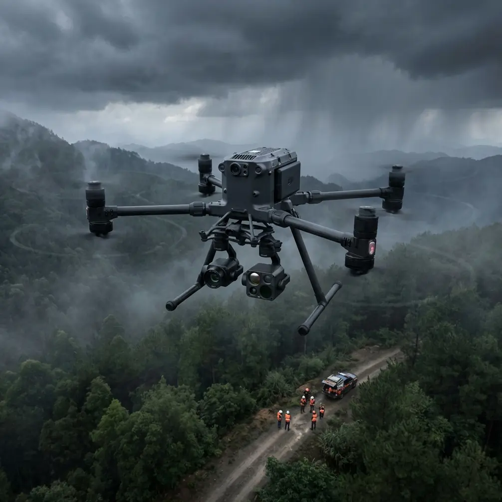
The Matrice 400 supports multiple sensor configurations:
- Zenmuse H30T – Thermal, wide, zoom, and laser rangefinder
- Zenmuse P1 – Full-frame photogrammetry camera
- Zenmuse L2 – LiDAR for canopy structure analysis
- Third-party multispectral sensors via payload SDK
Expert Insight: After three seasons of vineyard mapping, I've found the H30T's thermal sensor most valuable during pre-dawn flights when temperature differentials between healthy and stressed vines reach maximum contrast. Schedule thermal missions for 2 hours before sunrise when ground temperature stabilization creates clearest signatures.
Mission Planning for Complex Vineyard Terrain
Effective vineyard scouting requires adapting standard mapping workflows to account for elevation changes, row orientation, and canopy density.
Terrain Following Configuration
Vineyards planted on hillsides present unique challenges. The Matrice 400's terrain following maintains consistent Above Ground Level (AGL) altitude using onboard sensors and imported Digital Elevation Models.
Configure terrain following with these parameters:
- AGL altitude: 30-40m for thermal, 60-80m for RGB mapping
- Terrain following sensitivity: High for slopes exceeding 15%
- Obstacle avoidance: Enable lateral sensors for trellis detection
- Speed: 5-7 m/s for thermal, 8-10 m/s for photogrammetry
Flight Pattern Optimization
Row orientation affects data quality. Flying perpendicular to vine rows captures maximum canopy information but creates more complex flight paths on contoured terrain.
For initial stress detection, fly parallel to rows at 40m AGL with 80% front overlap and 70% side overlap. This configuration captures inter-row areas where irrigation issues first manifest.
GCP Placement Strategy
While RTK positioning enables GCP-free workflows, strategic ground control point placement improves absolute accuracy for multi-temporal analysis.
Place GCPs at:
- Vineyard corners and block boundaries
- Elevation high points and low points
- Permanent infrastructure (posts, irrigation valves)
- Minimum 5 points per 50-acre block
Pro Tip: Paint GCP targets directly onto concrete irrigation valve covers. These permanent markers eliminate setup time and ensure consistent positioning across seasons. Use high-contrast colors visible in both RGB and thermal imagery.
Thermal Imaging for Vine Health Assessment
Thermal signature analysis reveals subsurface conditions invisible to standard cameras.
Irrigation System Monitoring
Drip irrigation failures create localized temperature anomalies. Blocked emitters produce warmer vine signatures as water stress develops. Leaking lines create cooler soil temperatures detectable before surface moisture appears.
The H30T thermal sensor's 640×512 resolution and 40° field of view captures individual vine thermal profiles from 30m AGL. Process thermal data using radiometric calibration to convert pixel values to absolute temperatures.
Disease Detection Applications
Certain vine diseases alter leaf transpiration rates, creating thermal signatures 2-5 days before visible symptoms. Leafroll virus, powdery mildew, and trunk diseases all produce detectable thermal anomalies.
Establish baseline thermal maps during healthy growth periods. Compare subsequent flights against baseline data to identify emerging problem areas.
Water Stress Mapping
Crop Water Stress Index (CWSI) calculations require thermal data combined with ambient temperature and humidity measurements. The Matrice 400's onboard environmental sensors provide necessary atmospheric data for accurate CWSI computation.
Photogrammetry Workflow for Vineyard Mapping
High-resolution orthomosaics and 3D models support precision viticulture decision-making.
Camera Settings for Vine Canopy
Configure the Zenmuse P1 for optimal vineyard imagery:
- Shutter speed: 1/1000s minimum to eliminate motion blur
- Aperture: f/5.6-f/8 for maximum sharpness
- ISO: Auto with 400 maximum
- Focus: Infinity lock
- Interval: Distance-based triggering at 80% overlap
Processing Considerations
Vineyard canopy creates challenging photogrammetry conditions. Repetitive row patterns confuse feature matching algorithms. Shadows between rows reduce tie point density.
Improve processing success with:
- Higher overlap: 85% front, 75% side minimum
- Cross-grid flights: Two perpendicular passes
- Optimal lighting: Overcast conditions or solar noon
- GCP distribution: Minimum 1 per 10 acres
Technical Comparison: Matrice 400 vs. Alternative Platforms
| Feature | Matrice 400 | Matrice 350 RTK | Phantom 4 RTK |
|---|---|---|---|
| Flight Time | 45 min | 41 min | 30 min |
| Max Payload | 2.7 kg | 2.7 kg | Fixed camera |
| Wind Resistance | 12 m/s | 12 m/s | 10 m/s |
| Transmission Range | 20 km | 20 km | 7 km |
| Hot-swap Batteries | Yes | No | No |
| IP Rating | IP55 | IP45 | None |
| Dual Operator | Yes | Yes | No |
| AES-256 Encryption | Yes | Yes | Limited |
| BVLOS Capability | Enhanced | Standard | Limited |
The Matrice 400's hot-swap battery system deserves special attention for vineyard operations covering large acreage.
Battery Management for Extended Operations
Efficient battery handling maximizes daily coverage and extends equipment lifespan.
Hot-Swap Procedure
The Matrice 400 supports single-battery flight, enabling mid-mission battery replacement without landing. This capability proves invaluable when mapping large vineyard blocks.
Execute hot-swap operations:
- Reduce altitude to 15m AGL over clear area
- Engage hover mode with GPS lock confirmed
- Remove depleted battery from accessible bay
- Insert charged battery within 90 seconds
- Verify connection and resume mission
Expert Insight: I learned this the hard way during a 300-acre mapping project—always mark your hot-swap location on the controller before removing the first battery. Disorientation during the swap procedure caused me to lose my reference point, resulting in duplicate coverage of some areas and gaps in others. Now I drop a waypoint pin before every swap.
Charging Infrastructure
Field charging requires planning. Each TB65 battery needs 70 minutes for full charge using the BS65 charging station.
For full-day operations, maintain:
- 8 batteries minimum for continuous flying
- 2 charging stations for rotation efficiency
- Generator capacity: 2000W minimum for dual chargers
- Shade structure to prevent thermal throttling
Storage and Transport
Lithium batteries require careful handling in vineyard environments where temperatures fluctuate significantly.
- Store batteries at 40-60% charge for transport
- Avoid vehicle storage above 45°C
- Allow batteries to reach ambient temperature before charging
- Inspect for swelling or damage after rough terrain transport
Common Mistakes to Avoid
Flying Too High for Thermal Detection
Thermal resolution degrades rapidly with altitude. Flying at 80m AGL for faster coverage reduces individual vine detection capability. Maintain 30-40m AGL for actionable thermal data, accepting longer flight times.
Ignoring Solar Angle Effects
Morning shadows create false thermal signatures as shaded vines appear cooler than sun-exposed neighbors. Schedule thermal flights during consistent lighting—either pre-dawn or midday when shadows minimize.
Skipping Pre-Flight Calibration
The H30T thermal sensor requires flat-field calibration before each flight. Skipping this step introduces measurement errors that compound across large datasets. Allow 3 minutes for proper thermal stabilization.
Underestimating Data Storage Requirements
A single vineyard mapping flight generates 15-25GB of imagery. Thermal video adds another 8-12GB per flight. Bring sufficient SD cards and portable storage for multi-day operations.
Neglecting Airspace Verification
Wine regions often overlap with agricultural aviation zones. Crop dusters operate at low altitudes with limited visibility. Verify NOTAM status and coordinate with local operators before each flight day.
Frequently Asked Questions
What flight altitude provides the best balance between coverage and resolution for vineyard thermal imaging?
For individual vine stress detection, maintain 30-35m AGL with the H30T sensor. This altitude produces 3.5cm/pixel thermal resolution sufficient for identifying single-vine anomalies while covering approximately 8 acres per battery. Higher altitudes improve efficiency but reduce detection sensitivity for early-stage problems.
How does the Matrice 400 handle connectivity in hilly vineyard terrain with limited cellular coverage?
The O3 transmission system operates independently of cellular networks, maintaining direct aircraft-to-controller communication. The system's 20km range and multi-path signal processing handle terrain obstacles effectively. For BVLOS operations requiring network connectivity, the aircraft supports 4G LTE dongles, though coverage remains dependent on local infrastructure.
Can the Matrice 400 operate effectively during harvest season when vineyard activity increases?
Yes, with proper coordination. The aircraft's IP55 rating protects against dust generated by harvest equipment. Schedule flights during early morning before harvest crews begin or during midday breaks. The quiet operation at 30m AGL causes minimal disturbance to ground workers. Communicate flight plans with vineyard management to avoid conflicts with picking schedules.
Precision vineyard management demands reliable aerial data collection across challenging terrain. The Matrice 400 delivers the flight performance, sensor flexibility, and operational durability that commercial viticulture operations require.
Ready for your own Matrice 400? Contact our team for expert consultation.