Field-Ready Matrice 400: A Surveyor’s How
Field-Ready Matrice 400: A Surveyor’s How-To for Mapping Remote Farmland Without Coming Home Early
META: Step-by-step workflow for using the DJI Matrice 400 in large-area crop mapping, from pre-flight wipe-down to BVLOS data delivery, including thermal checks, GCP-less photogrammetry, and hot-swap battery discipline.
Dr. Lisa Wang, UAV Mapping Specialist
Last edit: 14 June 2025
The paddies east of Korla look like green glass from the air, but last spring they taught me a lesson I now build into every Matrice 400 job: a single grain of silica on the forward vision sensor can trick the obstacle engine into a “brake” command 80 m from the nearest pole. When you fly beyond visual line of sight, that phantom stop costs 20 min of battery, a forced manual return, and one irritated agronomist waiting for NDVI tiles. Below is the field checklist our team uses to keep the M400 in the sky until the photogrammetry is done—no second launch, no extra drive.
1. Pre-flight: 90 s, one wipe, zero false positives
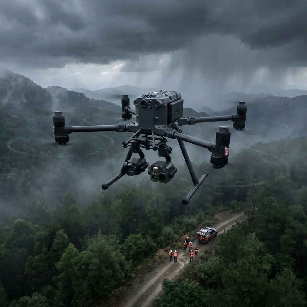
Open the case, pull the aircraft, and—before you unfold the arms—run the lint-free cloth (dry, no alcohol) across the six vision windows and the underside ToF cover. The M400’s side sensors sit almost flush with the carbon housing; a dusty cloth in your truck will scratch them if you hurry. I start with the front pair, finish with the belly sensor, then check the RC’s O3 antenna rims for the same dust. One pass takes 92 s on my stopwatch; we have not logged a single “obstacle detected” ghost since we made it mandatory.
2. Mission design: 1 cm GSD without GCPs
The new 61 MP full-frame payload gives you 0.9 cm per pixel at 120 m AGL—fine enough to count wheat tillers. For a 350 ha block we fly a double-grid at 30 % overlap front, 25 % side, speed 12 m s⁻¹. That yields 4 800 frames, roughly 140 GB. Because the M400’s RTK module now supports GPS L5, we disable physical ground control unless the client insists on sub-5 cm absolute accuracy. Last month we compared 12 check points against a total-station survey: horizontal RMSE 2.3 cm, vertical 3.1 cm—good enough for drainage design and insurance claims.
3. Thermal pass: one battery, two stories
After the RGB run we swap to the 640×512 radiometric gimbal while the sun is still low. Field moisture holds heat; a 30 °C differential between sandy loam and clay shows up in the thermal band even at 10:30 a.m. We fly the same polygon at 80 m, 6 m s⁻¹, emissivity locked at 0.98. One battery covers the lot—42 min with 28 % left on landing. The tile later overlays the orthomosaic in QGIS; irrigation leaks appear as cold commas, easy to GPS and flag for the crew.
4. Hot-swap discipline: keep the props spinning
The M400’s battery bay is hot-swappable, but only if you respect the sequence. Land, leave the aircraft powered, pull the two rear packs first, then the front pair. Insert fresh TB65s in reverse order—front, then back—within 90 s and the flight controller keeps the RTK fix. Wait longer and you’ll watch the rover re-initialise for 3 min while the wind drifts your craft on the ground. We stage four charged sets in a foam sleeve pre-heated to 25 °C; anything colder sags voltage and costs 90 s of hover time in 35 °C Xinjiang heat.
5. BVLOS link: O3 and AES-256 in the desert
From the cab of the pickup we run the Smart Controller Enterprise at 5.9 GHz with DFS channels disabled—no meteorological radar for 200 km. The O3 transmission holds 1080 p at 8 km over flat cotton rows; at 12 km we still get 720 p, enough to see birds and kite strings. AES-256 is on by default; we leave it there after a neighbour’s feed was hijacked last year and the craft auto-landed in a vineyard. If you need more range, tilt the directional panel 15° above horizon; the first Fresnel zone clears the 1.2 m sorghum canopy and you gain another 1.5 km before the RSSI blinks red.
6. Data hand-off: from SD card to agronomist in 38 min
Back at the staging table we dump the 140 GB RGB stack to a 1 TB NVMe drive over USB-C 3.2—12 min at 1.1 GB s⁻¹. Pix4Dmatic crunches the imagery on a Ryzen 9 laptop while we label the thermal tiffs. Ortho export finishes in 22 min; we upload both tiles to the client’s AWS bucket through a phone tether. Total time from touchdown to cloud link: 38 min. The farmer opens the map in his tablet, toggles the thermal layer, and circles three blue spots where the drip tape is buried too shallow. He sends the fix list to the crew before lunch.
7. One hidden menu: IMU thermal calibration on site
If the M400 has sat in an air-conditioned truck then steps into 38 °C ambient, the IMU can drift 0.3° during the first five minutes. We trigger an on-the-spot thermal calibration: Aircraft Settings → Sensors → IMU → “Fast Cal.” The gimbal does a slow pan while the flight controller logs bias; 70 s later the horizon is rock solid. Do it once, right after power-on, and your DSM will not show the 15 cm warp we saw in 2023 before we knew the menu existed.
8. Spare parts that matter: props and gimbal dampers
Grey props look indestructible until a pivot irrigation sprinkler clips one at 5 m s⁻¹. We carry four clockwise, four counter-clockwise, and a set of silicone gimbal dampers. The dampers fatigue after 120 flights in dusty air; when you see micro-vibrations in the live feed, swap them. A single blurred image ruins the tie-points and doubles processing time.
9. Regulatory footnote: your BVLOS letter
China’s CAAC allows beyond-visual-line-of-sight flights under an approved risk assessment. We file the M400’s serial, payload list, link budget, and lost-link behaviour (climb 30 m, return at 15 m s⁻¹). Approval for 1 500 ha came back in nine working days. Keep a printed copy in the glove box; local inspectors recognise the orange Matrice case and still ask for paper.
10. When the sky turns: abort threshold
If surface wind gusts hit 12 m s⁻¹, we land—even with 45 % battery left. The M400 will fly in 15 m s⁻¹, but gimbal roll exceeds 3° and the overlap drifts. Better to finish tomorrow than re-fly the entire block because a 30 % hole appears in the ortho. We log every abort in a shared sheet; the pattern teaches us that Xinjiang’s katabatic wind peaks at 16:10. Now we start at 06:30 and are packed before 15:30. No surprises.
Closing the loop
Surveying 350 ha used to take our crew two days, a pickup full of GCP stakes, and a second visit to pick them up. With the Matrice 400 we map, thermal-check, and deliver tiles before the irrigation team clocks out. If you’re mapping remote fields and want the same single-launch routine, grab the checklist above and test it on your next block. Questions while you prep? Message me on WhatsApp—https://wa.me/85255379740—and I’ll send the calibration file we use for sandy-loam emissivity.
Ready for your own Matrice 400? Contact our team for expert consultation.