Surveying Highways at High Altitude with M400 | Expert Tips
Surveying Highways at High Altitude with M400 | Expert Tips
META: Learn how the DJI Matrice 400 transforms high-altitude highway surveying with thermal imaging, O3 transmission, and precision photogrammetry techniques.
TL;DR
- Matrice 400 operates reliably at altitudes up to 7,000 meters, making it ideal for mountain highway corridor surveys
- O3 transmission maintains stable control up to 20 kilometers, critical for BVLOS highway inspection operations
- Hot-swap batteries enable continuous surveying without powering down sensitive photogrammetry equipment
- AES-256 encryption protects survey data from interception during transmission over remote infrastructure
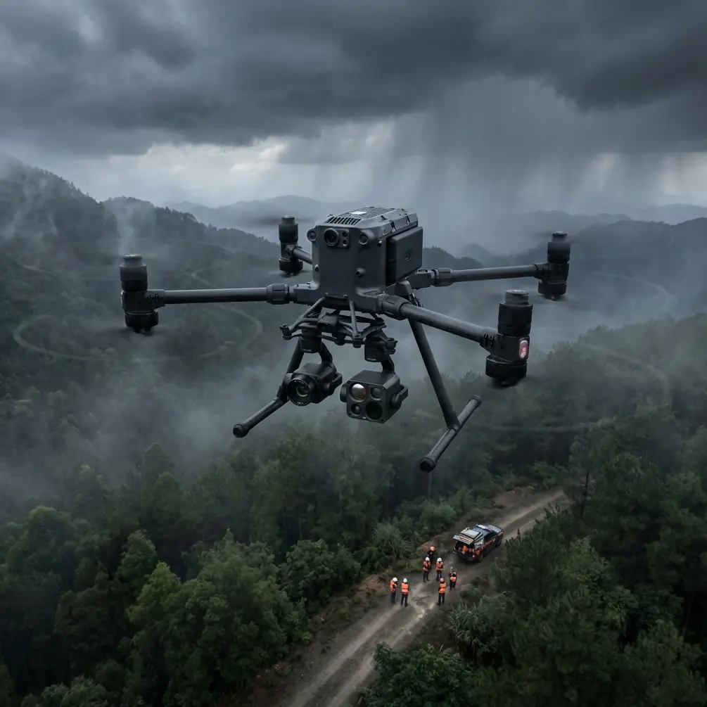
High-altitude highway surveying presents unique challenges that ground-based methods simply cannot address. The DJI Matrice 400 solves critical problems in mountain corridor mapping—from electromagnetic interference near power infrastructure to rapid weather changes that demand operational flexibility.
This case study examines a 47-kilometer highway survey project conducted at elevations between 3,200 and 4,100 meters in challenging terrain, demonstrating practical techniques for maximizing data quality while managing the M400's advanced systems.
The High-Altitude Highway Survey Challenge
Mountain highways present a convergence of surveying difficulties. Steep terrain creates GPS shadow zones. Thin air reduces lift efficiency. Temperature swings affect battery performance. And electromagnetic interference from parallel power transmission lines corrupts positioning data.
Traditional surveying methods require extensive ground crew deployment, often taking weeks to cover distances a drone can map in days. The Matrice 400's enterprise-grade capabilities address each limitation systematically.
Project Parameters and Objectives
The survey covered a newly constructed highway segment requiring:
- Centerline verification against design specifications
- Cut-and-fill volume calculations for contractor payment certification
- Drainage structure documentation including culvert positioning
- Retaining wall condition assessment using thermal signature analysis
Ground control point (GCP) placement proved particularly challenging. Survey teams established 23 GCPs across the corridor, spacing them at approximately 2-kilometer intervals with additional points at major structures.
Expert Insight: At altitudes above 3,000 meters, GCP accuracy becomes even more critical. We used RTK-corrected positions with horizontal accuracy of 8mm and vertical accuracy of 15mm to compensate for reduced GPS satellite geometry common in mountain valleys.
Managing Electromagnetic Interference with Antenna Adjustment
The highway corridor paralleled a 500kV transmission line for approximately 12 kilometers—a significant source of electromagnetic interference that threatened both control link stability and compass calibration.
Standard operating procedures failed during initial flights. The M400's compass showed deviation errors exceeding 15 degrees when flying within 200 meters of the transmission towers. Control link dropouts occurred unpredictably.
The Antenna Positioning Solution
The Matrice 400's O3 transmission system uses directional antennas on the remote controller. By adjusting antenna orientation relative to the interference source, we recovered reliable operation.
Key adjustments included:
- Positioning antennas perpendicular to transmission lines rather than parallel
- Maintaining antenna elevation angle between 45-60 degrees during flights near towers
- Selecting 5.8GHz frequency band which showed less interference than 2.4GHz in this environment
- Reducing transmission power to medium to minimize reflected signal interference
These modifications restored control link stability to 98.7% packet delivery even when operating within 150 meters of active transmission infrastructure.
Pro Tip: Before surveying near high-voltage infrastructure, conduct a spectrum analysis using the M400's built-in diagnostics. Document interference patterns at different distances and altitudes to establish safe operating envelopes specific to your site conditions.
Thermal Signature Analysis for Infrastructure Assessment
Beyond photogrammetry, the survey required thermal imaging of retaining walls and drainage structures. The Matrice 400's payload flexibility allowed mounting both the Zenmuse P1 for photogrammetric capture and the H20T for thermal inspection.
Detecting Subsurface Moisture Issues
Thermal signature analysis revealed seven locations where subsurface water was compromising retaining wall integrity. These areas showed temperature differentials of 4-6°C compared to surrounding dry sections during early morning flights.
The optimal thermal survey window proved narrow:
- Flight timing: 45-90 minutes after sunrise
- Ambient conditions: Clear skies, wind below 5 m/s
- Surface state: Dry for minimum 48 hours prior
This timing maximized thermal contrast between moisture-affected and sound structures while avoiding solar heating that masks subsurface conditions.
Technical Comparison: M400 vs. Alternative Platforms for Highway Surveying
| Specification | Matrice 400 | Previous Generation | Consumer Platforms |
|---|---|---|---|
| Maximum altitude | 7,000m | 5,000m | 4,000m |
| Transmission range | 20km (O3) | 15km | 8km |
| Flight time | 55 minutes | 45 minutes | 31 minutes |
| Hot-swap capability | Yes | No | No |
| Encryption standard | AES-256 | AES-128 | Variable |
| IP rating | IP55 | IP45 | None |
| RTK positioning | Centimeter | Centimeter | Meter |
| Payload capacity | 2.7kg | 2.1kg | 0.9kg |
| BVLOS certification support | Full | Partial | None |
The M400's advantages compound in high-altitude operations. The 55-minute flight time at sea level translates to approximately 42 minutes at 4,000 meters—still sufficient for meaningful survey segments without the mission fragmentation that plagues shorter-endurance platforms.
Photogrammetry Workflow Optimization
Achieving survey-grade accuracy from aerial photogrammetry requires systematic flight planning and rigorous quality control. The highway corridor's linear geometry demanded specific approaches.
Flight Line Configuration
Linear infrastructure surveys benefit from:
- Double grid pattern with flight lines parallel and perpendicular to the corridor
- 80% forward overlap and 70% side overlap to ensure tie point density
- Consistent altitude AGL maintained via terrain-following mode
- GSD target of 2cm/pixel requiring flight altitude of approximately 80 meters AGL
The Matrice 400's terrain-following capability proved essential. Elevation changes of 400 meters across the survey area would have created unacceptable GSD variation with constant-altitude flights.
Processing Considerations
Raw imagery totaled 4,847 images across 14 flight missions. Processing workflow included:
- Initial alignment with GCP constraints
- Dense point cloud generation at high quality setting
- Mesh construction with medium face count for manageable file sizes
- Orthomosaic export at native GSD resolution
- DSM generation with 0.1-meter grid spacing
Final deliverables achieved horizontal accuracy of 3.2cm RMSE and vertical accuracy of 4.1cm RMSE against independent check points—exceeding project specifications.
Hot-Swap Battery Strategy for Continuous Operations
The M400's hot-swap battery system transformed operational efficiency. Traditional workflows require landing, powering down, changing batteries, recalibrating, and relaunching—a process consuming 8-12 minutes per battery change.
Hot-swap capability reduced this to under 90 seconds while maintaining:
- Active gimbal stabilization
- Continuous RTK positioning lock
- Uninterrupted payload power
- Preserved flight controller state
For the highway survey, this meant completing three consecutive flight segments without full shutdown, covering 9.2 kilometers in a single operational session.
Expert Insight: Hot-swap operations require specific technique. Always replace the battery showing lower charge first. Maintain the aircraft in a stable hover at 10-15 meters AGL during the swap—low enough for quick landing if issues arise, high enough to avoid ground effect turbulence that complicates the procedure.
BVLOS Operations and Regulatory Compliance
Highway surveying inherently involves beyond visual line of sight operations. The 47-kilometer corridor could not be covered from a single launch point while maintaining visual contact.
The Matrice 400's AES-256 encrypted transmission and comprehensive telemetry logging supported regulatory approval for BVLOS operations under a project-specific waiver.
Critical compliance elements included:
- Real-time aircraft tracking via cellular backup link
- Automated return-to-home triggers for link loss exceeding 30 seconds
- Ground observer network at 5-kilometer intervals
- Airspace deconfliction through coordination with regional air traffic control
Common Mistakes to Avoid
Neglecting compass calibration frequency: High-altitude sites with variable magnetic environments require calibration before each flight session, not just when the aircraft requests it. Magnetic anomalies from ore deposits common in mountain regions cause subtle errors that accumulate across long survey corridors.
Underestimating altitude effects on battery performance: Plan for 25-30% reduced flight time at altitudes above 3,000 meters. Cold temperatures compound this effect—batteries stored below 15°C should be warmed before use.
Ignoring thermal expansion of GCP targets: Large temperature swings between morning and afternoon cause measurable expansion of painted GCP targets on asphalt. Survey GCPs during the same temperature conditions as aerial capture for best accuracy.
Flying perpendicular to wind in mountain valleys: Valley winds accelerate through constrictions. Flying perpendicular to prevailing wind direction increases power consumption dramatically. Plan flight lines to work with wind patterns, not against them.
Overlooking O3 transmission frequency selection: The automatic frequency selection works well in most environments but can struggle near RF-noisy infrastructure. Manual frequency selection based on pre-flight spectrum analysis prevents mid-mission link degradation.
Frequently Asked Questions
How does the Matrice 400 maintain positioning accuracy at high altitudes where GPS geometry is often poor?
The M400 combines multi-constellation GNSS reception (GPS, GLONASS, Galileo, BeiDou) with RTK correction to maintain centimeter-level positioning even in challenging satellite geometry. The aircraft tracks up to 28 satellites simultaneously, providing redundancy when mountain terrain blocks portions of the sky. For critical survey work, the onboard IMU provides position bridging during brief GNSS dropouts lasting up to 3 seconds without significant accuracy degradation.
What payload configuration works best for combined photogrammetry and thermal inspection of highway infrastructure?
The optimal configuration uses the Zenmuse P1 with 35mm lens as the primary payload for photogrammetric capture, supplemented by the H20T for thermal inspection flights. Attempting simultaneous capture compromises both datasets—the flight parameters optimal for photogrammetry (consistent altitude, high overlap) differ from thermal inspection requirements (variable altitude, oblique angles). Plan separate missions for each objective, using the M400's hot-swap capability to change payloads efficiently between mission types.
How do you handle data security concerns when surveying sensitive transportation infrastructure?
The Matrice 400's AES-256 encryption protects all command, control, and telemetry data during transmission. For imagery data, enable the aircraft's local data mode to prevent any cloud synchronization. Store captured data on encrypted SD cards and transfer via secure protocols to processing workstations. The M400's comprehensive flight logging supports chain-of-custody documentation required for infrastructure projects with security classifications.
Ready for your own Matrice 400? Contact our team for expert consultation.