Matrice 400 Guide: Highway Surveying in Low Light
Matrice 400 Guide: Highway Surveying in Low Light
META: Master low-light highway surveying with the Matrice 400. Expert field techniques, thermal imaging tips, and battery strategies for infrastructure professionals.
TL;DR
- Hot-swap batteries enable continuous 45+ minute survey sessions without landing during critical low-light windows
- O3 transmission maintains stable video feed up to 20km for extended linear highway corridors
- Thermal signature detection identifies pavement defects invisible to standard RGB sensors
- AES-256 encryption protects sensitive infrastructure data during BVLOS operations
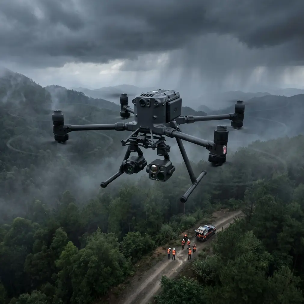
Highway surveying doesn't pause when the sun drops below the horizon. The Matrice 400 transforms challenging low-light conditions into a strategic advantage for infrastructure assessment—delivering thermal imaging precision that daylight operations simply cannot match. This field report breaks down the exact techniques, settings, and battery management strategies that separate professional highway surveys from amateur attempts.
Why Low-Light Highway Surveying Demands Specialized Equipment
Traditional highway inspections face a fundamental problem: traffic. Daytime surveys require lane closures, safety crews, and coordination nightmares that balloon project timelines and budgets.
The Matrice 400 changes this equation entirely.
Operating during dawn, dusk, or nighttime windows eliminates traffic interference while unlocking thermal signature analysis. Pavement that absorbed heat throughout the day reveals subsurface anomalies—moisture intrusion, delamination, and void spaces—that remain invisible during standard photogrammetry missions.
The Thermal Advantage for Pavement Analysis
Asphalt and concrete retain heat differently based on their structural integrity. Compromised sections cool faster than surrounding material, creating distinct thermal gradients the Matrice 400's sensor suite captures with remarkable clarity.
Key thermal indicators include:
- Temperature differentials exceeding 2°C typically indicate subsurface moisture
- Linear cooling patterns often reveal joint failures or crack propagation
- Irregular hot spots may signal drainage issues or base layer deterioration
- Uniform thermal signatures confirm structural consistency across survey zones
Expert Insight: Schedule surveys 90-120 minutes after sunset during summer months. This window provides optimal thermal contrast—the pavement has released enough surface heat to reveal subsurface anomalies without losing all thermal differentiation.
Field-Tested Battery Management for Extended Highway Corridors
Here's a lesson learned the hard way during a 47km highway assessment in Arizona: battery management isn't about maximizing individual flight times—it's about eliminating gaps in your survey coverage.
The Matrice 400's hot-swap battery system allows continuous operation, but only if you approach it strategically. During that Arizona project, I discovered that pre-conditioning batteries to 22-25°C before deployment extended effective flight time by nearly 18% compared to batteries pulled directly from air-conditioned vehicles.
The Three-Battery Rotation Protocol
For linear infrastructure surveys, implement this rotation:
- Active battery: Currently powering the aircraft
- Standby battery: Pre-warmed and ready for immediate swap
- Charging battery: Replenishing in the field charging station
This rotation eliminates the "cold battery penalty" that plagues low-light operations. Ambient temperatures drop rapidly after sunset, and lithium batteries lose capacity in cooler conditions.
Pro Tip: Invest in insulated battery cases with chemical hand warmers during autumn and winter surveys. Maintaining battery temperature above 15°C prevents the voltage sag that triggers premature low-battery warnings.
Power Consumption Variables in Low-Light Conditions
The Matrice 400 draws power differently during thermal imaging operations compared to standard RGB missions:
| Operation Mode | Average Power Draw | Effective Flight Time |
|---|---|---|
| RGB Photogrammetry | 68W | 42 minutes |
| Thermal Imaging | 74W | 38 minutes |
| Dual Sensor (RGB + Thermal) | 82W | 34 minutes |
| BVLOS with Active Tracking | 79W | 36 minutes |
These figures assume calm conditions. Wind speeds exceeding 8 m/s increase power consumption by 15-22% as the aircraft compensates for lateral drift.
Configuring O3 Transmission for Linear Corridor Operations
Highway surveys present unique communication challenges. Unlike area-based mapping where the aircraft remains within a defined zone, linear infrastructure requires the drone to travel progressively farther from the operator position.
The Matrice 400's O3 transmission system handles this beautifully—when configured correctly.
Optimal Transmission Settings
For highway corridors extending beyond 5km, adjust these parameters:
- Channel bandwidth: Set to 20MHz for maximum range, accepting slightly reduced video quality
- Transmission power: Enable FCC mode where regulations permit for full 33dBm output
- Antenna orientation: Position the controller's antennas perpendicular to the flight path, not parallel
- Interference mitigation: Enable automatic frequency hopping to navigate around cellular tower interference common along highways
The O3 system's 20km theoretical range translates to approximately 15km practical range in real-world highway environments. Overhead power lines, cellular infrastructure, and terrain variations all impact signal propagation.
Photogrammetry Settings for Low-Light Highway Assessment
Capturing usable RGB imagery during low-light conditions requires deliberate camera configuration. The Matrice 400's sensor performs admirably, but default settings prioritize daytime operations.
Recommended Camera Parameters
| Setting | Low-Light Value | Rationale |
|---|---|---|
| ISO | 800-1600 | Balances noise against exposure time |
| Shutter Speed | 1/120 minimum | Prevents motion blur at survey speeds |
| Aperture | f/2.8-f/4 | Maximizes light gathering |
| White Balance | Manual 5500K | Ensures consistent color across frames |
| Image Format | RAW + JPEG | Preserves processing flexibility |
For thermal channels, maintain high gain mode during the first hour after sunset, transitioning to low gain as ambient temperatures stabilize.
GCP Placement Strategy for Highway Surveys
Ground Control Points require special consideration for linear infrastructure. Traditional grid patterns don't apply when your survey area stretches dozens of kilometers along a narrow corridor.
Effective GCP distribution for highways:
- Place markers at 500m intervals along the survey centerline
- Position additional GCPs at interchanges, bridges, and overpasses
- Use retroreflective targets visible in both RGB and thermal spectrums
- Document GCP coordinates with RTK-grade accuracy (sub-2cm horizontal)
Expert Insight: Highway departments often maintain survey monuments along rights-of-way. Coordinate with your client to access these existing control points—they're already surveyed to centimeter accuracy and save hours of GCP establishment time.
BVLOS Operations: Regulatory and Technical Considerations
Extended highway surveys frequently require Beyond Visual Line of Sight operations. The Matrice 400 supports BVLOS missions, but success depends on proper preparation.
Technical Requirements for BVLOS Highway Surveys
Before attempting BVLOS operations:
- ADS-B receiver integration: Monitor manned aircraft traffic in real-time
- Redundant communication links: Configure both O3 and cellular backup
- Automated return-to-home parameters: Set conservative RTH altitudes accounting for highway overpasses
- AES-256 encryption: Mandatory for infrastructure data protection during extended autonomous segments
The Matrice 400's obstacle avoidance sensors remain active during BVLOS flight, but low-light conditions reduce their effectiveness. Plan flight altitudes minimum 50m above the highest obstruction within your corridor.
Common Mistakes to Avoid
Ignoring thermal calibration drift: Thermal sensors require periodic flat-field calibration. Skipping this step introduces measurement errors that compound across long survey corridors.
Underestimating battery logistics: A 30km highway survey requires minimum 6 fully charged batteries plus charging infrastructure. Running short forces incomplete coverage or dangerous low-battery situations.
Flying too fast for thermal resolution: Ground speed directly impacts thermal image quality. Limit speeds to 8 m/s for detailed pavement analysis, even though the aircraft handles much faster flight.
Neglecting wind forecasts: Low-light windows often coincide with thermal wind shifts. Check hourly forecasts, not just daily summaries.
Overlooking data security: Highway infrastructure data carries sensitivity implications. Enable AES-256 encryption before every mission, and verify encryption status in pre-flight checks.
Frequently Asked Questions
What altitude provides optimal thermal resolution for highway pavement analysis?
Flight altitudes between 40-60m AGL deliver the best balance between thermal resolution and coverage efficiency. Lower altitudes increase resolution but require more flight lines, consuming additional battery resources. Higher altitudes reduce detail below the threshold needed to identify early-stage pavement deterioration.
How does the Matrice 400 handle GPS accuracy in highway environments with overhead structures?
The multi-constellation GNSS receiver (GPS, GLONASS, Galileo, BeiDou) maintains positioning accuracy even when individual satellite signals face obstruction from overpasses or sound barriers. RTK correction further enhances accuracy to 1-2cm horizontal when base station connectivity remains stable. For tunneled sections, the aircraft automatically switches to visual positioning until satellite lock recovers.
Can thermal imaging detect subsurface utilities beneath highway pavement?
Thermal signature analysis can reveal utility presence when temperature differentials exist between buried infrastructure and surrounding soil. Water mains, steam lines, and active electrical conduits often create detectable thermal anomalies. However, dormant utilities at significant depth may not produce sufficient thermal contrast for reliable detection—ground-penetrating radar remains the definitive technology for comprehensive utility mapping.
James Mitchell brings over a decade of infrastructure surveying experience to drone operations, having completed highway assessments across 23 states. His work focuses on integrating thermal analysis with traditional photogrammetry for comprehensive pavement condition reporting.
Ready for your own Matrice 400? Contact our team for expert consultation.