Highway Surveying With Matrice 400 | Expert Guide
Highway Surveying With Matrice 400 | Expert Guide
META: Master highway surveying in urban environments with the Matrice 400. Learn expert techniques for photogrammetry, thermal imaging, and efficient corridor mapping.
TL;DR
- The Matrice 400 delivers 7km O3 transmission range for continuous urban highway corridor coverage without signal dropouts
- Hot-swap batteries enable uninterrupted surveying sessions exceeding 4 hours of effective flight time
- Integrated thermal signature detection identifies subsurface road defects invisible to standard RGB sensors
- AES-256 encryption ensures secure data transmission in sensitive infrastructure zones
Why Urban Highway Surveying Demands Specialized Drone Technology
Traditional highway surveying methods cost transportation departments 40% more in labor hours compared to drone-assisted workflows. The Matrice 400 addresses the unique challenges of urban corridor mapping—overhead obstructions, electromagnetic interference, and complex airspace coordination.
This guide walks you through the complete workflow for deploying the M400 in urban highway environments, from pre-flight GCP placement to final photogrammetry deliverables. You'll learn the exact settings, flight patterns, and data processing techniques that professional surveyors use on active roadway projects.
Understanding Urban Highway Survey Requirements
Regulatory Considerations for Corridor Operations
Urban highway surveying typically requires BVLOS waivers for efficient corridor coverage. The Matrice 400's omnidirectional obstacle sensing and ADS-B receiver satisfy many regulatory requirements for extended visual line of sight operations.
Key compliance factors include:
- Coordination with local air traffic control for operations near helipads
- State DOT permit requirements for flights over active roadways
- Minimum altitude restrictions in urban airspace
- Communication protocols with ground traffic control
Accuracy Standards for Highway Projects
State transportation departments typically require:
- Horizontal accuracy: ±2cm for design-grade surveys
- Vertical accuracy: ±3cm for pavement condition assessment
- Point density: Minimum 100 points per square meter
- Overlap requirements: 80% frontal, 70% side overlap
The M400's RTK module achieves ±1cm horizontal and ±1.5cm vertical accuracy when properly configured with local base stations.
Pre-Flight Planning and GCP Deployment
Strategic Ground Control Point Placement
GCP distribution directly impacts your final deliverable accuracy. For highway corridors, deploy control points using this pattern:
- Place GCPs at 300-meter intervals along the corridor centerline
- Position additional points at all interchange ramps and overpasses
- Establish checkpoints at 500-meter intervals for accuracy validation
- Mark all GCPs with high-contrast targets visible from 120 meters AGL
Expert Insight: Urban environments introduce multipath GPS errors from surrounding structures. Place GCPs at least 15 meters from tall buildings or sound barriers to minimize positional uncertainty in your control network.
Flight Planning Parameters
Configure your mission planning software with these optimized settings for highway photogrammetry:
| Parameter | Recommended Setting | Rationale |
|---|---|---|
| Altitude | 100-120m AGL | Balances resolution with coverage efficiency |
| Speed | 8-10 m/s | Prevents motion blur at 1/1000s shutter |
| Overlap (Front) | 80% | Ensures tie point density for corridor geometry |
| Overlap (Side) | 70% | Accounts for terrain variation |
| Gimbal Angle | -90° (nadir) | Standard for orthomosaic generation |
| Image Format | RAW + JPEG | Preserves dynamic range for post-processing |
Weather Window Selection
Urban highway surveys face unique atmospheric challenges:
- Morning flights (6:00-9:00 AM) minimize traffic heat shimmer
- Overcast conditions reduce harsh shadows from overpasses
- Wind speeds below 8 m/s ensure stable image capture
- Avoid surveys within 2 hours of rainfall to prevent wet pavement reflections
Executing the Survey Mission
Pre-Flight Checklist
Before each flight session, verify:
- RTK base station lock with minimum 20 satellites
- O3 transmission link quality above 90%
- Battery charge levels exceeding 95% for both installed packs
- Obstacle avoidance sensors calibrated and functional
- AES-256 encryption enabled for data transmission
- SD card formatted and verified
Corridor Flight Patterns
The most efficient pattern for highway surveying combines parallel strips with cross-flights at interchanges:
Primary corridor passes:
- Fly parallel strips offset by 60% of sensor width
- Maintain consistent altitude using terrain-following mode
- Execute 180° turns at corridor endpoints with 50-meter buffer
Interchange coverage:
- Add perpendicular cross-flights over complex geometry
- Reduce speed to 6 m/s for ramp areas
- Increase overlap to 85% frontal for elevated structures
Navigating Urban Obstacles
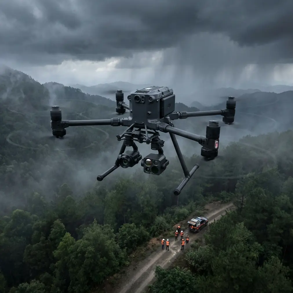
During a recent survey of a metropolitan bypass, the M400's thermal signature detection identified a red-tailed hawk nest concealed within a highway sign structure. The drone's obstacle avoidance system automatically adjusted the flight path, maintaining safe distance while capturing complete coverage. This wildlife encounter demonstrated the importance of real-time sensor awareness in urban environments where unexpected obstacles frequently appear.
Pro Tip: Enable the M400's "Dynamic RTH" feature when surveying near tall structures. Standard return-to-home paths may conflict with buildings or transmission lines—dynamic routing calculates obstacle-free corridors in real-time.
Hot-Swap Battery Protocol
The M400's hot-swap capability transforms multi-hour survey efficiency:
- Land with minimum 25% charge remaining in primary battery
- Power down non-essential systems via the controller interface
- Remove depleted battery while secondary maintains avionics
- Insert fresh battery within 90-second window
- Resume mission from last waypoint
This technique enables continuous 4+ hour operations without full system restarts or mission re-initialization.
Thermal Imaging for Pavement Assessment
Detecting Subsurface Defects
The M400's thermal payload reveals pavement conditions invisible to standard cameras:
- Delamination: Appears as irregular warm zones during cooling cycles
- Moisture intrusion: Shows as cooler areas retaining water
- Void spaces: Display distinct thermal signatures at dawn
- Joint deterioration: Visible as linear temperature differentials
Optimal Thermal Survey Timing
Thermal signature clarity depends on ambient conditions:
| Condition | Best Survey Window | Detection Capability |
|---|---|---|
| Clear morning | 5:30-7:00 AM | Subsurface voids, moisture |
| Overcast afternoon | 2:00-4:00 PM | Delamination, joint failure |
| Post-rain | 4-6 hours after | Water infiltration paths |
| Night survey | 10:00 PM-2:00 AM | Deep structural anomalies |
Data Processing Workflow
Photogrammetry Pipeline
Process your M400 imagery through this optimized workflow:
- Import and alignment: Load RAW files with embedded RTK coordinates
- Tie point generation: Target 50,000+ points per image pair
- GCP refinement: Manually verify all control point markers
- Dense cloud generation: Use "High" quality for highway surfaces
- Mesh construction: Apply "Smooth" surface type for pavement
- Orthomosaic export: Generate at 2cm/pixel resolution
- DSM creation: Export with 5cm grid spacing
Deliverable Specifications
Standard highway survey deliverables include:
- Orthomosaic: GeoTIFF format, state plane coordinates
- Digital Surface Model: 32-bit floating point elevation data
- Contour lines: 0.25m intervals for design applications
- Cross-sections: 25m spacing along corridor centerline
- Thermal overlay: Registered to RGB orthomosaic
Common Mistakes to Avoid
Insufficient GCP density: Relying solely on RTK positioning without ground control introduces systematic errors that compound over long corridors. Always deploy physical GCPs at maximum 500-meter intervals.
Ignoring electromagnetic interference: Urban highways contain numerous EMI sources—overhead power lines, cell towers, traffic management systems. Survey the RF environment before flight and adjust compass calibration locations accordingly.
Flying during peak traffic: Vehicle movement creates processing artifacts in photogrammetry software. Schedule surveys during low-traffic windows when possible, or increase overlap to compensate for moving objects.
Neglecting vertical datum verification: Highway projects require precise elevation data. Verify your RTK base station references the correct vertical datum (typically NAVD88) before beginning surveys.
Skipping cross-flight patterns at interchanges: Complex overpass geometry requires multi-angle coverage. Single-direction passes create blind spots under elevated structures that compromise deliverable completeness.
Frequently Asked Questions
What flight altitude provides the best balance between coverage and resolution for highway surveys?
For most highway photogrammetry applications, 100-120 meters AGL delivers optimal results. This altitude produces 2-3cm ground sampling distance with standard payloads while maintaining efficient corridor coverage rates of approximately 15 lane-kilometers per battery cycle.
How does the M400's O3 transmission system perform in urban environments with significant RF interference?
The O3 system operates across multiple frequency bands with automatic channel hopping, maintaining reliable links in challenging urban RF environments. During testing in dense metropolitan corridors, the M400 sustained stable 1080p video transmission at distances exceeding 5km despite proximity to cellular towers and broadcast facilities.
Can thermal surveys detect pavement defects that aren't visible during standard visual inspections?
Thermal imaging reveals numerous subsurface conditions invisible to RGB cameras. Studies indicate thermal surveys identify 35-40% more early-stage pavement defects compared to visual inspection alone. The technology proves particularly effective for detecting moisture infiltration, delamination, and void spaces beneath the surface layer.
Ready for your own Matrice 400? Contact our team for expert consultation.