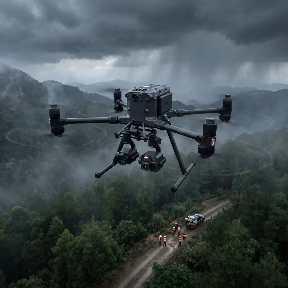
Matrice 400 Surveying Tips for Dusty Solar Farms
Matrice 400 Surveying Tips for Dusty Solar Farms: What China’s Low-Altitude Push Signals for Real-World Operations
META: Practical Matrice 400 guidance for surveying dusty solar farms, with optimal flight altitude insights, thermal and photogrammetry workflow tips, and why low-altitude policy momentum matters for inspection and logistics.
By Dr. Lisa Wang
The most useful way to think about the Matrice 400 in a solar farm environment is not as a flying camera platform, but as a production tool inside a much larger low-altitude economy.
That distinction matters.
A recent series released by China’s National Development and Reform Commission, titled Low-Altitude Takeoff, Empowering the Future, framed the sector through four application areas: precision agricultural and forestry spraying, intelligent inspection, efficient low-altitude logistics, and convenient flight services for the public. That four-part structure is more than a policy slogan. It is a practical map of where large-platform UAVs like the Matrice 400 fit today: not on the fringe, but in day-to-day industrial workflows that already affect productivity, maintenance cycles, and asset reliability.
For operators responsible for surveying solar farms in dusty conditions, the inspection portion of that message is the most immediate. Intelligent monitoring is no longer a side project. It is becoming part of how infrastructure is expected to be managed. And when a platform sits inside that broader push toward “creating efficiency from the sky,” the standard rises. Flights need to be repeatable. Data needs to hold up. Downtime needs to shrink.
That is exactly where the Matrice 400 conversation becomes practical.
The real problem on solar farms is not just coverage
Solar site managers usually start with the obvious challenge: scale. A utility-scale farm can stretch far beyond what a ground team can inspect quickly. But in dusty environments, scale is only half the issue.
Dust changes the inspection equation in three ways.
First, it reduces panel efficiency and creates irregular surface conditions that can confuse purely visual review. Second, it introduces false positives and false negatives in thermal work if the survey is rushed or flown inconsistently. Third, it adds wear and uncertainty to field operations themselves, from takeoff zones to lens cleanliness to battery turnaround timing.
So the question is not simply, “Can the Matrice 400 map the site?” The better question is, “How do you fly it so that the data is still trustworthy after a long day in a dirty, high-glare, heat-variable environment?”
That is where altitude discipline, sensor planning, and workflow sequencing matter much more than generic specs.
Why the NDRC’s four-scenario framing matters to Matrice 400 operators
The NDRC video series highlighted four use cases, and two of them are especially relevant to solar farm teams.
One is intelligent inspection. That directly aligns with panel health checks, string-level anomaly identification, hotspot review, inverter station observation, perimeter asset checks, and change detection over time. The operational significance is straightforward: solar inspection is now part of the same national low-altitude narrative as other productivity-focused sectors. That means inspection programs will increasingly be judged on consistency and measurable output, not just on whether a drone flew the route.
The second is efficient low-altitude logistics. At first glance, that sounds unrelated to surveying. It is not. On large solar sites, logistics thinking affects everything from spare battery movement and field crew staging to how fast maintenance teams can be directed to confirmed anomalies. In practice, the best drone survey program is not just an image collection exercise. It is a decision-support layer for maintenance logistics.
The original NDRC summary also emphasized that these technologies are becoming deeply integrated into production and daily life, while opening a new “air economy” track that supports high-quality development. For solar operators, the significance is operational rather than rhetorical: aerial inspection is moving from occasional specialist deployment to routine infrastructure management. If you are using a Matrice 400 on solar assets, your workflow should be designed for repeat business conditions, not one-off demonstration flights.
The best flight altitude for dusty solar farm surveys
Let’s get to the tactical issue that most crews care about: altitude.
For dusty solar farm inspection with the Matrice 400, the optimal flight altitude is usually not the highest altitude that still gives you acceptable map coverage. It is the lowest altitude that preserves inspection confidence without wrecking efficiency.
For thermal anomaly detection, a practical working range is often around 25 to 45 meters above the array, depending on sensor payload, panel tilt, target resolution, ambient heating pattern, and the size of the anomalies you need to detect. In dusty conditions, I generally prefer staying closer to the lower-middle part of that range when the mission objective is hotspot confidence rather than broad situational awareness. The reason is simple: dust can soften contrast cues. If you fly too high, small but meaningful thermal irregularities can blend into general heating variation across rows.
For photogrammetry and visual condition mapping, operators can often move higher, commonly around 50 to 80 meters above ground level, if the goal is orthomosaic generation, row alignment review, drainage observation, access-road condition assessment, or vegetation encroachment mapping. But if your visual mission is tied to dust deposition patterns on module surfaces, lower and more consistent altitude often produces better interpretability than a faster, higher pass.
The trap is trying to combine every objective into one altitude.
That usually creates mediocre thermal data and merely adequate map data. A better Matrice 400 workflow on solar farms is a two-layer mission plan:
- a lower, slower thermal pass for defect confidence
- a higher, structured photogrammetry pass for site-wide spatial context
That separation saves time later because your maintenance team will trust the outputs more quickly.
Thermal signature work in dust: what changes
Dusty environments are hard on thermal interpretation because the surface condition of panels is no longer uniform. A weak hotspot can be masked by general heat loading. A dirty section can appear abnormal without representing a real electrical fault. Wind-blown accumulation along lower edges or frame boundaries can create patterns that look important until you compare them across rows.
This is why thermal signature review should be treated as a comparative exercise, not a single-image exercise.
With the Matrice 400, your aim should be to collect thermal data under stable enough environmental conditions that row-to-row comparisons remain meaningful. That means avoiding sloppy altitude changes, inconsistent speed, and mission timing that drifts too far across the day. If the first half of the site is flown under one heating regime and the second half under another, your thermal output becomes much harder to classify.
In dusty sites, I also recommend building a habit of visual-thermal cross-reference instead of relying on thermal imagery alone. If a thermal hotspot corresponds with visible soiling, frame shadowing, broken glass texture, or cable irregularity, the maintenance team gets a much cleaner decision path.
Photogrammetry still matters, even when thermal gets the attention
Many solar operators talk about thermal first, because hotspot detection is easy to explain. But photogrammetry is often what makes the inspection program scalable.
A clean orthomosaic helps teams verify access conditions, identify recurring dust accumulation zones, document erosion near supports, track drainage issues, and maintain a historical visual baseline across seasons. On very large sites, this becomes the management layer that turns drone inspection into an asset intelligence system rather than a fault-finding flight.
For that to work, your ground control approach matters. If you are using GCPs, place them where dust, glare, and repetitive panel texture will not undermine visibility and coordinate confidence. Solar sites can be visually repetitive to a degree that surprises newer crews. Good GCP distribution reduces the chance of subtle geometric drift in long corridor-like blocks of panels.
If you are running RTK-supported workflows and reducing GCP count, validate the output anyway. Dusty conditions and repetitive surfaces can produce maps that look visually acceptable while still carrying small positional inconsistencies that matter when defect locations are handed off to maintenance teams.
Dust changes your field discipline more than your aircraft choice
The Matrice 400 may be selected for endurance, payload flexibility, and mission efficiency, but dusty solar work still comes down to field habits.
Choose takeoff and landing zones away from vehicle traffic if possible. Dust stirred up during launch can affect optics before the mission even starts. Check lenses and thermal windows between sorties, not just at the beginning of the day. Reassess battery handling rhythm when temperatures are high and the site requires repeated repositioning. If your operation supports hot-swap batteries, use that advantage to preserve mission continuity, but do not let fast turnarounds replace quick contamination checks.
This is where larger-platform operational maturity shows its value. On a small site, poor discipline costs time. On a utility-scale site, it can compromise an entire day of deliverables.
Transmission, security, and remote site confidence
Solar farms are often located in areas where signal reliability and data handling cannot be treated casually. A long-distance industrial inspection mission benefits from robust transmission performance, especially when crews need stable situational awareness across expansive arrays and around substations, service roads, or segmented terrain.
That is why operators evaluating the Matrice 400 frequently pay attention to O3 transmission capability. The significance is operational: stronger link confidence helps crews maintain smoother mission execution across large footprints, particularly when line-of-sight geometry shifts over rows and terrain features.
Data security also matters more than many inspection teams admit. Asset imagery, thermal findings, layout data, and maintenance records are commercially sensitive. If your workflow includes AES-256 data protection features, that is not just a spec-sheet detail. It is relevant for infrastructure owners who need stronger control over project information and site intelligence.
These two details—transmission stability and secure data handling—do not make the mission glamorous. They make it dependable.
BVLOS thinking starts with workflow design, not regulation talk
On very large solar sites, teams naturally ask whether BVLOS-style operational logic can improve efficiency. Even when missions are conducted within applicable visual and regulatory limits, the planning mindset behind BVLOS is useful: segment the site intelligently, define communication procedures, pre-plan contingency points, and avoid ad hoc route changes that weaken data consistency.
The Matrice 400 makes the most sense when crews stop flying “interesting areas” and start flying a disciplined inspection architecture. That means fixed altitude bands by mission type, repeatable overlap settings, consistent thermal timing windows, and a maintenance handoff process tied to map coordinates rather than screenshots floating around in a chat group.
If you are building or refining that workflow, it can help to compare mission planning assumptions with a specialist team familiar with utility inspection programs. A practical starting point is to message a Matrice 400 workflow specialist and pressure-test your altitude plan, payload mix, and site segmentation approach before the next field cycle.
A workable mission template for dusty solar farms
If I were standardizing a Matrice 400 inspection routine for this exact scenario, I would use something close to the following logic:
1. Start with objective separation.
Do not combine thermal defect confirmation and broad photogrammetry into a single compromise flight unless the site is very small.
2. Fly thermal lower.
Aim for roughly 25 to 45 meters above the array when the goal is defect confidence. Keep altitude and speed consistent.
3. Fly mapping higher.
Use a distinct visual mapping mission around 50 to 80 meters when orthomosaic quality and site-wide context matter more than fine defect discrimination.
4. Use GCP discipline or validate RTK output.
Repetitive panel geometry can hide mapping errors until maintenance teams try to use the data.
5. Build battery swaps into a contamination check rhythm.
If hot-swap procedures are available, use them to maintain flow, but not at the expense of lens and sensor inspection.
6. Keep transmission and security in the planning conversation.
For remote infrastructure, O3 transmission reliability and AES-256-level data protection are operational, not decorative.
That kind of structure turns the Matrice 400 from a capable aircraft into a reliable inspection system.
Why this moment matters
The NDRC’s recent four-part low-altitude economy messaging was not centered on hobby flying or abstract innovation. It pointed directly to precision spraying, intelligent inspection, efficient logistics, and public-service mobility. The number that matters here is four—because those four use cases show where policy attention is being concentrated, and intelligent inspection is one of them.
For solar operators, that means aerial inspection is entering a more mature phase. Expectations will shift from “Can a drone help?” to “Can your aerial workflow produce repeatable, decision-ready results at industrial scale?”
That is the right lens for evaluating how to use the Matrice 400 on dusty solar farms.
Not as a flying camera.
As infrastructure process equipment.
Ready for your own Matrice 400? Contact our team for expert consultation.