Surveying Remote Venues With Matrice 400
Surveying Remote Venues With Matrice 400: What Shandong’s Low-Altitude Logistics Push Means in the Field
META: A field-focused look at how Matrice 400 fits remote venue surveying as Shandong’s April 14 low-altitude action plan highlights cross-sea logistics, flight support, and new operational demands.
By Dr. Lisa Wang
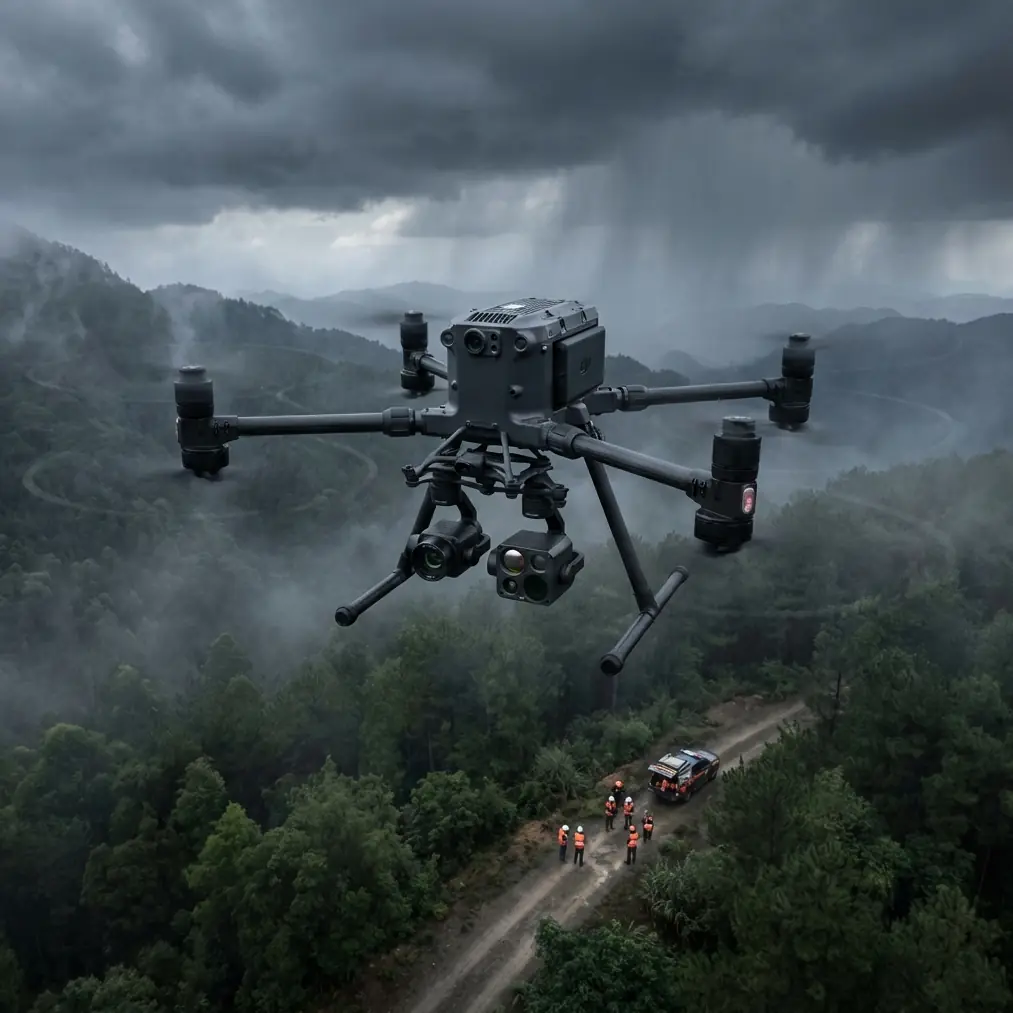
Remote venue surveying rarely fails because of camera resolution alone. The trouble usually starts earlier: getting aircraft, batteries, crews, and data links into places where infrastructure is thin, wind behaves badly, and electromagnetic noise does strange things to an otherwise clean mission plan.
That is why a recent policy move in Shandong matters more to Matrice 400 operators than it may appear at first glance.
On April 14, the General Office of the Shandong Provincial Government formally issued an action plan centered on scenario cultivation and open application to drive new productive capacity. The plan spans 20 key sectors. For drone professionals, the important section is not abstract policy language but its practical emphasis on aerospace and the low-altitude economy, especially low-altitude flight service support and the creation of signature use cases. One example stands out: a Yantai-to-Dalian cross-sea low-altitude logistics corridor designed to improve regional logistics efficiency.
That single corridor tells us a lot about the operating environment commercial UAV teams are moving toward. It suggests longer routes, greater dependence on flight support systems, stronger pressure on reliability, and a more serious view of low-altitude infrastructure as an operational backbone rather than an afterthought. If you are using a Matrice 400 to survey remote venues, whether for infrastructure planning, industrial development, land preparation, coastal assets, or logistics nodes, those same conditions shape your work on the ground.
The real problem in remote venue surveying
A remote venue can mean many things: an island-side staging area, a mountain construction site, a future logistics transfer point, or a coastal industrial parcel that still lacks stable access roads. In each case, the survey brief sounds simple enough. Build an accurate model. Generate topographic outputs. Identify thermal anomalies if needed. Deliver data the engineers can trust.
Then reality shows up.
You may have unstable GNSS conditions near structures or uneven terrain. You may have weak network coverage, making cloud-dependent workflows awkward. You may have reflective surfaces or marine humidity that complicate visual results. In coastal corridors and industrial zones, electromagnetic interference can degrade the confidence of your control link and video feed. If the site is far enough away, battery rotation becomes a planning exercise of its own. When the client wants photogrammetry and thermal signature analysis in the same mobilization window, payload and mission sequencing start to matter.
This is where the Matrice 400 conversation becomes less about headline specs and more about how the platform behaves as a field system.
Why Shandong’s April 14 action plan is relevant to M400 crews
The Shandong action plan is notable for two reasons.
First, it does not treat low-altitude operations as isolated aircraft activity. It explicitly focuses on low-altitude flight service support. Operationally, that means the ecosystem around the drone matters: route assurance, communications stability, logistics continuity, and repeatable procedures.
Second, the Yantai-to-Dalian cross-sea low-altitude logistics corridor points to a category of work where distance, weather exposure, and regional transport efficiency are tightly linked. Even if your job is surveying rather than logistics, the same environment rewards aircraft that can maintain dependable transmission, protect data, and keep turnaround times under control.
For remote venue surveys, that translates into four priorities:
- Link stability over difficult terrain or water-adjacent space
- Fast battery workflow with minimal downtime
- Reliable data security for sensitive project mapping
- Payload flexibility when clients want both visual mapping and thermal insight
The Matrice 400 fits that profile because it can be approached as a mission platform rather than a single-purpose airframe.
Problem: electromagnetic interference at remote sites
One of the least glamorous but most common field issues is electromagnetic interference. Survey teams run into it near temporary communications equipment, industrial transformers, power infrastructure, coastal relay installations, or even clustered contractor machinery. The effect is not always dramatic. Sometimes it is just enough to create intermittent instability in transmission quality, which is exactly the kind of issue that wastes time because crews keep second-guessing whether the problem is signal propagation, terrain masking, or poor antenna orientation.
With Matrice 400-class operations, O3 transmission becomes more than a comfort feature. In remote venue surveying, a resilient transmission system helps maintain command confidence while you execute structured capture patterns for photogrammetry. But transmission technology alone does not solve poor field discipline.
A practical adjustment that experienced teams make is antenna alignment based on aircraft position changes rather than leaving the controller setup fixed for the whole mission. That sounds basic, yet it is often neglected during long runs across uneven ground or when the pilot shifts to maintain line quality around obstructions. In electromagnetic clutter, small antenna corrections can restore margin before the link visibly deteriorates. The operational significance is simple: smoother transmission means fewer interrupted mapping lines, fewer partial datasets, and less need to re-fly sections that were already covered.
For remote venues, that is not just convenience. It affects crew hours, battery usage, and the integrity of your photogrammetry deliverables.
Solution: build the mission around data quality, not just flight time
When a site is difficult to access, every launch should do meaningful work. The Matrice 400 is best used when the mission design combines primary mapping outputs with targeted validation passes.
For example, a remote venue survey can begin with a photogrammetry grid supported by well-placed GCPs. Ground control points still matter, especially when the deliverable is expected to support engineering decisions rather than just visual context. In isolated locations, teams are sometimes tempted to reduce GCP density to save setup time. That shortcut often shows up later as avoidable alignment drift or uncertainty at the edges of the model.
A more disciplined approach is to place GCPs where terrain variation, access limitations, and line-of-sight complexity are most likely to challenge reconstruction. Then use the Matrice 400 to capture the broad geometry first. After that, run selective thermal passes if the venue includes structures, utilities, or materials where thermal signature can reveal drainage issues, insulation variation, equipment hotspots, or moisture behavior.
The significance of this sequence is operational, not theoretical. By separating broad photogrammetry from targeted thermal work, you reduce the risk of compromising one dataset to satisfy the other. You also make post-processing cleaner because each flight has a defined purpose.
Why hot-swap batteries matter more in remote areas
Battery management is easy to underestimate until you work several hours from a reliable staging base. In remote surveying, hot-swap batteries are not just a nice workflow improvement. They preserve tempo.
A team that can rotate power quickly spends more of the weather window collecting usable data and less time idling on the ground. This becomes especially valuable in coastal or elevated areas where conditions can change abruptly. If your site sits near a future logistics corridor, shoreline, or industrial edge, that weather volatility can compress the safe and productive operating period.
The link back to Shandong’s policy direction is clear. A province pushing low-altitude application scenarios and a cross-sea logistics route is effectively signaling that uptime and operational continuity will matter. Surveying teams supporting these projects need the same mindset. Remote venue work is often the first layer in a bigger chain of development, and delays at the survey stage can ripple outward.
Hot-swap capability helps crews stay ahead of that.
Data security is not a side issue
Many remote venues are not empty land. They can involve critical infrastructure planning, logistics staging concepts, industrial parcels, utility corridors, or pre-construction environments where geospatial data should be tightly controlled. That makes AES-256 relevant in a practical sense.
Secure transmission and data handling are not there to decorate a specification sheet. They matter because survey datasets increasingly have commercial sensitivity. A topographic model, thermal record, or orthomosaic can reveal asset conditions, access patterns, and development intent. For clients operating in logistics, energy, or industrial development, that is valuable information.
When an aircraft like the Matrice 400 is used in these contexts, secure workflows help align field operations with client expectations. For professional crews, this should also shape how data is offloaded, labeled, and transferred after the mission. The aircraft can support secure operations, but the team still has to behave like the data matters.
BVLOS thinking changes survey planning, even when your mission is local
Shandong’s emphasis on low-altitude service support and its planned cross-sea corridor also reflects a wider industry shift toward more structured route operations. That does not mean every survey mission becomes long-range. It does mean BVLOS thinking is creeping into normal planning practice.
For remote venue surveying, that mindset changes how you prepare. You think more deliberately about launch point selection, terrain masking, emergency alternates, battery thresholds, and communication reliability. You also structure your site reconnaissance to identify where signal geometry might become problematic before you begin capture.
This is where Matrice 400 crews tend to separate themselves from casual operators. They do not just ask whether the aircraft can fly the route. They ask whether the entire data collection chain remains stable and defensible from takeoff to final export.
A realistic remote surveying workflow with Matrice 400
On a typical remote venue assignment, I would structure the operation like this:
- Start with a site RF check and visual review of likely interference sources.
- Set GCPs before the aircraft is powered if ground access allows.
- Brief the team on antenna orientation responsibilities, especially if the pilot position needs to shift during the mission.
- Fly the photogrammetry grid first while the weather is most stable.
- Review dataset completeness before moving to thermal tasks.
- Use thermal signature collection for specific assets or anomalies, not as a substitute for mapping geometry.
- Rotate hot-swap batteries aggressively to preserve the weather window.
- Lock down data handling from the moment files are offloaded.
This is the kind of method that suits the broader direction hinted at by the April 14 Shandong plan. As low-altitude infrastructure becomes more formalized, clients will expect drone teams to operate with repeatability and discipline, not improvisation.
What the Yantai-Dalian corridor signals for survey demand
The proposed Yantai-to-Dalian cross-sea low-altitude logistics corridor is easy to read as a logistics story only. That would be too narrow.
Corridors create demand for upstream geospatial work. Before routes mature, there is surveying. Before support facilities are optimized, there is surveying. Before remote nodes connect efficiently, there is surveying. The corridor’s stated purpose is to improve regional logistics efficiency, but the groundwork behind that efficiency includes site evaluation, terrain assessment, infrastructure planning, and environmental understanding.
That gives Matrice 400 operators a useful lens. The platform is not just serving today’s remote venue survey. It is also aligned with the kind of preparatory work that expands when regions invest in low-altitude application ecosystems.
Final field advice
If you are taking Matrice 400 into a remote surveying environment, do not reduce the mission to “can it map this site?” Ask harder questions.
Can your transmission remain stable when interference appears unexpectedly?
Have you planned antenna adjustments instead of assuming the initial setup is enough?
Are your GCPs placed for actual reconstruction quality, not convenience?
Will your battery workflow protect the best part of the weather window?
Is your data security process strong enough for commercially sensitive geospatial work?
Those questions matter because the industry is moving from isolated drone jobs to integrated low-altitude operations. Shandong’s 20-sector action plan and its cross-sea corridor proposal are evidence of that shift. For survey teams, the opportunity is real, but so is the demand for tighter execution.
If you want to compare remote venue workflows or discuss signal management strategies around coastal and industrial sites, you can message the field team here: https://wa.me/85255379740
Ready for your own Matrice 400? Contact our team for expert consultation.