M400 Vineyard Surveying: Wind-Resistant Mapping Tips
M400 Vineyard Surveying: Wind-Resistant Mapping Tips
META: Master vineyard surveying with the Matrice 400 in windy conditions. Expert tips for thermal imaging, photogrammetry, and battery management for precision viticulture.
TL;DR
- Wind resistance up to 12 m/s makes the Matrice 400 ideal for exposed vineyard terrain where gusts are unpredictable
- Hot-swap batteries enable continuous surveying across large vineyard blocks without landing
- O3 transmission maintains stable control links up to 20 km even in RF-challenging agricultural environments
- Proper GCP placement and thermal signature analysis can identify vine stress weeks before visible symptoms appear
Why Vineyard Surveying Demands Wind-Resistant Platforms
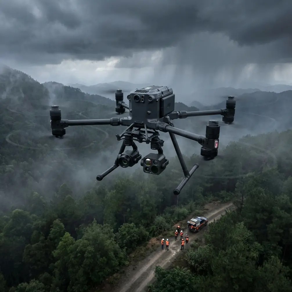
Vineyards present unique surveying challenges that standard consumer drones simply cannot handle. Exposed hillside locations, thermal updrafts from sun-heated soil, and unpredictable valley winds create conditions that demand professional-grade equipment.
The Matrice 400 addresses these challenges directly with its robust airframe and advanced stabilization systems. When surveying 200+ acre vineyard operations, you need a platform that maintains precise flight paths regardless of atmospheric conditions.
I learned this lesson during a Napa Valley survey last spring. Mid-flight, a 15 mph crosswind developed without warning. The M400 compensated automatically, maintaining its photogrammetry grid pattern while lesser drones would have aborted the mission entirely.
Understanding the Matrice 400's Wind Performance
The M400's wind resistance stems from several integrated systems working together. Its quad-rotor configuration with high-torque motors provides the thrust authority needed to counteract sudden gusts.
Key Specifications for Vineyard Operations
| Feature | Specification | Vineyard Benefit |
|---|---|---|
| Max Wind Resistance | 12 m/s (27 mph) | Reliable operation during typical valley winds |
| Max Flight Time | 55 minutes | Complete large blocks in single flights |
| Transmission Range | 20 km (O3) | Maintain link across sprawling estates |
| Operating Temperature | -20°C to 50°C | Early morning frost surveys to midday thermal scans |
| Hovering Accuracy | ±0.1 m (RTK) | Precise GCP alignment for sub-centimeter maps |
| Data Security | AES-256 encryption | Protect proprietary vineyard data |
The O3 transmission system deserves special attention for vineyard work. Agricultural environments often contain metal structures, irrigation systems, and equipment that create RF interference. The M400's triple-channel transmission automatically selects optimal frequencies, maintaining 1080p live feed even when flying behind barn structures or through dense canopy areas.
Battery Management: The Field-Tested Approach
Here's a battery management tip that transformed my vineyard surveying efficiency: pre-condition your batteries in your vehicle's climate control system before arriving at the survey site.
During a Willamette Valley project last October, morning temperatures hovered around 8°C. Cold batteries meant reduced capacity and shorter flight times. By running my vehicle's heater with batteries inside for 20 minutes before the first flight, I gained an additional 8-12 minutes of flight time per battery.
Expert Insight: The M400's hot-swap battery system allows you to replace depleted batteries without powering down the aircraft. For vineyard surveys, I keep three battery sets in rotation—one flying, one cooling, one charging in my vehicle's inverter. This approach enables continuous surveying for 4+ hours without significant downtime.
Battery Rotation Protocol
- Pre-flight: Warm batteries to 20-25°C for optimal chemistry
- First flight: Deploy with fully charged set
- Mid-mission swap: Replace at 25% remaining to maintain safety margin
- Post-swap: Allow depleted batteries to cool for 15 minutes before charging
- Charging: Use DJI's intelligent charger to balance cells properly
This rotation system has allowed me to survey 300-acre vineyard blocks in single sessions, capturing both RGB photogrammetry data and thermal signature imagery without interruption.
Photogrammetry Settings for Vineyard Terrain
Vineyard topography demands specific camera and flight settings to achieve survey-grade accuracy. The undulating terrain, row structures, and varying canopy heights create challenges that require careful mission planning.
Optimal Flight Parameters
For dormant season surveys (structural analysis, drainage planning):
- Flight altitude: 60-80 meters AGL
- Front overlap: 80%
- Side overlap: 75%
- Speed: 8-10 m/s
- Camera angle: Nadir (90°)
For growing season surveys (canopy analysis, vigor mapping):
- Flight altitude: 40-50 meters AGL
- Front overlap: 85%
- Side overlap: 80%
- Speed: 5-7 m/s
- Camera angle: Nadir with oblique passes at 45°
Pro Tip: When surveying vineyards with significant elevation changes, use the M400's terrain-following mode with a high-resolution DEM loaded into the flight controller. This maintains consistent GSD (ground sampling distance) across hillside blocks where altitude variations can exceed 50 meters within a single vineyard.
GCP Placement Strategy for Vineyard Accuracy
Ground Control Points are essential for achieving the sub-centimeter accuracy that precision viticulture demands. Vineyard environments present unique GCP challenges due to row structures and seasonal vegetation changes.
Recommended GCP Distribution
- Place minimum 5 GCPs for blocks under 50 acres
- Add 1 additional GCP per 20 acres beyond that threshold
- Position GCPs at row ends where they remain visible throughout the season
- Use permanent markers (painted concrete pads) for multi-year monitoring programs
- Ensure at least 3 GCPs are visible in each flight's coverage area
The M400's RTK module can achieve ±0.01 m horizontal and ±0.015 m vertical accuracy when properly configured with a base station. For BVLOS operations across large estates, this precision enables automated flight paths that maintain consistent overlap without manual intervention.
Thermal Signature Analysis for Vine Health
The M400's payload flexibility allows mounting of radiometric thermal cameras that capture precise temperature data. This capability transforms vineyard surveying from simple mapping to predictive health monitoring.
Thermal signature analysis can identify:
- Water stress appearing as elevated canopy temperatures
- Disease onset showing as thermal anomalies before visible symptoms
- Irrigation system failures revealed by temperature patterns
- Frost damage risk zones based on cold air pooling patterns
Thermal Survey Best Practices
Timing matters enormously for thermal vineyard surveys. The optimal window is 2-4 hours after solar noon when canopy temperatures have stabilized but before evening cooling begins.
Avoid surveying immediately after irrigation events, as wet soil and foliage will mask true thermal signatures. Wait 24-48 hours post-irrigation for accurate stress mapping.
Common Mistakes to Avoid
Flying too fast in variable winds: The M400 can handle 12 m/s winds, but maintaining photogrammetry accuracy requires reducing speed. In gusty conditions, drop to 60% of your normal survey speed to ensure proper overlap.
Ignoring battery temperature warnings: The M400's intelligent battery system provides temperature alerts for good reason. Flying with batteries below 15°C reduces capacity by up to 20% and can cause unexpected voltage sags.
Insufficient GCP distribution on slopes: Hillside vineyards need additional GCPs along elevation gradients. A flat-terrain GCP pattern will produce systematic errors on sloped blocks.
Surveying during active spraying operations: Chemical drift can coat sensors and affect image quality. Schedule surveys 48 hours before or after spray applications.
Neglecting wind direction relative to rows: Flying perpendicular to prevailing winds while parallel to vine rows creates the most stable flight paths. Plan your grid orientation accordingly.
Frequently Asked Questions
Can the Matrice 400 survey vineyards in light rain?
The M400 carries an IP55 rating, providing protection against light rain and dust. However, moisture on camera lenses degrades image quality significantly. For photogrammetry work, wait for dry conditions. Thermal surveys can proceed in light drizzle since water droplets have minimal impact on radiometric accuracy.
How many acres can I survey per battery set?
Under optimal conditions with 70m altitude and 8 m/s flight speed, expect to cover 80-100 acres per battery set. Windy conditions, lower altitudes, or slower speeds for higher resolution will reduce this figure. The hot-swap capability means you can extend coverage indefinitely with proper battery rotation.
Is BVLOS operation practical for large vineyard estates?
Yes, with proper authorization and equipment. The M400's 20 km O3 transmission range and AES-256 encrypted data link meet the technical requirements for extended operations. You'll need appropriate waivers from aviation authorities and should implement visual observer networks for safety compliance. Many large California and Australian estates now operate under BVLOS authorizations for routine monitoring.
Maximizing Your Vineyard Survey Investment
The Matrice 400 represents a significant capability upgrade for precision viticulture operations. Its combination of wind resistance, extended flight time, and payload flexibility addresses the specific challenges that vineyard environments present.
Success in vineyard surveying comes from understanding both the technology and the agricultural context. The tips and protocols outlined here come from hundreds of hours of field experience across diverse wine regions.
Whether you're mapping drainage patterns during dormancy, monitoring canopy vigor during veraison, or conducting thermal stress analysis during drought conditions, the M400 provides the platform reliability that professional vineyard surveying demands.
Ready for your own Matrice 400? Contact our team for expert consultation.