M400 Wildlife Surveying Tips for Mountain Terrain
M400 Wildlife Surveying Tips for Mountain Terrain
META: Master wildlife surveying in mountains with the Matrice 400. Expert tips on thermal imaging, antenna positioning, and BVLOS operations for accurate data.
TL;DR
- Antenna positioning at 45-degree angles maximizes O3 transmission range in mountainous terrain by up to 15 kilometers
- Thermal signature detection identifies wildlife through dense canopy with 640×512 resolution sensors
- Hot-swap batteries enable continuous 55-minute flight sessions without returning to base
- AES-256 encryption protects sensitive wildlife location data from unauthorized access
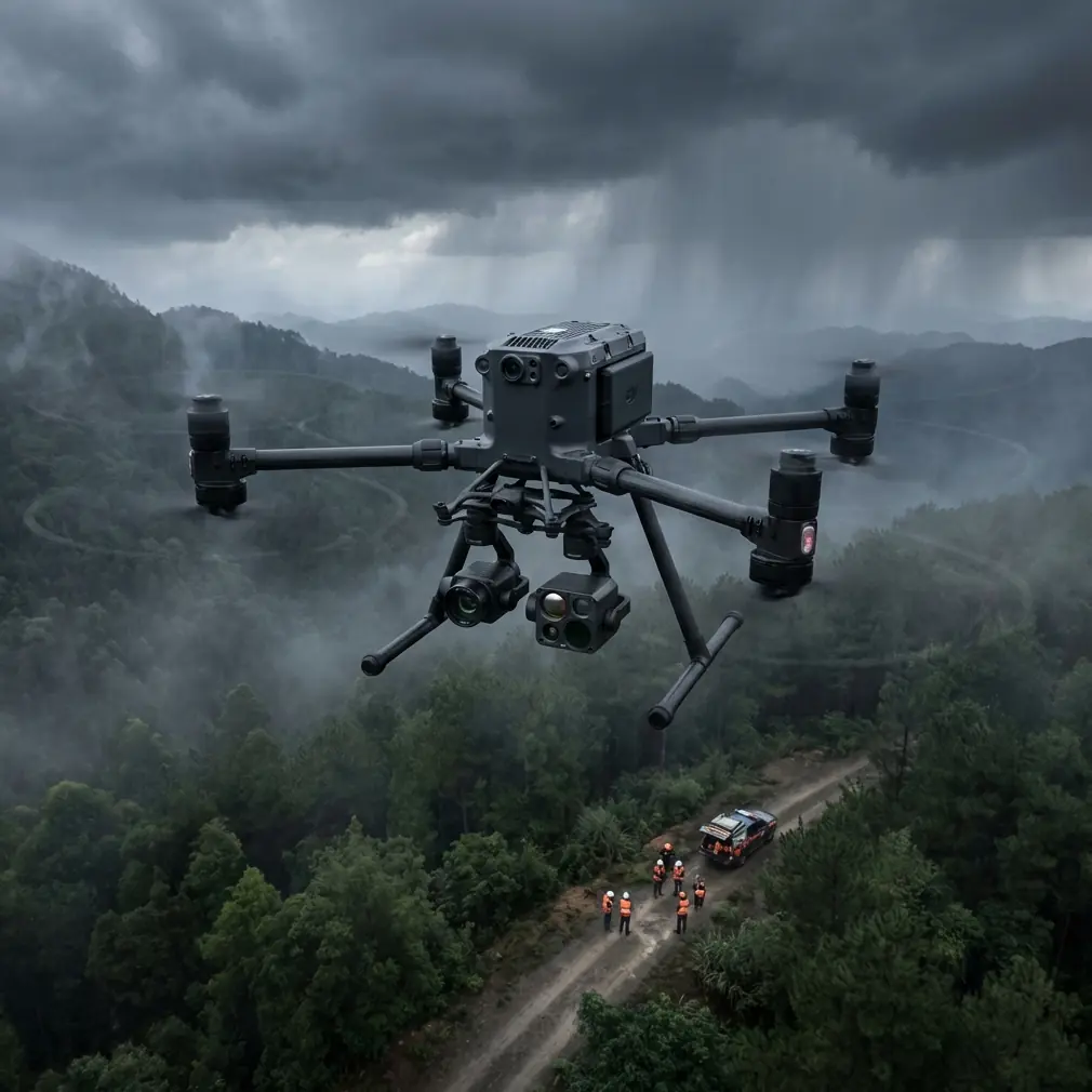
Wildlife surveying in mountain environments pushes drone technology to its limits. The DJI Matrice 400 addresses these challenges with enterprise-grade features specifically designed for remote, high-altitude operations. This technical review breaks down antenna optimization strategies, thermal imaging configurations, and photogrammetry workflows that professional surveyors rely on for accurate population counts and habitat mapping.
Why the Matrice 400 Excels in Mountain Wildlife Operations
Mountain terrain creates unique obstacles for aerial surveying. Radio signal interference from rock faces, unpredictable thermal updrafts, and limited ground control point (GCP) accessibility demand equipment built for adversity.
The M400 platform integrates several systems that directly address these challenges:
- Triple-redundant GPS/GLONASS/Galileo positioning maintains lock in deep valleys
- O3 transmission technology punches through interference at ranges exceeding 20 kilometers line-of-sight
- IP55 weather resistance handles sudden mountain weather changes
- Operating altitude ceiling of 7,000 meters accommodates high-elevation surveys
- Wind resistance up to 15 m/s maintains stable hover for thermal scanning
Expert Insight: When surveying above 4,000 meters, reduce payload weight by 10-15% to compensate for decreased rotor efficiency in thin air. This extends flight time and improves maneuverability during wildlife tracking sequences.
Antenna Positioning for Maximum Range in Mountainous Terrain
Signal integrity determines mission success in remote mountain operations. The M400's O3 transmission system delivers exceptional range, but antenna orientation dramatically affects real-world performance.
Optimal Controller Positioning
Position your remote controller antenna elements at 45-degree angles relative to the aircraft's expected flight path. This creates overlapping signal coverage that compensates for terrain obstruction.
For canyon operations, maintain these practices:
- Keep antennas perpendicular to canyon walls, not parallel
- Elevate the controller position 2-3 meters above surrounding terrain when possible
- Avoid positioning near metal structures or vehicle roofs that create interference
- Use a tripod mount for consistent antenna orientation during extended surveys
Signal Relay Strategies
When surveying beyond visual line of sight (BVLOS), consider these range extension methods:
| Method | Range Extension | Complexity | Best Use Case |
|---|---|---|---|
| Elevated controller position | +20-30% | Low | Valley surveys |
| Secondary spotter with relay | +40-50% | Medium | Canyon operations |
| Mesh network repeaters | +100%+ | High | Multi-day expeditions |
| Satellite backup link | Unlimited | Very High | Remote wilderness areas |
Pro Tip: Before each mountain mission, conduct a signal strength survey by flying a test pattern at your maximum intended distance. Document dead zones on your map—these areas require adjusted flight paths or relay positioning.
Thermal Signature Detection for Wildlife Identification
Thermal imaging transforms wildlife surveying accuracy. The M400's payload compatibility with the Zenmuse H30T thermal camera enables detection of animals invisible to standard RGB sensors.
Configuring Thermal Settings for Wildlife
Mountain wildlife presents unique thermal signature challenges. Temperature differentials between animals and their environment vary significantly based on:
- Time of day and solar heating of rock surfaces
- Animal size and metabolic rate
- Vegetation density and canopy coverage
- Ambient temperature and wind chill effects
For optimal wildlife detection, configure these parameters:
- Palette selection: Use "White Hot" for general surveys, "Ironbow" for species differentiation
- Gain mode: Set to "High Gain" for detecting smaller mammals under 10 kilograms
- Temperature span: Narrow to 15-25°C range centered on expected body temperatures
- Frame rate: Maintain 30 fps for tracking moving subjects
Species-Specific Detection Strategies
Different wildlife requires adjusted approaches:
Large ungulates (elk, deer, mountain goats):
- Fly at 80-120 meters AGL for optimal thermal resolution
- Survey during dawn/dusk when temperature differential peaks
- Use 640×512 thermal resolution for accurate counts
Small mammals (marmots, pikas):
- Reduce altitude to 40-60 meters AGL
- Narrow temperature span to 5-10°C
- Slow flight speed to 3-4 m/s for detection accuracy
Predators (wolves, mountain lions):
- Maintain 100+ meters AGL to avoid behavioral disturbance
- Use longer focal lengths to compensate for distance
- Schedule surveys during known activity periods
Photogrammetry Workflows for Habitat Mapping
Beyond population counts, the M400 enables detailed habitat analysis through photogrammetry. Accurate 3D terrain models reveal migration corridors, denning sites, and vegetation patterns critical to conservation planning.
Ground Control Point Strategies in Remote Terrain
Traditional GCP placement becomes impractical in rugged mountain environments. The M400's RTK module provides centimeter-level accuracy without ground markers when properly configured.
For missions requiring GCPs:
- Deploy lightweight, packable targets at accessible ridgelines
- Use natural features (distinctive rock formations) as supplementary control points
- Document GCP coordinates with survey-grade GNSS receivers
- Plan flight paths to capture each GCP from minimum 3 angles
Optimal Flight Parameters for Terrain Modeling
| Parameter | Recommended Setting | Rationale |
|---|---|---|
| Overlap (frontal) | 80% | Compensates for terrain variation |
| Overlap (side) | 70% | Ensures complete coverage on slopes |
| Flight altitude | 100-150m AGL | Balances resolution with efficiency |
| Camera angle | -80° to -90° | Reduces shadow interference |
| Speed | 8-10 m/s | Prevents motion blur at high resolution |
| Image format | RAW + JPEG | Preserves data for post-processing |
Hot-Swap Battery Management for Extended Missions
Mountain wildlife surveys often require 4-6 hours of continuous coverage. The M400's hot-swap battery system enables uninterrupted operations when managed correctly.
Battery Rotation Protocol
Maintain three battery sets minimum for extended surveys:
- Set A: Currently flying
- Set B: Fully charged, warming to ambient temperature
- Set C: Charging at base station
Rotate sets every 45 minutes to maintain 20% reserve for emergency return-to-home scenarios.
Cold Weather Considerations
Mountain temperatures affect battery performance significantly:
- Pre-warm batteries to 20°C minimum before flight
- Store spare batteries in insulated cases against your body
- Reduce expected flight time by 15-20% below 5°C ambient
- Monitor cell voltage differential—land immediately if spread exceeds 0.3V
Common Mistakes to Avoid
Ignoring wind patterns at altitude: Mountain winds accelerate through passes and over ridges. Check conditions at your intended flight altitude, not ground level. The M400's wind speed indicator provides real-time data—respect warnings.
Overlooking AES-256 encryption configuration: Wildlife location data has significant value to poachers. Enable encryption before every mission and verify secure data transfer protocols to your processing workstation.
Flying too fast during thermal surveys: Thermal sensors require stable positioning for accurate readings. Speeds exceeding 5 m/s during active scanning reduce detection rates by up to 40%.
Neglecting pre-flight compass calibration: Mountain terrain contains magnetic anomalies from mineral deposits. Calibrate at each new launch site, even if only 500 meters from your previous location.
Underestimating return-to-home battery requirements: Headwinds during return consume significantly more power. Program RTH triggers at 35% battery minimum for mountain operations, not the default 25%.
Frequently Asked Questions
What is the maximum effective range for wildlife thermal detection with the M400?
The M400 paired with the Zenmuse H30T reliably detects large mammal thermal signatures at distances up to 1,200 meters in optimal conditions. For accurate identification and counting, reduce this to 400-600 meters. Atmospheric conditions, humidity, and temperature differentials affect these ranges significantly.
How do I maintain BVLOS compliance during mountain wildlife surveys?
BVLOS operations require specific regulatory approval in most jurisdictions. The M400 supports compliant operations through its ADS-B receiver for manned aircraft detection, O3 transmission for reliable command links, and RTK positioning for precise flight path documentation. Work with aviation authorities to establish approved corridors before conducting extended-range surveys.
Can the M400 operate effectively above the tree line in alpine environments?
The M400 performs exceptionally in alpine conditions above tree line. Reduced vegetation interference actually improves both thermal detection and photogrammetry accuracy. Key considerations include increased UV exposure affecting camera sensors (use appropriate filters), reduced air density affecting flight dynamics, and rapid weather changes requiring conservative mission planning. The platform's 7,000-meter altitude ceiling accommodates virtually all mountain survey requirements.
Ready for your own Matrice 400? Contact our team for expert consultation.